My Store
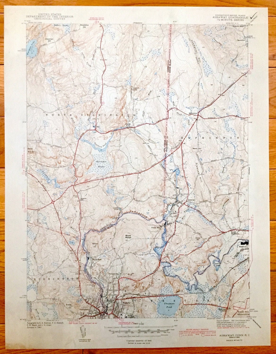
Antique Ashaway, Connecticut 1943 US Geological Survey Topographic Map – North Stonington, Pawcatuck, Westerly, Hopkinton Rhode Island CT RI
Antique Ashaway, Connecticut 1943 US Geological Survey Topographic Map – North Stonington, Pawcatuck, Westerly, Hopkinton Rhode Island CT RI
Beautiful, antique map of Stonington, Connecticut & Westerly, Hopkinton, Rhode Island. This is an authentic 1943 print from the U.S. Geological Survey and NOT a computer reproduction.
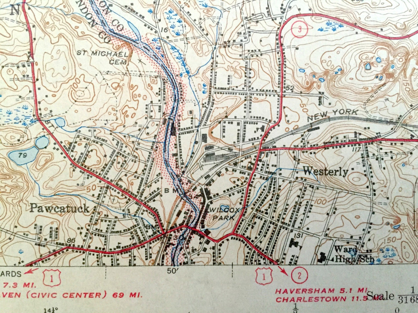
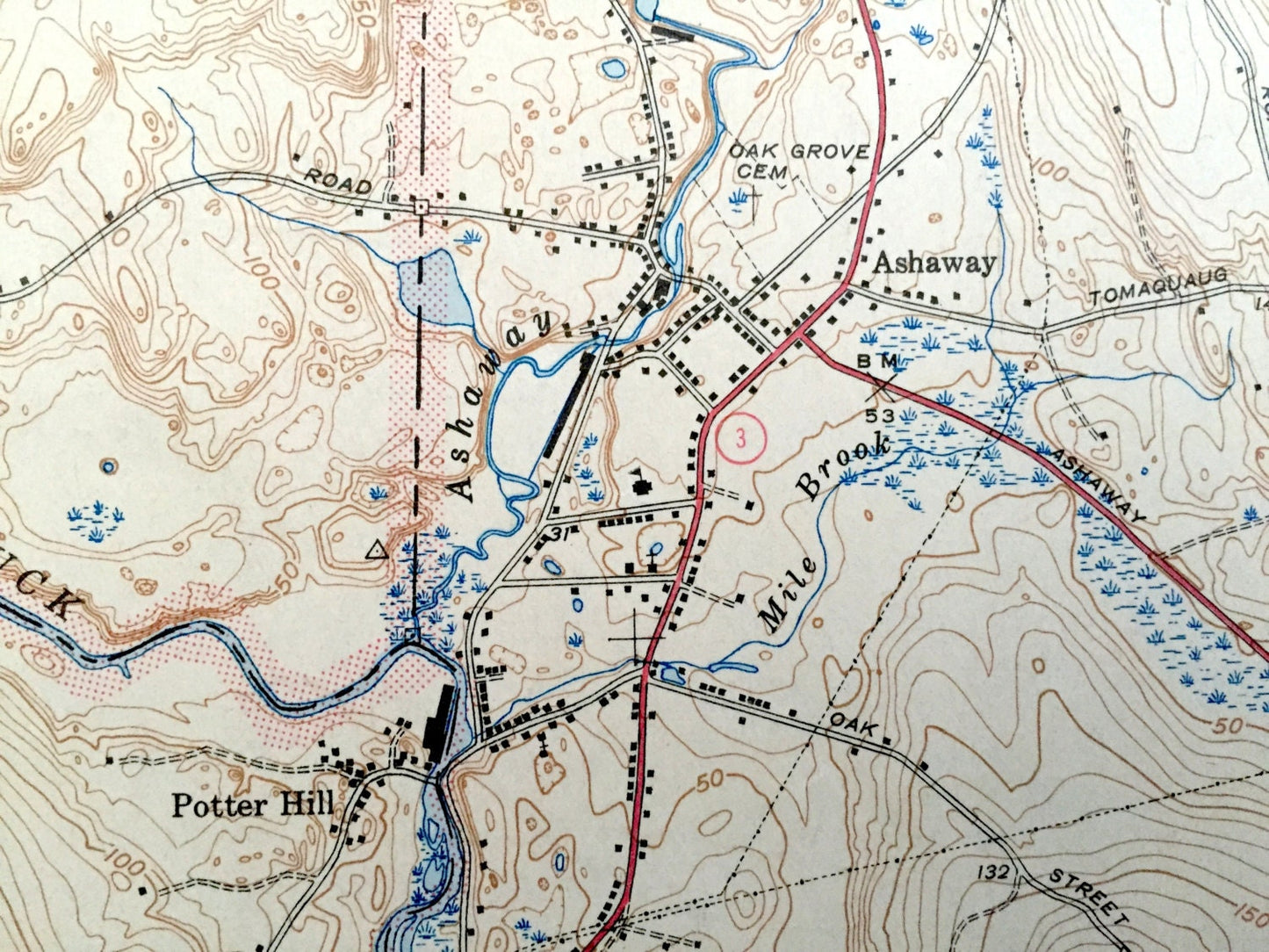
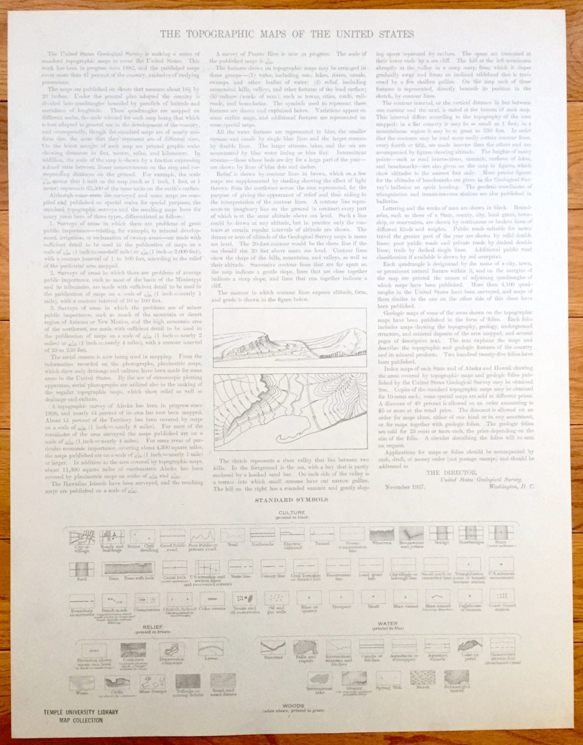
See what North Stonington and surrounding area looked like over 80 years ago. Lots of intricate details and geological contours. Map even has little squares for every house that existed at the time. The cartographers were very thorough back then! On the back is a description of topographic symbols and map guide.
Perfect for the historian, map-lover, the curious or just as a conversation starter. Wonderful and rare. Maps such as these make great gifts.
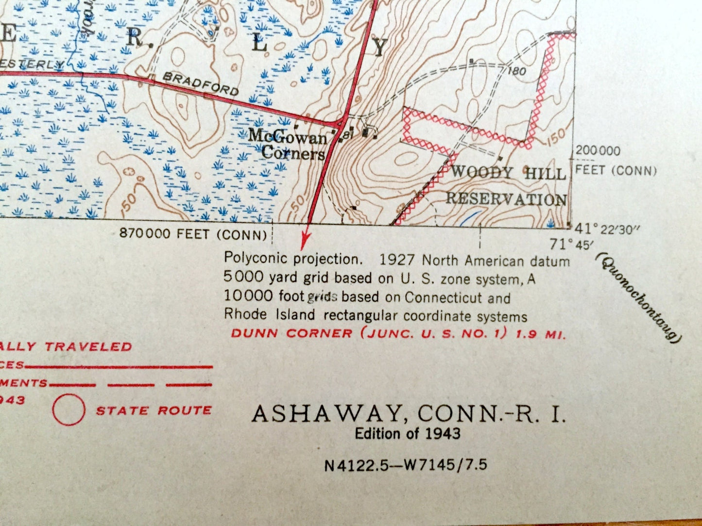
Edition of 1943, printed 1943
Dimensions: 15 1/2" width x 20" height
----
Features
Cities & Towns: North Stonington, Stonington, Hopkinton, Westerly, Ashaway, Bradford, South Hopkinton, Pawcatuck, Stillmanville, Clarks Falls.
Points of Interest: Chapman Hill, Wyassup Lake, Spalding Pond, Chapman Pond, Ward high School, Mount Moriah, Wood Hill Reservation, Maxon Hill, Pitcher Mountain, Spaulding Pond, New York New Haven and Hartford Railroad and lots more hills, mountains, creeks, towns, and roads.
Condition: Good Vintage condition, commensurate with age. This map is in great condition for being over 80 old. Light wear, mostly in bottom left, and ex-libris markings, but this will all add to vintage character when framed.
----
We will happily adjust shipping price for multiple purchases. Maps are rolled up and shipped in sturdy mailing tubes, never folded.
Couldn't load pickup availability
Share