My Store
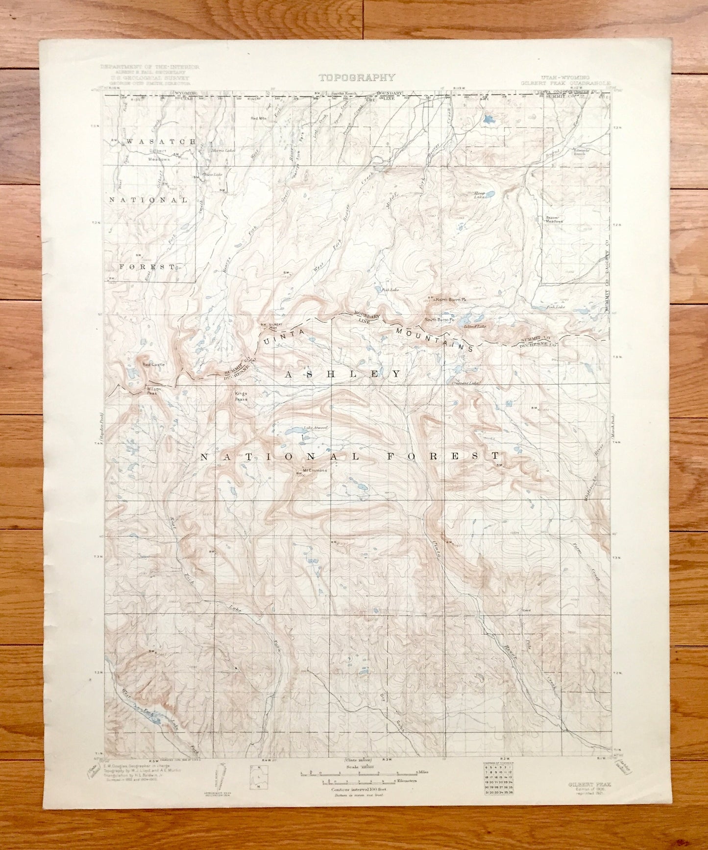
Antique Ashley National Forest, Utah 1906 US Geological Survey Topographic Map – Gilbert Peak, Uinta Mountains, Wasatch, Summit, Duchesne UT
Antique Ashley National Forest, Utah 1906 US Geological Survey Topographic Map – Gilbert Peak, Uinta Mountains, Wasatch, Summit, Duchesne UT
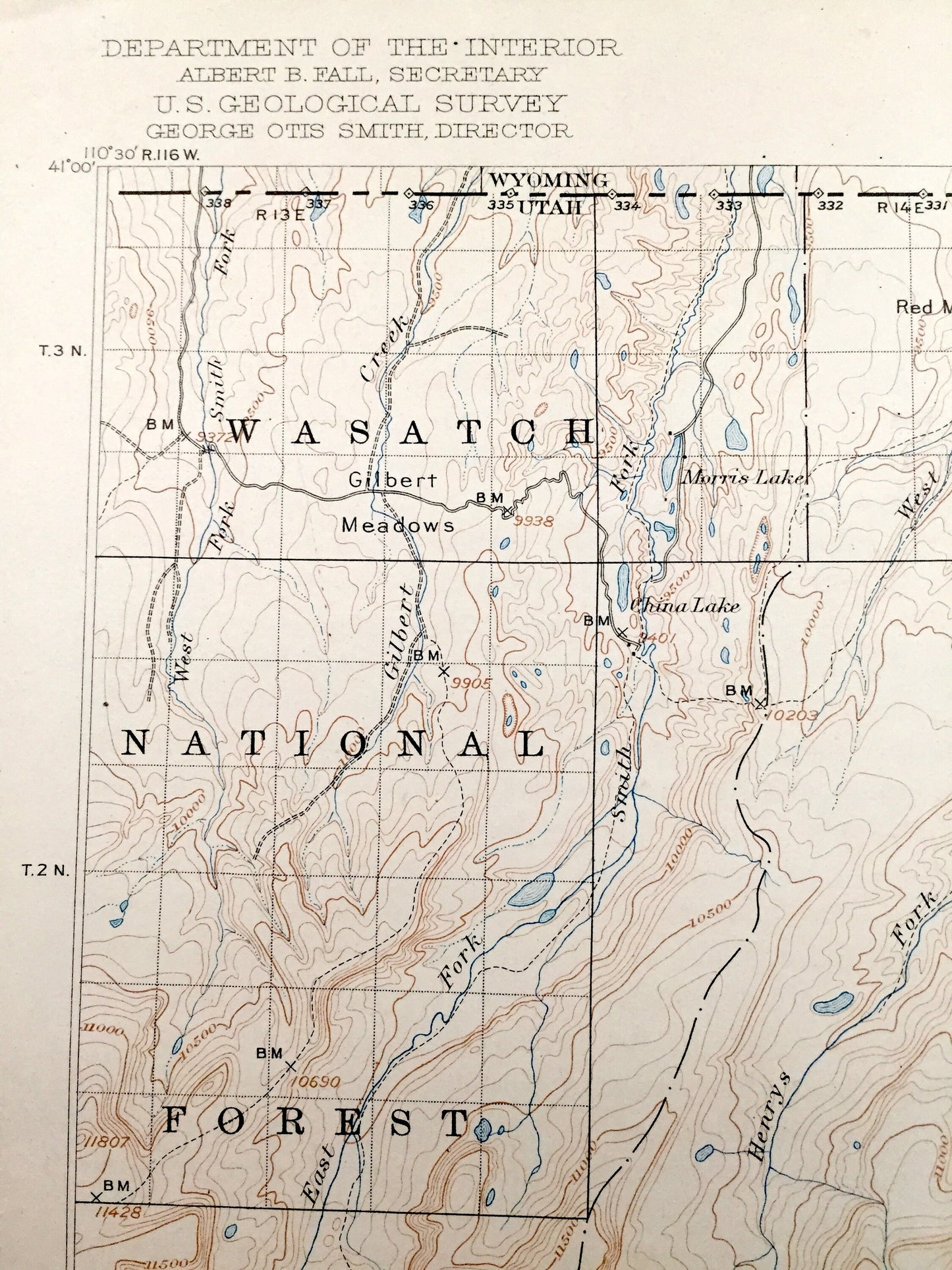
Beautiful, antique map of Ashley National Forest, Utah, including Gilbert Peak of the Uinta Mountains, Summit County and Duchesne County. This is an authentic 1921 print of 1906 survey data from the U.S. Geological Survey and NOT a computer reproduction.
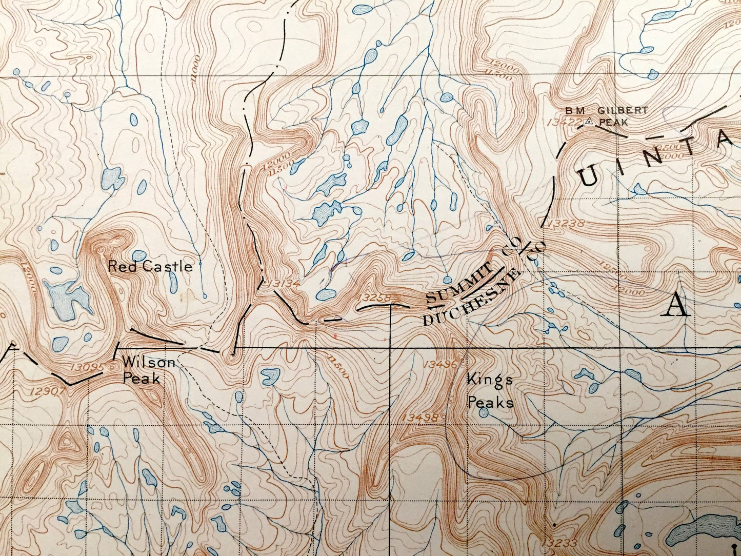
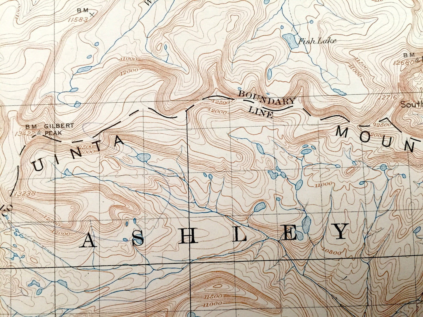
See what Ashley National Forest looked like over 110 years ago. Lots of intricate details and geological contours. Map even has little squares for every house that existed at the time. The USGS cartographers were very thorough back then! On the back is a description of topographic symbols and map guide.
Perfect for the historian, map-lover, the curious or just as a conversation starter. Wonderful and rare. Maps such as these make great gifts.
Edition of 1906, printed 1921
Dimensions: 16 1/2" width x 20" height
----
Features
Points of Interest: Wasatch National Forest, Ashley National Forest, Uinta Mountains, Summit County, Duchesne County, Red Castle, Gilbert Peak, Kings Peak, Mt Emmons, Wilson Peak, Gilbert Meadows, Beaver Creek, Lake Atwood, Uinta River, North Burro Peak, Island Lake, a sliver of Wyoming and lots more creeks, mountains, ranges, lakes, houses and roads.
Condition: Good Vintage condition, commensurate with age. This map is in great shape for being 100 years old. Has some wear, foxing and toning, but this will add to vintage character when framed.
----
We will happily adjust shipping price for multiple purchases. Maps are rolled up and shipped in sturdy mailing tubes, never folded.
Couldn't load pickup availability
Share