My Store
Antique Atlantic City, New Jersey 1952 US Geological Survey Topographic Map — Atlantic County, Margate City, Ventnor City, Heights, Shore NJ
Antique Atlantic City, New Jersey 1952 US Geological Survey Topographic Map — Atlantic County, Margate City, Ventnor City, Heights, Shore NJ
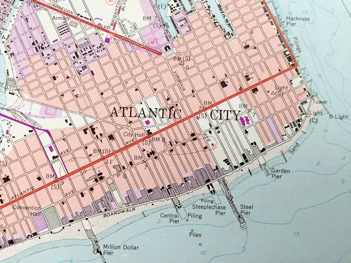
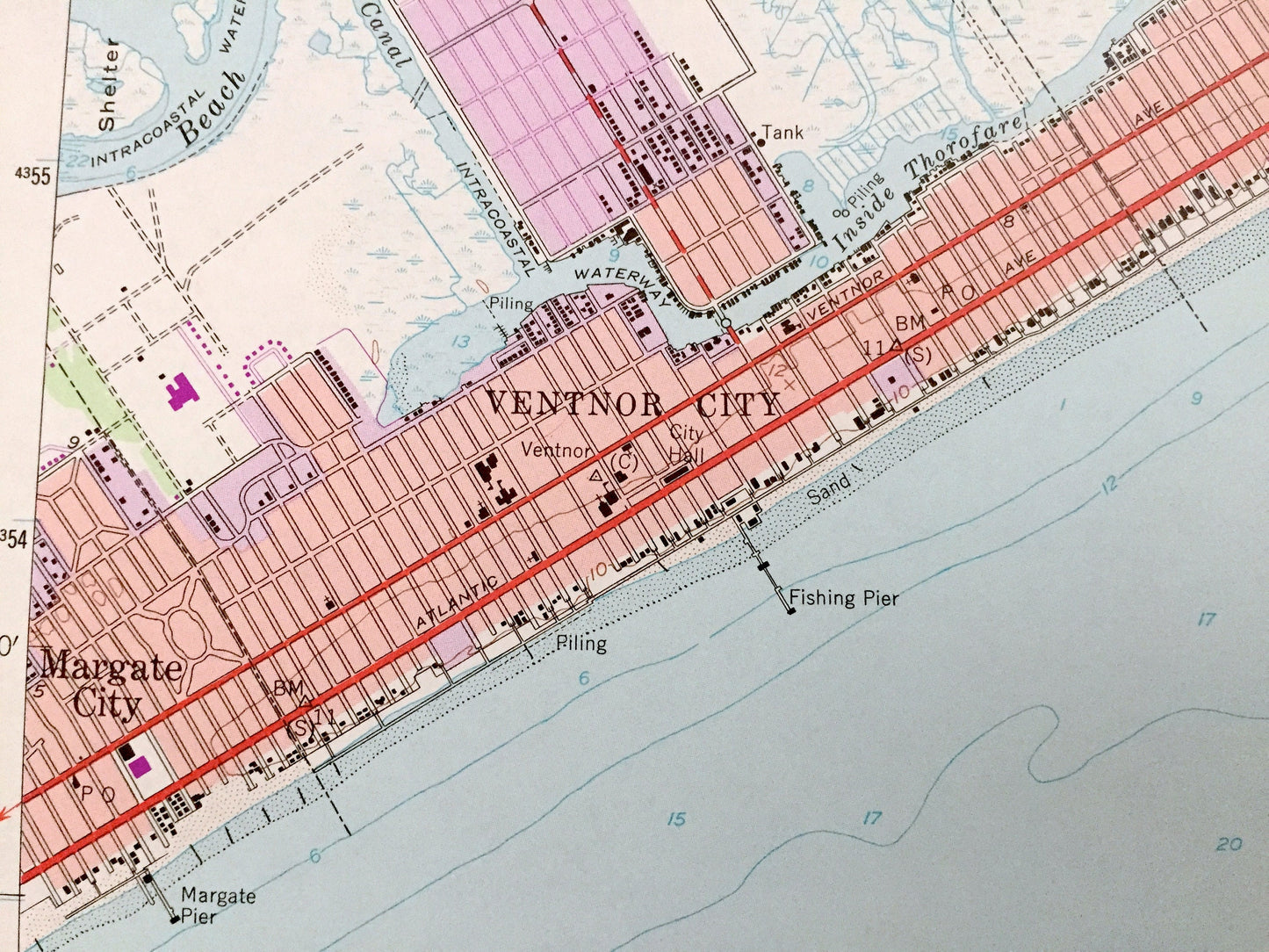
Beautiful, antique map of Atlanitc City, New Jersey and surrounding Atlantic County areas. This is an authentic 1952 edition, 1984 print from the U.S. Geological Survey and NOT a computer reproduction.
See what New Jersey looked like over 65 years ago. Lots of intricate details and geological contours. Map even has little squares for every house that existed at the time. The USGS cartographers were very thorough back then!
Perfect for the historian, map-lover, the curious or just as a conversation starter. Wonderful and rare. Vintage maps such as these make great gifts.
Edition of 1952, printed 1984
Dimensions: 22" width x 27" height
----
Features
Cities & Towns: West Atlantic City, Egg Harbor, Pleasantville, Shelter Island, Great Island.
Points of Interest: Atlantic Ocean, Lakes Bay, Great Thorofare, Intracoastal Waterway, Hackneys Pier, Garden Pier, Million Dollar Pier, Fishing Pier, Margate Pier, Atlantic City Boardwalk, Municipal Airport (Badger Field), City Hall, Convention Hall, Atlantic City Expressway, Armory, pipe lines, and many more streams, ponds, houses, schools, railroads, churches, roads, inlets, and beaches.
Condition: Very Good Vintage condition, commensurate with age. This map is in great shape for being over 35 years old. Light wear and stamp in bottom margin, but this will all add to vintage character when framed.
----
We will happily adjust shipping price for multiple purchases. Maps are rolled up and shipped in sturdy mailing tubes, never folded.
Couldn't load pickup availability
Share