My Store
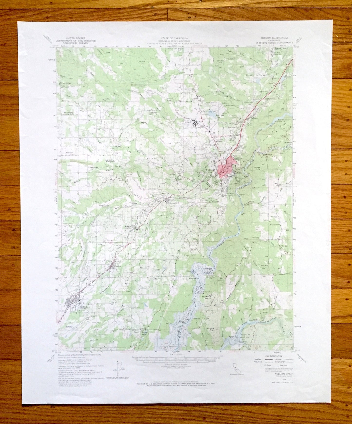
Antique Auburn, California 1954 US Geological Survey Topographic Map – Rocklin, Loomis, Penryn, Newcastle, Placer, El Dorado County, CA
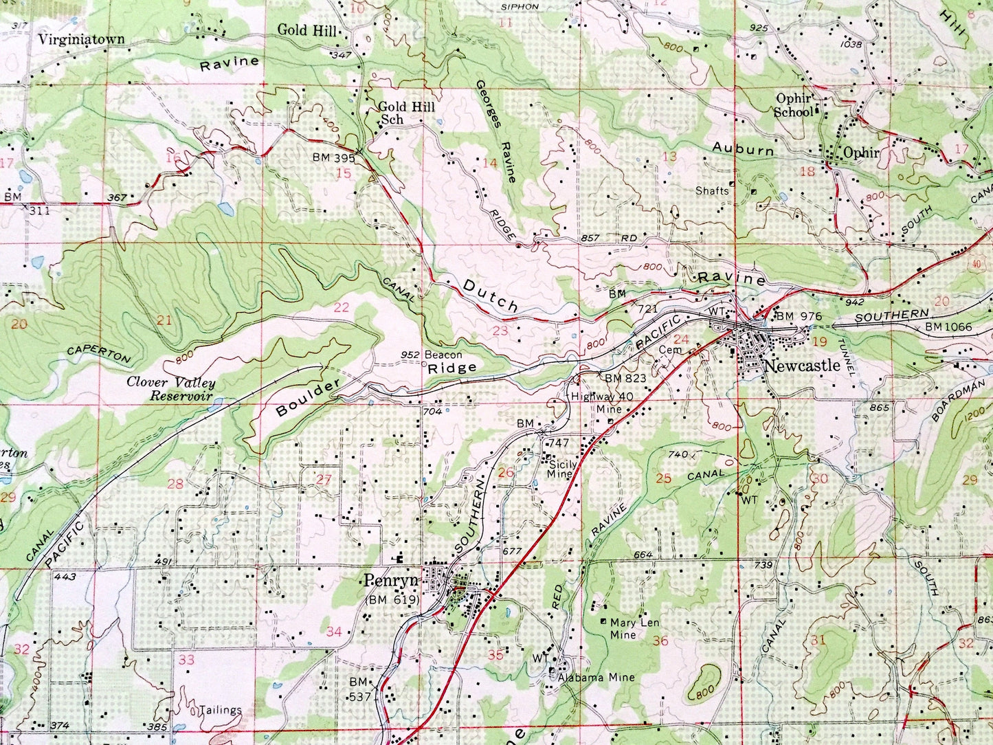
Antique Auburn, California 1954 US Geological Survey Topographic Map – Rocklin, Loomis, Penryn, Newcastle, Placer, El Dorado County, CA
Beautiful, antique map of Auburn, California and surrounding Placer & EL Dorado County area. This is an authentic 1954 edition, 1965 print from the U.S. Geological Survey and NOT a computer reproduction.
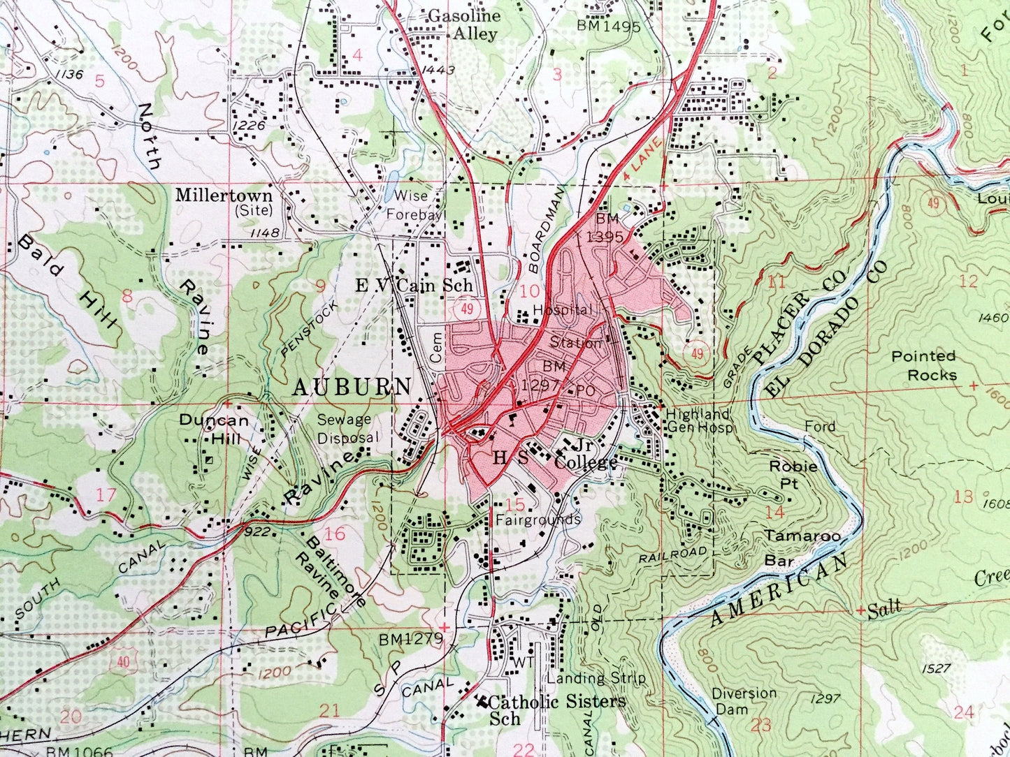
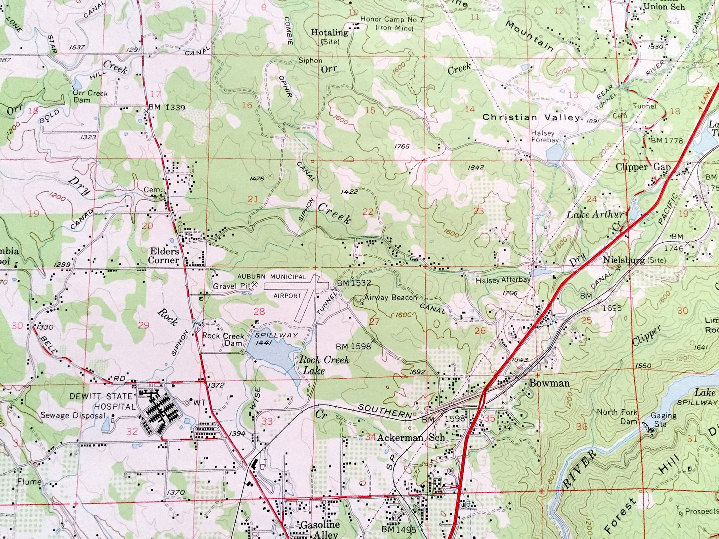
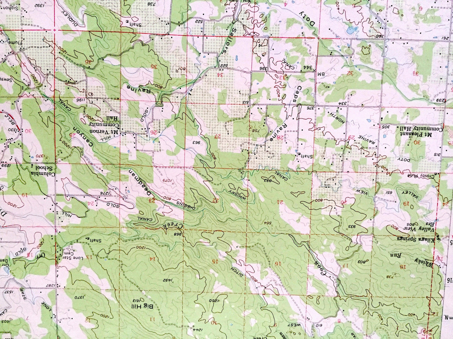
See what California looked like over 65 years ago. Lots of intricate details and geological contours. Map even has little squares for every house that existed at the time. The USGS cartographers were very thorough back then!
Perfect for the historian, map-lover, the curious or just as a conversation starter. Wonderful and rare. Vintage maps such as these make great gifts.
Edition of 1954, printed 1965
Dimensions: 18" width x 22" height
----
Features
Cities & Towns: Auburn, Rocklin, Loomis, Kilaga Springs, Gold Hill, Virginitown, Mt. Vernon, Gasoline Alley, Millertown, Boman, Nielsburg, Placer Hills, Clipper Gap, Ophir, Newcastle, Penryn, Hidden Valley, Pilot Hill, Salmon Falls, Cool.
Points of Interest: Placer County, El Dorado County, American River, Rock Creek Lake, Folsom Reservoir, Dewitt State Hospital, Clover Valley, Dutch Ravine, Cooper Canyon, Flagstaff Hill, Miners Ravine, Boulder Ridge, Big Hill, Christian Valley, Bald Hill, Secret Ravine, and many more hills, streams, ponds, houses, schools, churches and roads.
Condition: Very Good Vintage condition, commensurate with age. This map is in great shape for being over 55 years old. Has light wear, but this will add to vintage character when framed.
----
We will happily adjust shipping price for multiple purchases. Maps are rolled up and shipped in sturdy mailing tubes, never folded.
Couldn't load pickup availability
Share