My Store
Antique Augusta, Georgia 1957 US Geological Survey Topographic Map – South Carolina, Aiken, Graniteville, Warrenville, Bath, North Augusta
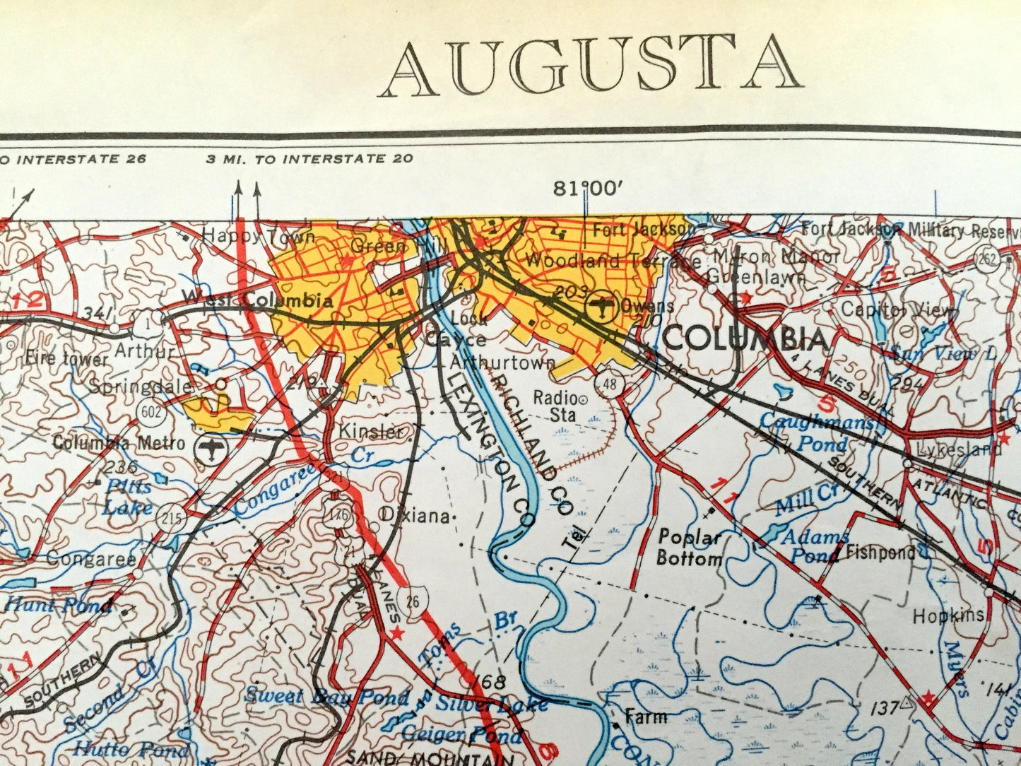
Antique Augusta, Georgia 1957 US Geological Survey Topographic Map – South Carolina, Aiken, Graniteville, Warrenville, Bath, North Augusta
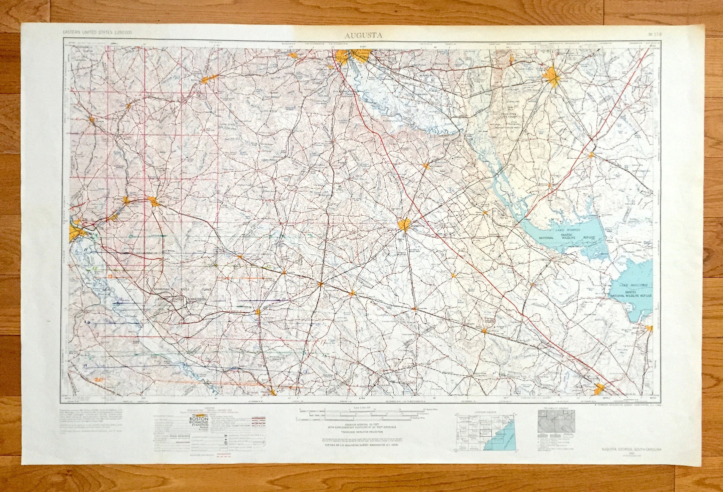
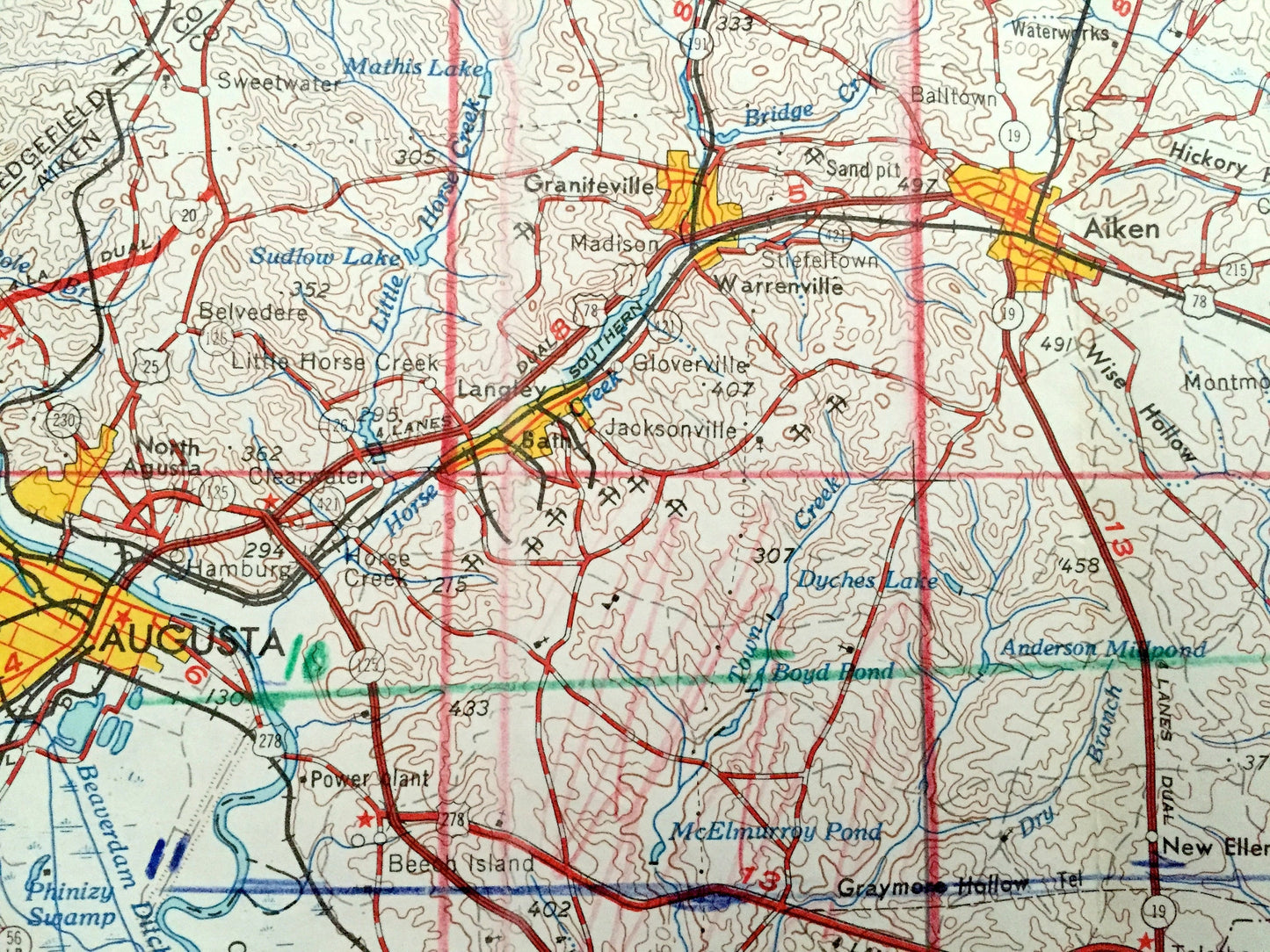
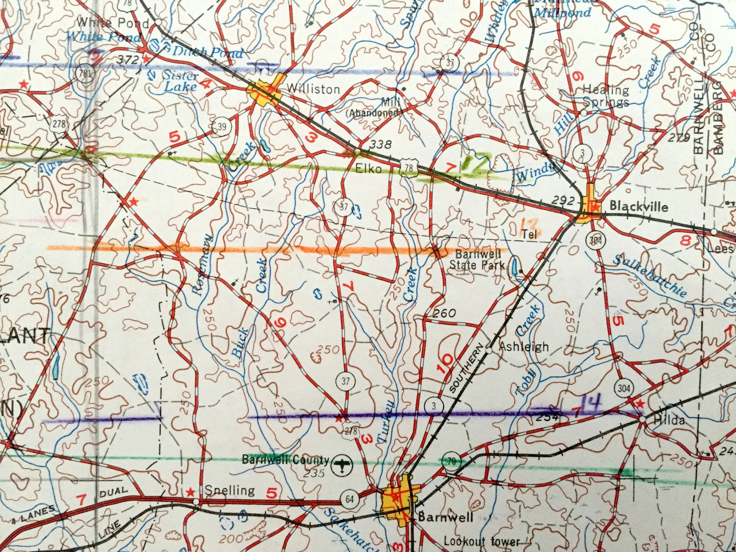
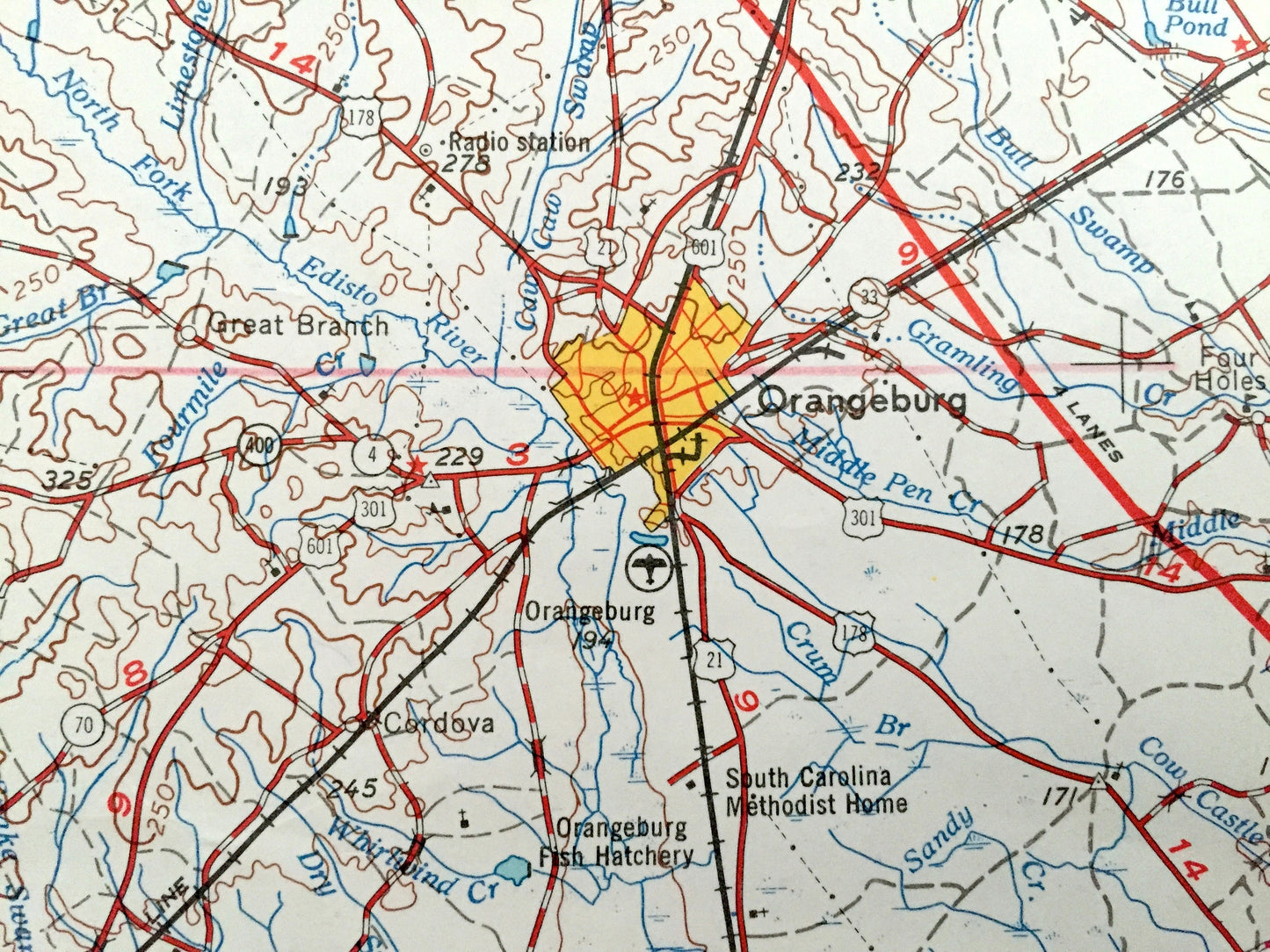
Beautiful, antique map of Augusta, Georgia & South Carolina and surrounding areas. This is an authentic 1957 edition, 1966 print from the U.S. Geological Survey and NOT a computer reproduction.
See what Georgia and South Carolina looked like over 60 years ago. Lots of intricate details and geological contours. Map is incredibly large and in the grand 1:250,000 scale. Lots of intricate details and geological contours. The USGS cartographers were very thorough back then!
Perfect for the historian, map-lover, the curious or just as a conversation starter. Wonderful and rare. Vintage maps such as these make great gifts.
Edition of 1957, printed 1966
Dimensions: 32" width x 22 1/2" height
----
Features
Cities & Towns: GEORGIA - Augusta, Griffins Landing, Bringhams Landing, Hancock Landing, Alexander, Barney Bluff.
SOUTH CAROLINA - Columbia, West Columbia, Barnwell, Allendale, Denmark, Bamberg, Branchville, Orangeburg, Bowman, Saint George, Summerville, Monks Corner, Sumter, Elloree, Saint Matthews, Edgefield, Bateburg.
Points of Interest: GEORGIA - Burke County, Screven County, Richmond County, Savannah River, Phinizy Swamp, Creek Millers Pond, Sweetwater Creek and lots more hills, mountains, lakes, islands, bays, highways, railroads.
SOUTH CAROLINA - Santee National Wildlife Refuge, Lake Marion, Manchester State Forest, Savannah River, Congaree River, Black River Swamp, Savannah River Plant, Sumter National Forest, Rivers Bridge State Park and lots more hills, mountains, lakes, ponds, islands, bays, highways and railroads.
Condition: Very Good condition, commensurate with age. This map is in incredible shape for being over 50 years old. This map was most likely used in the field. Has light edge-wear, tears and pencil markings all of which will read as vintage character when framed.
----
We will happily adjust shipping price for multiple purchases. Maps are rolled up and shipped in sturdy mailing tubes, never folded.
Couldn't load pickup availability
Share