My Store
Antique Averill, Vermont 1929 US Geological Survey Topographic Map – Coos, Essex County, Lemington, Stratford, Columbia, New Hampshire VT NH
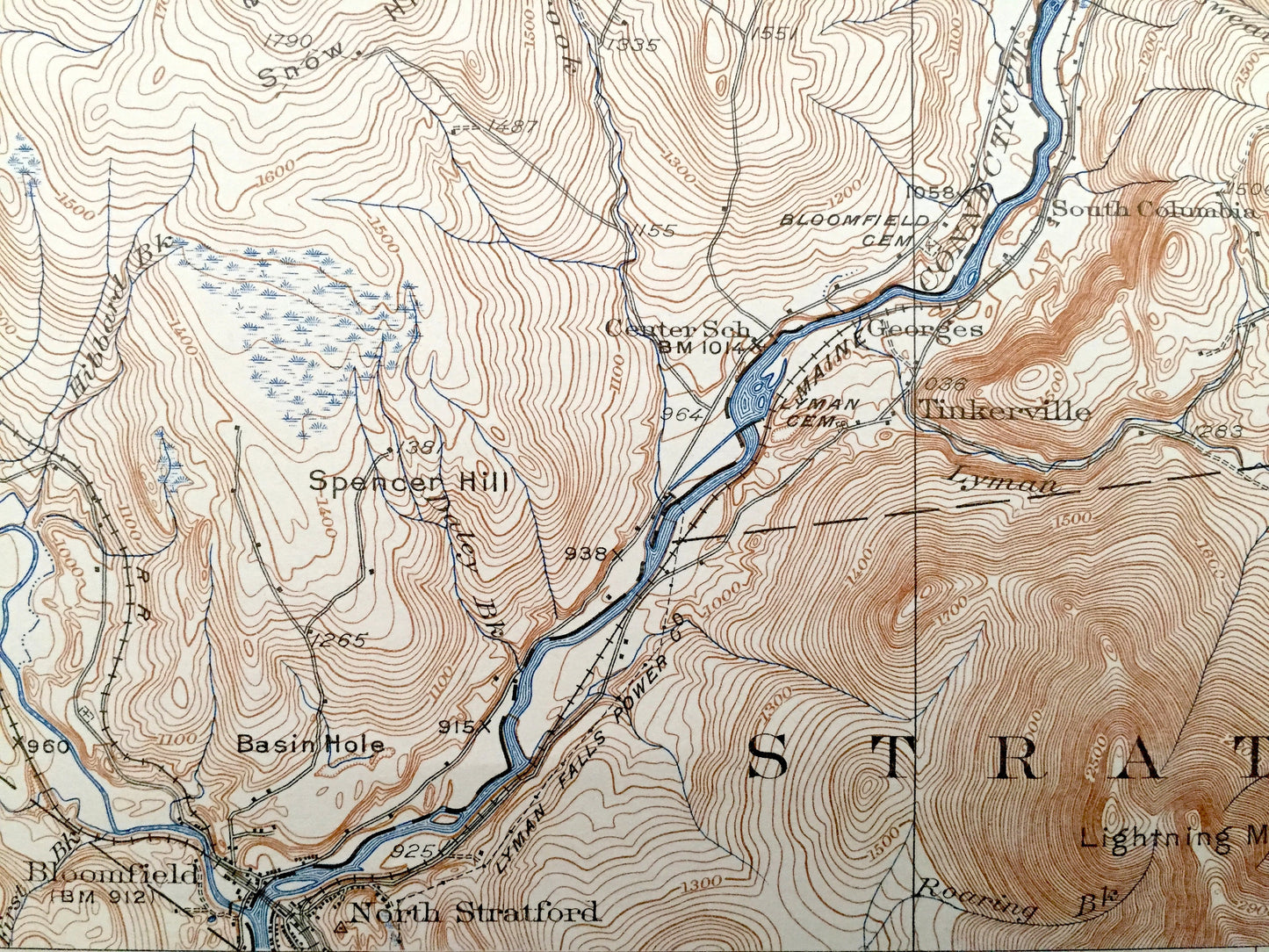
Antique Averill, Vermont 1929 US Geological Survey Topographic Map – Coos, Essex County, Lemington, Stratford, Columbia, New Hampshire VT NH
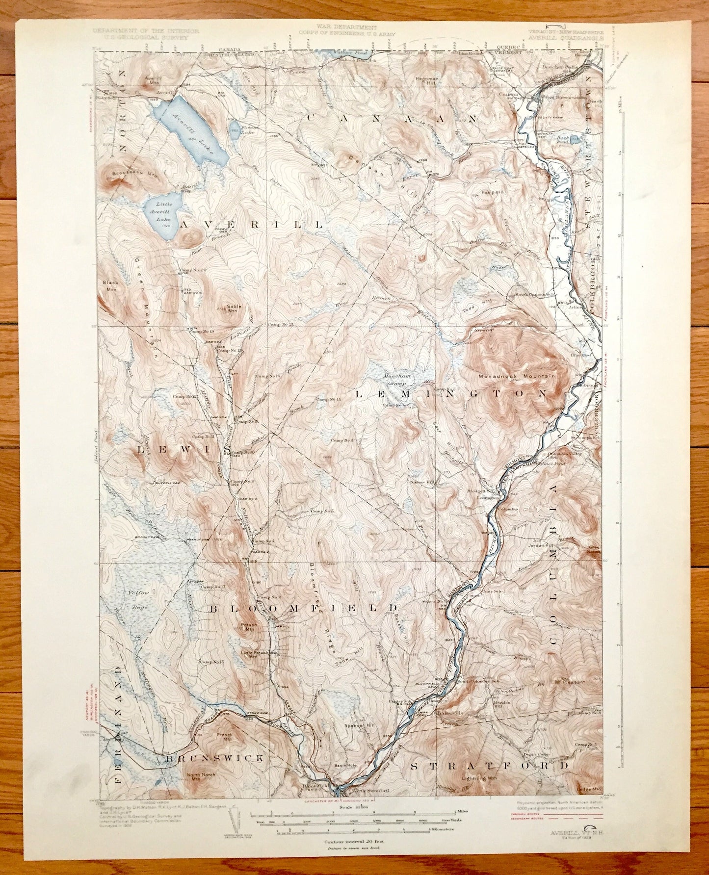
Beautiful, antique map of Coos County, New Hampshire and Essex County, Vermont on the Connecticut River, just south of Quebec, Canada. This is an authentic 1929 print from the U.S. Geological Survey and NOT a computer reproduction.
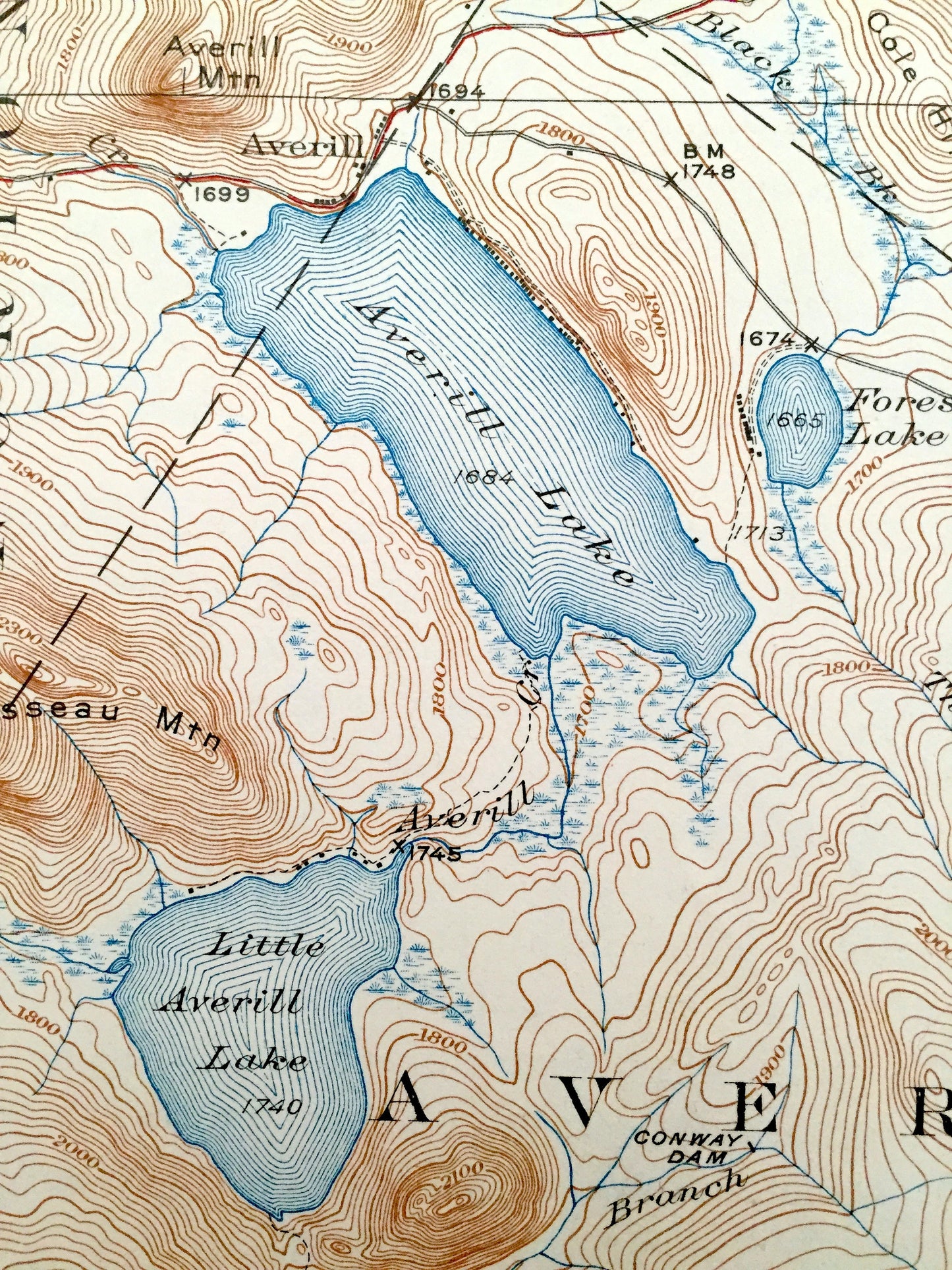
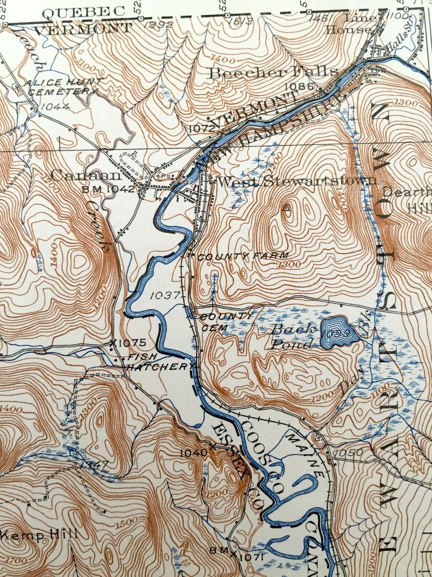
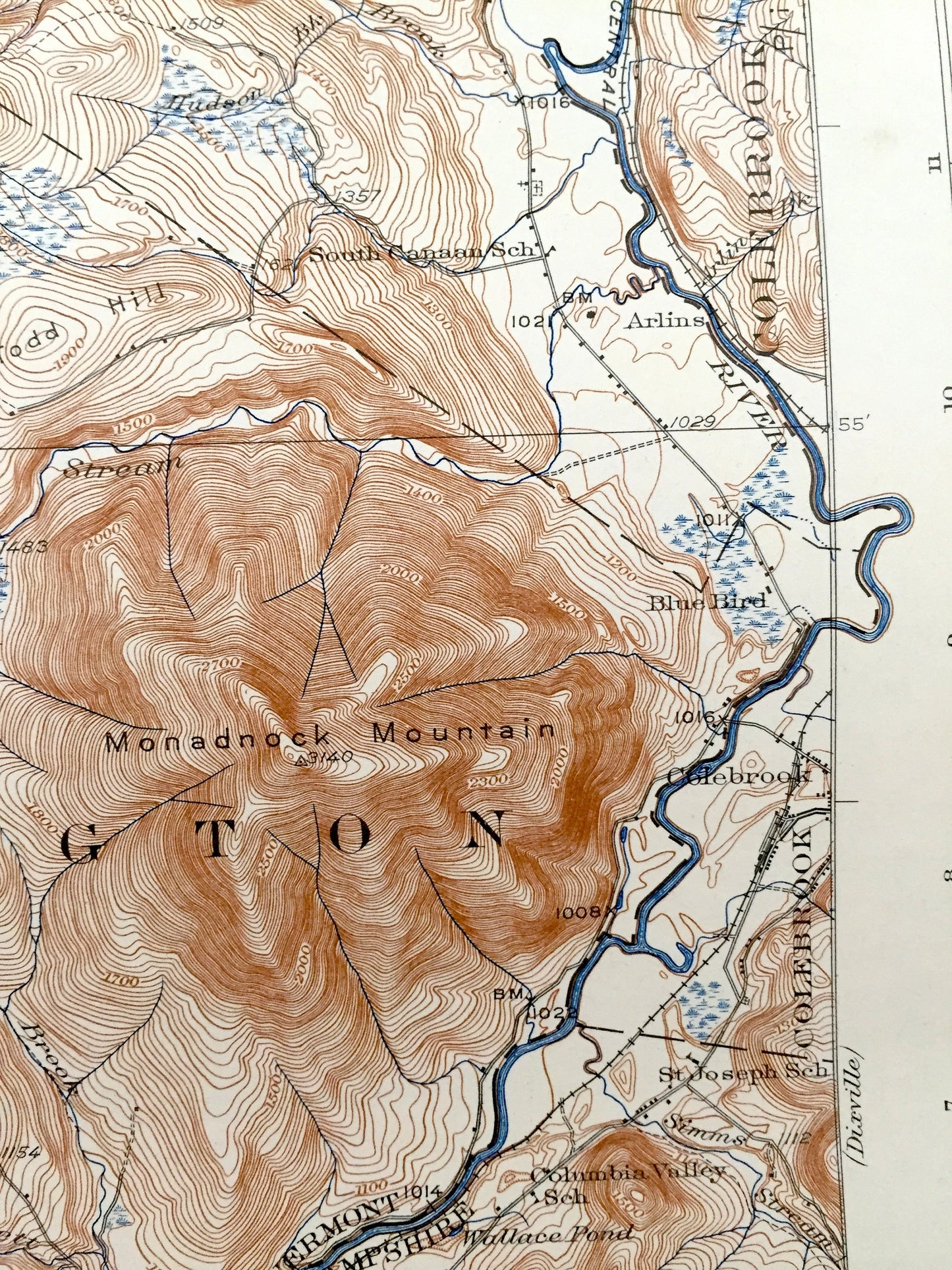
See what Stratford, Columbia, Stewartstown, New Hampshire & Averill, Lemington, Brunswick, Vermont looked like over 90 years ago. Lots of intricate details and geological contours. Map even has little squares for every house that existed at the time. The USGS cartographers were very thorough back then! On the back is a description of topographic symbols and map guide.
Perfect for the historian, map-lover, the curious or just as a conversation starter. Wonderful and rare. Vintage maps such as these make great gifts.
Edition of 1929, printed 1929
Dimensions: 16 1/2" width x 20" height
----
Features
Cities & Towns: VERMONT: Norton, Averill, Canaan, Lewis, Lemington, Ferdinand, Bloomfield, Brunswick, Beecher Falls, Line House, Arlins, Bloomfield.
NEW HAMPSHIRE: Stewartstown, Colebrook, Columbia, Stratford, West Stewartstown, Cones, Tinkerville, North Stratford.
Points of Interest: Coos County, Essex County, Connecticut River, United States-Canada border, Averill Lake, Little Averill Lake, Nulgegan River, Monadnock Mountain, Kemp Hill, Potash Mountain, Little Potash Mountain, Line House, Wallace Pond, Brousseau Mountain, Green Mountain, Black Mountain, Yellow Bogs, Bloomfield Ridge, Snow Hill, St. Joseph school, Meacham Swamp, Forest Lake, Canaan Hill, Harriman Hill, Todd Hill, Grand Trunk Railroad, and many more streams, hills, mountains, houses, churches, school, roads and railroads.
Condition: Good Vintage condition, commensurate with age. This map is in great shape for being over 90 years old. Has some wear, foxing and toning, but this will all add to the vintage character when framed.
----
We will happily adjust shipping price for multiple purchases. Maps are rolled up and shipped in sturdy mailing tubes, never folded.
Couldn't load pickup availability
Share