My Store
Antique Avon, Connecticut 1957 US Geological Survey Topographic Map – Hartford County, Simsbury, Bloomfield, Farmington, West Hartford, CT
Antique Avon, Connecticut 1957 US Geological Survey Topographic Map – Hartford County, Simsbury, Bloomfield, Farmington, West Hartford, CT
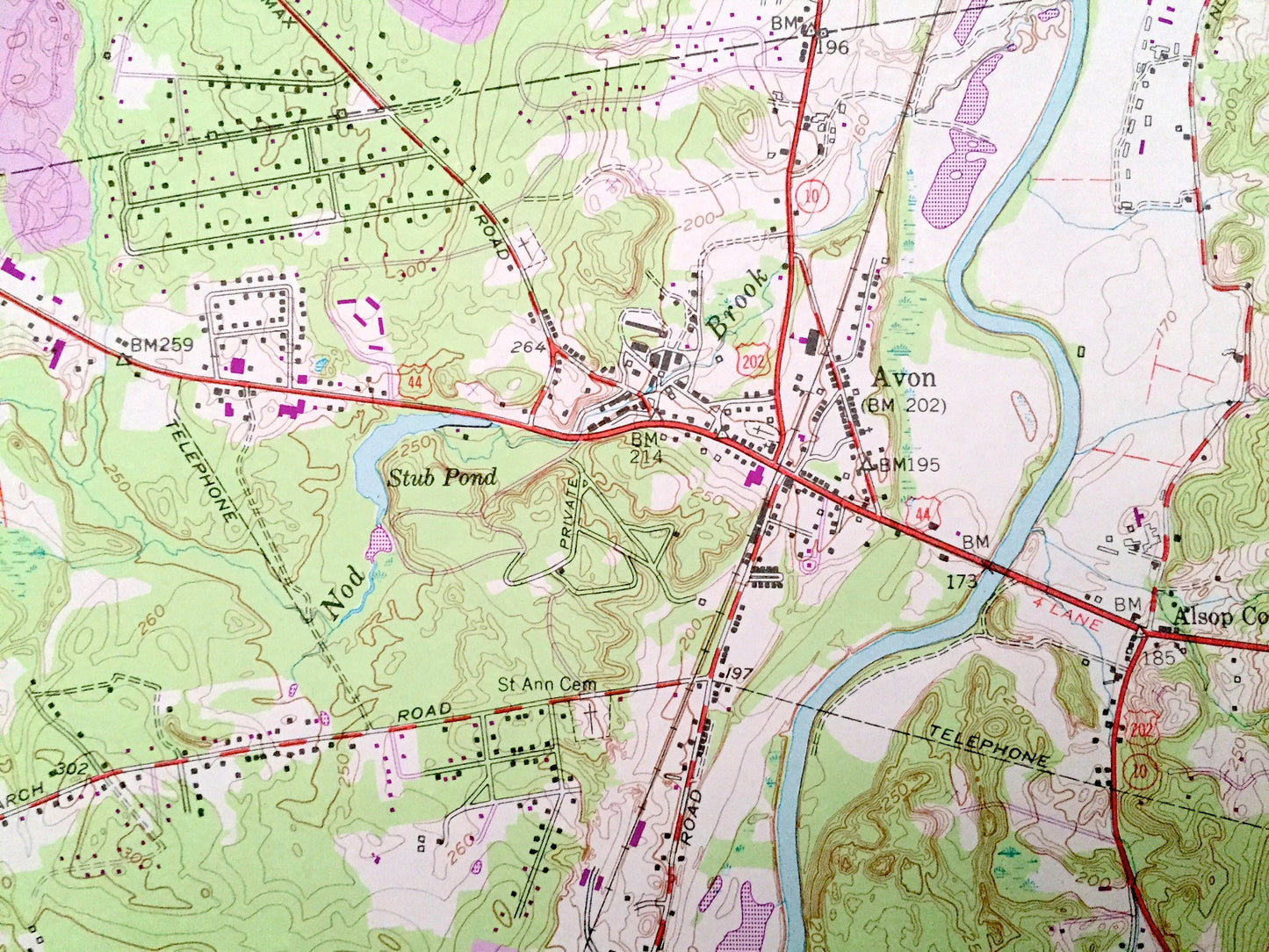
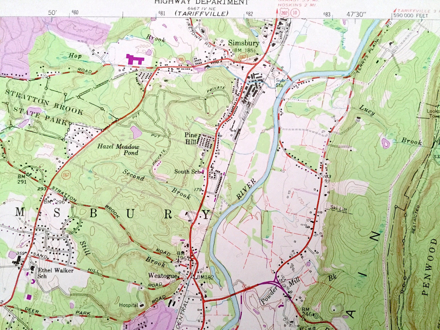
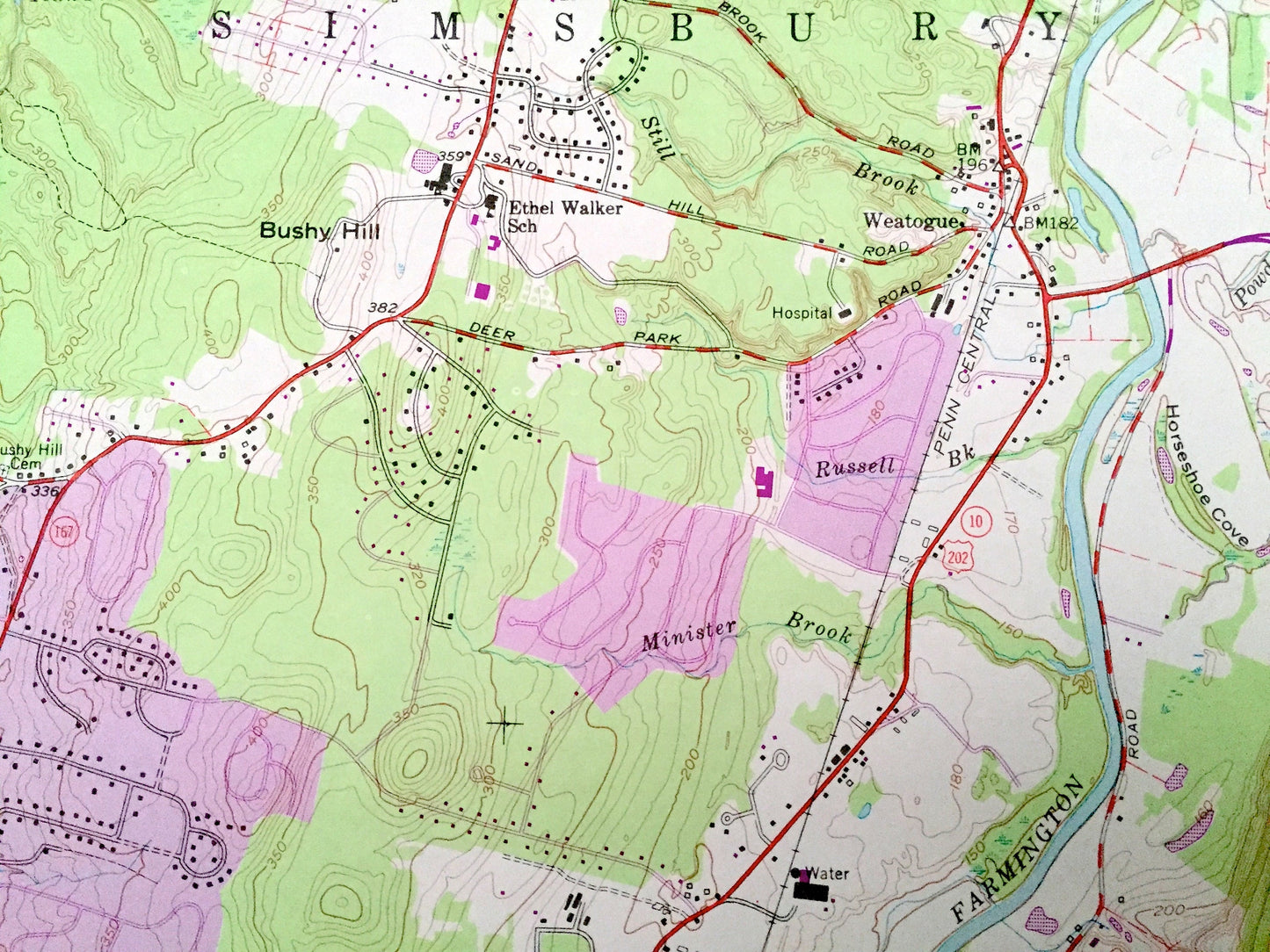
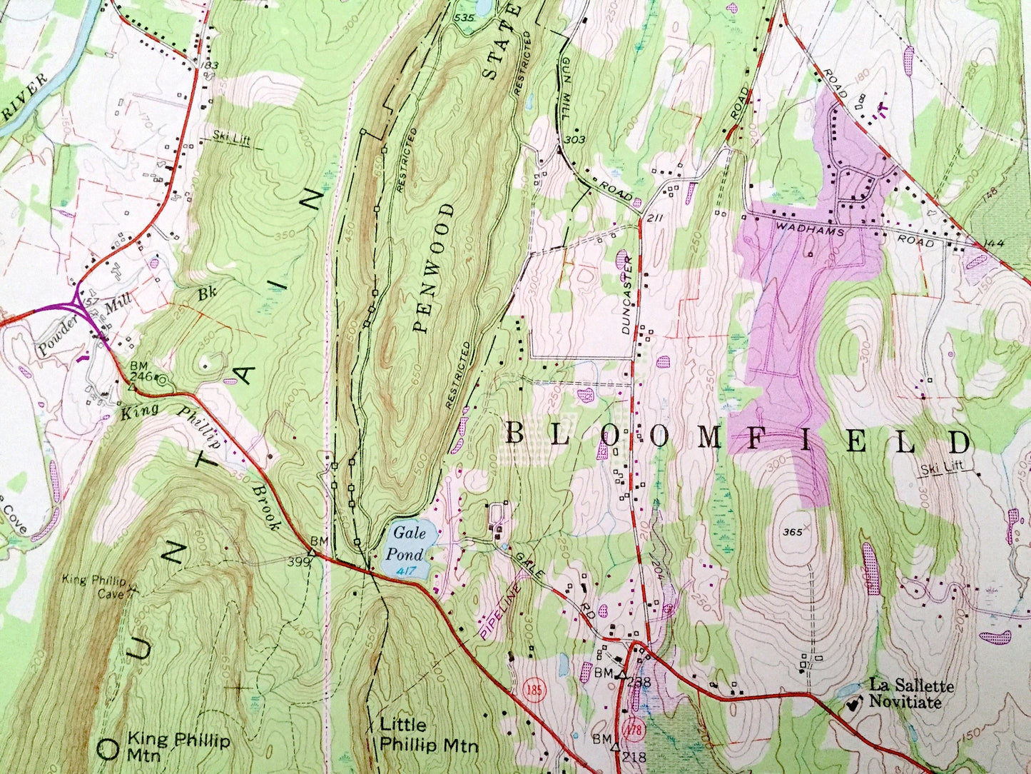
Beautiful, antique map of Avon, Connecticut and surrounding Hartford County area. This is an authentic 1957 edition, 1970 print from the U.S. Geological Survey and NOT a computer reproduction.
See what Connecticut looked like over 65 years ago. Lots of intricate details and geological contours. Map even has little squares for every house that existed at the time. The USGS cartographers were very thorough back then!
Perfect for the historian, map-lover, the curious or just as a conversation starter. Wonderful and rare. Vintage maps such as these make great gifts.
Edition of 1957, printed 1970
Dimensions: 22" width x 27" height
----
Features
Cities & Towns: West Simsbury, Pine Hill, Weatogue, Canton, Crowleys Corner, Alsop Corner, West Avon, Whitings Corner.
Points of Interest: Massacoe State Forest, Stratton Brook State Park, Penwood State Park, MacDonald Memorial Park, La Sallette Novitiate, Talbot Mountain, Kilkenny Rocks, Onion Mountain, The Sugarloaf, Bushy Hill, The Pinnacle, King Phillip Mountain, Little Phillip Mountain, Grant Hill, Hartford Reservoirs, Gale Pond, Stub Pond, Lily Pond, Farmington River, Griffin Brook, Nod Brook, Thompson Brook, Stratton Brook, and many more hills, streams, ponds, houses, schools, railroads, churches and roads.
Condition: Very Good Vintage condition, commensurate with age. This map is in great shape for being over 50 years old.
----
We will happily adjust shipping price for multiple purchases. Maps are rolled up and shipped in sturdy mailing tubes, never folded.
Couldn't load pickup availability
Share