My Store
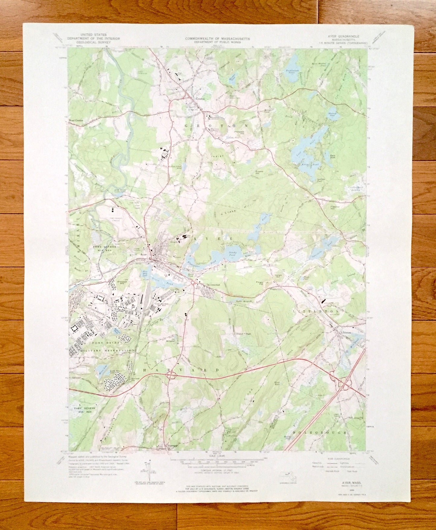
Antique Ayer, Massachusetts 1966 US Geological Survey Topographic Map – Middlesex, Worcester County, Groton, Harvard, Boxborough, Shirley MA
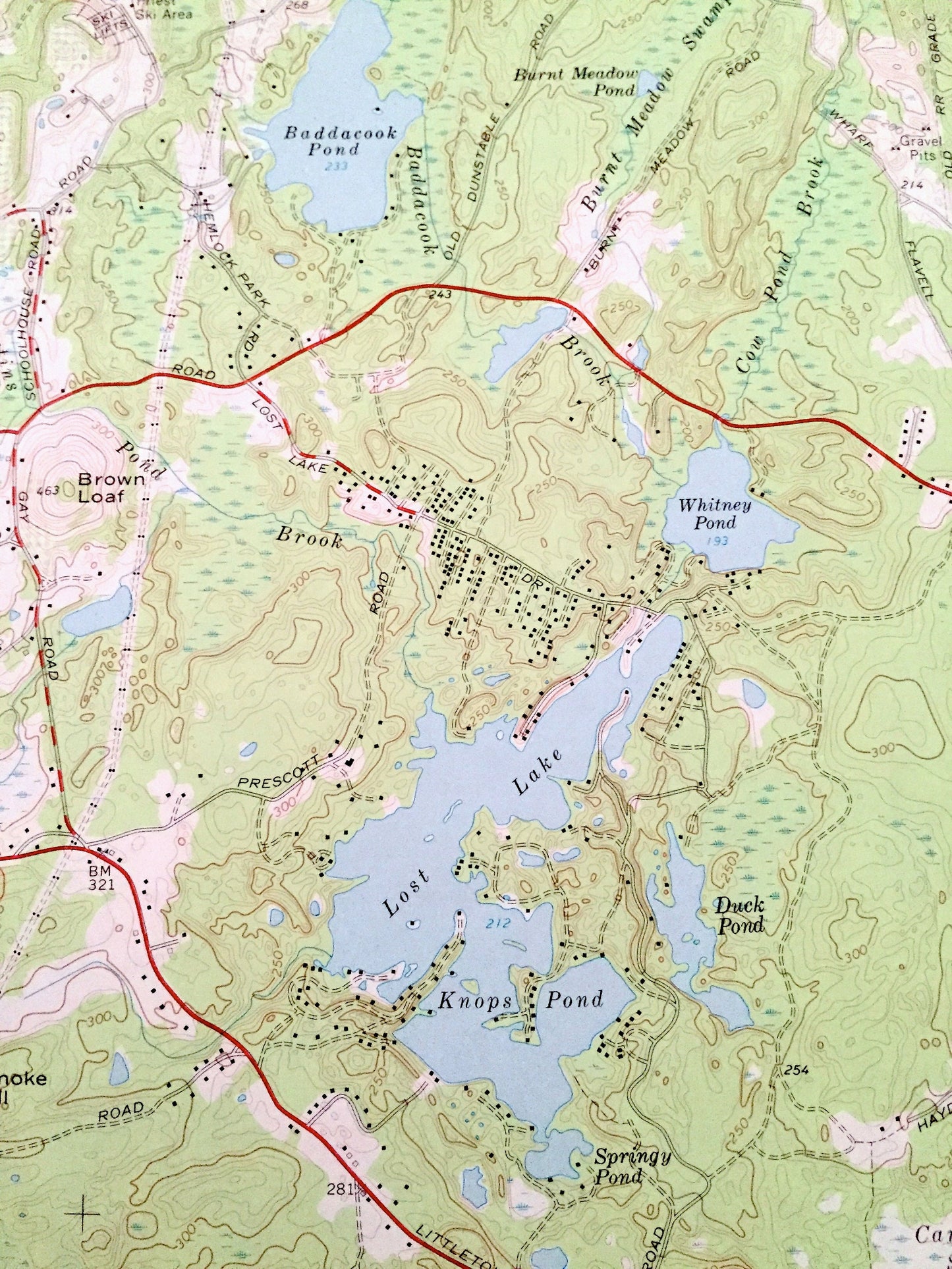
Antique Ayer, Massachusetts 1966 US Geological Survey Topographic Map – Middlesex, Worcester County, Groton, Harvard, Boxborough, Shirley MA
Beautiful, antique map of Ayer, Massachusetts and surrounding Worcester County and Middlesex County areas. This is an authentic 1966 edition, 1977 print from the U.S. Geological Survey and NOT a computer reproduction.
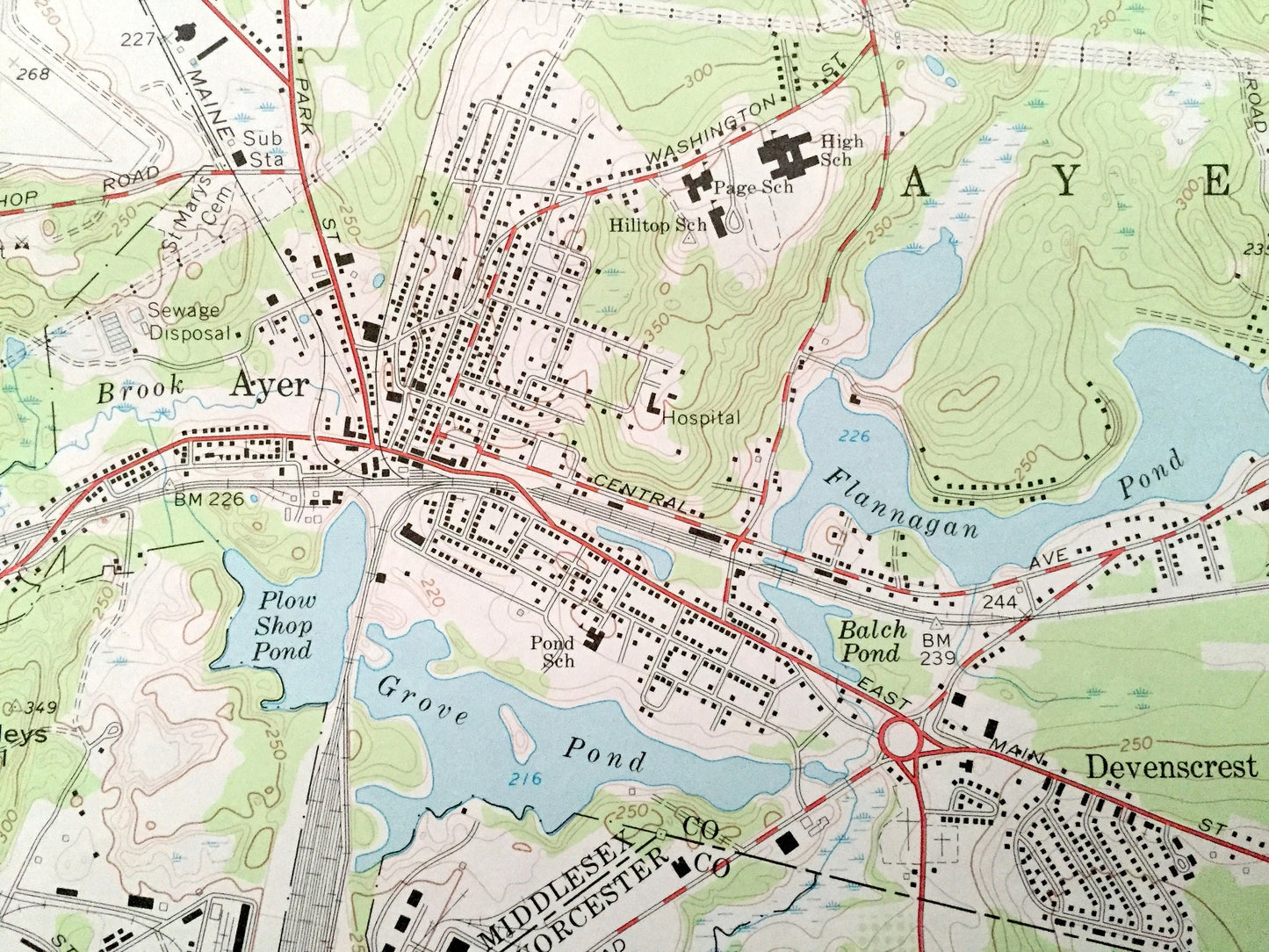
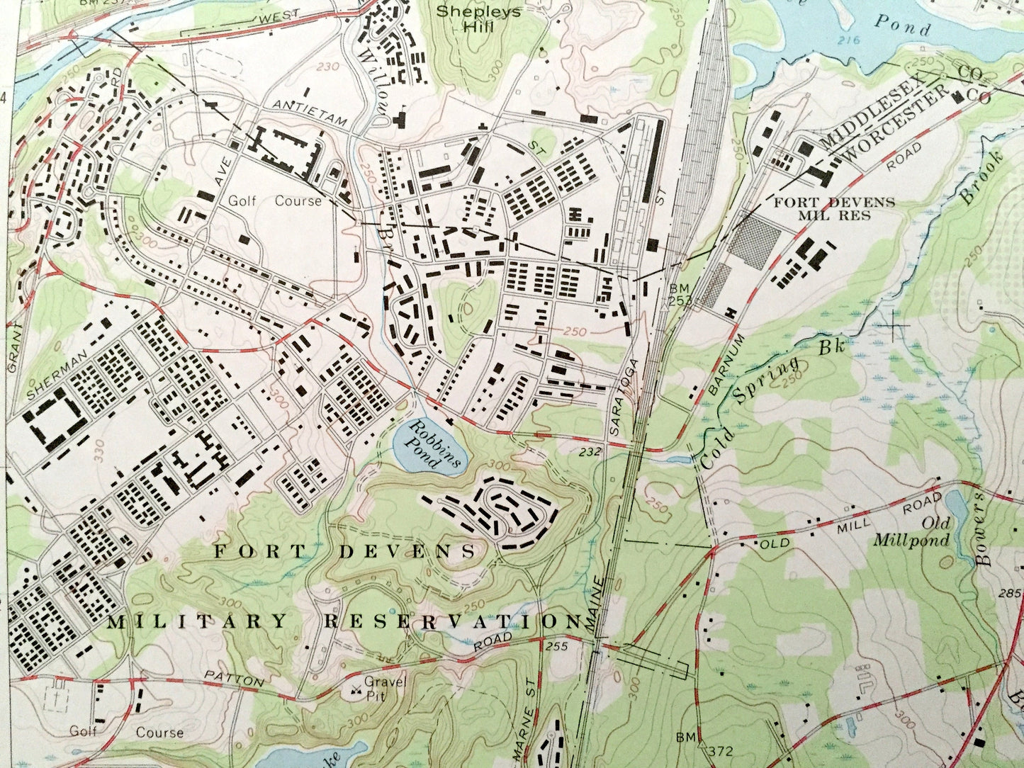
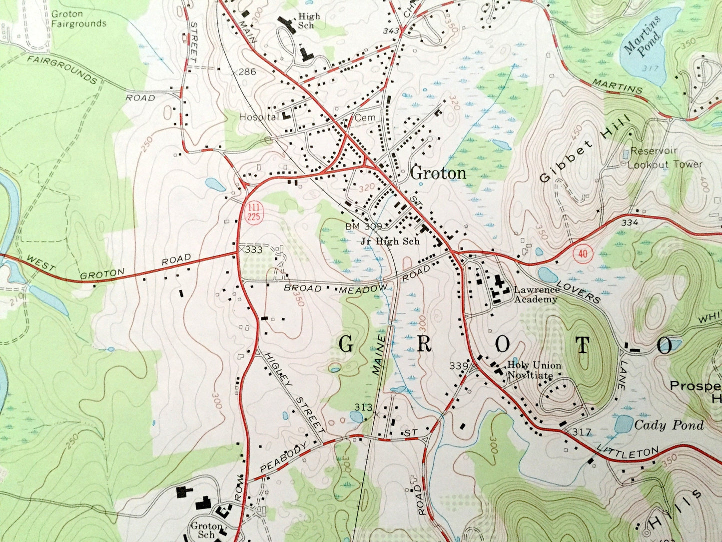
See what eastern Massachusetts looked like over 55 years ago. Lots of intricate details and geological contours. Map even has little squares for every house that existed at the time. The USGS cartographers were very thorough back then!
Perfect for the historian, map-lover, the curious or just as a conversation starter. Wonderful and rare. Vintage maps such as these make great gifts.
Edition of 1966, printed 1977
Dimensions: 22" width x 27" height
----
Features
Cities & Towns: Groton, Shirley, Harvard, Boxborough, Littleton, West Groton, Devenscrest, Pingryville., Shaker Village.
Points of Interest: Fort Devens Airport, Fort Devens Military Reservation, Lawrence Academy, Harvard University Observatory, Groton Fairgrounds, Ayer State Game Farm, Prospect Hill, Snake Hill, Pingry Hill, Shepleys Hill, Oak Hill, Baddacook Pond, Lost Lake, Knops Pond, Mirror Lake, Grove Pond, Sandy Pond, Nashua River, Cold Spring Brook, Bowers Brook, Beaver Brook, and many more hills, streams, ponds, houses, schools, railroads, churches and roads.
Condition: Very Good Vintage condition, commensurate with age. This map is in great shape for being over 40 years old. Has subtle edge-wear but will read as character when framed.
----
We will happily adjust shipping price for multiple purchases. Maps are rolled up and shipped in sturdy mailing tubes, never folded.
Couldn't load pickup availability
Share