My Store
Antique Bath, Maine 1894 US Geological Survey Topographic Map – Brunswick, Topsham, Woolwich, Phippsburg, Harpswell, Georgetown Casco Bay ME
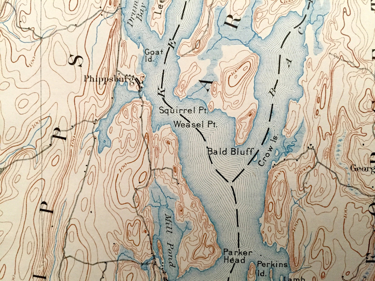
Antique Bath, Maine 1894 US Geological Survey Topographic Map – Brunswick, Topsham, Woolwich, Phippsburg, Harpswell, Georgetown Casco Bay ME
Beautiful, antique map of Bath, Maine and surrounding Sagadahoc and Cumberland County area on the Maine Coast. This is an authentic 1894 edition, 1928 print from the U.S. Geological Survey and NOT a computer reproduction.
See what Bath looked like over 125 years ago. Lots of intricate details and geological contours. Map even has little squares for every house that existed at the time. The USGS cartographers were very thorough back then! On the back is a description of topographic symbols and map guide.
Perfect for the historian, map-lover, the curious or just as a conversation starter. Wonderful and rare. Vintage maps such as these make great gifts.
Edition of 1894, printed 1928
Dimensions: 16 1/2" width x 20" height
----
Features
Cities & Towns: Bowdoin, Bowdoinham, Topsham, Brunswick, West Bath, Bath, Woolwich, Harpswell, Phippsburg, Arrowsic, Georgetown, North Bath, West Woolwich, Nequasset, Harding, Cooks Corner, Dyer Corner, Pennellville, Gurnet, Sabino, West Georgetown, Marrtown, Bay Point, Popham Beach, Winnegance, Parker Head, Sebasco Estates, Ashdale, Oak Ledge, East Harpswell, North Harpswell, Harpswell Center, Orrs Island, Cundys Harbor.
Points of Interest: Sagahadoc County, Cumberland County, Kennebec River, Merrymeeting Bay, New Meadows River, Quohog Bay, Harpswell Sound, Middle Bay, Androscoggin River, Nequasset Lake, Hockomock Bay, Casco Bay, Cathance River, Maquoit Bay, The Gurnet, Long Reach, Mill Cove, Sagadahoc Bay, Harpswell Neck, Orrs Island, Sebascodegan Island, Rogers Neck, Long Reach Mountain, Yarmouth Island, The Basin, Rich Montain, Merritt Mountain and many more streams, ponds, inlets, bays, islands, hills, mountains, towns, houses and roads.
Condition: Good Vintage condition, commensurate with age. This map is in incredible shape for being over 90 years old. Has some edge-wear and stamp, mostly at bottom margin, but this will all read as vintage character when framed.
----
We will happily adjust shipping price for multiple purchases. Maps are rolled up and shipped in sturdy mailing tubes, never folded.
Couldn't load pickup availability
Share