My Store
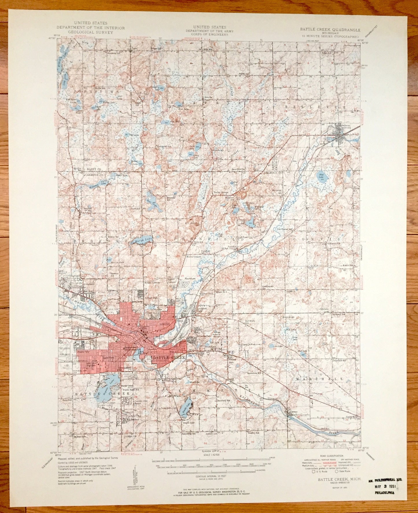
Antique Battle Creek, Michigan 1950 US Geological Survey Topographic Map – Bellevue, Assyria, Pennfield, Bedford, Emmett, Calhoun County, MI
Antique Battle Creek, Michigan 1950 US Geological Survey Topographic Map – Bellevue, Assyria, Pennfield, Bedford, Emmett, Calhoun County, MI
Beautiful, antique map of the Battle Creek, Michigan and surrounding Calhoun County area. This is an authentic 1950 print from the U.S. Geological Survey and NOT a computer reproduction.
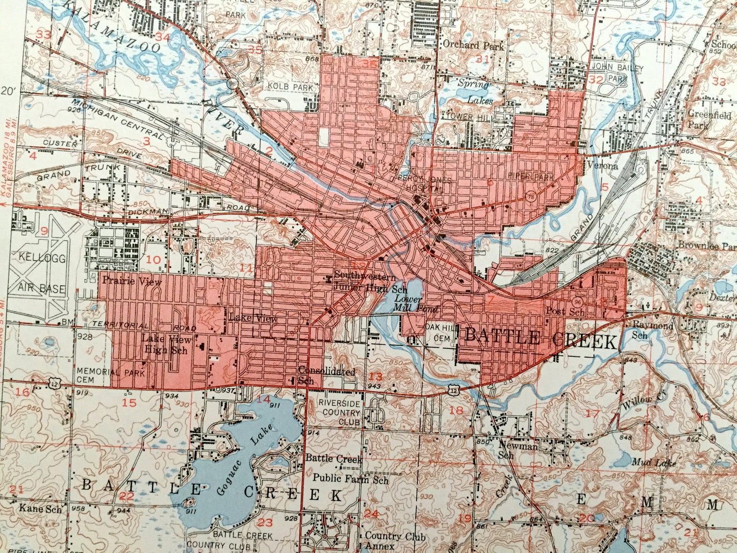
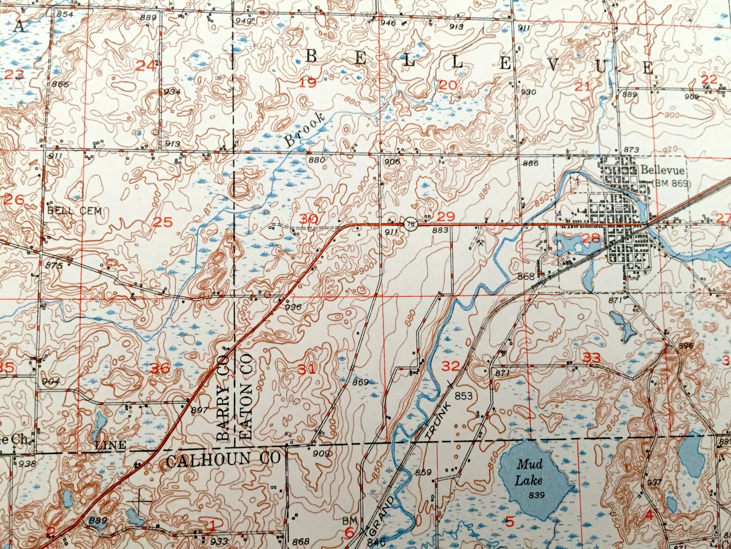
See what Battle Creek looked like over 70 years ago. Lots of intricate details and geological contours. Map even has little squares for every house that existed at the time. The USGS cartographers were very thorough back then!
Perfect for the historian, map-lover, the curious or just as a conversation starter. Wonderful and rare. Maps such as this make great gifts.
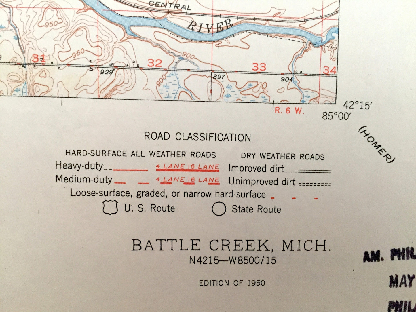
Edition of 1950, printed 1950
Dimensions: 17" width x 21" height
----
Features
Cities & Towns: Johnstown, Assyria, Bellevue, Bedford, Pennfield, Convis, Battle Creek, Emmett, Marshall, Urbandale, Spring Lakes, Verona.
Points of Interest: Kalamazoo River, Battle Creek, Wabascon Creek, Wanadoga Creek, Ellis Creek, Wabascon Lake, Bear Lake, St. Mary's Lake, Mud Lake, Lower Mill Pond, Upper Mill Pond, Beadle Lake, Goguac Lake, Brewer Marsh, and many more small towns, schools, train tracks, roads, hills and creeks.
Condition: Very Good Vintage condition, commensurate with age. This map is in great shape for being over 70 years old. Has light wear, toning and ex-libris stamp in margin, but this will all add to vintage character when framed.
----
We will happily adjust shipping price for multiple purchases. Maps are rolled up and shipped in sturdy mailing tubes, never folded.
Couldn't load pickup availability
Share