My Store
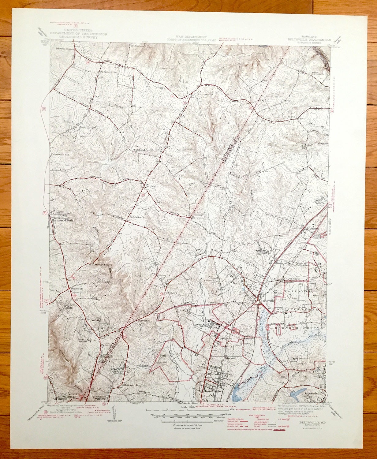
Antique Beltsville, Maryland 1945 US Geological Survey Topographic Map – Greenbelt, Hollywood, Edgewood, Montgomery, Prince Georges County
Antique Beltsville, Maryland 1945 US Geological Survey Topographic Map – Greenbelt, Hollywood, Edgewood, Montgomery, Prince Georges County
Beautiful, antique map of Prince Georges and Montgomery County Maryland, just north of Washington, DC. This is an authentic 1945 print from the U.S. Geological Survey and NOT a computer reproduction.
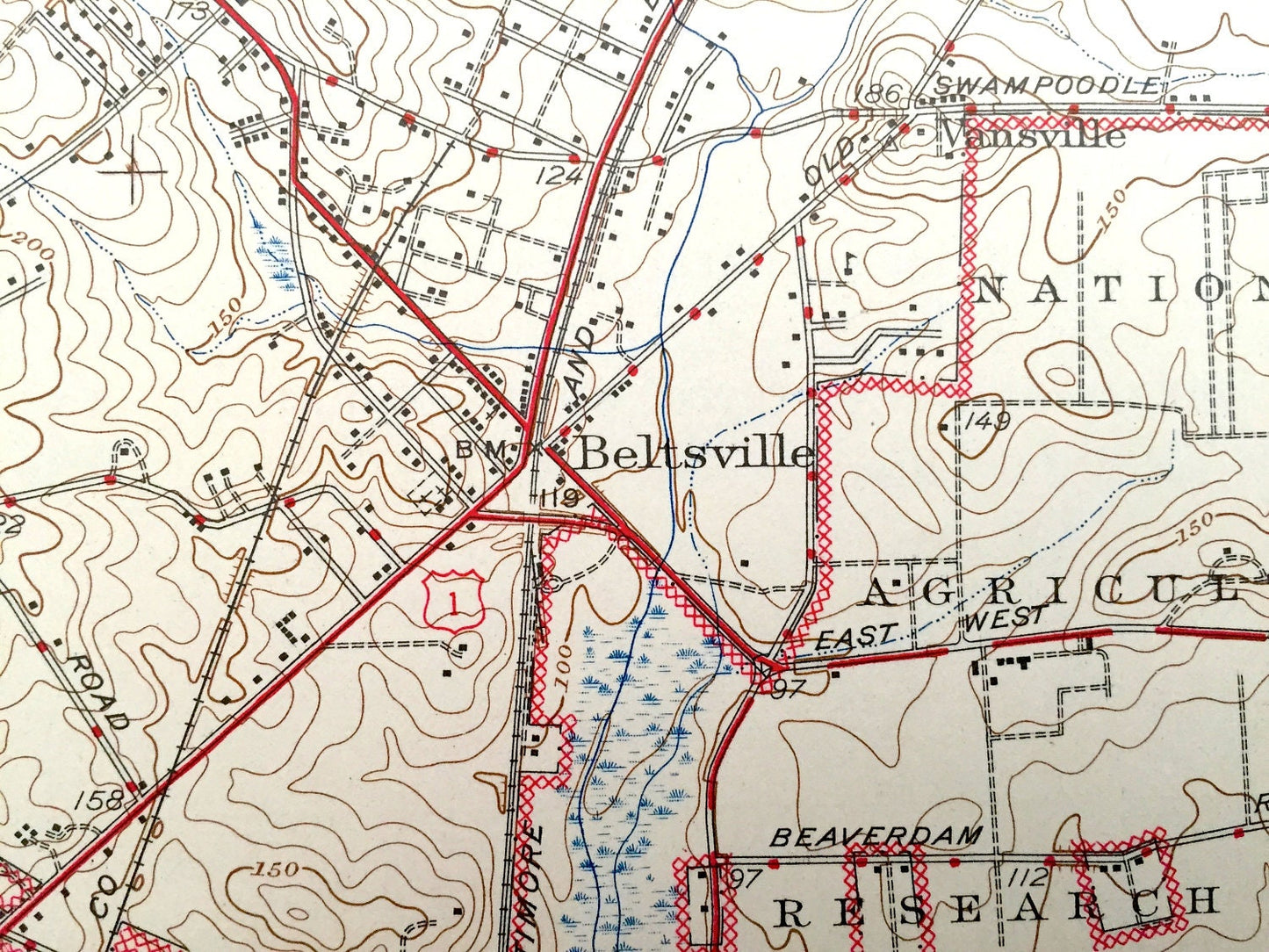
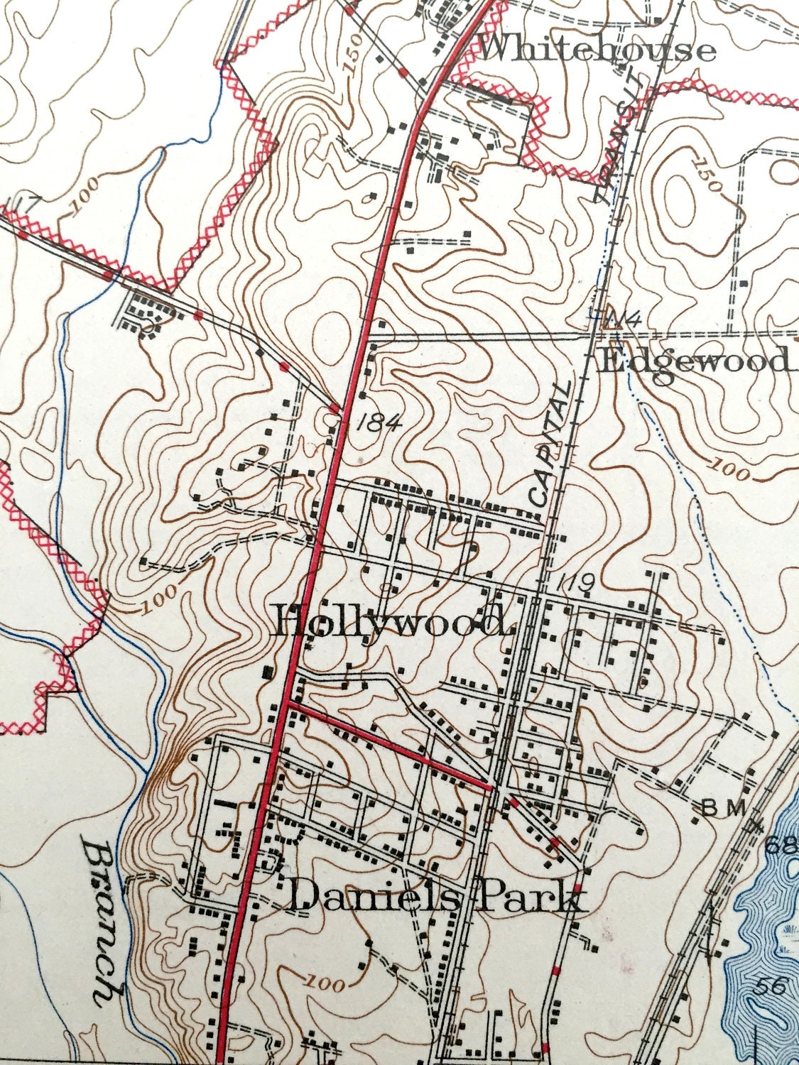
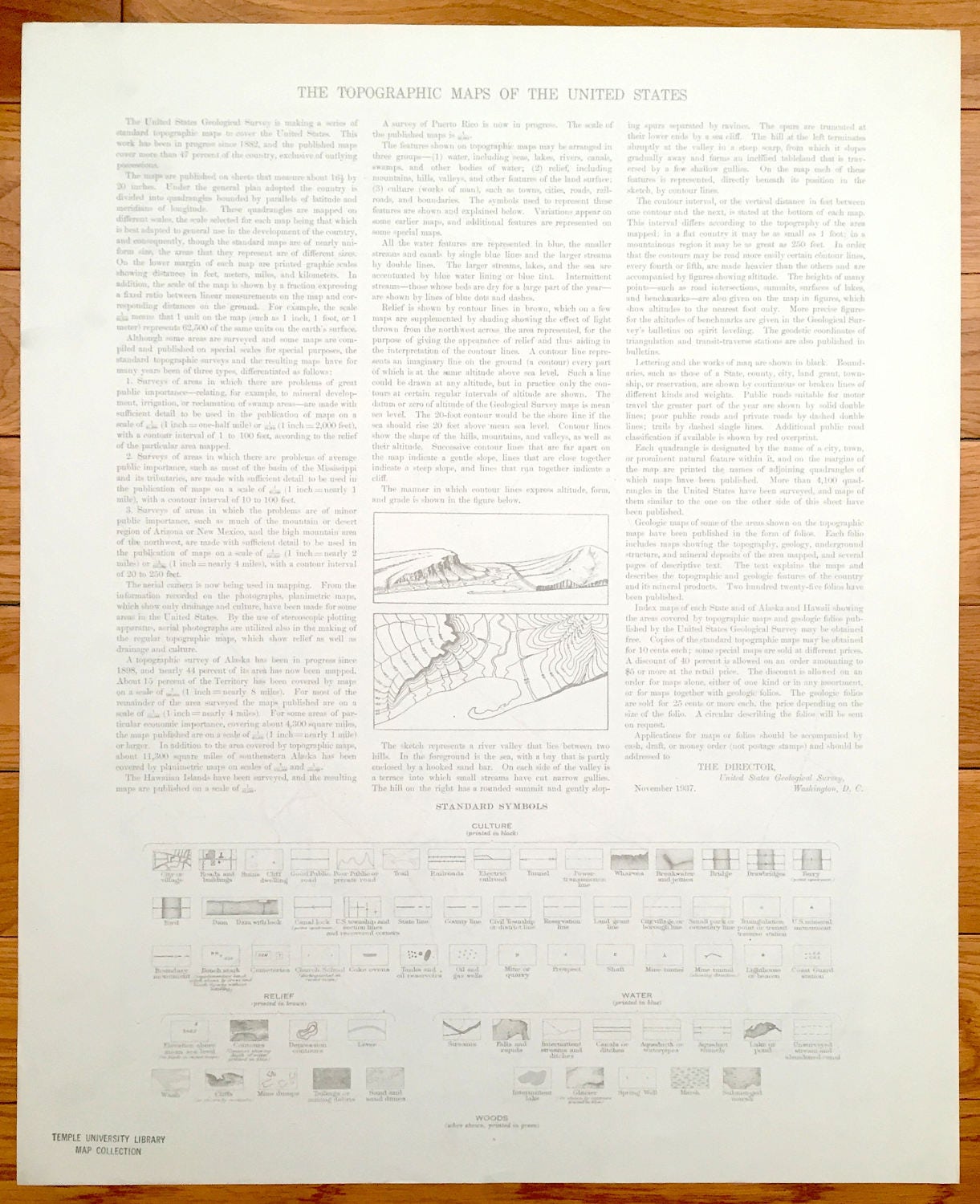
See what Beltsville and surrounding area looked like over 70 years ago. Lots of intricate details and geological contours. Map even has little squares for every house that existed at the time. The USGS cartographers were very thorough back then! On the back is a description of topographic symbols and map guide.
Perfect for the historian, map-lover, the curious or just as a conversation starter. Wonderful and rare. Vintage maps such as these make great gifts.
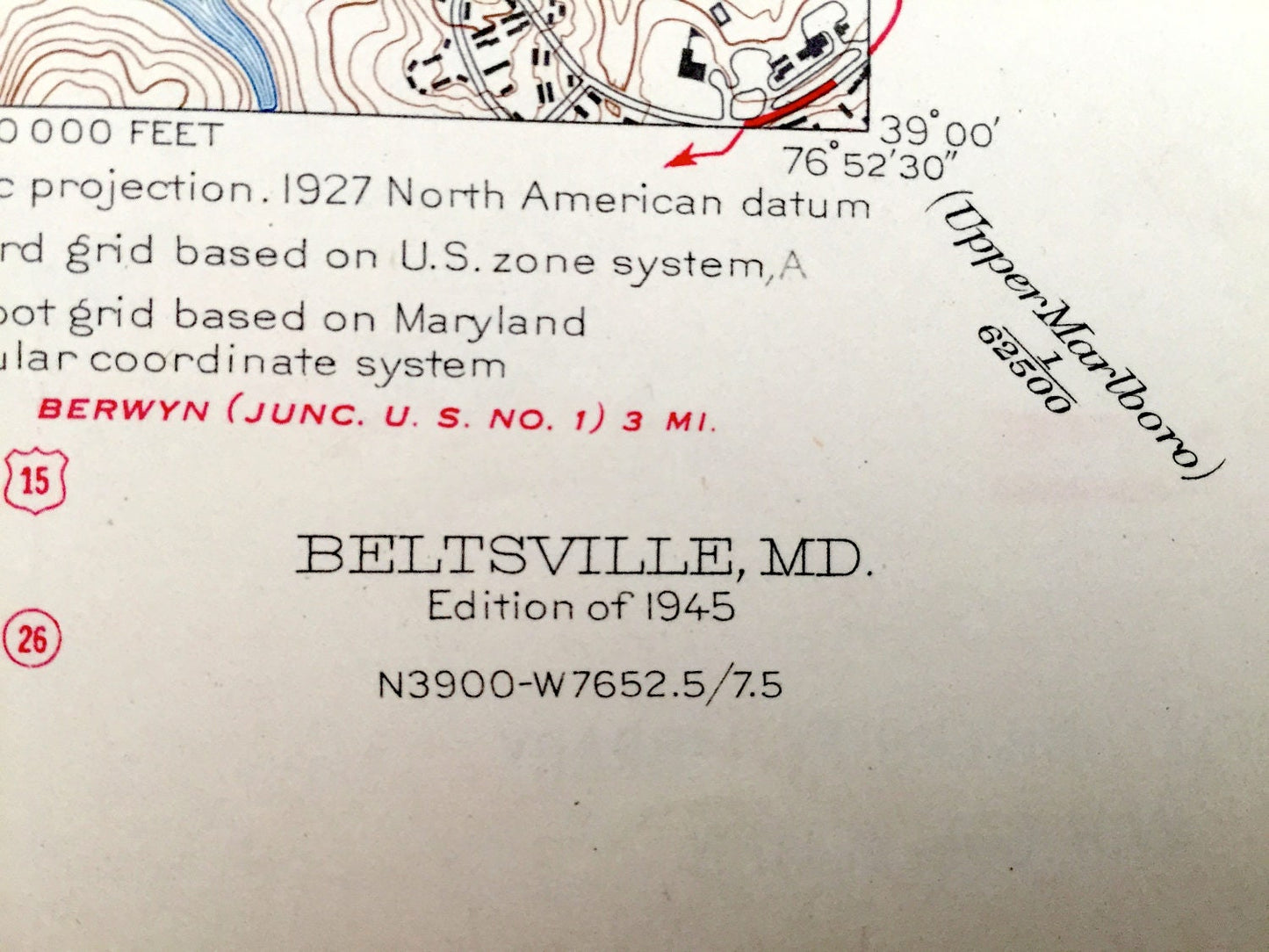
Edition of 1945, printed 1945
Dimensions: 17" width x 21" height
----
Features
Cities & Towns: Good Hope, Burtsonsville, Hollywood Park, Fairland, Pine Ridge, Whiteoak, Burnt Mills Hills, Hillandale, Lewiston, Clifton Park Village, Whitehouse, Edgewood, Hollywood, Daniels Park, Beltsville, Greenbelt, Ammendale, Sunnyside, Queens Chapel, Muirkirk.
Points of Interest: National Agricultural Research Center, Xaverian College, Washington Memorial Park, Holy Trinity Missionary Cenacle, Beaverdam Creek, Indian Creek, Briarley Military Academy, Patuxent River, and lots more streams, marshes, houses, churches, roads and national monuments.
Condition: Very Good condition, commensurate with age. This map is in incredible shape for being over 70 years old.
----
We will happily adjust shipping price for multiple purchases. Maps are rolled up and shipped in sturdy mailing tubes, never folded.
Couldn't load pickup availability
Share