My Store
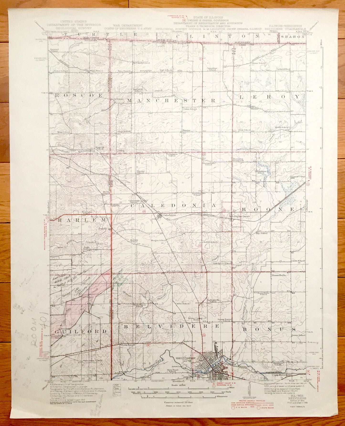
Antique Belvidere, Illinois 1918 US Geological Survey Topographic Map – Winnebago, Boone County, Caledonia, Guilford, Bonus, Wisconsin IL
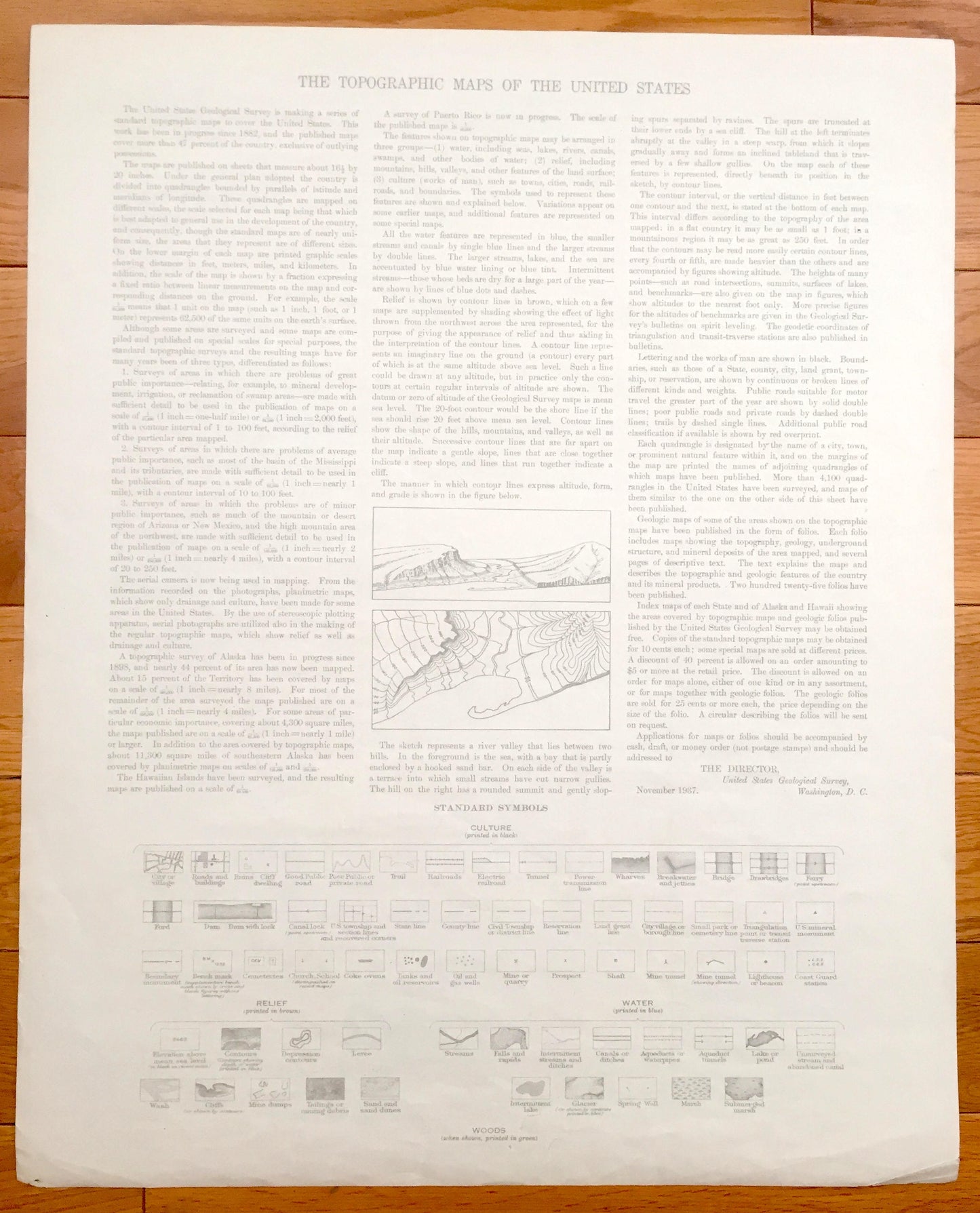
Antique Belvidere, Illinois 1918 US Geological Survey Topographic Map – Winnebago, Boone County, Caledonia, Guilford, Bonus, Wisconsin IL
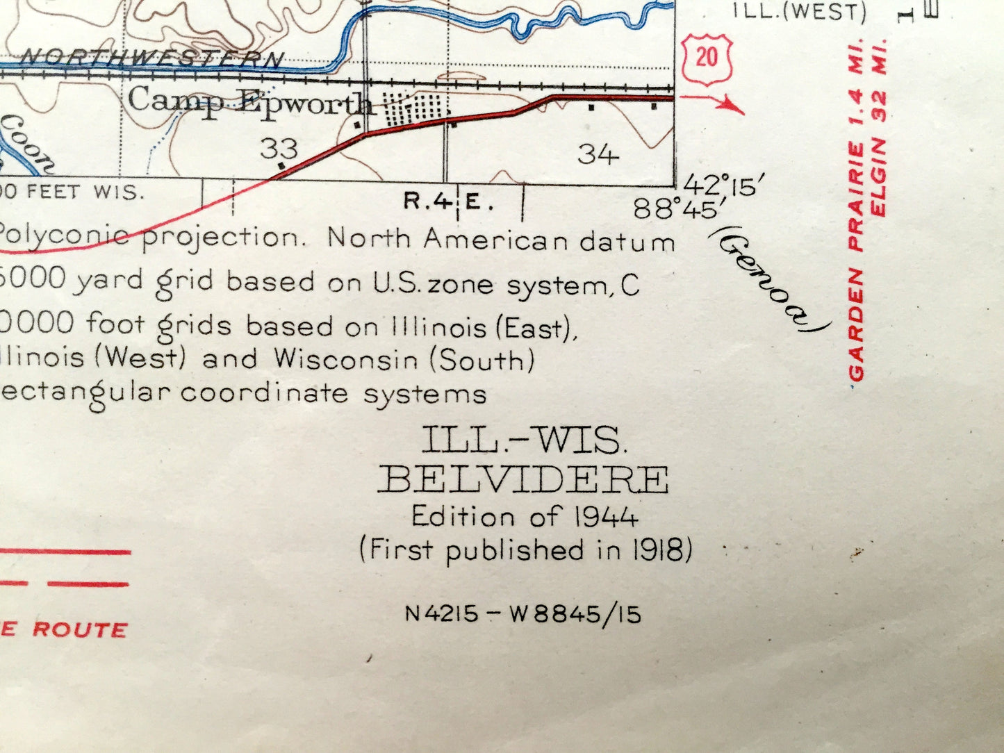
Beautiful, antique map of Belvidere, Caledonia, Guilford, Bonus & Manchester, Illinois and surrounding Winnebago & Boone County area. This is an authentic 1918 edition, 1944 print from the U.S. Geological Survey and NOT a computer reproduction.
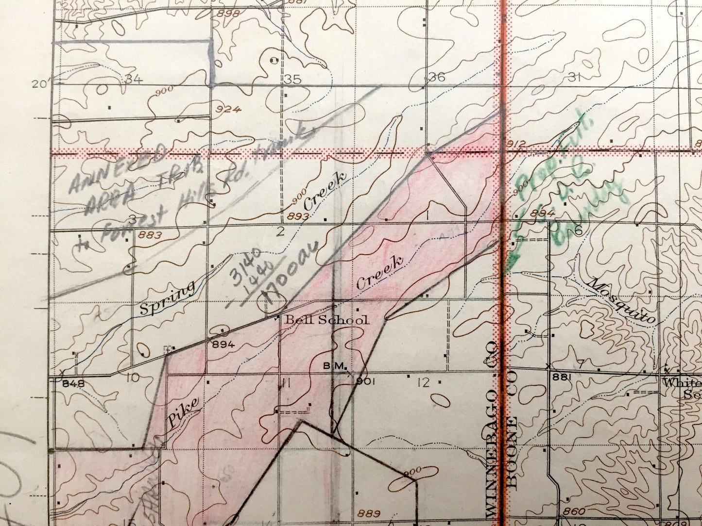
See what Illinois looked like over 100 years ago. Lots of intricate details and geological contours. Map even has little squares for every house that existed at the time. The USGS cartographers were very thorough back then! On the back is a description of topographic symbols and map guide.
Perfect for the historian, map-lover, the curious or just as a conversation starter. Wonderful and rare. Vintage maps such as these make great gifts.
Edition of 1918, printed 1944
Dimensions: 16 1/2" width x 20 1/2" height
----
Features
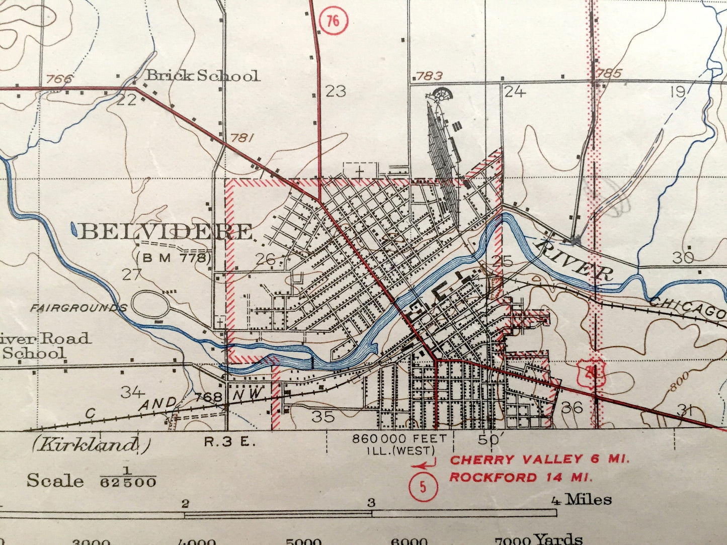
Cities & Towns: ILLINOIS: Roscoe, Machester, Leroy, Harlem, Caledonia, Boone, Guilford, Belvidere, Bonus, Hunter, Blaine, Argyle, Poplar Grove, Camp Epworth, Russellville.
WISCONSIN: Turtle, Clinton, Sharon.
Points of Interest: Winnebago County, Boone County, Kishwaukee River, Willow Creek, Pike Creek, Chicago & Northwest Railroad and lots more hills, brooks, towns, schools, churches, roads and train tracks.
Condition: Good Vintage condition, commensurate with age. This map is in great shape for being over 75 years old. Has light edge-wear and some cartographic pencil markings, but these will read as vintage character when framed.
----
We will happily adjust shipping price for multiple purchases. Maps are rolled up and shipped in sturdy mailing tubes, never folded.
Couldn't load pickup availability
Share