My Store
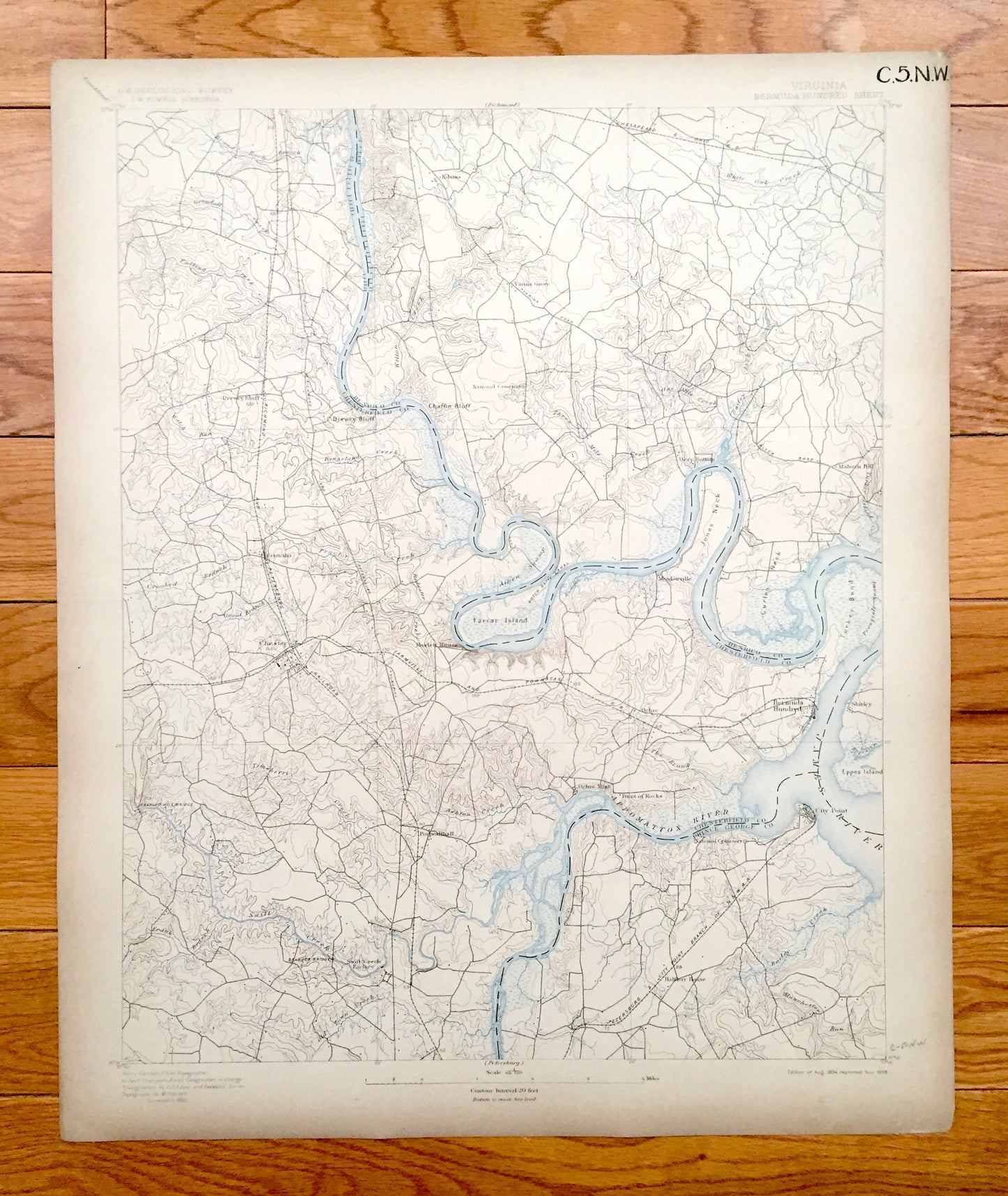
Antique Bermuda Hundred, Virginia 1894 US Geological Survey Topographic Map – Hopewell, City Point, Chester, Richmond, Colonial Heights, VA
Antique Bermuda Hundred, Virginia 1894 US Geological Survey Topographic Map – Hopewell, City Point, Chester, Richmond, Colonial Heights, VA
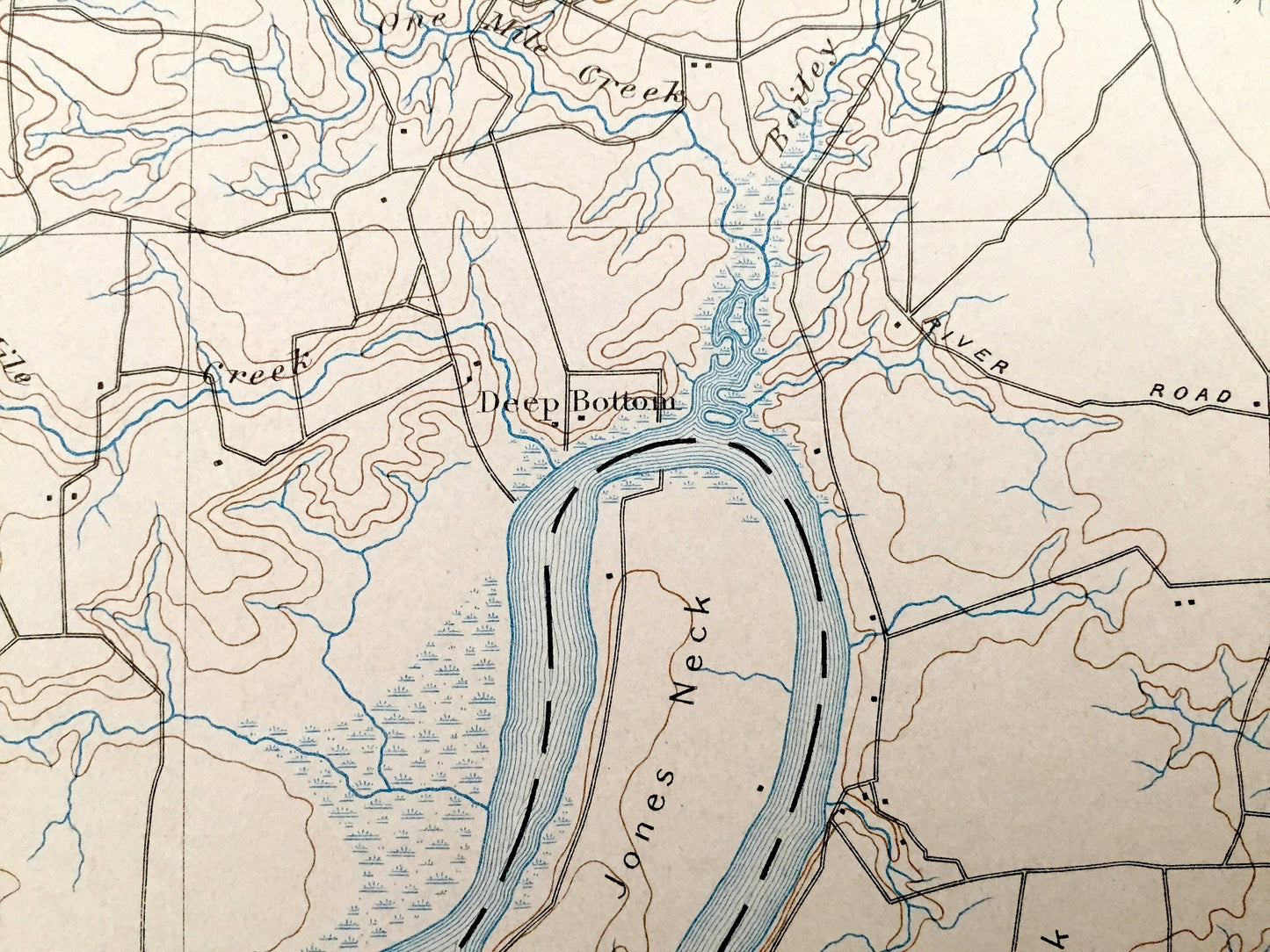
Beautiful, antique map of Bermuda Hundred, Virginia and surrounding Chesterfield County area on the James River. This is an authentic 1894 edition, 1898 print from the U.S. Geological Survey and NOT a computer reproduction.
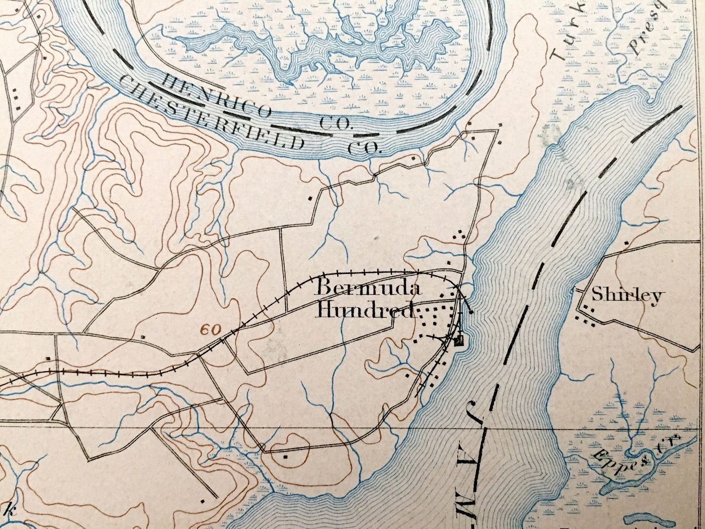
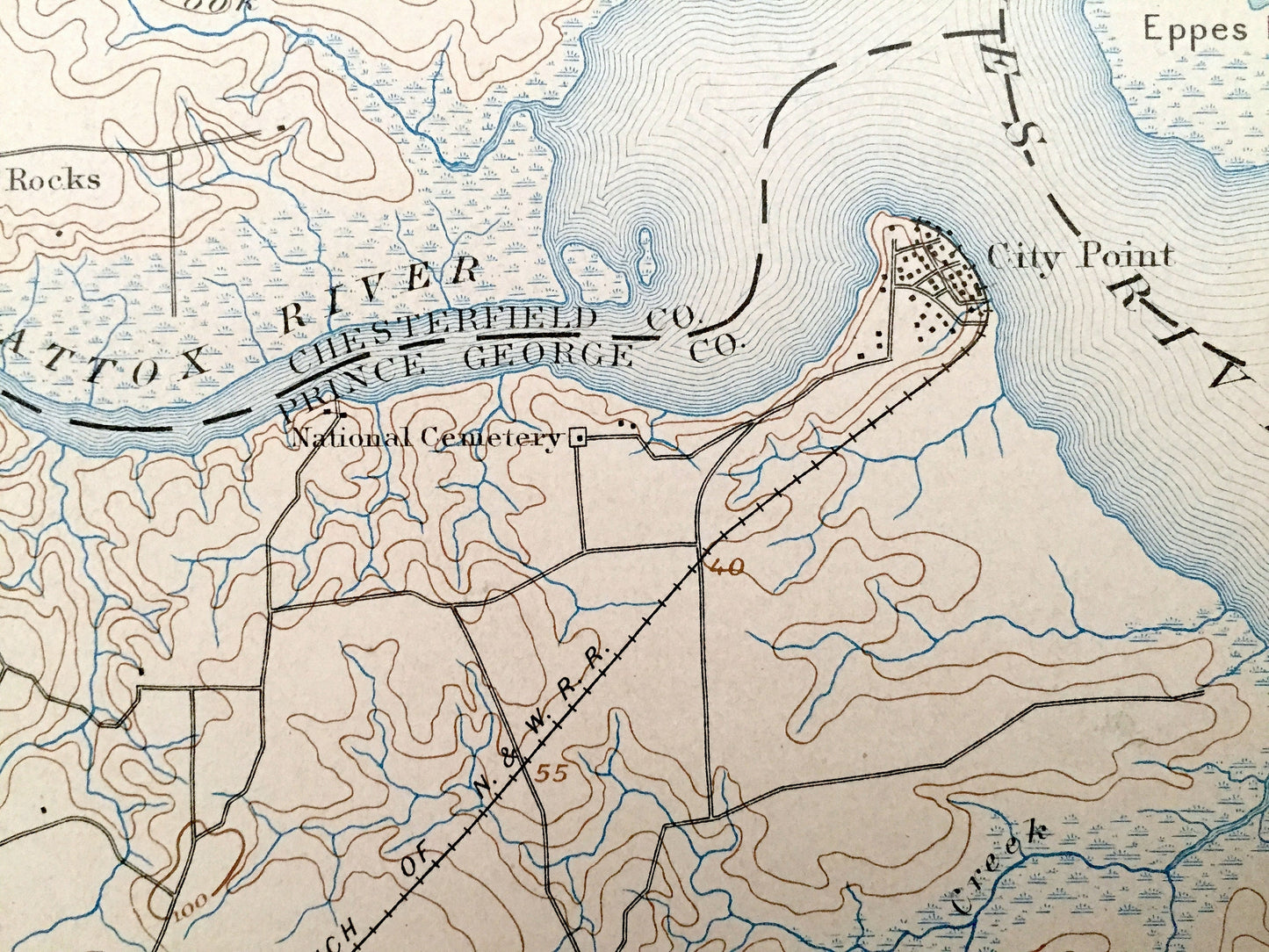
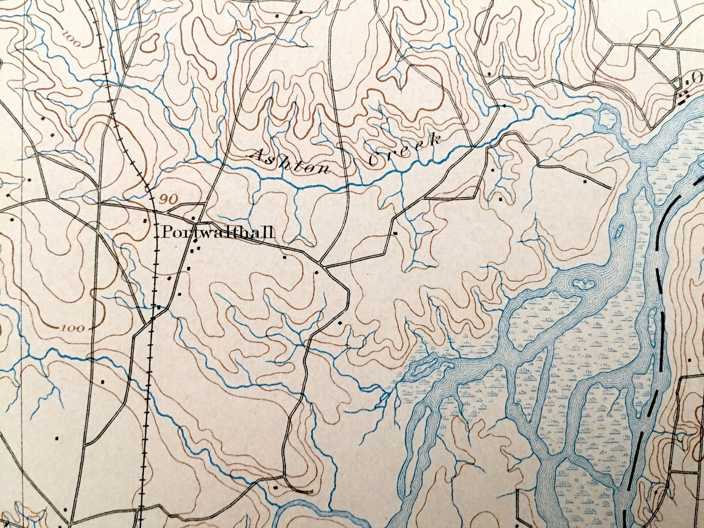
See what Virginia looked like more than 125 years ago—including Chesterfield, Henrico, Prince George & Charles City County. Lots of intricate details and geological contours. Map even has little squares for every house that existed at the time. The USGS cartographers were very thorough back then! Map is canvas-backed.
Perfect for the historian, map-lover, the curious or just as a conversation starter. Wonderful and rare. Vintage maps such as this make great gifts.
Edition of 1894, printed 1898
Dimensions: 16 1/2" width x 20" height
----
Features
Cities & Towns: (Some future sites) Richmond, Broad Rock, Clopton, Richmond Heights, Capital View, Fort Lee, Bensley Village, Drewrys Bluff, Chimney Corner, Centralia, Chester, Bermuda Hundred, Shirley, Fair Hill, Walthall, Pickadat Corner, Woodlawn, Colonial Heights, Hopewell, City Point, Arlington, Kenwood, Five Forks, Jefferson Park, Camp Lee, Sherman Corner, Falling Creek, Deep Bottom, Ochre Mine, Point of Rocks, Ochre, Meadowville, Varina Grove.
Points of Interest: James River, Appomattox River, Turkey Bend, Jones Neck, Farrar Island, Swift Creek, Old Town Creek, Chaffin Bluff, Ashton Creek, Hatcher Island, Dutch Gap Channel, Chesapeake & Ohio Railroad, Richmond & Petersburg Railroad, and many more small towns, roads, train tracks, hills, islands and creeks.
Condition: Good Vintage condition, commensurate with age. This map is in great shape for being more than 120 years old. Some edge wear, toning and library marking in upper right margin, which will all read as character when framed.
----
We will happily adjust shipping price for multiple purchases. Maps are rolled up and shipped in sturdy mailing tubes, never folded.
Couldn't load pickup availability
Share