My Store
Antique Bethel, Maine 1940 US Geological Survey Topographic Map – Hanover, Newry, Gilead, Albany, Stoneham, Oxford, Cumberland County, ME
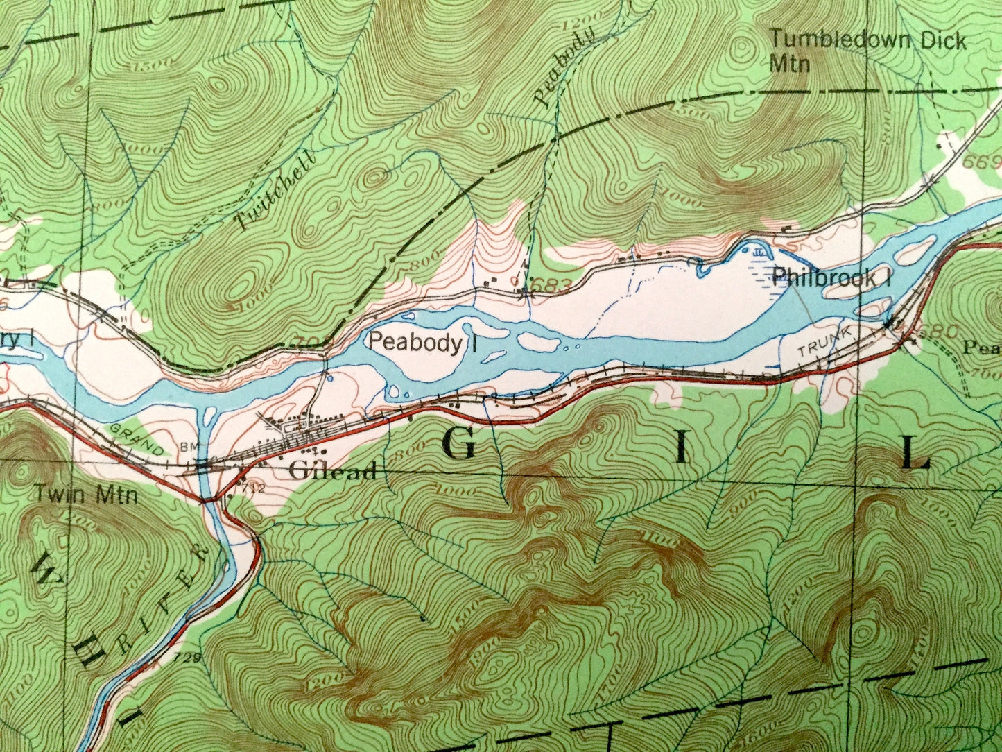
Antique Bethel, Maine 1940 US Geological Survey Topographic Map – Hanover, Newry, Gilead, Albany, Stoneham, Oxford, Cumberland County, ME
Beautiful, antique map of Bethel, Maine and surrounding Oxford & Cumberland County area on the New Hampshire border. This is an authentic 1940 edition, 1968 print from the U.S. Geological Survey and not a computer reprint.
See what Maine looked like 80 years ago. Lots of intricate details and geological contours. Map even has little squares for every house that existed. The USGS cartographers were very thorough back then!
Perfect for the historian, map-lover, the curious or just as a conversation starter. Wonderful and rare. Vintage maps such as these make great gifts.
Edition of 1940, printed 1968
Dimensions: 17" width x 21" height
----
Features
Towns: Riley, Newry, Hanover, Gilead, Bethel, Batcheldersgrant, Mason, Albany, Stow, Stoneham, Lovell, Northwest Bethel, Middle Intervale, North Bethel, Mayville, Hastings, West Bethel, Greenwood, East Stoneham, Town House.
Bodies of Water: Androscoggin River, Oxford County, Farwell Mountain, Crooked River, Mt. Will, Barker Mountain, Bear Mountains, Peter Grover Hill, Keewaydin Lake, Virginia Lake, Songo Pond, Hastings Island, Tumbledown Dick Mountain, Alder River, Sunday River, Campbell Mountain, Jakes Notch and lots more smaller hills, mountains, ponds and streams, bogs, houses, schools, roads, churches, railroads.
Condition: Very Good Vintage condition, commensurate with age. This map is in great shape for being more than 50 years old.
----
We will happily adjust shipping price for multiple purchases. Maps are rolled up and shipped in sturdy mailing tubes, never folded.
Couldn't load pickup availability
Share