My Store
Antique Beverly, New Jersey & Philadelphia, Pennsylvania 1966 US Geological Survey Topographic Map – Bristol, Delran, Morestown, Cinnaminson
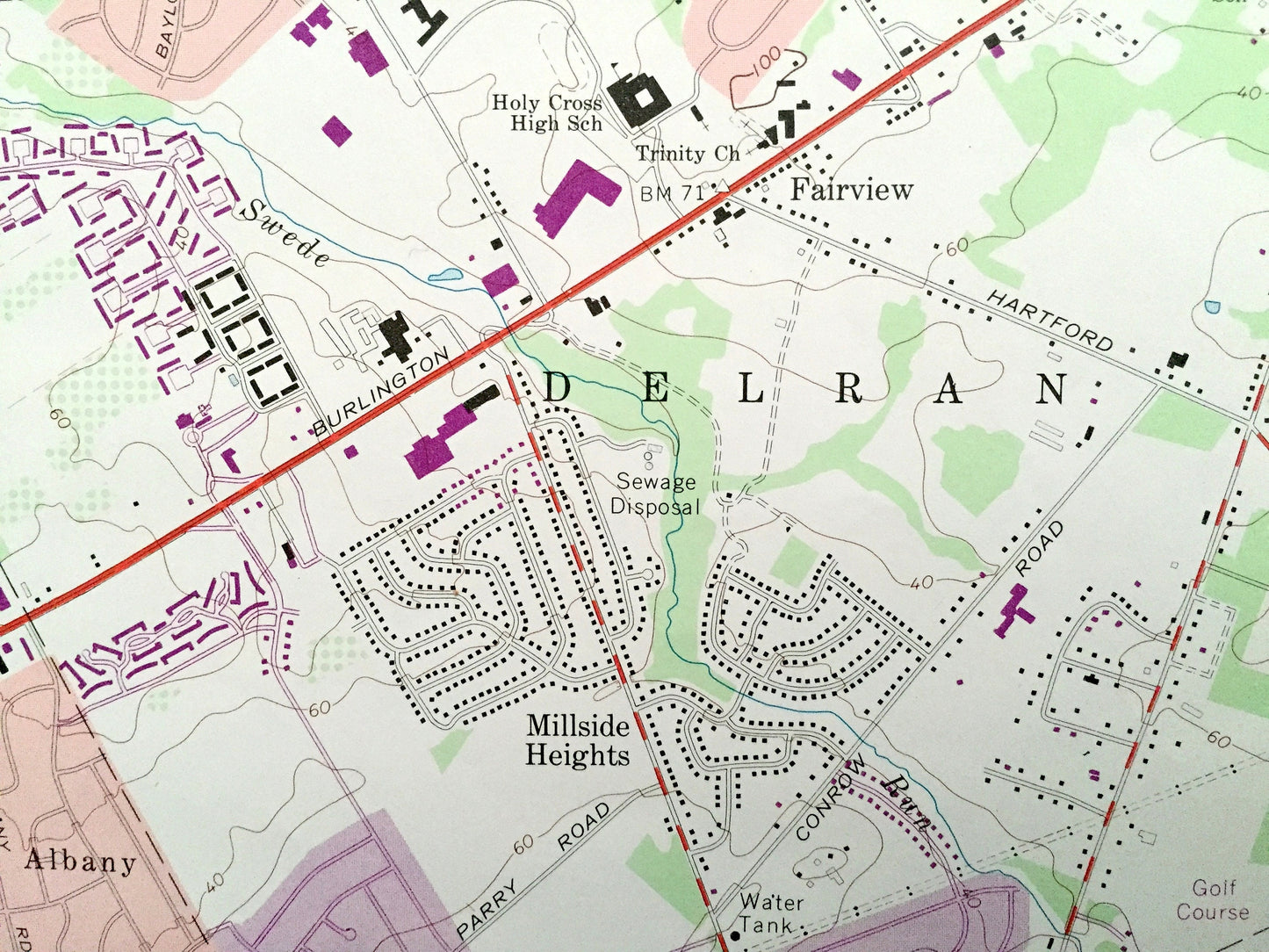
Antique Beverly, New Jersey & Philadelphia, Pennsylvania 1966 US Geological Survey Topographic Map – Bristol, Delran, Morestown, Cinnaminson
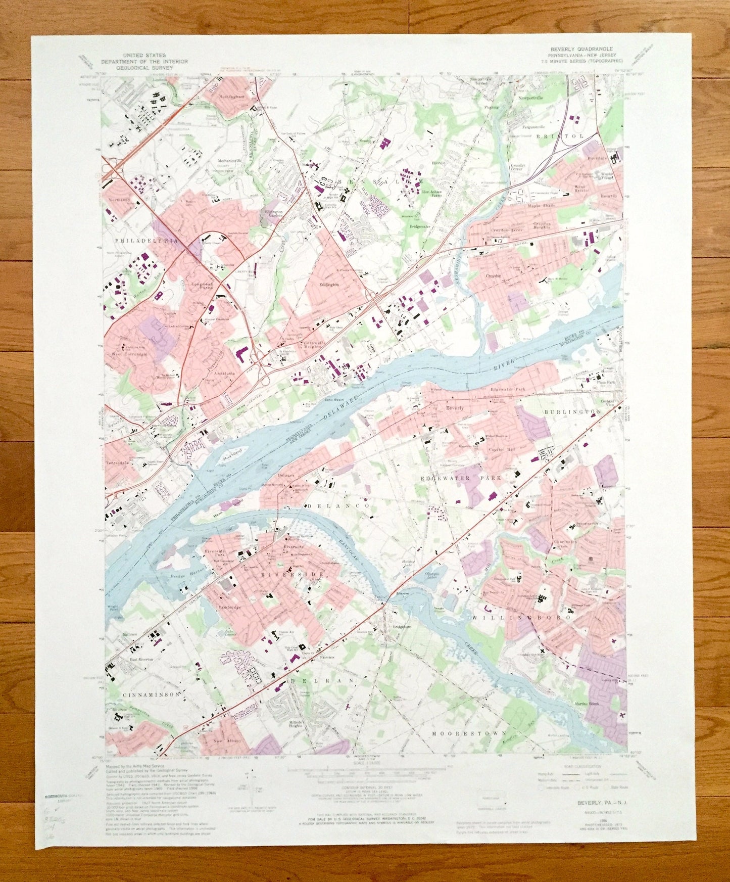
Beautiful, antique map of Beverly, Edgewater Park, Burlington, Cinnaminson and Delran, New Jersey, including Philadelphia, Eddington and Croydon, Pennsylvania. This is an authentic 1966 edition, 1974 print from the U.S. Geological Survey and NOT a computer reproduction.
See what Burlington County of New Jersey and Philadelphia and Bucks Counties of Pennsylvania looked like over 50 years ago. Lots of intricate details and geological contours. Map even has little squares for every house that existed at the time. The USGS cartographers were very thorough back then!
Perfect for the historian, map-lover, the curious or just as a conversation starter. Wonderful and rare. Vintage maps such as these make great gifts.
Edition of 1966, printed 1974
Dimensions: 22" width x 27" height
----
Features
Cities & Towns: PENNSYLVANIA: Philadelphia neighborhoods- Normandy, Longmead Farms, West Torresdale, Torresdale. Surrounding Philadelphia- Eddington, Glen Ashton Farms, Bridgewater, Bristol, Newportville, Flushing, Newportville Terrace, Nottingham, Cornwell Heights, Croydon, Croydon Heights, Croydon, Maple Shade, West Bristol, Rockdale, Winder Village, Fergusnville, Grundys Corner.
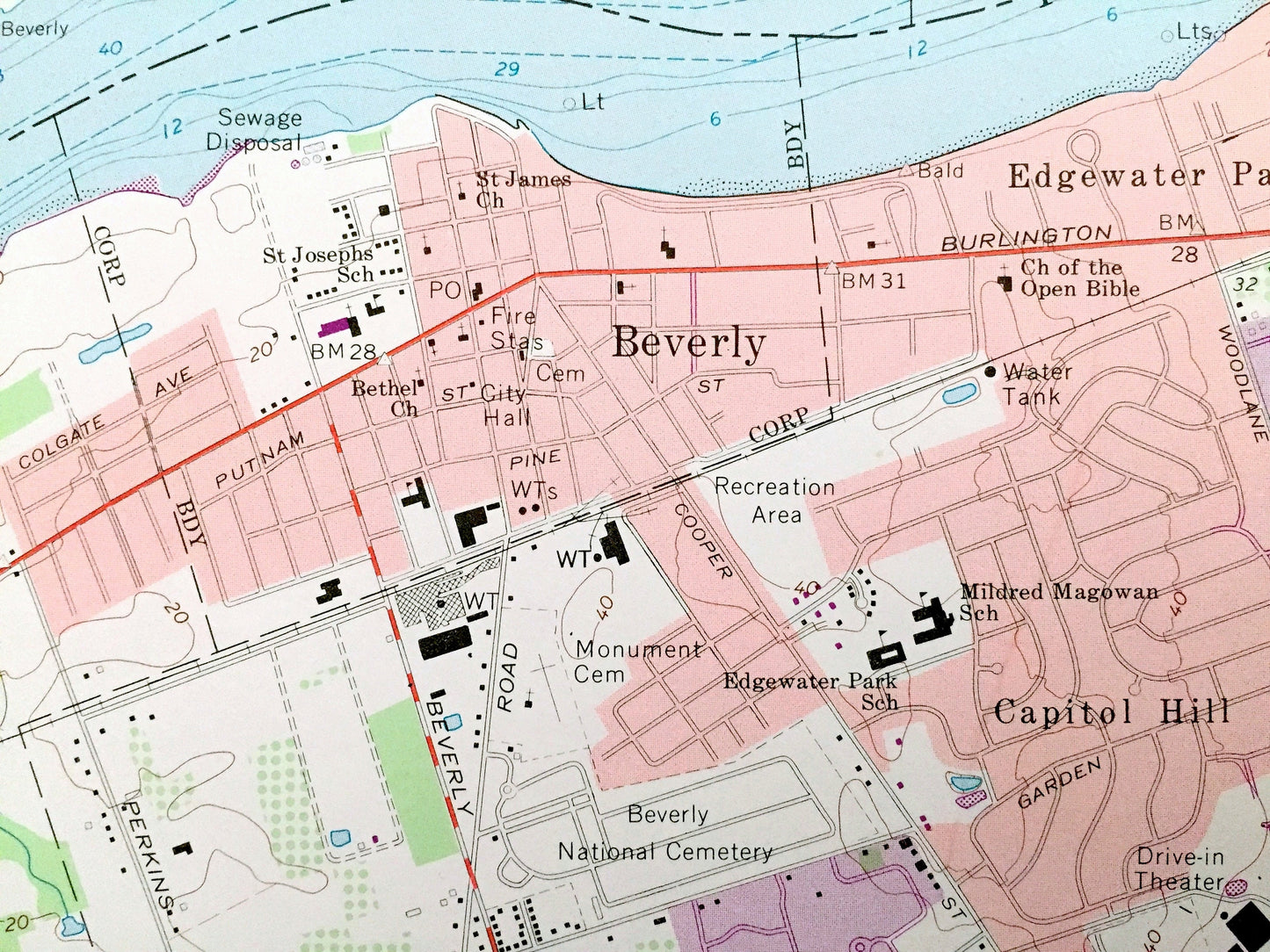
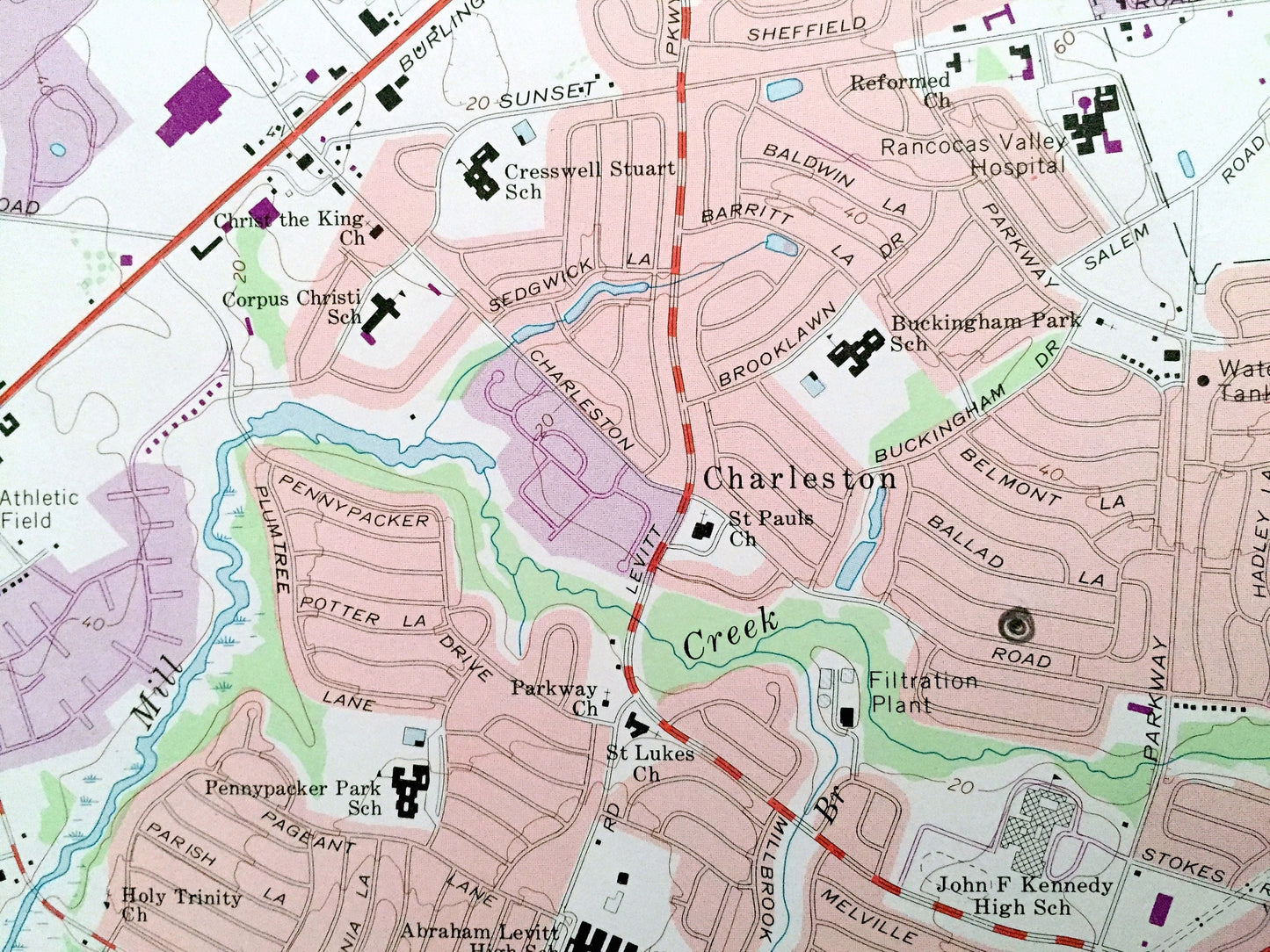
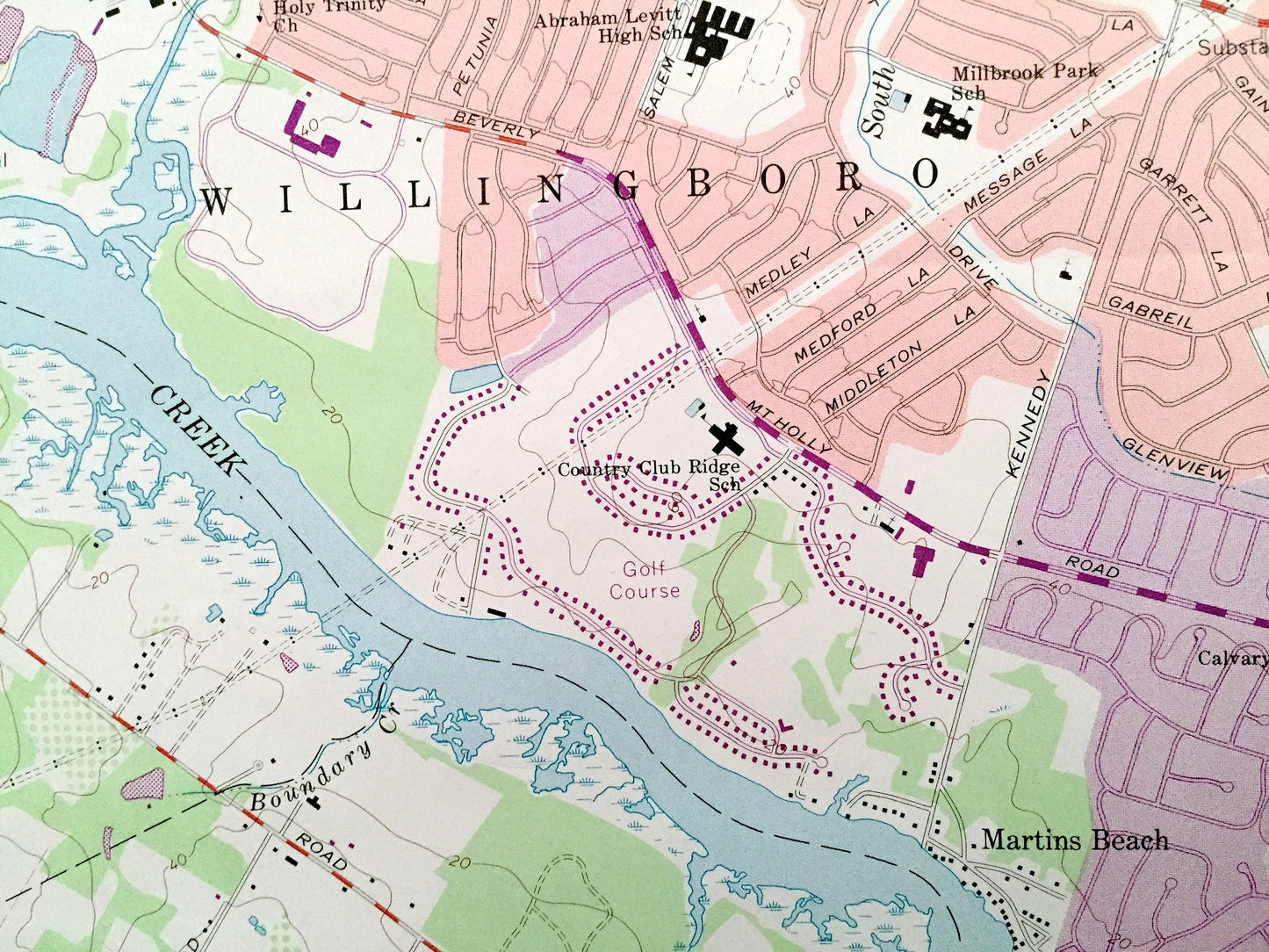
NEW JERSEY: Edgewater Park, Beverly, Burlington, Capitol Hill, Delanco, Riverside, Cinnaminson, New Albany, Delran, Moorsetown, Willingboro, Martins Beach.
Points of Interest: North Philadelphia Airport, County Prison Farm, Our Lady of Fatima School, St Michael Mission Venter, Torresdale- Frankford Country Club, Sacred Heart Convent, Fish Hatchery, Christ the King School, St Elizabeths Convent, Pen Ryn School, Echo Beach, Hickory Street School, Delaware River, Neshaminy Creek, Mary W Devine School, Pennsylvania Central Railroad, Drive-in Theater, Pennypacker School, Olympa Lakes, Delanco Fire Station, Lake Lonnie, Cinnaminson High School, Millbrook Park School, and lots more streams, towns, schools, churches, houses, and roads.
Condition: Very Good Vintage condition, commensurate with age. This map is in great shape for being over 45 years old. Has library pencil mark in bottom left corner, which will add to character when framed.
----
We will happily adjust shipping price for multiple purchases. Maps are rolled up and shipped in sturdy mailing tubes, never folded.
Couldn't load pickup availability
Share