My Store
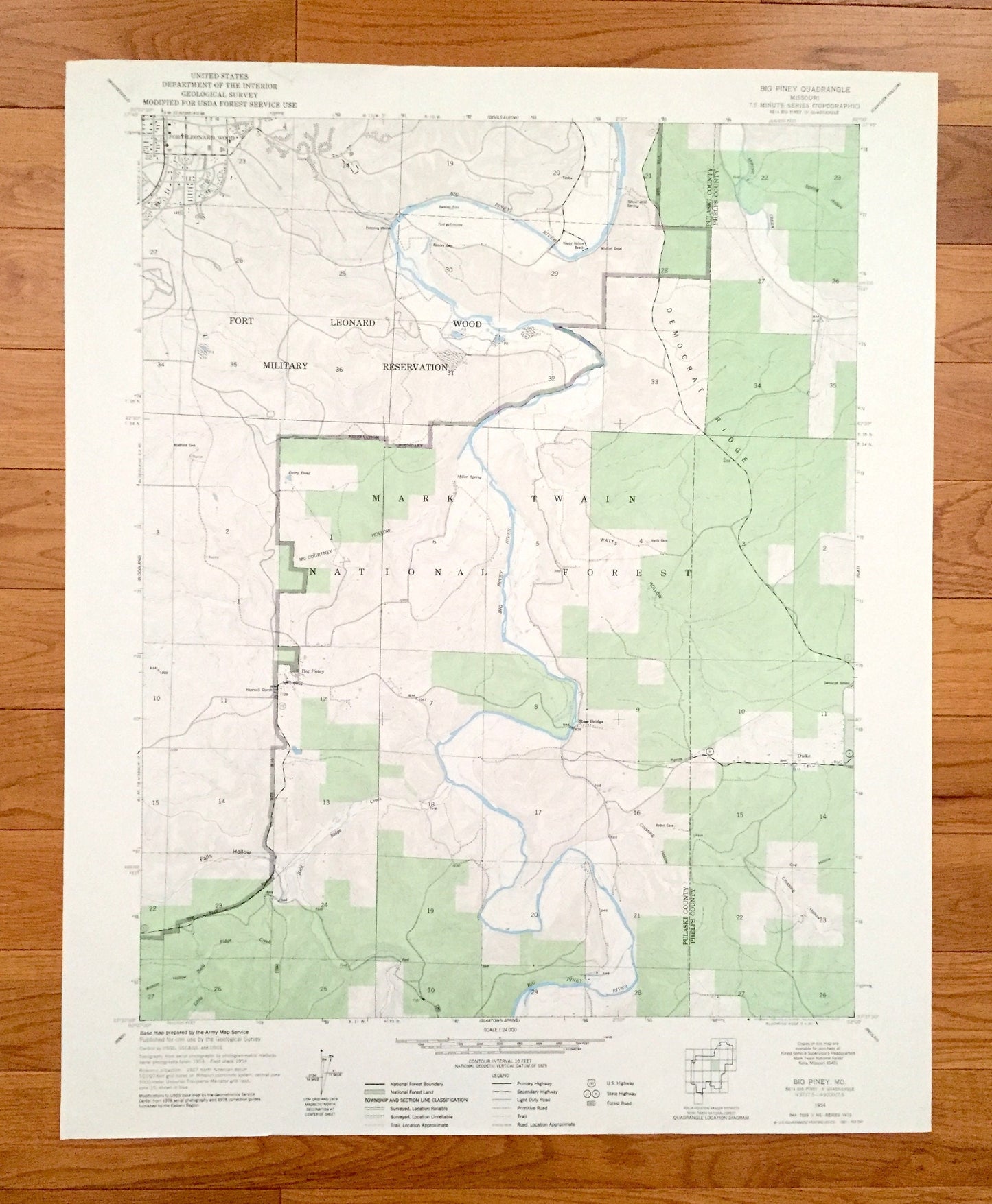
Antique Big Piney, Missouri 1954 US Geological Survey Topographic Map – Phelps, Pulaski County, Fort Leonard Wood, Rose Bridge, Duke, MO
Antique Big Piney, Missouri 1954 US Geological Survey Topographic Map – Phelps, Pulaski County, Fort Leonard Wood, Rose Bridge, Duke, MO
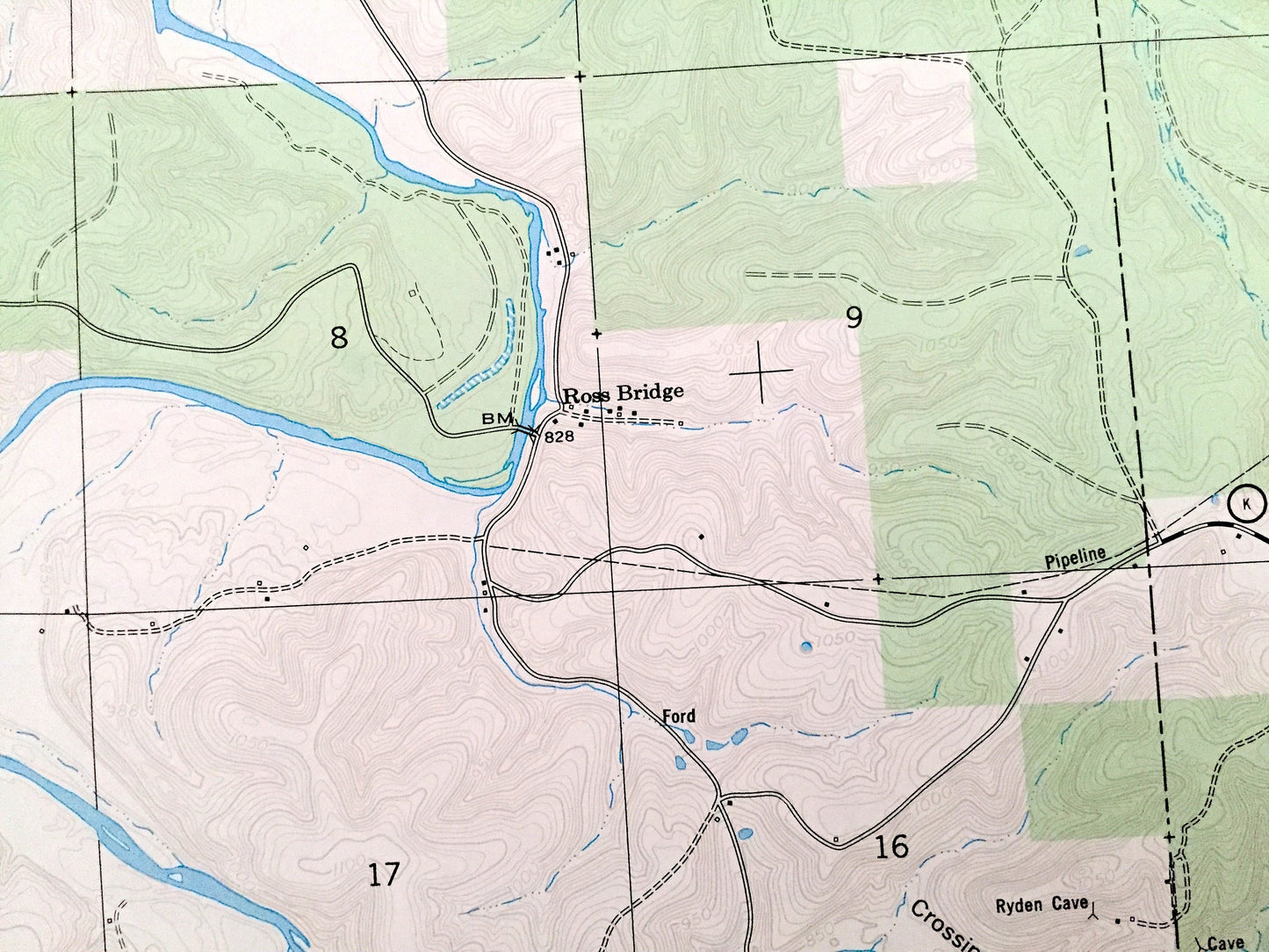
Beautiful, antique map of Big Piney, Missouri and surrounding Pulaski County and Phelps County areas. This is an authentic 1954 edition, 1977 print from the U.S. Geological Survey and NOT a computer reproduction.
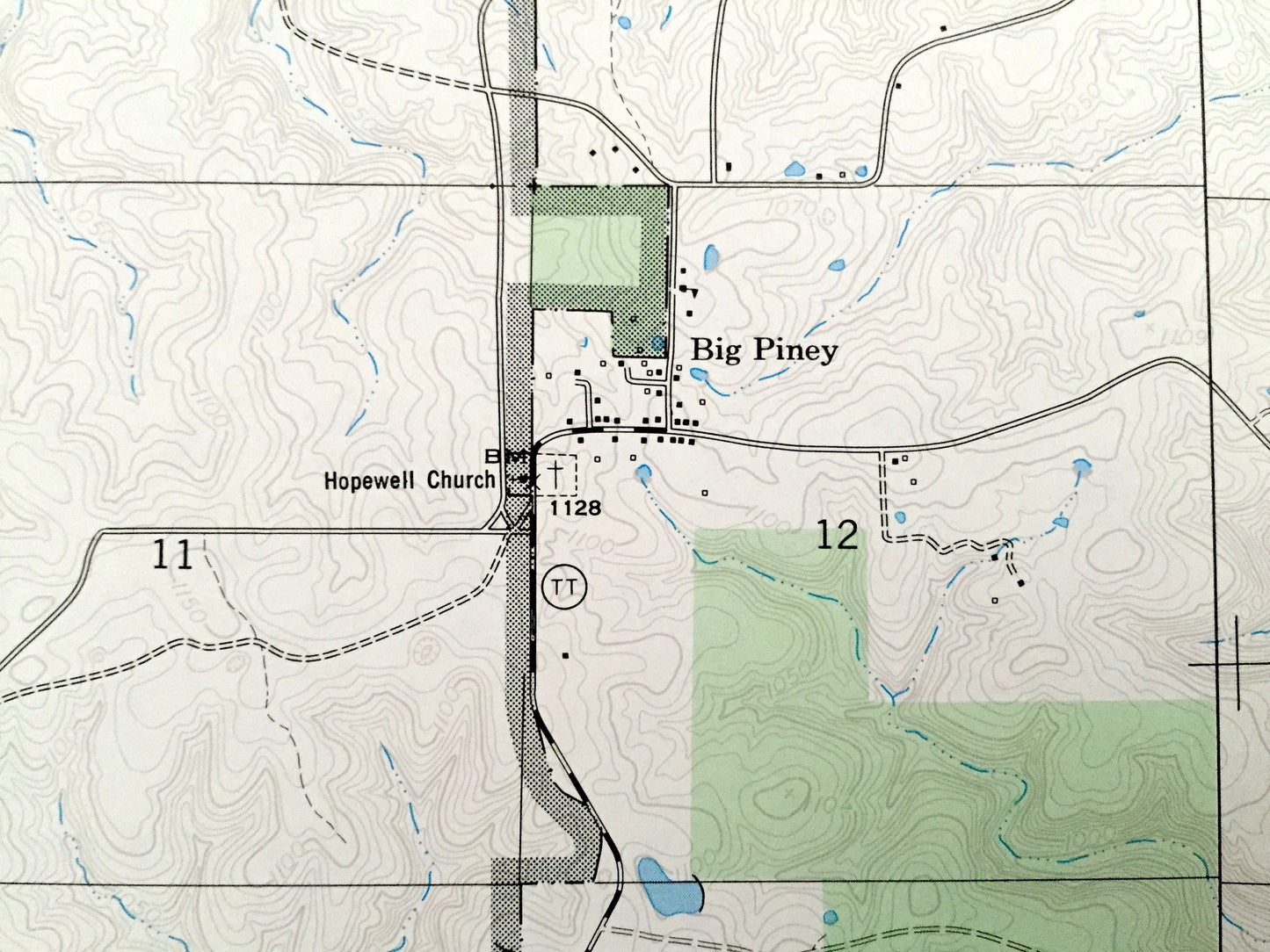
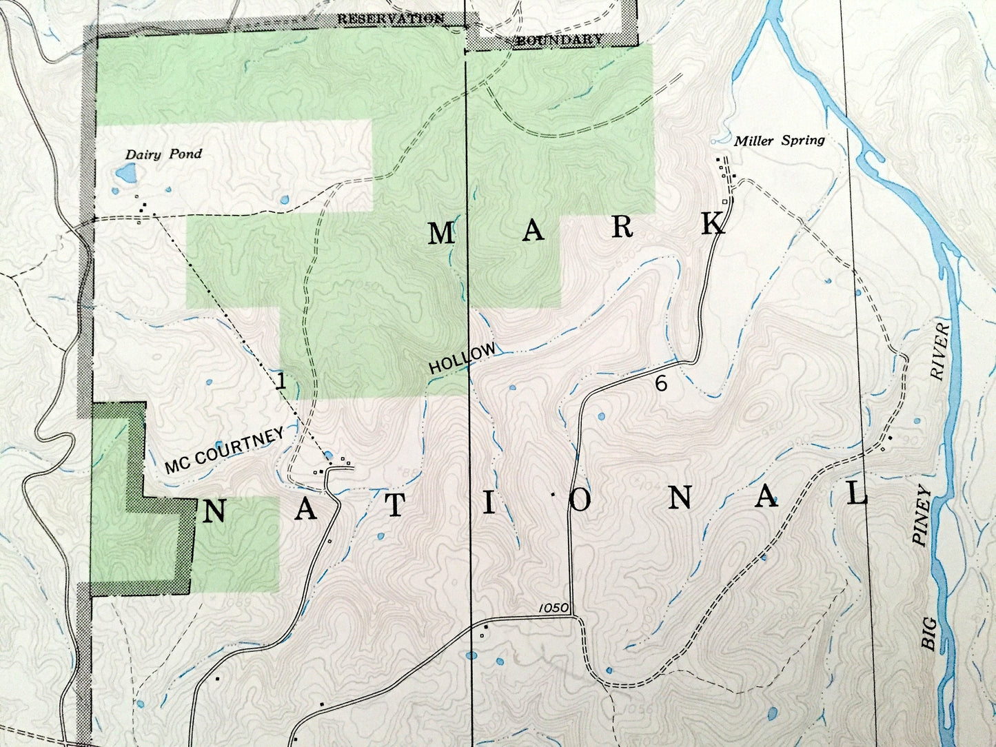
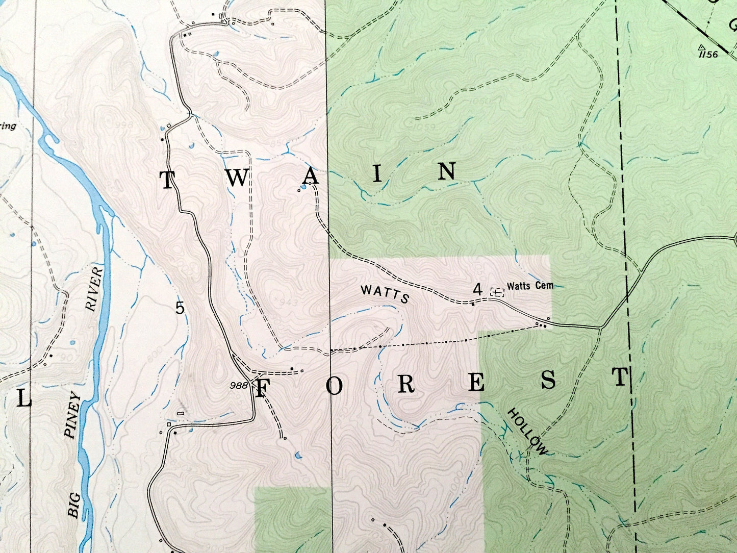
See what Missouri looked like over 65 years ago. Lots of intricate details and geological contours. Map even has little squares for every house that existed at the time. The USGS cartographers were very thorough back then!
Perfect for the historian, map-lover, the curious or just as a conversation starter. Wonderful and rare. Maps such as these make great gifts.
Edition of 1954, printed 1977
Dimensions: 22" width x 27" height
----
Features
Cities & Towns: Rose Bridge, Duke.
Points of Interest: Mark Twain National Forest, Fort Leonard Wood Military Reservation, Democrat Ridge, Happy Hollow Beach, Ryden Cave, Big Piney River, Wildcat Shoal, Stone Mill Spring, Miller Spring, Dairy Pond, Falls Hollow, Wildcat Hollow, McCourtney Hollow, Crossing Hollow, Watts Hollow, Spring Hollow, Spring Creek, Little Bald Ridge Creek, and many more hills, streams, ponds, houses, schools, railroads, churches and roads.
Condition: Very Good Vintage condition, commensurate with age. This map is in incredible shape for being over 40 years old. Has light edge-wear but this will read as character when framed.
----
We will happily adjust shipping price for multiple purchases. Maps are rolled up and shipped in sturdy mailing tubes, never folded.
Couldn't load pickup availability
Share