My Store
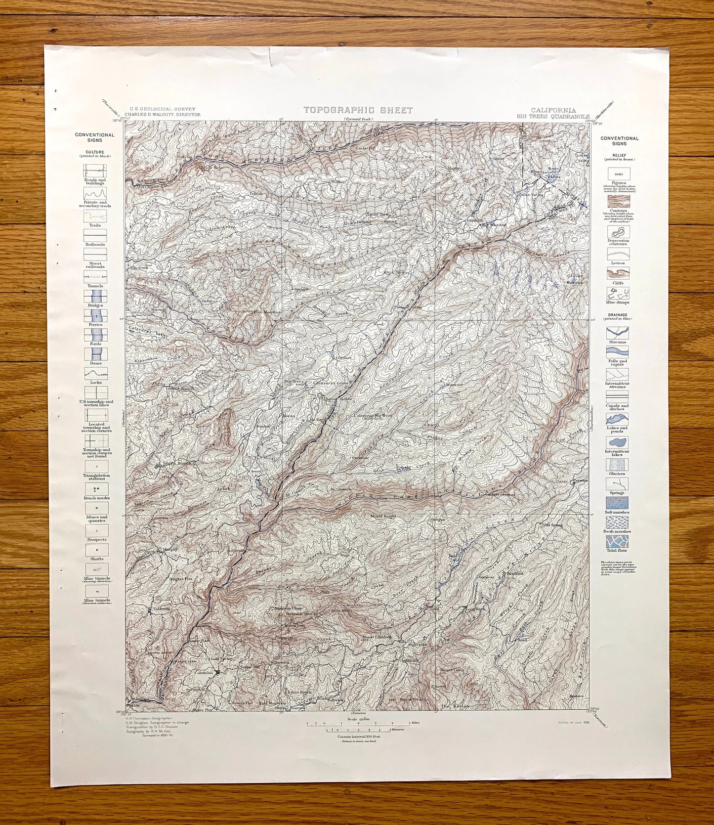
Antique Big Trees, California 1898 US Geological Survey Topographic Map – Calaveras, Tuolumne County, Stanislaus National Forest, Lake, CA
Antique Big Trees, California 1898 US Geological Survey Topographic Map – Calaveras, Tuolumne County, Stanislaus National Forest, Lake, CA
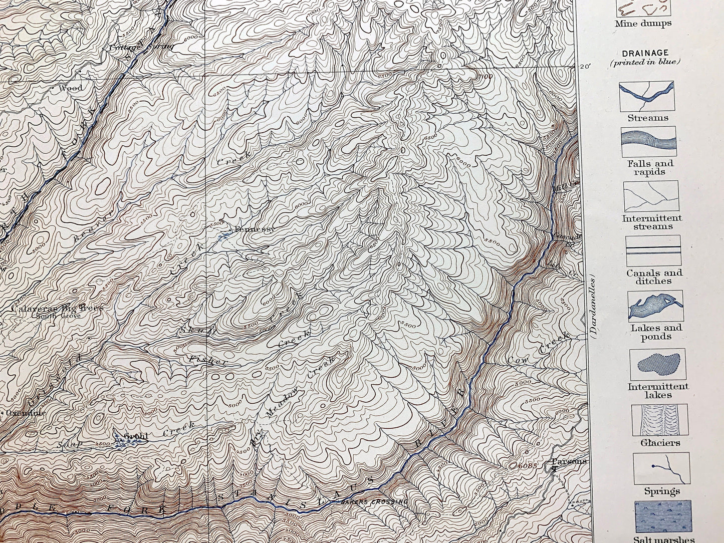
Beautiful, antique map of Big Trees, California and surrounding Tuolumne County, Amador County & Calaveras County area, including Stanislaus National Forest. This is an authentic 1898 edition, 1898 print from the U.S. Geological Survey and NOT a computer reproduction. It is from a Geologic Atlas folio.
See what California looked like over 125 years ago, before New Melones Lake was created. Lots of intricate details and geological contours. The USGS cartographers were very thorough back then! This is one of the rare maps with the map legend on the front.
Perfect for the historian, map-lover, the curious or just as a conversation starter. Wonderful and rare. Vintage maps such as these make great gifts.
Edition of 1898, printed 1898
Dimensions: 18 1/2" width x 22" height
----
Features
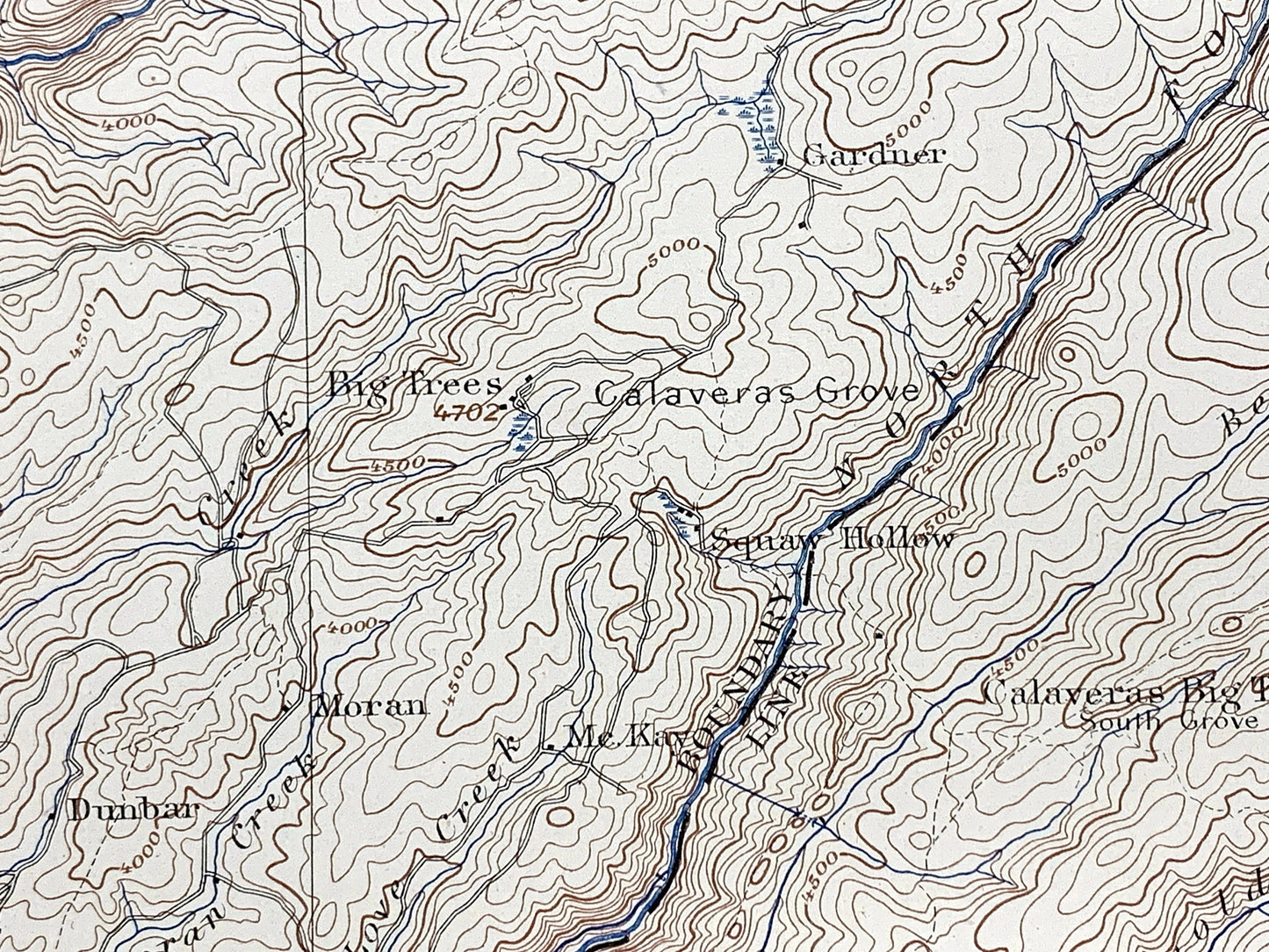
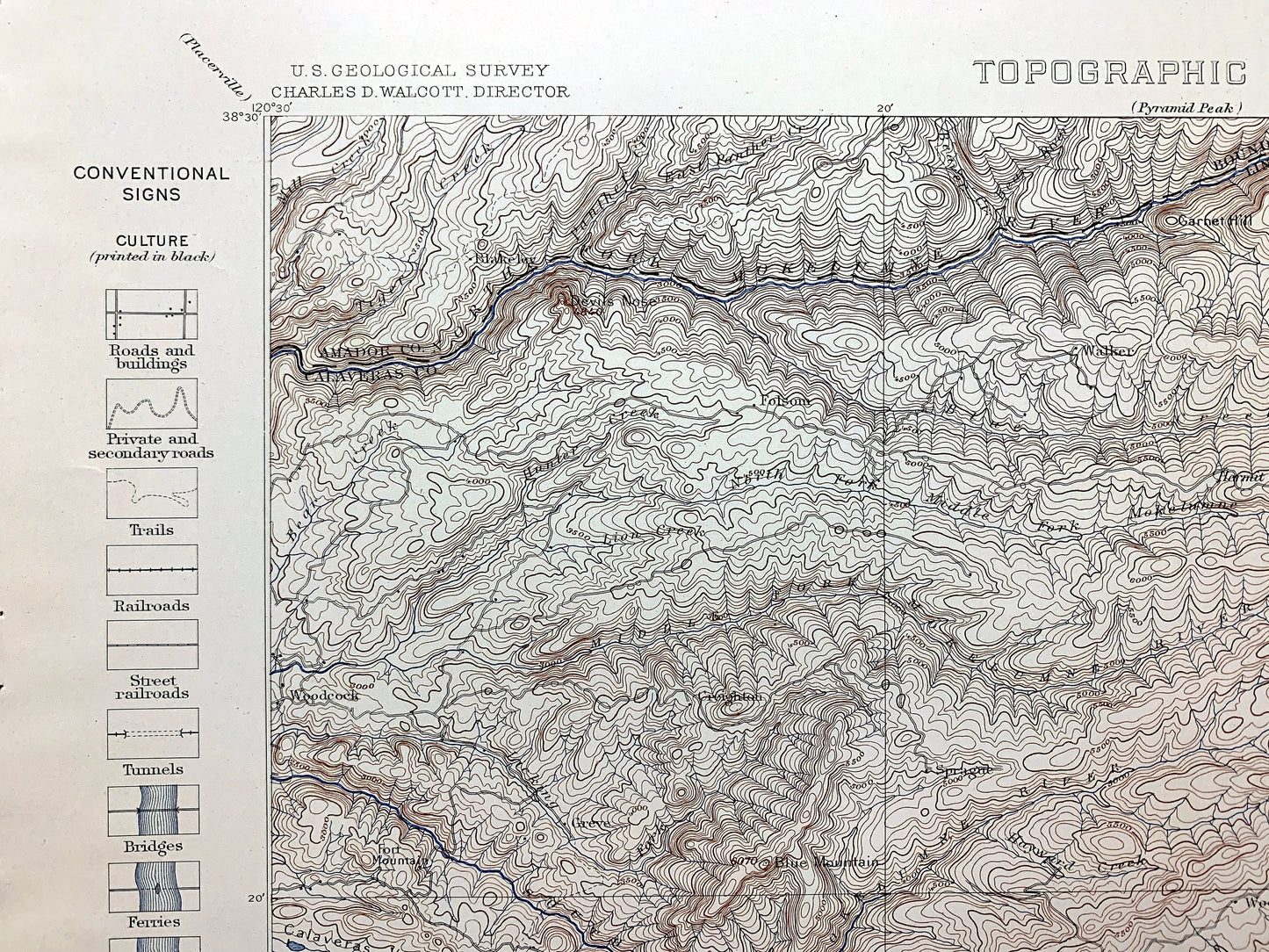
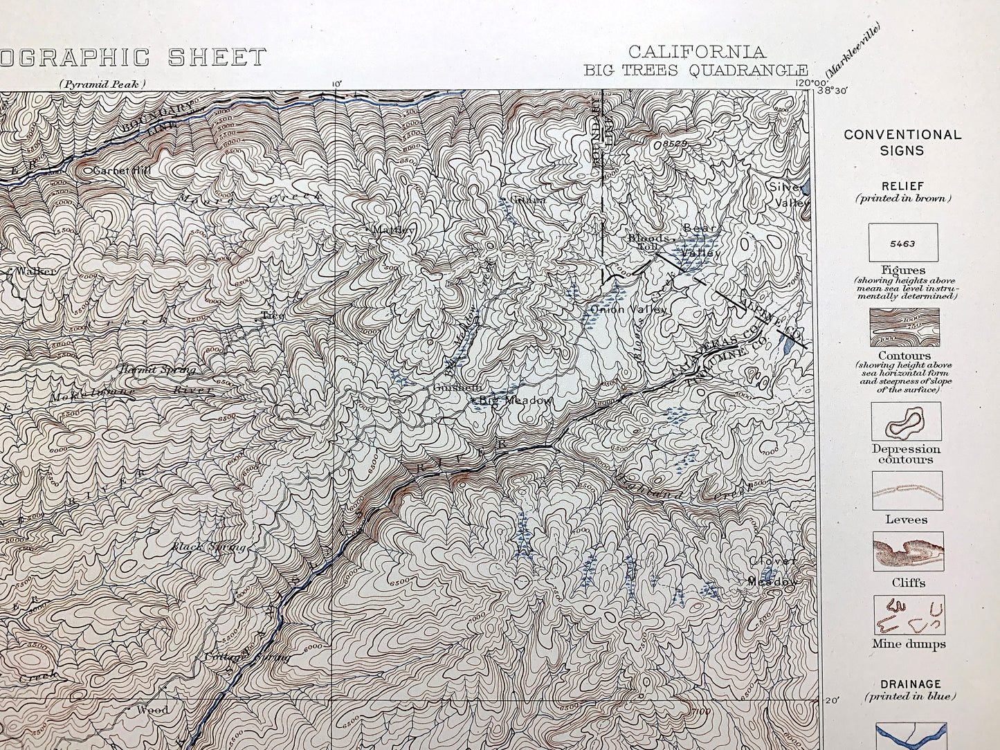
Cities & Towns: Big Trees, Greve, Woodcock, Sprague, Walker, Creighton, Bloods Toll, Gitana, Mattley, Guishetti, Swiss Ranch, Dunbar, Sheep Ranch, Gardner, Wood, Mt Kay, Moran, Oxendine, McCorinick, Fennessy, Parsons, Murphy, Douglas Flat, Collierville, Vallecito, Columbia, Gold Spring, Yankee Hill, Petersen, American Camp, Springfield, Shaws Flat, Robinson, Stage, Sugarpine, Toll, Confidence, Belleview, Genness, Hale, Shotgun, Bradford, Gold Spring, Lord, Lewis, Long Barn, Rosasco, Italian Ranch.
Points of Interest: Amador County, Calaveras County, Tuolumne County, Stanislaus National Forest, New Melones Lake location, Stanislaus River, Mount Lewis, Tuolumne River, The Basin, Mount Provo, Knight Creek, Calaveras Grove, Calaveras Valley, Mokelumne RIver, Moore Creek and many more creeks, mountains, hills, canyons, houses, streets and train tracks.
Condition: Very Good Vintage condition, commensurate with age. This map is in incredible shape for being 125 years old. Has light edge-wear, toning, but these will read as vintage character when framed.
----
We will happily adjust shipping price for multiple purchases. Maps are rolled up and shipped in sturdy mailing tubes, never folded.
Couldn't load pickup availability
Share