My Store
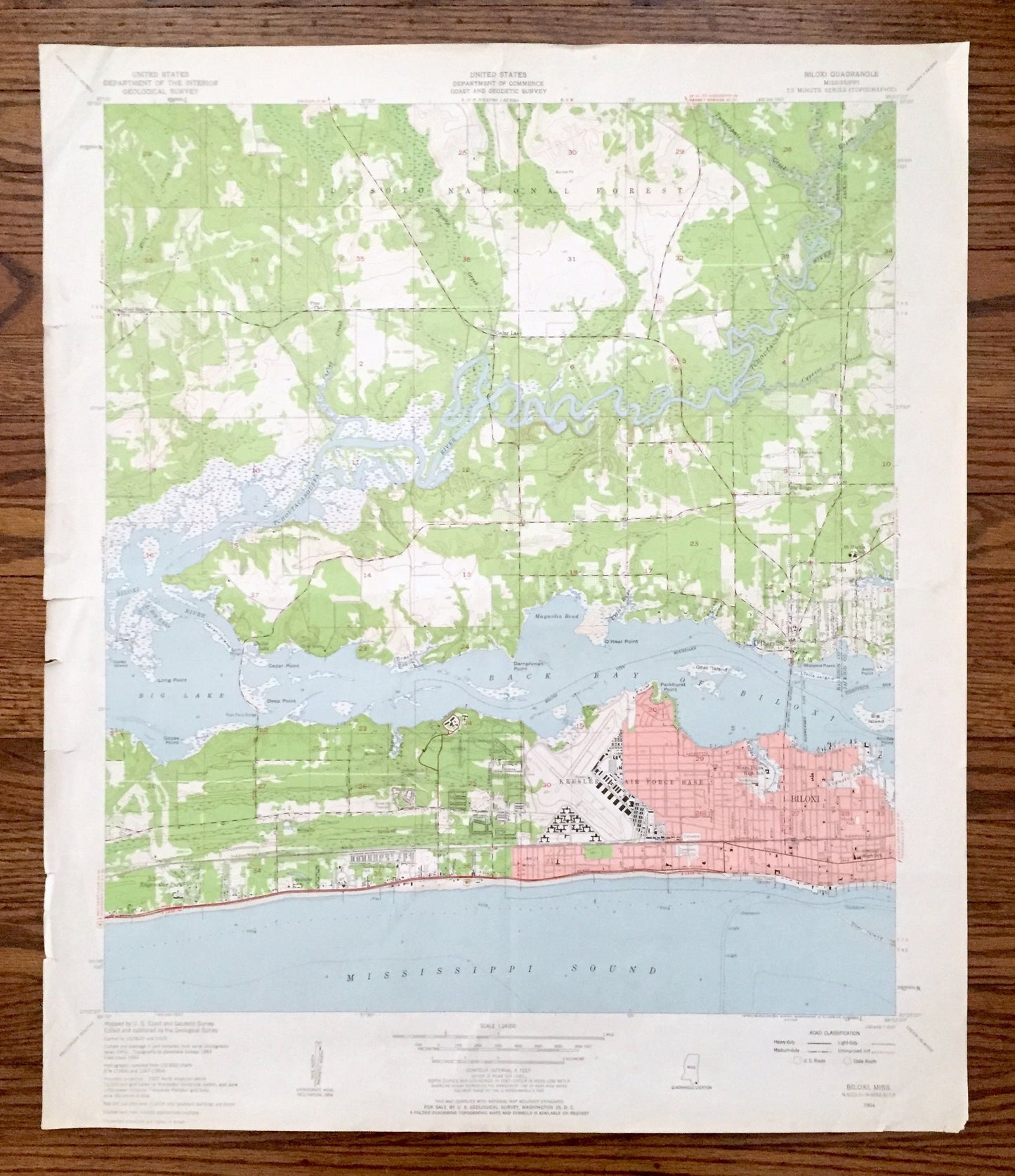
Antique Biloxi, Mississippi 1954 US Geological Survey Topographic Map –Harrison, Jackson County, De Soto National Forest, D'Iberville, MS
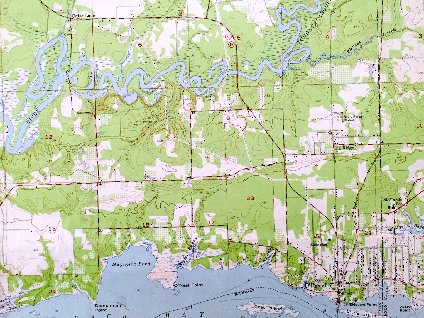
Antique Biloxi, Mississippi 1954 US Geological Survey Topographic Map –Harrison, Jackson County, De Soto National Forest, D'Iberville, MS
Beautiful, antique map of Biloxi, Mississippi and surrounding Harrison & Jackson County area on Mississippi Sound. This is an authentic 1954 edition, 1958 print from the U.S. Geological Survey and NOT a computer reproduction.
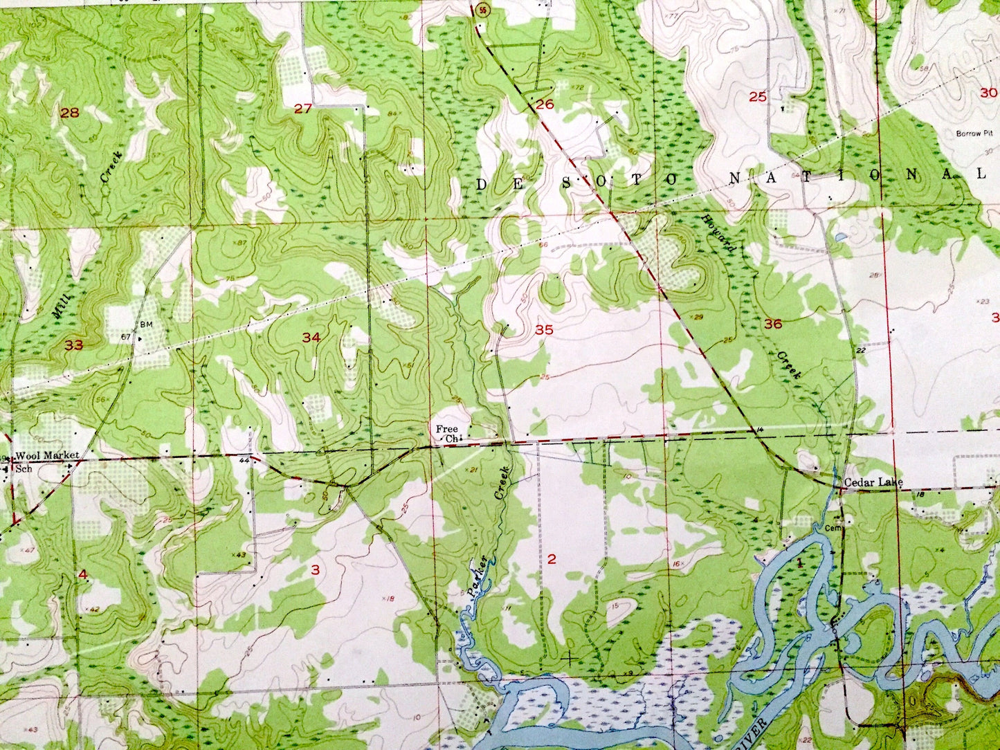
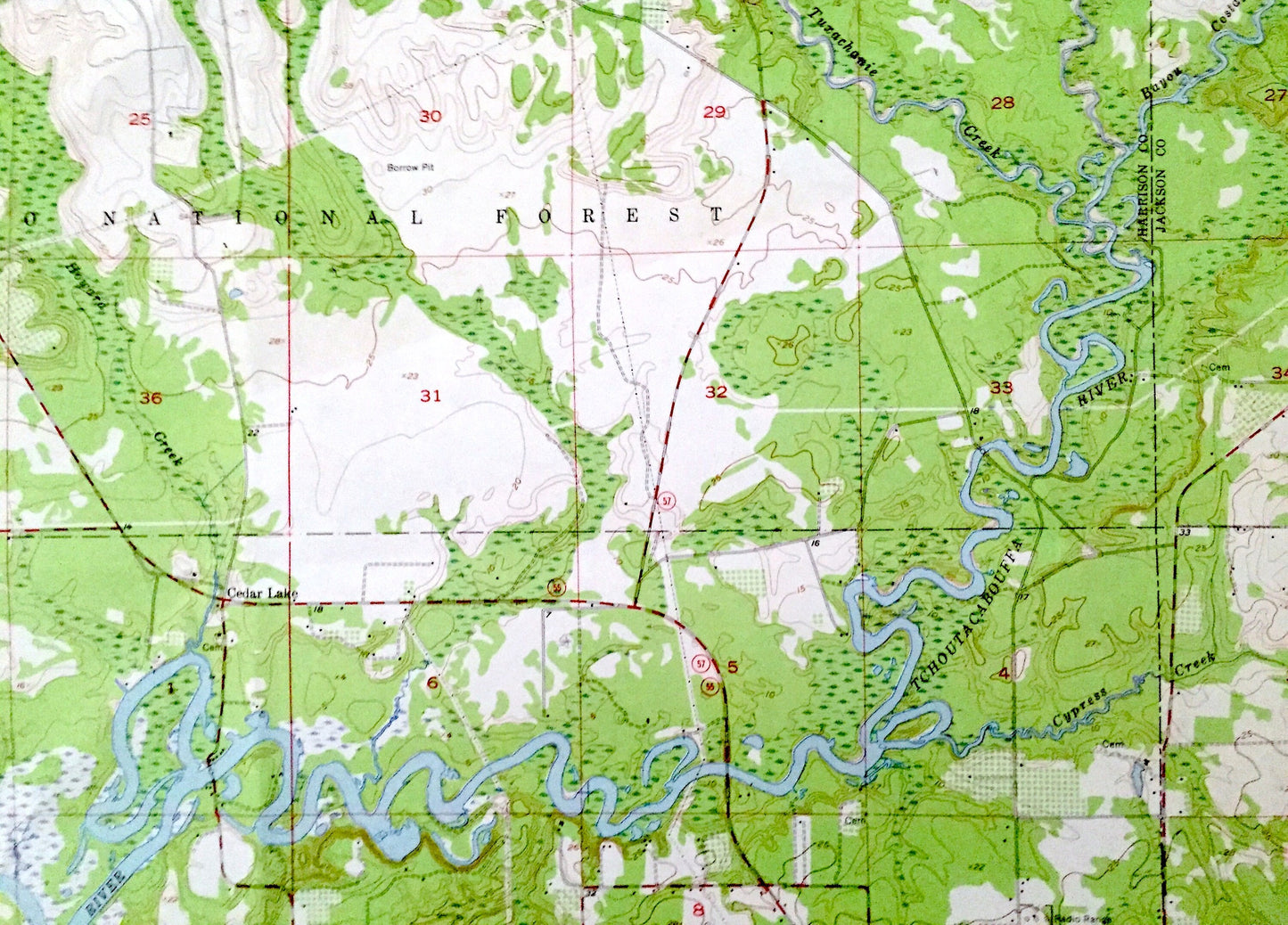
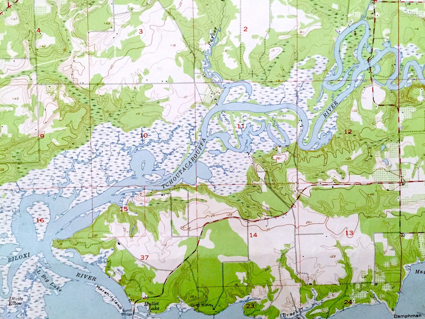
See what Mississippi looked like almost more than 65 years ago. Lots of intricate details and geological contours. Map even has little squares for every house that existed at the time. The USGS cartographers were very thorough back then!
Perfect for the historian, map-lover, the curious or just as a conversation starter. Wonderful and rare. Vintage maps such as this make great gifts.
Edition of 1954, printed 1958
Dimensions: 23" width x 27" height
----
Features
Cities & Towns: Biloxi, Ocean Springs, D'Iberville, Edgewater Park.
Points of Interest: Jackson County, Harrison County, De Soto National Forest, Biloxi Bay, Back Bay of Biloxi, Big Lake, Tchoutacabouffa River, Magnolia Bend, Keesler Air Force Base, Little Island, Big Island, Deer Island, O'Neal Point, Damphman Point, Goat Island, Tuxachanie Creek, Biloxi River, Devils Elbow, and many more towns, train tracks, villages, bayous, streams and rivers.
Condition: Good Vintage condition, commensurate with age. This map is in great shape for being over 60 years old. Has some real edge-wear, toning and foxing, old flattened fold lines, as well as a few smallish tears along the left margin, but all of this will add to the map's vintage character when framed.
----
We will happily adjust shipping price for multiple purchases. Maps are rolled up and shipped in sturdy mailing tubes, never folded.
Couldn't load pickup availability
Share