My Store
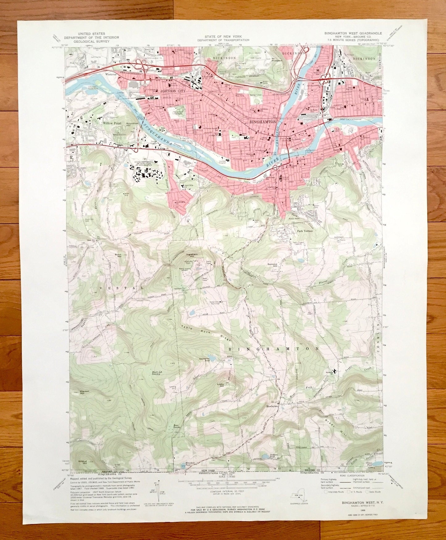
Antique Binghamton West, New York 1968 US Geological Survey Topographic Map – Broome County, Willow Point, Hawleyton, Park Terrace, SUNY, NY
Antique Binghamton West, New York 1968 US Geological Survey Topographic Map – Broome County, Willow Point, Hawleyton, Park Terrace, SUNY, NY
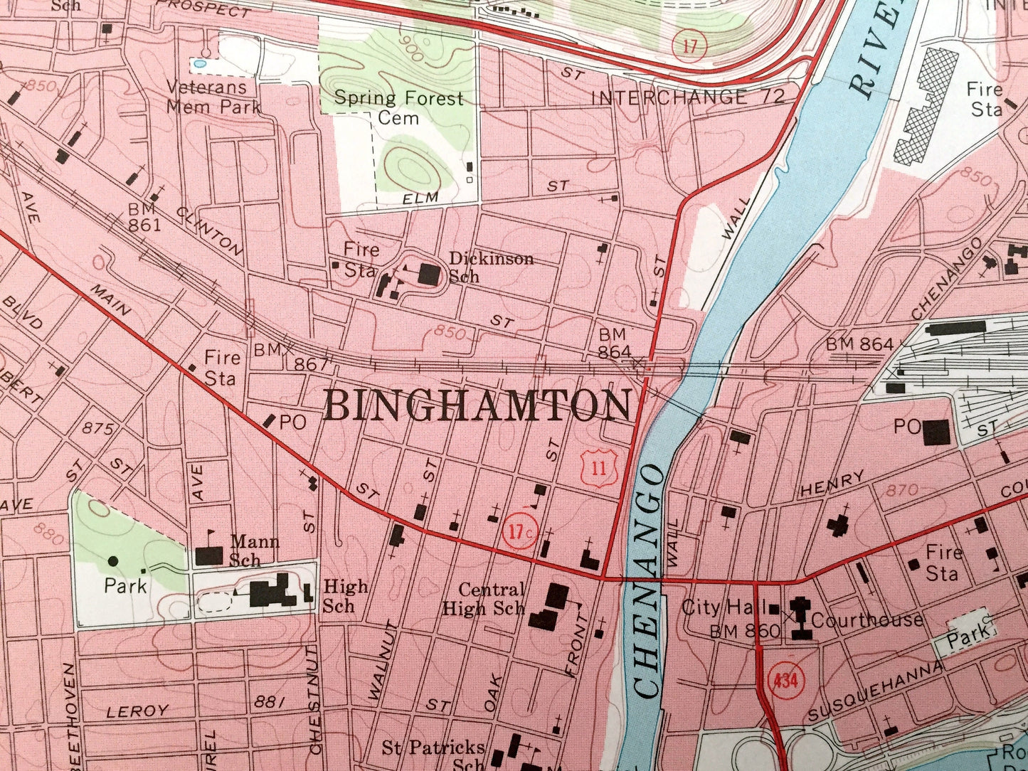
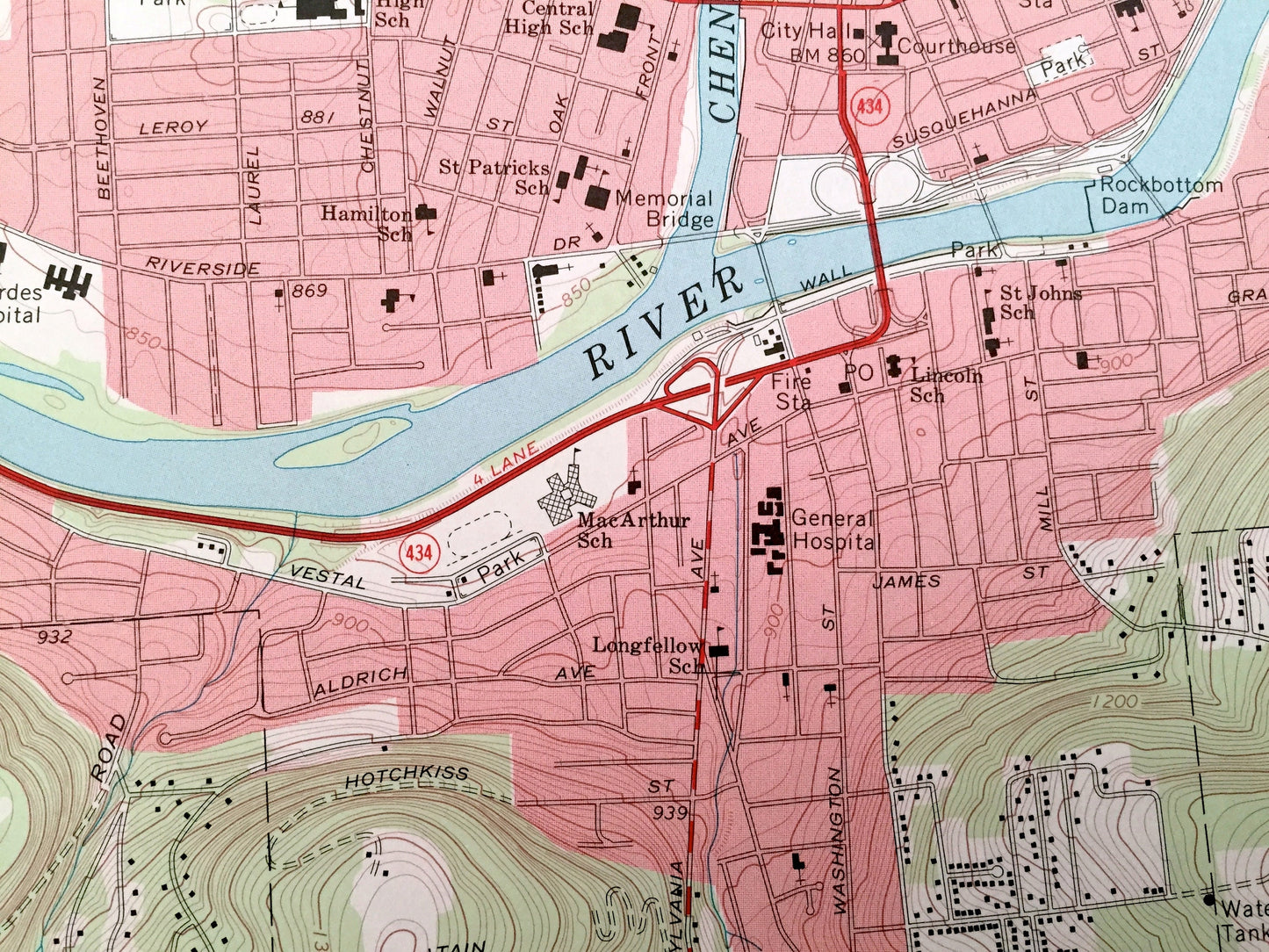
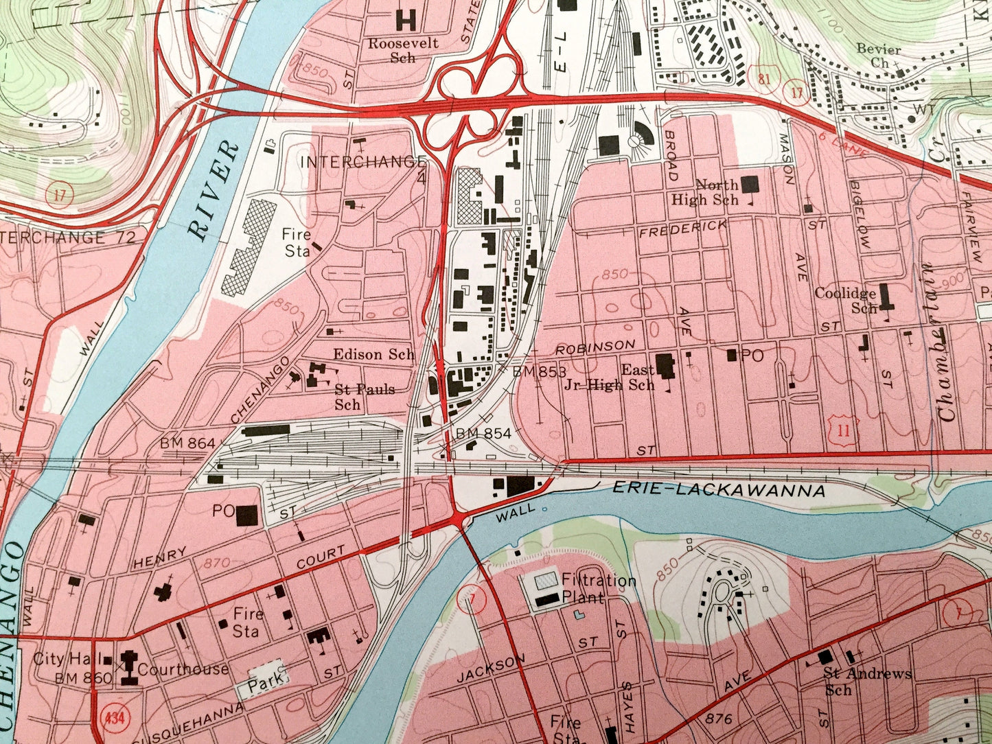
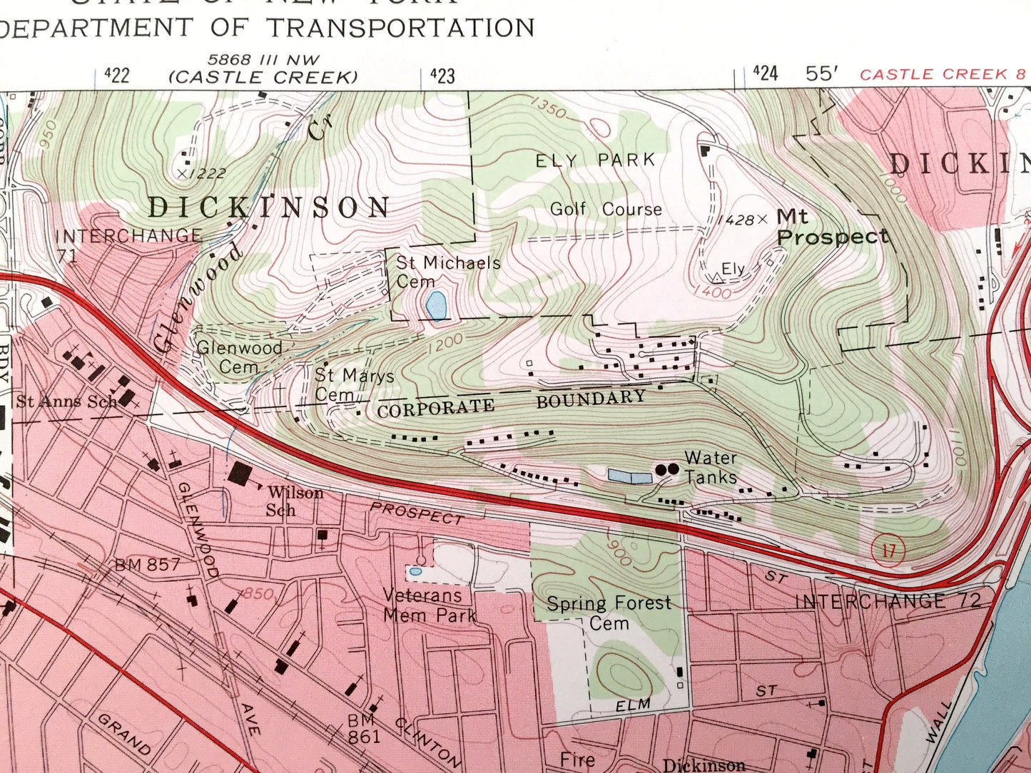
Beautiful, antique map of Binghamton West, Johnson City, Dickinson, Willow Point, Vestal and Park Terrace, New York. This is an authentic 1968 edition, 1972 print from the U.S. Geological Survey and NOT a computer reproduction.
See what Broome County of New York looked like over 50 years ago. Lots of intricate details and geological contours. Map even has little squares for every house that existed at the time. The USGS cartographers were very thorough back then!
Perfect for the historian, map-lover, the curious or just as a conversation starter. Wonderful and rare. Vintage maps such as these make great gifts.
Edition of 1968, printed 1972
Dimensions: 22" width x 27" height
----
Features
Cities & Towns: Binghamton, Johnson City, Dickinson, Westover, Willow Point, Vestal, Hawleyton, Park Terrace, Union.
Points of Interest: Broome County, Susquehanna River, Table Rock Ridge, Chenango River, C F Johnson School, Veterans Memorial Park, Ely Park and Golf Course, Binghamton Fire Station, City Hall, Court House, Longfellow School, St Andrews School, North High School, State University of New York at Binghamton, Vestal Hills Golf Club, Jackson Pond, Radio Towers (WKOP), and lots more streams, ponds, schools, houses, and roads.
Condition: Good Vintage condition, commensurate with age. This map is in incredible shape for being over 50 years old. Has light edge-wear, which will add to vintage character when framed.
----
We will happily adjust shipping price for multiple purchases. Maps are rolled up and shipped in sturdy mailing tubes, never folded.
Couldn't load pickup availability
Share