My Store
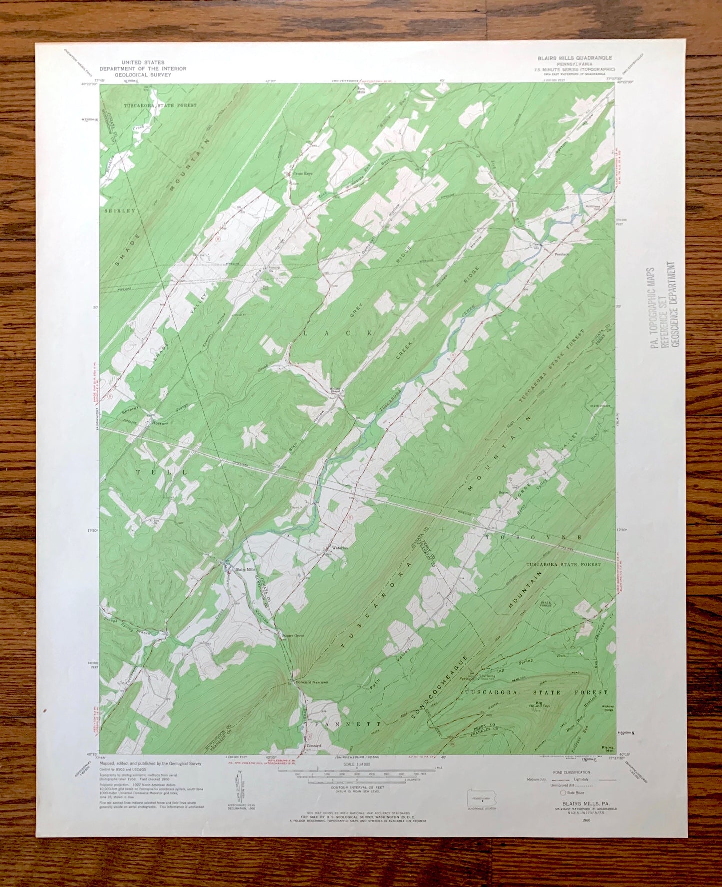
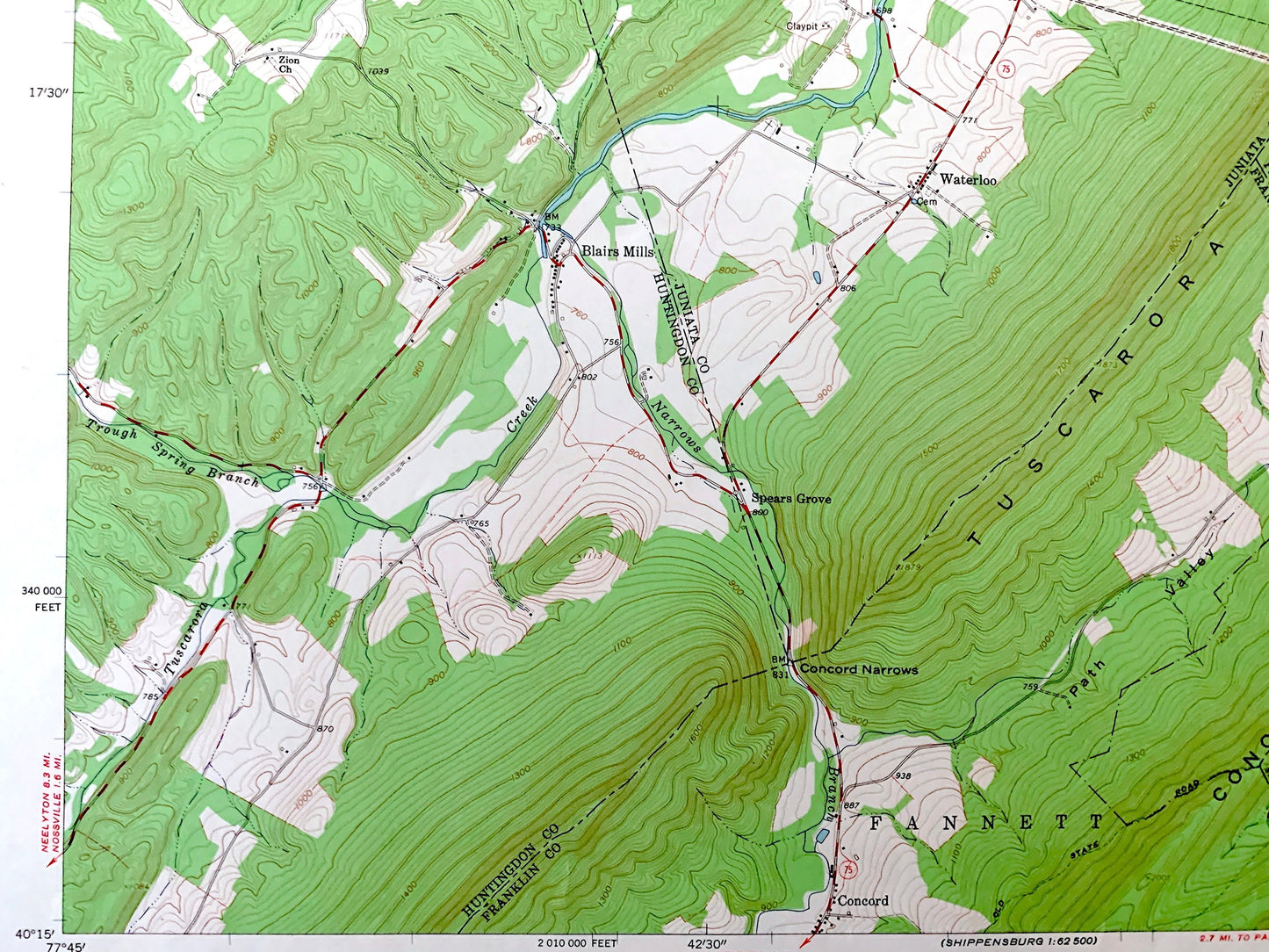
Antique Blairs Mills, Pennsylvania 1960 US Geological Survey Topographic Map – Juniata, Perry, Huntingdon, Franklin County, Lack, Tell, PA
Antique Blairs Mills, Pennsylvania 1960 US Geological Survey Topographic Map – Juniata, Perry, Huntingdon, Franklin County, Lack, Tell, PA
Beautiful, antique map of Blairs Mills, Pennsylvania and surrounding Huntingdon County, Franklin County, Perry County & Juniata County area. This is an authentic 1960 edition, 1963 print from the U.S. Geological Survey and NOT a computer reproduction.
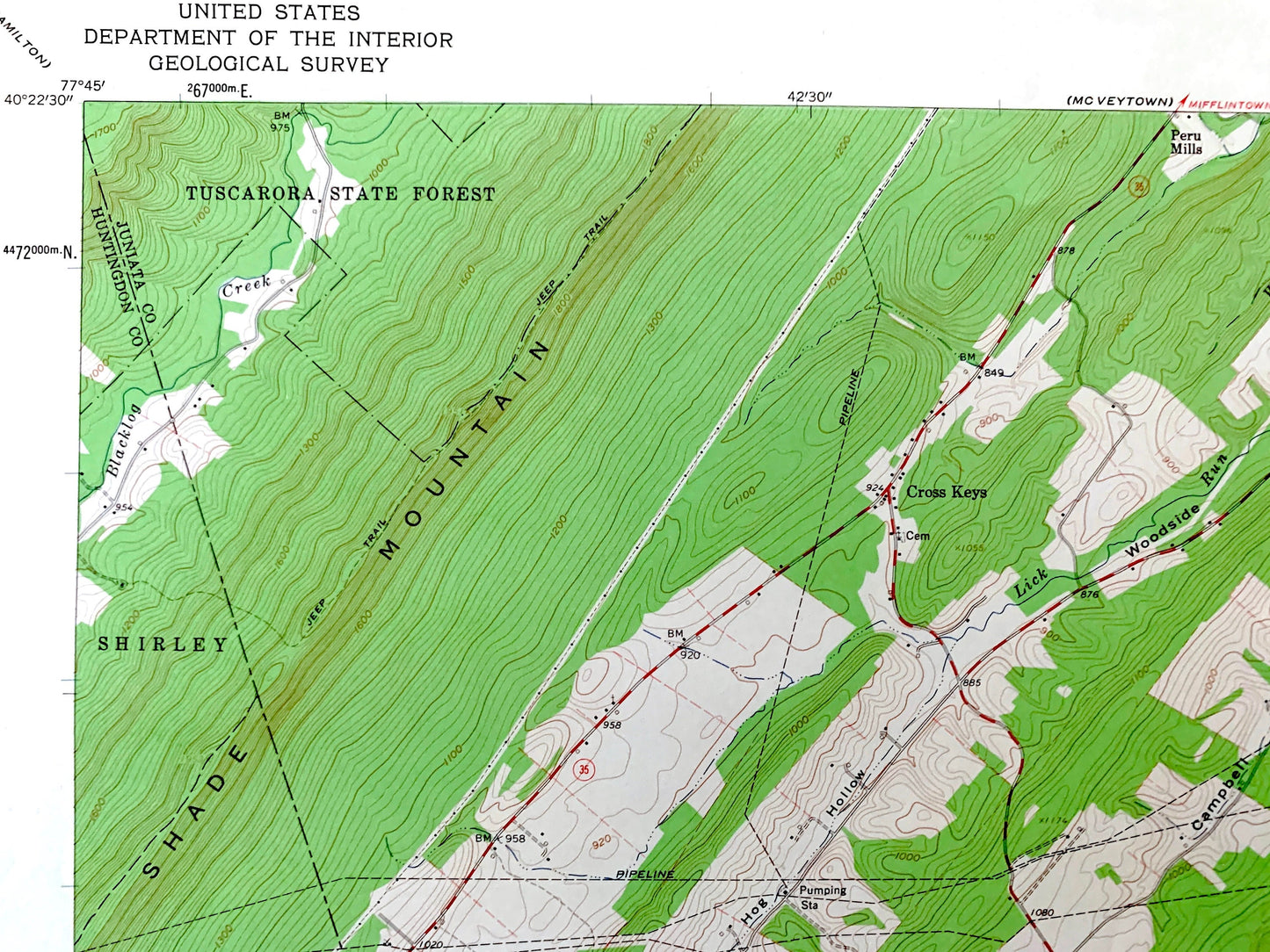
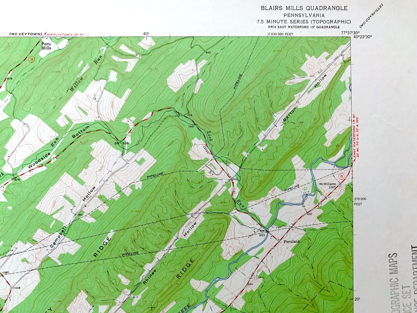
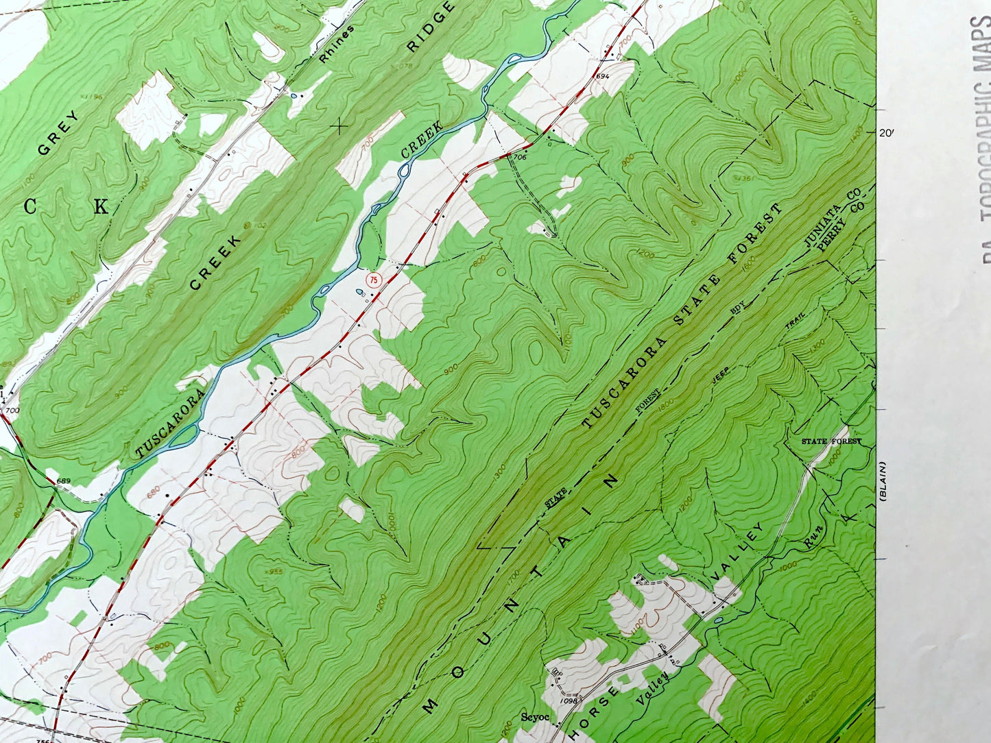
See what Pennsylvania looked like over 50 years ago. Lots of intricate details and geological contours. Map even has little squares for every house that existed at the time. The USGS cartographers were very thorough back then!
Perfect for the historian, map-lover, the curious or just as a conversation starter. Wonderful and rare. Vintage maps such as these make great gifts.
Edition of 1960, printed 1963
Dimensions: 22" width x 27" height
----
Features
Cities & Towns: Blairs Mills, Shirley, Lack, Tell, Toboyne, Fannett, Cross Keys, Perulack, Waterloo, Spears Grove, Concord.
Points of Interest: Huntingdon County, Juniata County, Perry County, Franklin County, Tuscarora State Forest, Tuscarora Creek, Shade Mountain, Creek Ridge, Grey Ridge, Conococheague Mountain, Big Round Top, Horse Valley, George Creek, Lick Run, Concord Narrows, and many more hills, creeks, ponds, schools, churches, houses, and roads.
Condition: Very Good Vintage condition, commensurate with age. This map is in great shape for being over 50 years old. Light wear but this will add to vintage character when framed.
----
We will happily adjust shipping price for multiple purchases. Maps are rolled up and shipped in sturdy mailing tubes, never folded.
Couldn't load pickup availability
Share