My Store
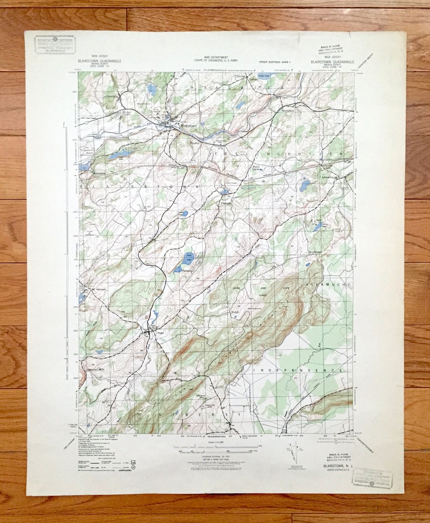
Antique Blairstown, New Jersey 1943 US Geological Survey Topographic Map – Warren County, Frelinghuysen, Hardwick, Independence, Liberty, NJ
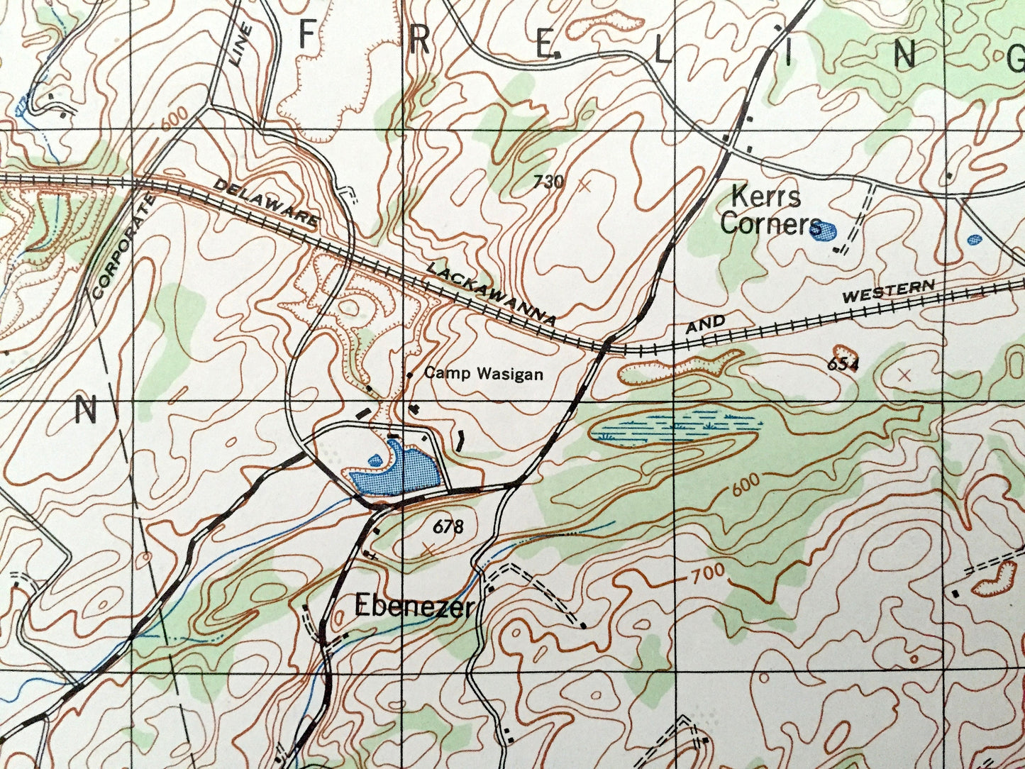
Antique Blairstown, New Jersey 1943 US Geological Survey Topographic Map – Warren County, Frelinghuysen, Hardwick, Independence, Liberty, NJ
Beautiful, antique map of Blairstown, New Jersey and surrounding Warren County area. This is an authentic 1943 print from the U.S. Army Corps of Engineers and NOT a computer reproduction.
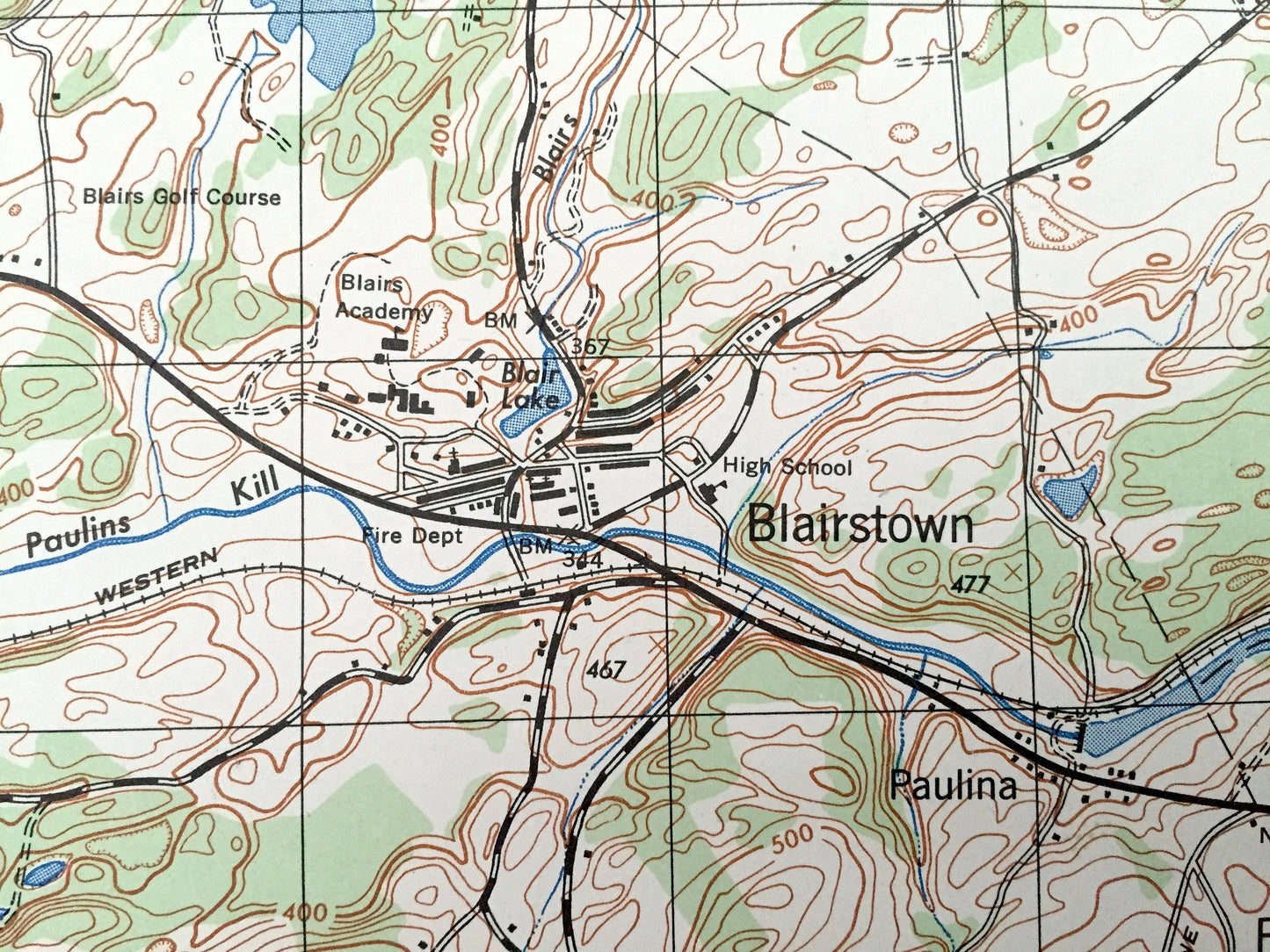
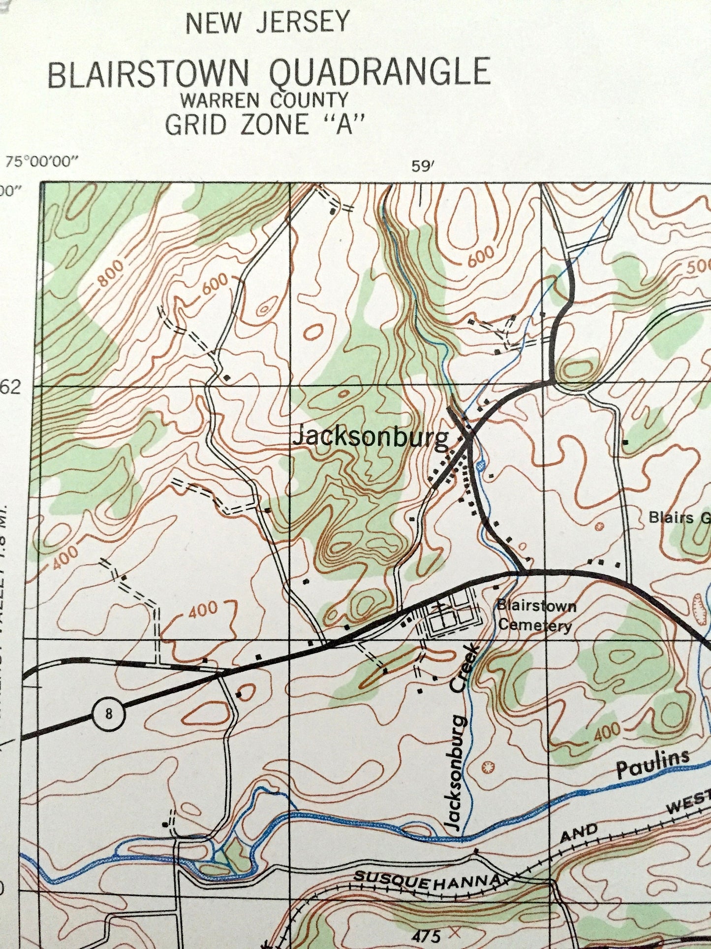
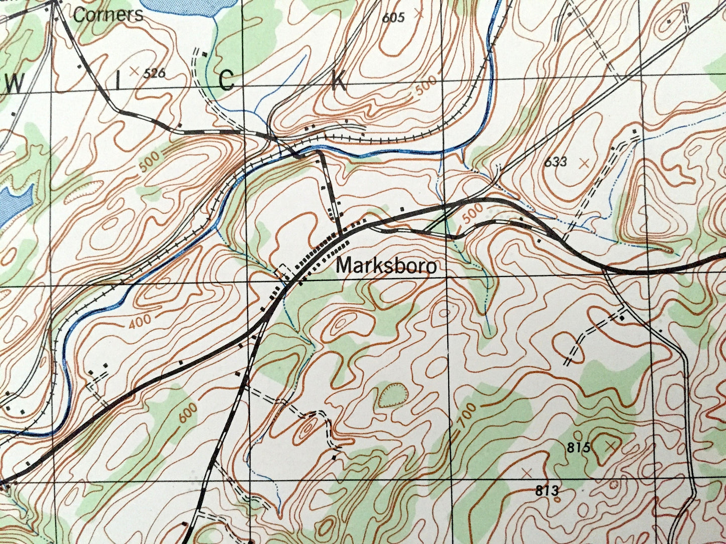
See what New Jersey looked like over 75 years ago. Lots of intricate details and geological contours. Map even has little squares for every house that existed at the time. The USGS cartographers were very thorough back then!
Perfect for the historian, map-lover, the curious or just as a conversation starter. Wonderful and rare. Vintage maps such as these make great gifts.
Edition of 1943, printed 1943
Dimensions: 18" width x 22" height
----
Features
Cities & Towns: Blairstown, Hope, Allamuchy, Jacksonburg, Squires Corners, Marksboro, Kalarama, Paulina, Kerrs Corners, Johnsonburg, Southtown, Mt. Hermon, Shiloh, Swayzes Mills, Marble Hill.
Points of Interest: Warren County, Jenny Jump Mountain, Jenny Jump State Forest, Federal Springs, Silver Lake, Cedar Lake, White Lake, Paulins Kill, Stevens Island, Post Island, Pequest River, Beaver Brook, Bear Swamp, Brookaloo Swamp and many more hills, streams, ponds, houses, schools, churches and roads.
Condition: Very Good Vintage condition, commensurate with age. This map is in incredible shape for being over 75 years old. Has some edge-wear, toning and margin stamps, all of which will read as vintage character when framed.
----
We will happily adjust shipping price for multiple purchases. Maps are rolled up and shipped in sturdy mailing tubes, never folded.
Couldn't load pickup availability
Share