My Store
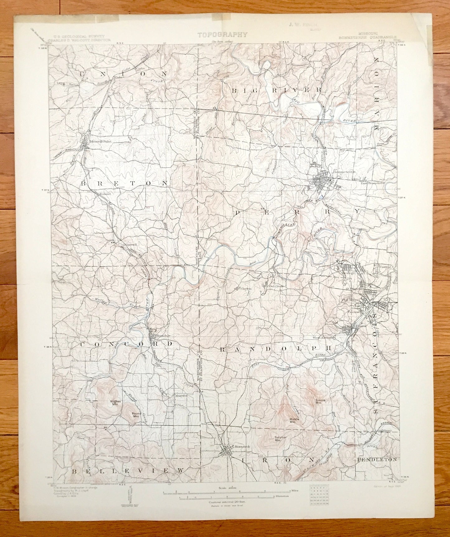
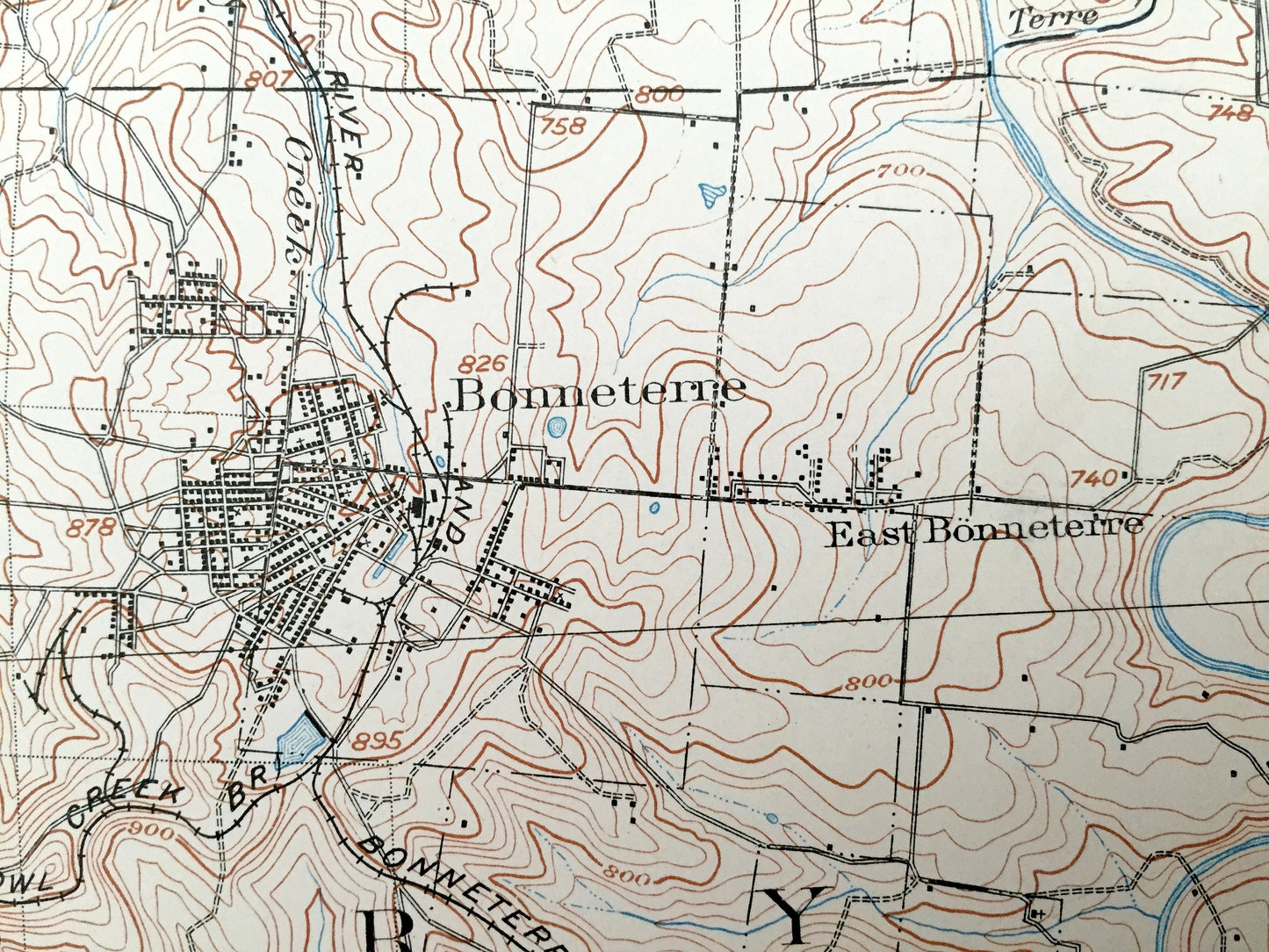
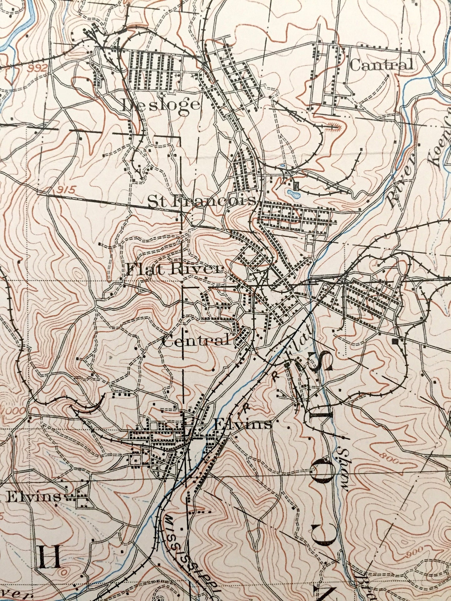
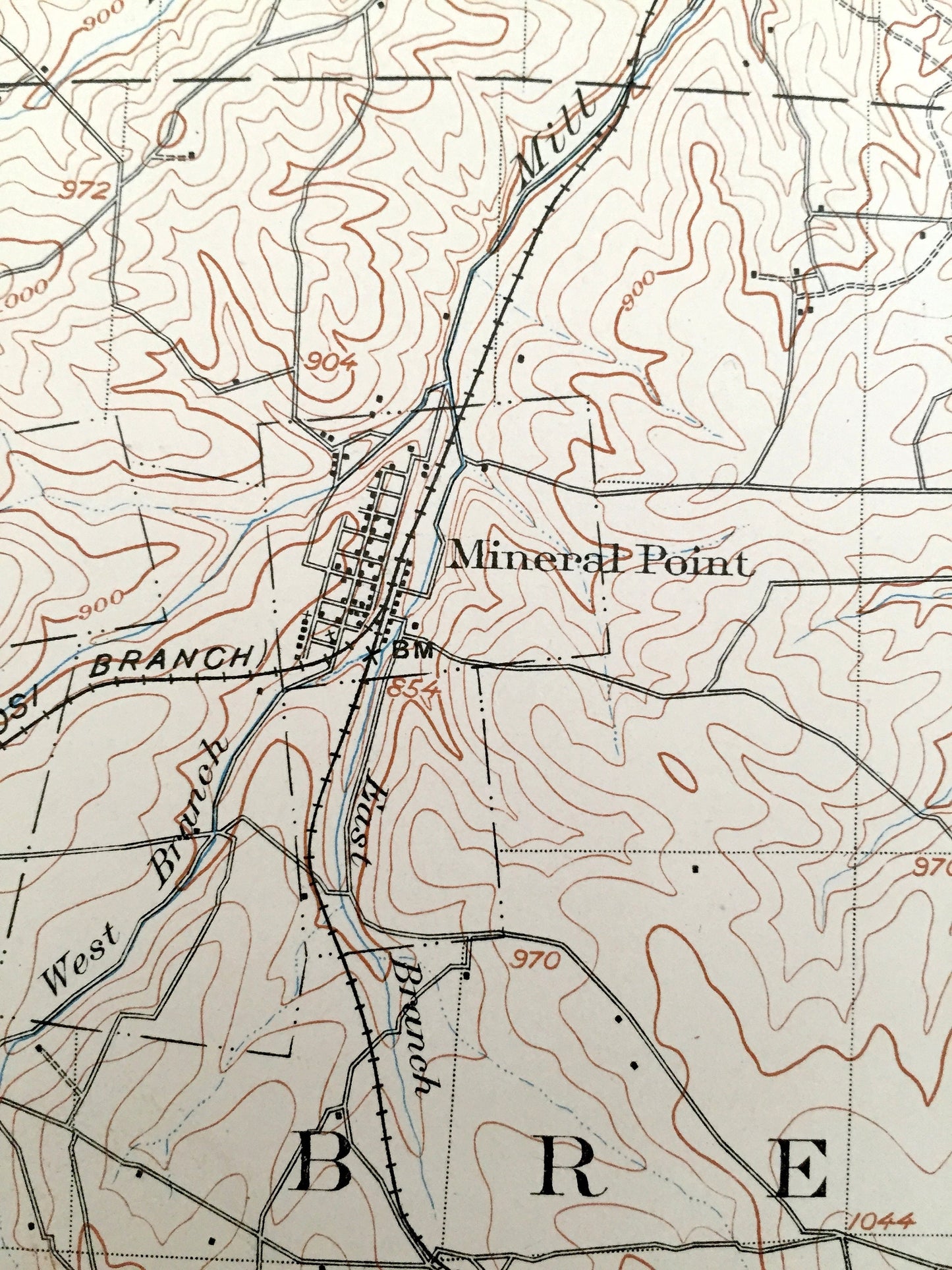
Antique Bonneterre, Missouri 1905 US Geological Survey Topographic Map – Washington, St Francois County, Desloge, Flat River, Central, MO
Antique Bonneterre, Missouri 1905 US Geological Survey Topographic Map – Washington, St Francois County, Desloge, Flat River, Central, MO
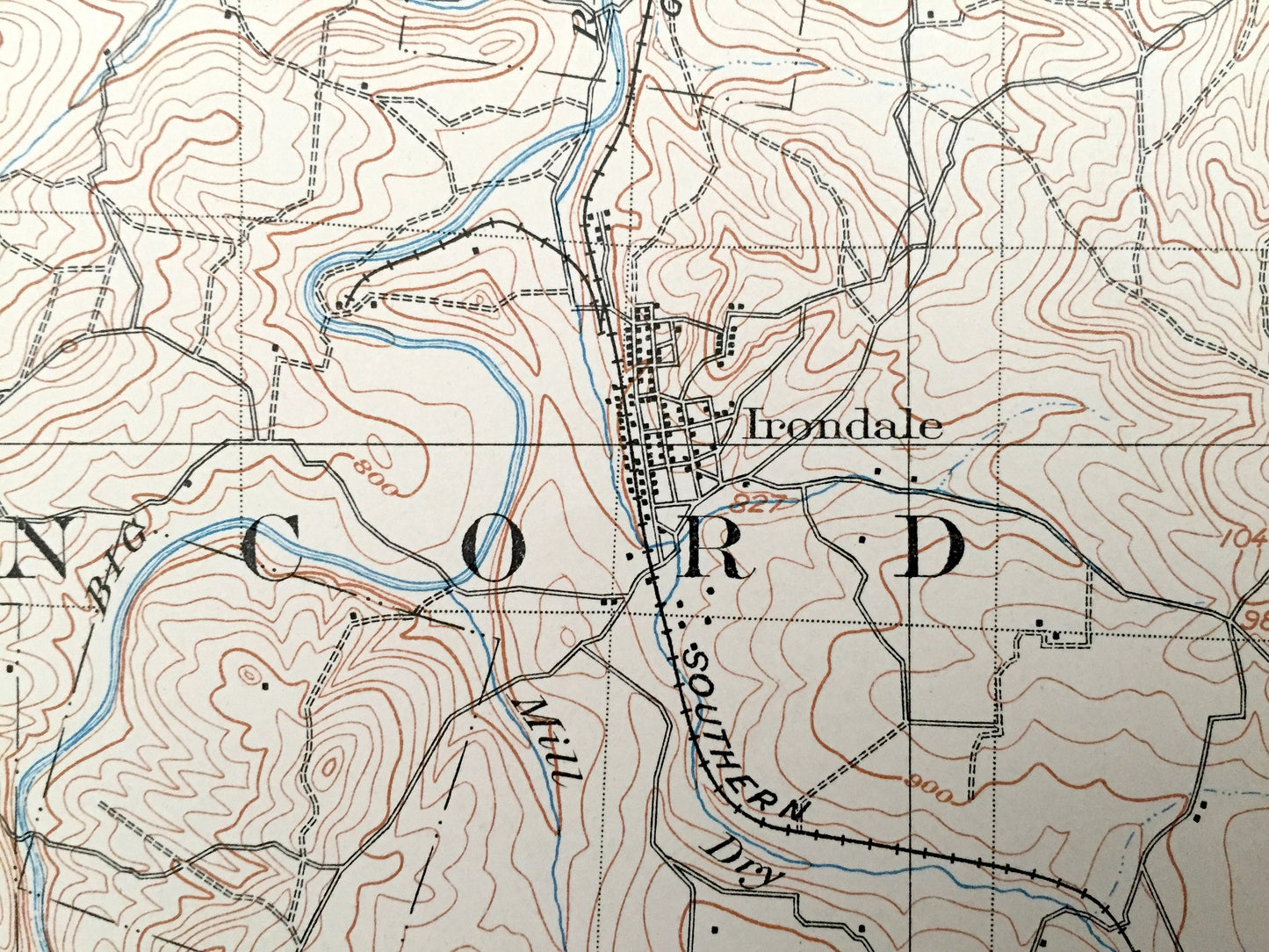
Beautiful, antique map of Bonneterre, Missouri and surrounding Washington & St Francois County area. This is an authentic 1905 print from the U.S. Geological Survey and NOT a computer reproduction.
See what Missouri looked like more than 110 years ago. Lots of intricate details and geological contours. Map even has little squares for every house that existed at the time. The USGS cartographers were very thorough back then! On the back is a description of topographic symbols and map guide.
Perfect for the historian, map-lover, the curious or just as a conversation starter. Wonderful and rare. Vintage maps such as these make great gifts.
Edition of 1905, printed 1905
Dimensions: 16 1/2" width x 20" height
----
Features
Cities & Towns: Mineral Point, Bonneterre, Desloge, Cantral, St Francois, Flat River, Central, Elvins, West Elvins, Bismarck, Irondale.
Points of Interest: Washington County, St Francois County, Mississippi River and Bonneterre Railroad, Illinois Southern Railroad, Iron mountain and Southern Railroad, Three Hill Creek, Wallen Creek, and many more hills, brooks, towns, schools, churches, roads and train tracks.
Condition: Very Good condition, commensurate with age. This map is in incredible shape for being 115 years old. Has light wear and folds as issued, but these will read as vintage character when framed.
----
We will happily adjust shipping price for multiple purchases. Maps are rolled up and shipped in sturdy mailing tubes, never folded.
Couldn't load pickup availability
Share