My Store
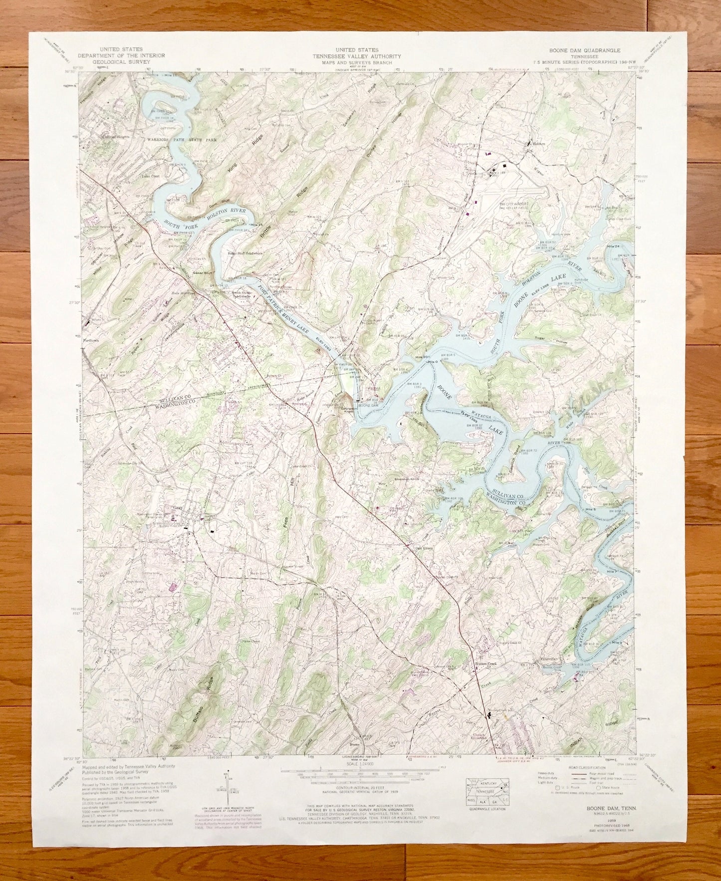
Antique Boone Dam, Tennessee 1959 US Geological Survey Topographic Map – Sullivan County, Colonial Heights, Gray Fordtown, Flourville, TN
Antique Boone Dam, Tennessee 1959 US Geological Survey Topographic Map – Sullivan County, Colonial Heights, Gray Fordtown, Flourville, TN
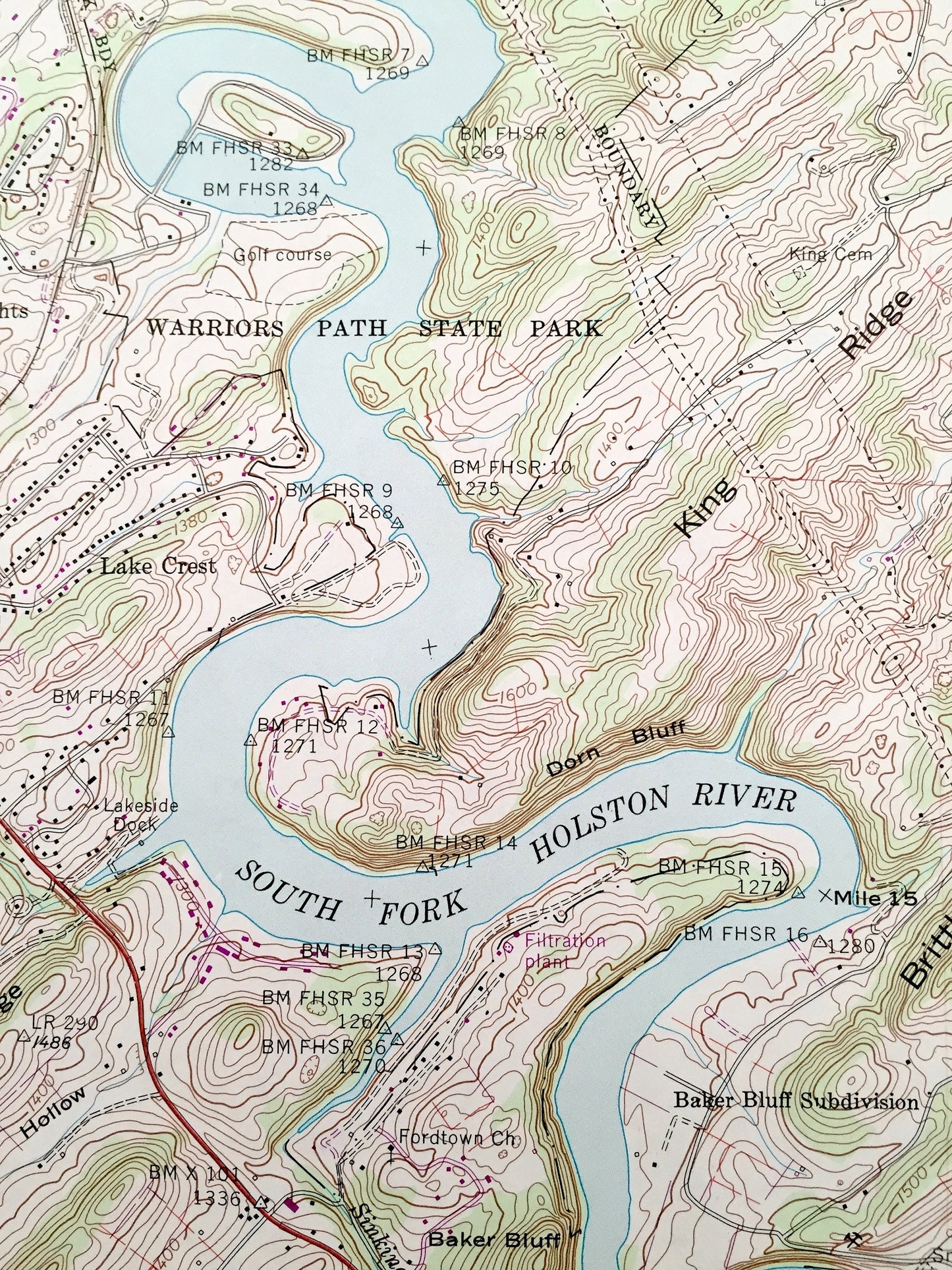
Beautiful, antique map of Boone Dam, Tennessee and surrounding Sullivan and Washington County areas. This is an authentic 1959 edition, 1978 print from the U.S. Geological Survey and NOT a computer reproduction.
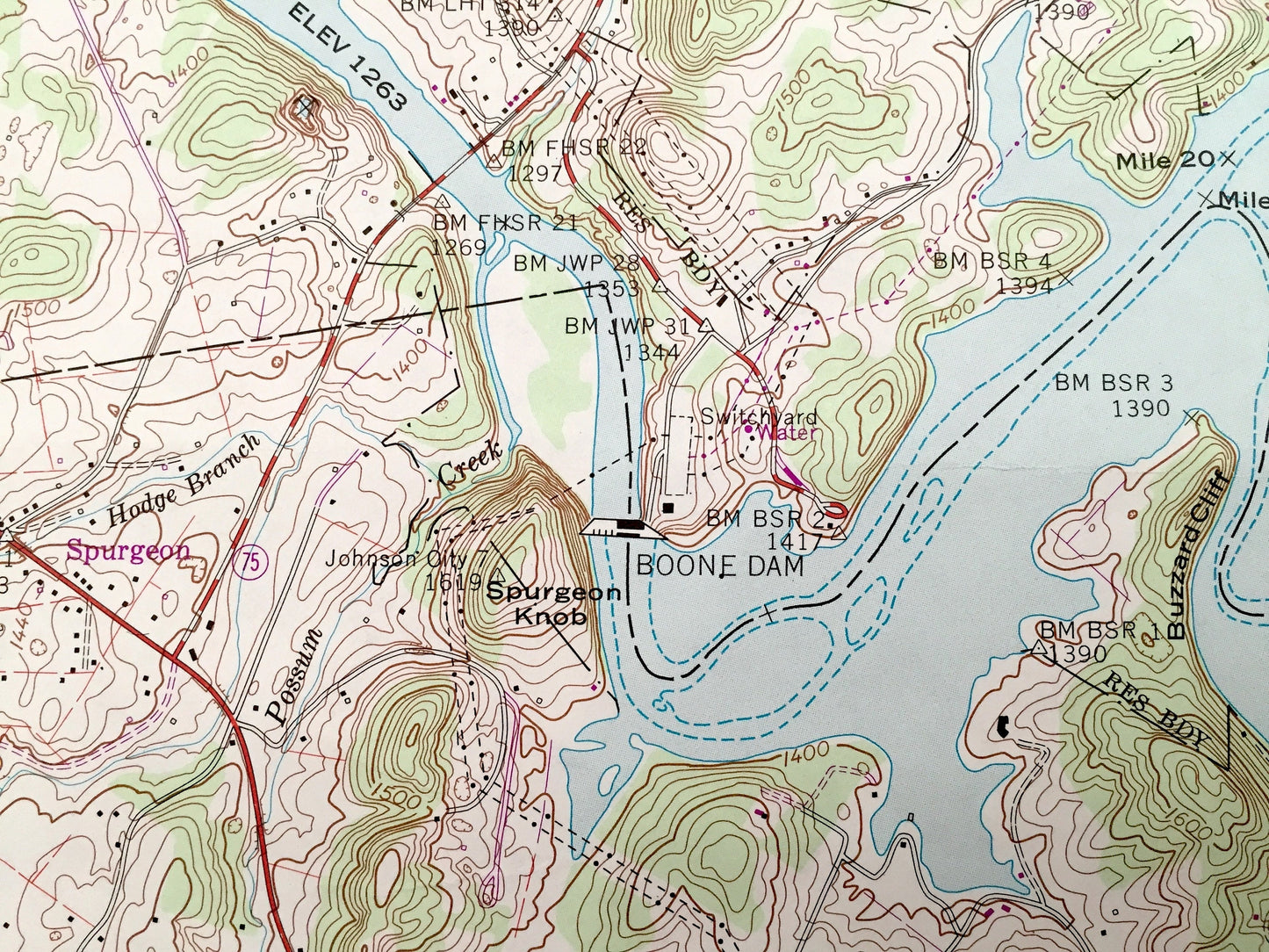
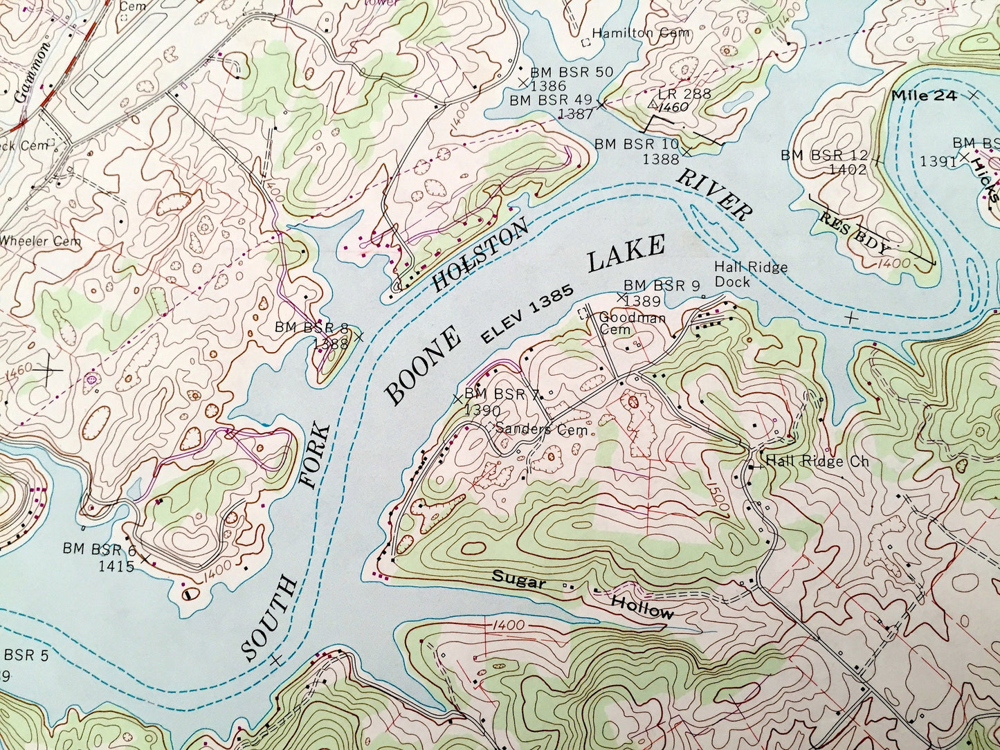
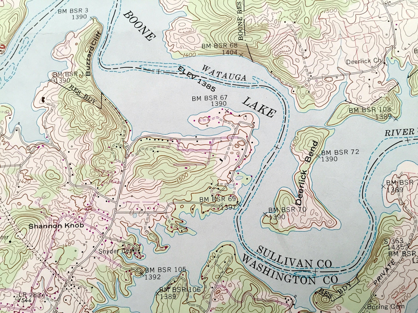
See what Tennessee looked like over 60 years ago. Lots of intricate details and geological contours. Map even has little squares for every house that existed at the time. The USGS cartographers were very thorough back then!
Perfect for the historian, map-lover, the curious or just as a conversation starter. Wonderful and rare. Vintage maps such as these make great gifts.
Edition of 1959, printed 1978
Dimensions: 22" width x 27" height
----
Features
Cities & Towns: Boone, Boones Creek, Lake Crest, Oak Grove, Holston, Colonial Heights, Gray Fordtown, Flourville.
Points of Interest: Sullivan County, Washington County, Boone Lake, Fort Patrick Henry Lake, Boone Dam, Holston River, Watauga River, Free Hill, Brittle Ridge, King Ridge, Buffalo Ridge, Warriors Path State Park, Strickler Hollow, Snyder Creek, Ready Creek, and lots more hills, mountains, creeks, ponds, brooks, towns, schools, churches, roads and railroads.
Condition: Very Good Vintage condition, commensurate with age. This map is in great shape for being 40 years old. Has light edge-wear and some tears, but this will all add to vintage character when framed.
----
We will happily adjust shipping price for multiple purchases. Maps are rolled up and shipped in sturdy mailing tubes, never folded.
Couldn't load pickup availability
Share