My Store
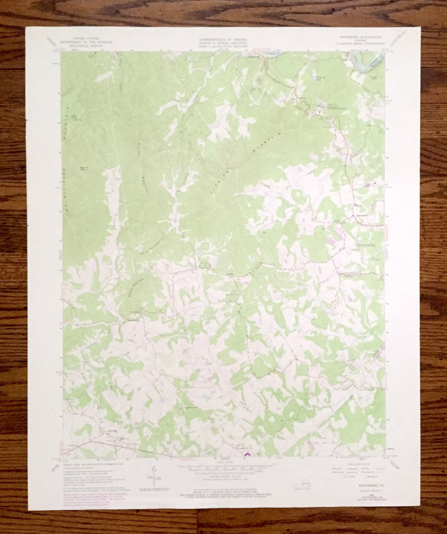
Antique Boonsboro, Virginia 1965 US Geological Survey Topographic Map – Bedford County, Lynchburg, Coleman Falls, Ivy Creek Lake, Golf VA
Antique Boonsboro, Virginia 1965 US Geological Survey Topographic Map – Bedford County, Lynchburg, Coleman Falls, Ivy Creek Lake, Golf VA
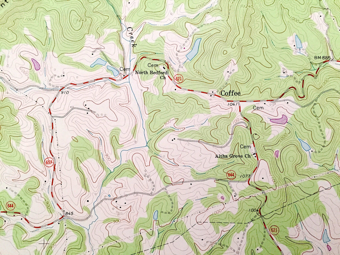
Beautiful, antique map of Boonsboro, Virginia and surrounding Bedford County area west of Lynchburg. This is an authentic 1965 edition, 1978 print from the U.S. Geological Survey and NOT a computer reproduction.
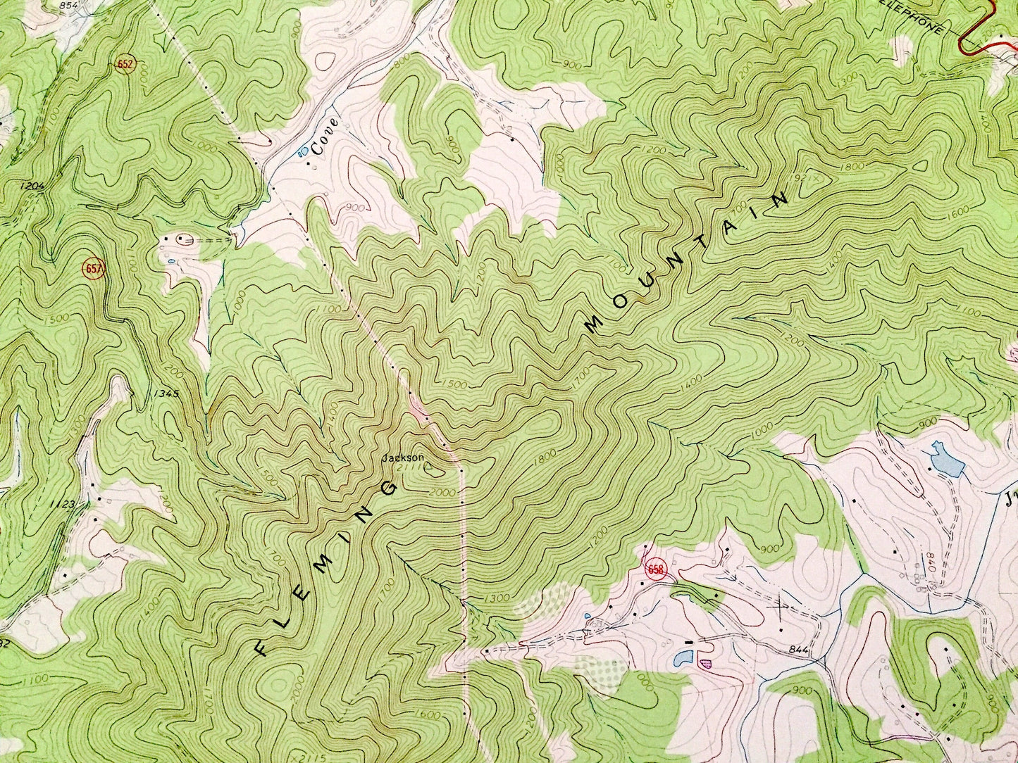
See what Virginia looked like over 55 years ago. Lots of intricate details and geological contours. Map even has little squares for every house that existed at the time. The USGS cartographers were very thorough back then!
Perfect for the historian, map-lover, the curious or just as a conversation starter. Wonderful and rare. Vintage maps such as these make great gifts.
Edition of 1965, printed 1987
Dimensions: 22" width x 27" height
----
Features
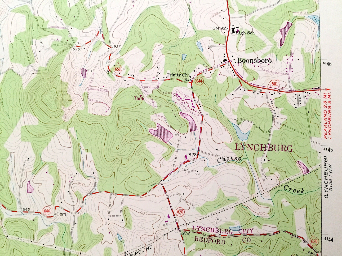
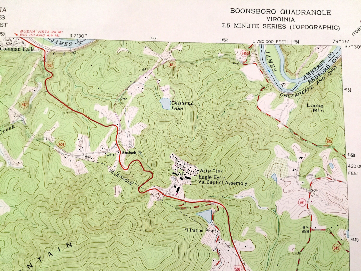
Cities & Towns: Boonsboro, Coleman Falls, Perrowville, Coffee, Norwood, Lynchburg.
Points of Interest: Bedford County, Amherst County, Lynchburg City, No Business Mountain, Fleming Mountain, James River, Grassy Mountain, Dolly Mountain, Elk Creek, Ivy Creek, Cheese Creek, Boonsboro Country Club, Judith Creek, Bear Camp, Eagle Eyrie Virginia Baptist Assembly, and many more hills, streams, ponds, houses, schools, churches and roads.
Condition: Good Vintage condition, commensurate with age. This map is in great shape for being over 40 years old. Has some edge-wear but this will add to vintage character when framed.
----
We will happily adjust shipping price for multiple purchases. Maps are rolled up and shipped in sturdy mailing tubes, never folded.
Couldn't load pickup availability
Share