My Store
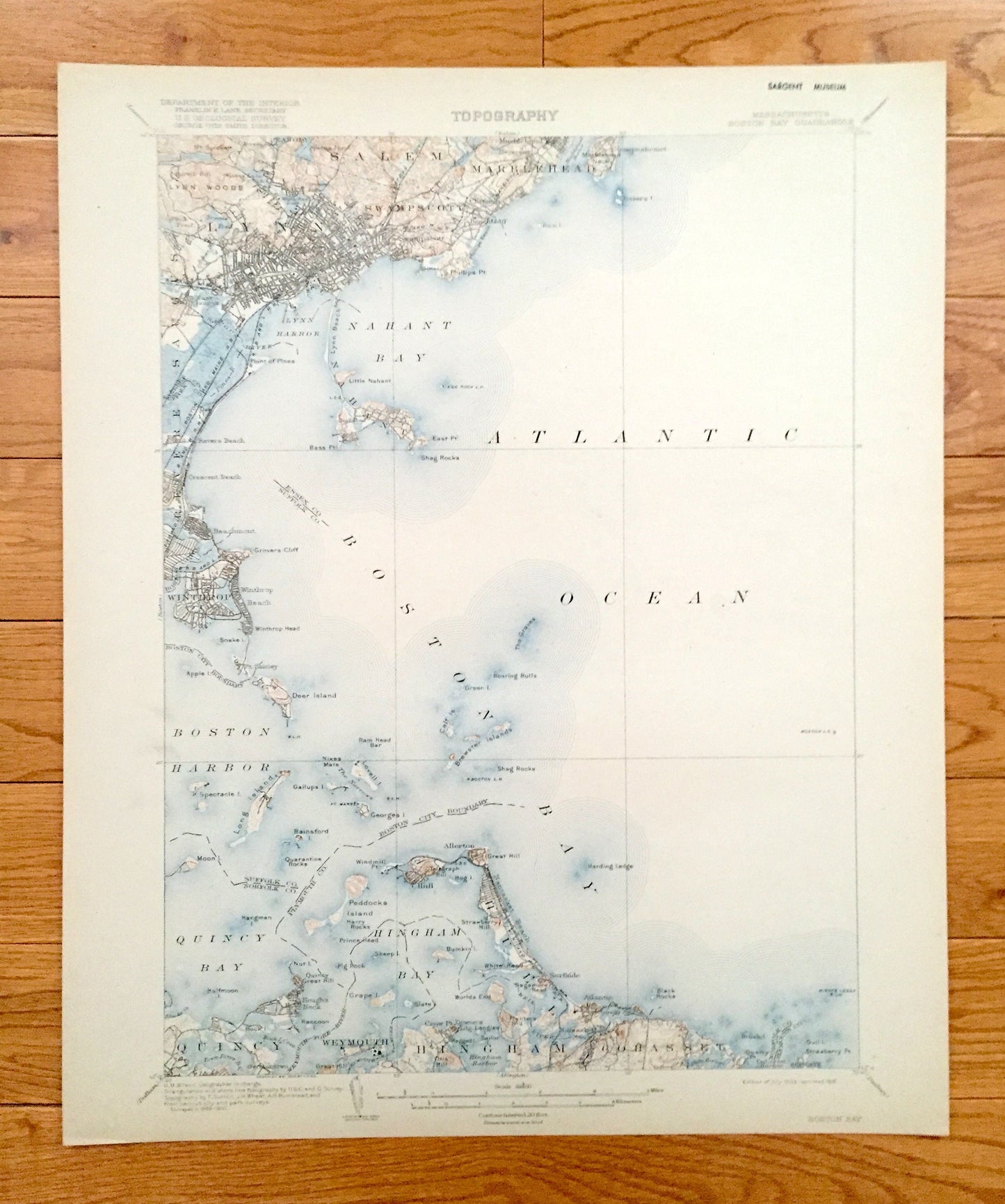
Antique Boston Harbor, Massachusetts 1903 US Geological Survey Topographic Map – Winthrop, Nahant, Quincy, Hull, Marblehead, Cohasset Bay MA
Antique Boston Harbor, Massachusetts 1903 US Geological Survey Topographic Map – Winthrop, Nahant, Quincy, Hull, Marblehead, Cohasset Bay MA
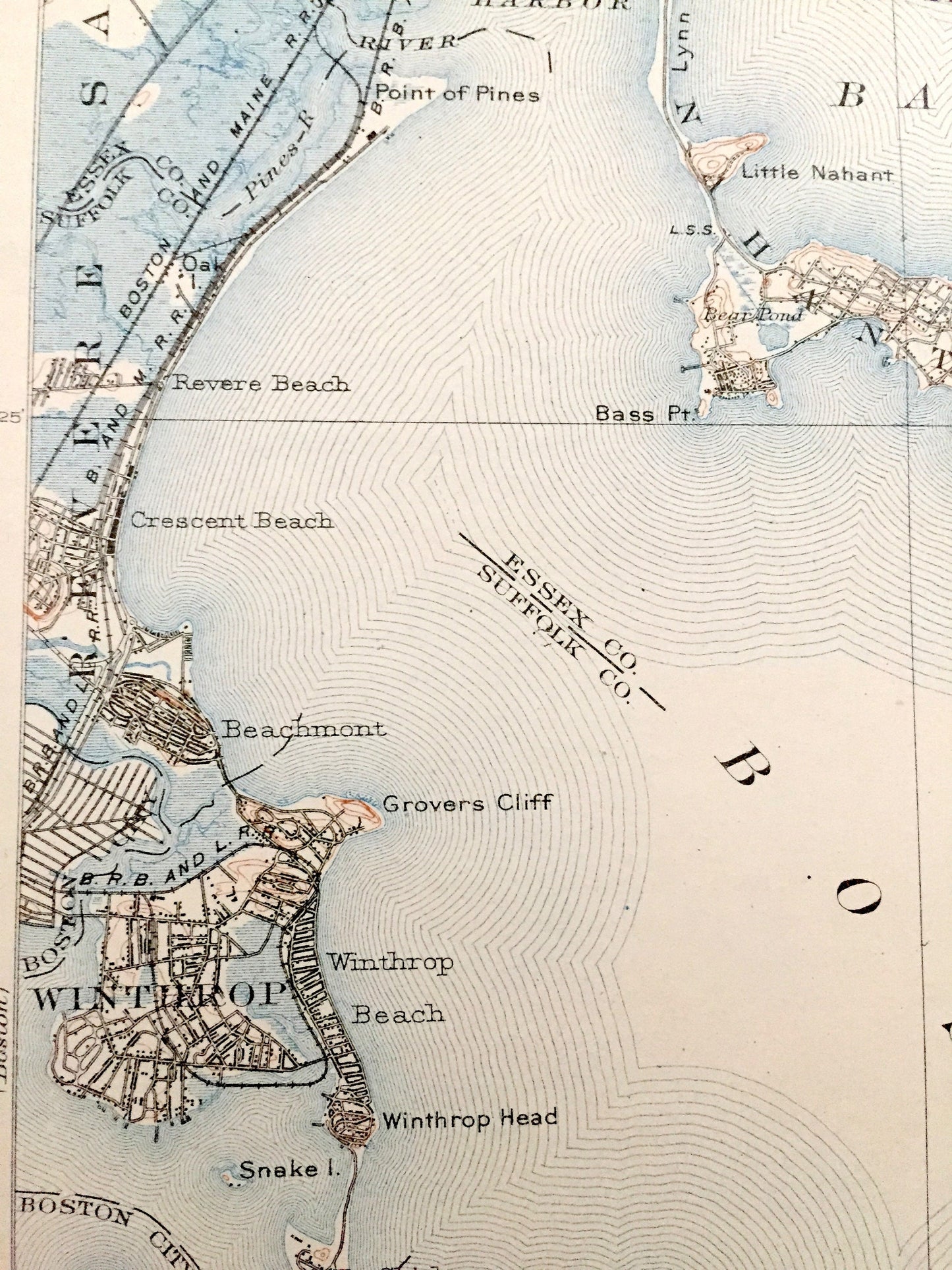
Beautiful, antique map of Boston Bay, Massachusetts including the surrounding towns of Winthrop, Revere, Saugus, Nahant, Lynn, Salem, Swampscott, Marblehead, Quincy, Hingham, Hull and Cohasset. This is an authentic 1903 edition, 1918 print from the U.S. Geological Survey and is NOT a computer reproduction.
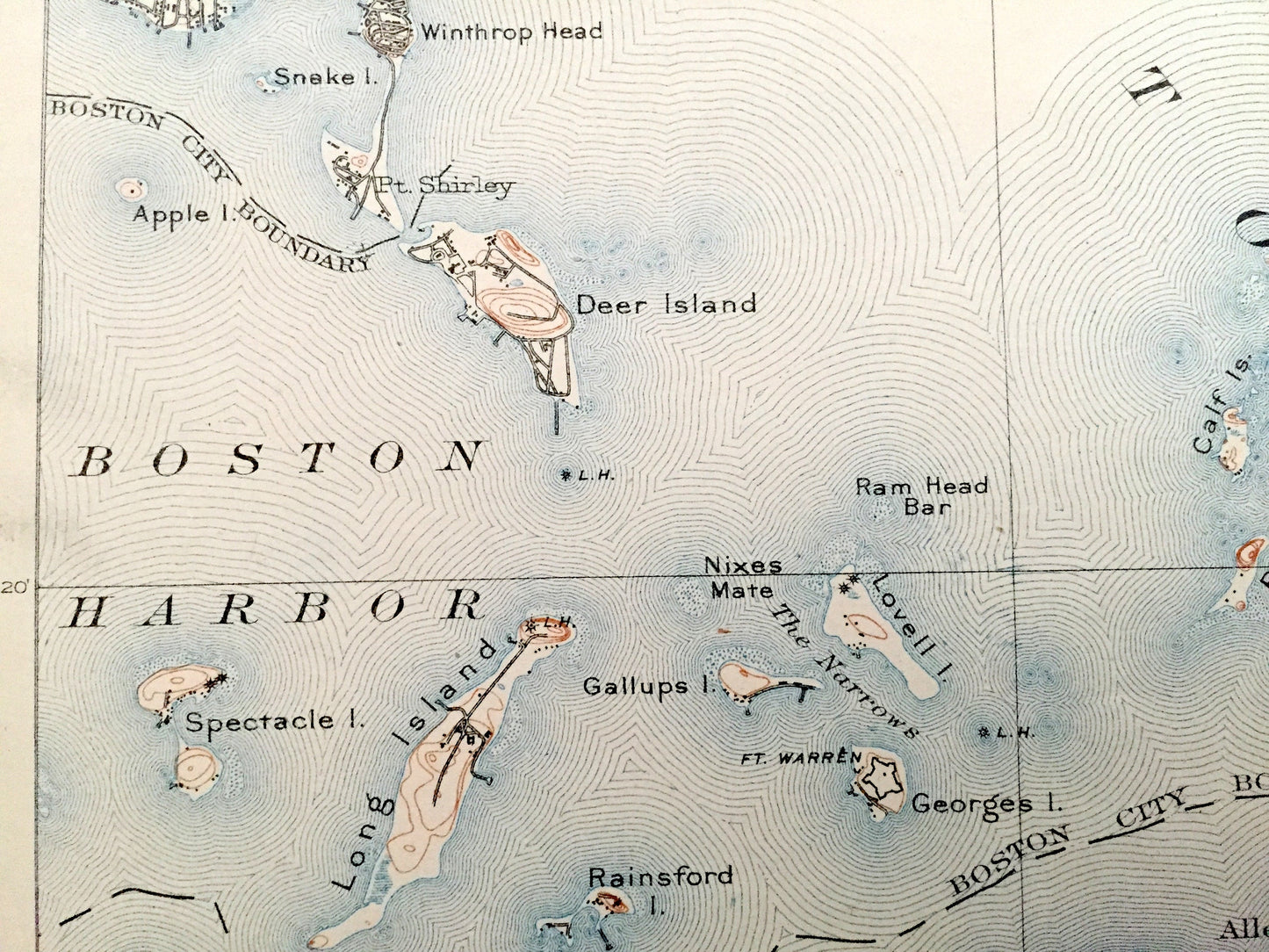
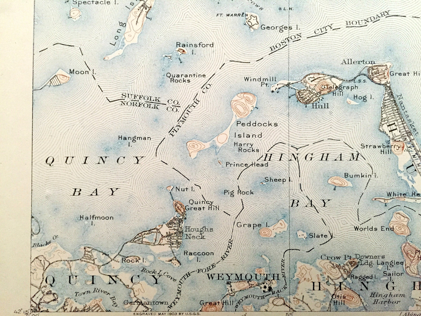
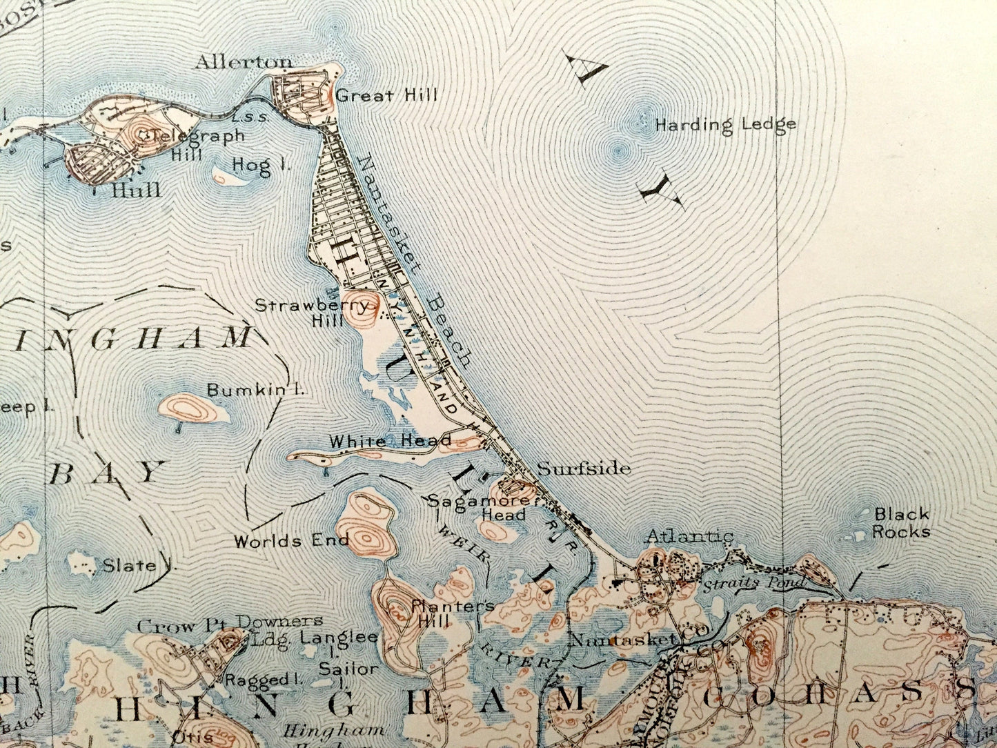
See what Boston Harbor looked like more than 115 years ago. Lots of intricate details and geological contours. Map even has little squares for every house that existed at the time. The USGS cartographers were very thorough back then! On the back is a description of topographic symbols and map guide.
Perfect for the historian, map-lover, the curious or just as a conversation starter. Wonderful and rare. Vintage maps such as these make great gifts.
Edition of 1903, printed 1918
Dimensions: 16 1/2" width x 20" height
----
Features
Cities & Towns: Boston, Winthrop, Revere, Saugus, Nahant, Lynn, Salem, Swampscott, Marblehead, Quincy, Hingham, Hull, Cohasset, Point of Pines, East Saugus, Nashua, Marblehead Neck, Little Nahant, Beachmont, Winthrop Head, Germantown, Downer Landing, Nantasket, North Cohasset.
Points of Interest: Essex County, Norfolk County, Boston Harbor, Boston Bay, President Roads of Boston Harbor and Islands, Long Island, Deer Island, Peddock's Island, Lovell's Island, George's Island, Winthrop Head, Grover's Cliff, Bass Point, Egg Rock Light, Revere Beach, Lynn Harbor, Nahant Bay, Dread Ledge, Phillips Beach, Tinker's Island, Marblehead Harbor, Chelsea Creek, Breed's Island, Spectacle Island, Moon Island, Nut Island, Bumkin Island, Half Moon Island, Town River Bay, Rock Island Cove, Weymouth Fore River, Weymouth Back River, Higham Harbor, World's End, Planters Hill, Point Allerton, sagamore Head, Minot's Ledge Light, East Point, Egg Rock Light, Boston & Maine Railroad, Marblehead Bridge Railroad, Nantasket Beach Railroad, and lots more rivers, hills, islands, coves, bays, houses, churches, schools, cemeteries, train tracks and roads.
Condition: Good Vintage condition, commensurate with age. This map is in great shape for being over 100 years old. Has light wear, foxing, toning and museum stamp in margin, but this will add to vintage character when framed.
----
We will happily adjust shipping price for multiple purchases. Maps are rolled up and shipped in sturdy mailing tubes, never folded.
Couldn't load pickup availability
Share