My Store
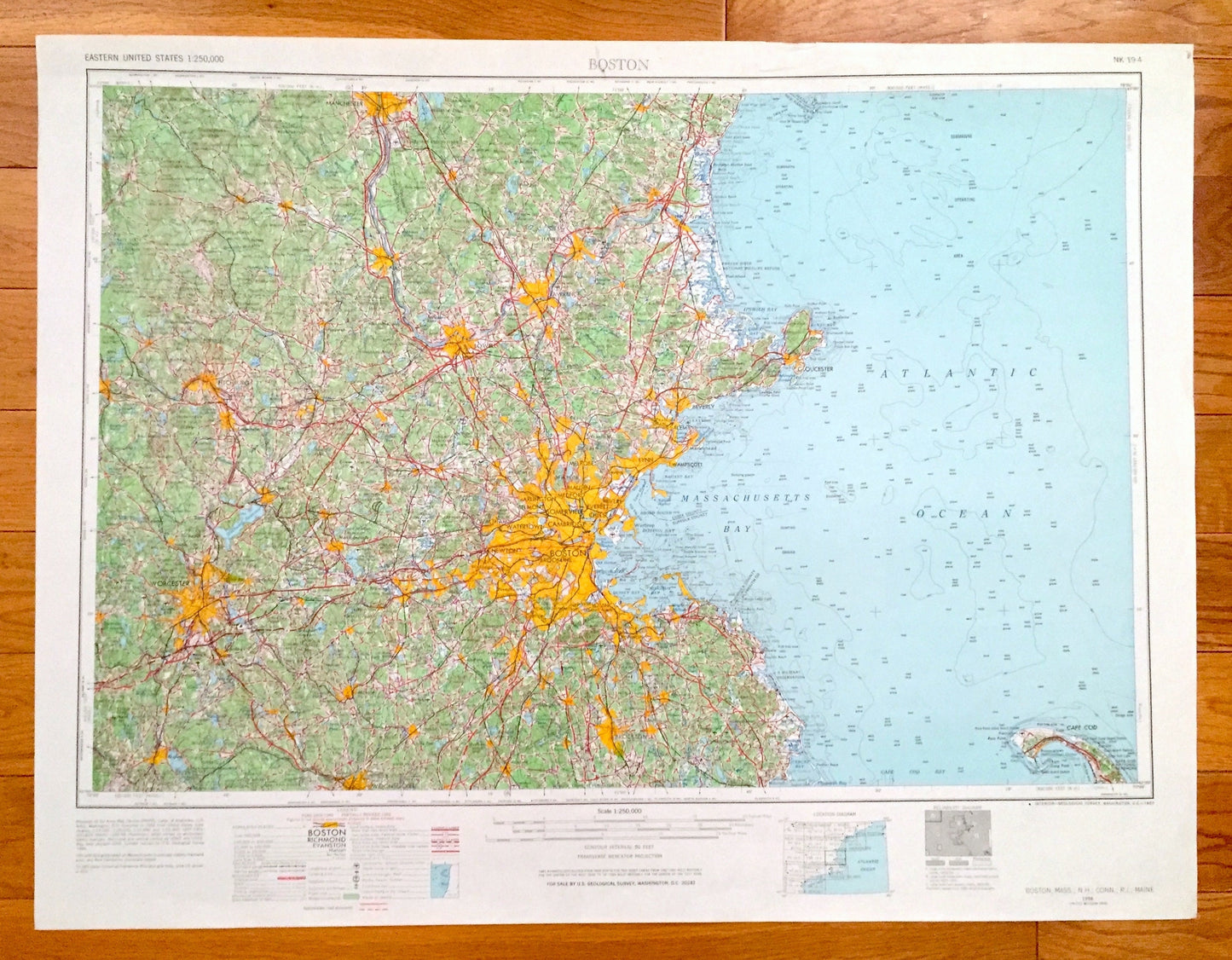
Antique Boston, Massachusetts 1956 US Geological Survey Topographic Map – Cambridge, Newton, Cape Cod, Brookline, Quincy, Revere, Salem, MA
Antique Boston, Massachusetts 1956 US Geological Survey Topographic Map – Cambridge, Newton, Cape Cod, Brookline, Quincy, Revere, Salem, MA
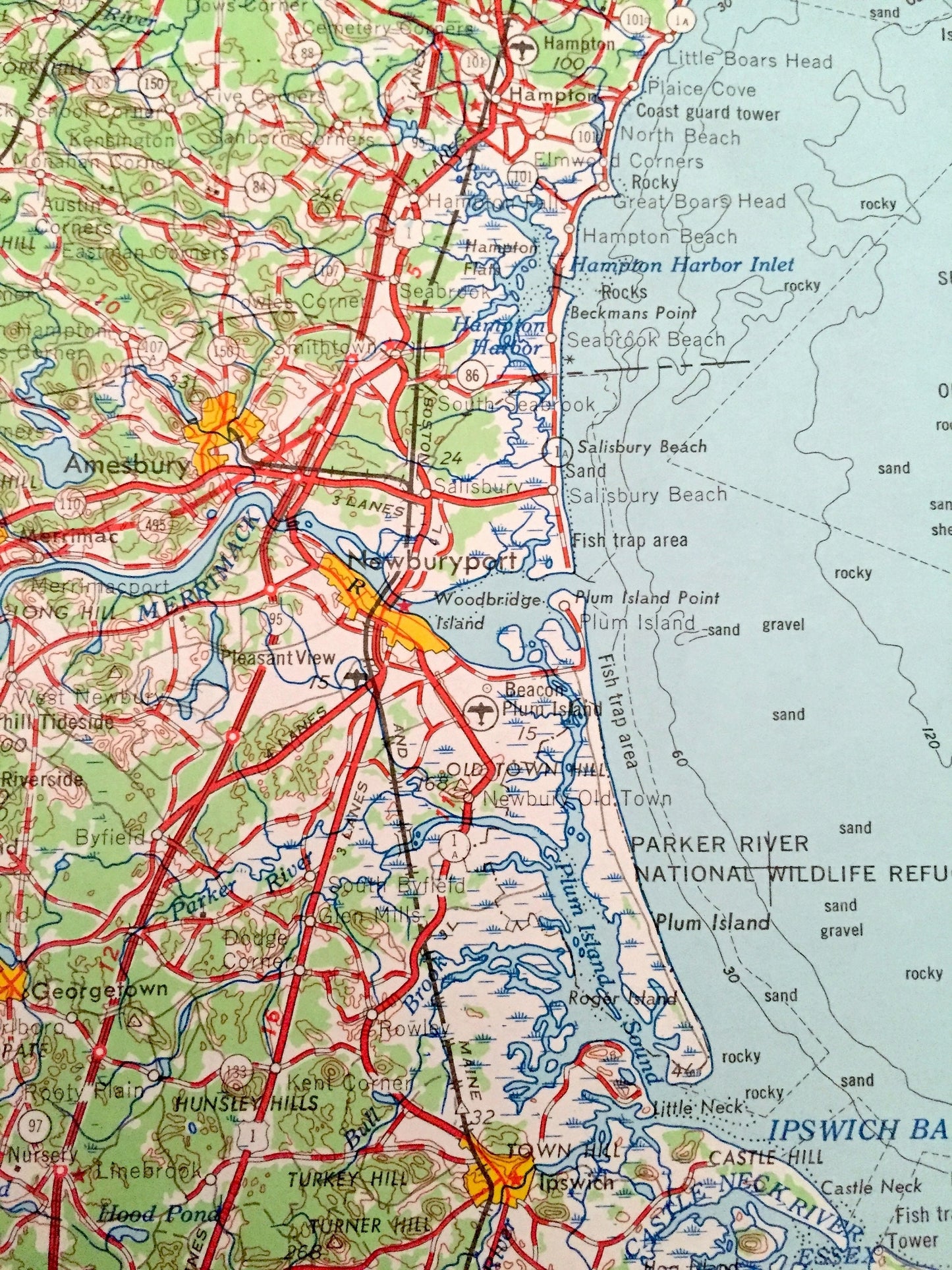
Beautiful, antique map of Boston, Massachusetts and surrounding New Hampshire, Connecticut, Rhode Island, and Maine areas. This is a 1956 edition, 1967 print from the U.S. Geological Survey and NOT a computer reproduction.
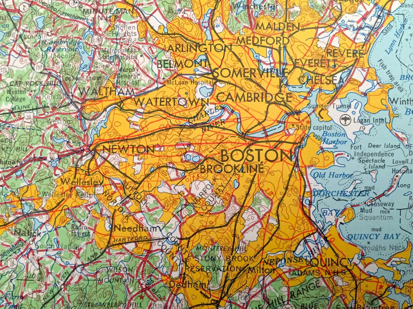
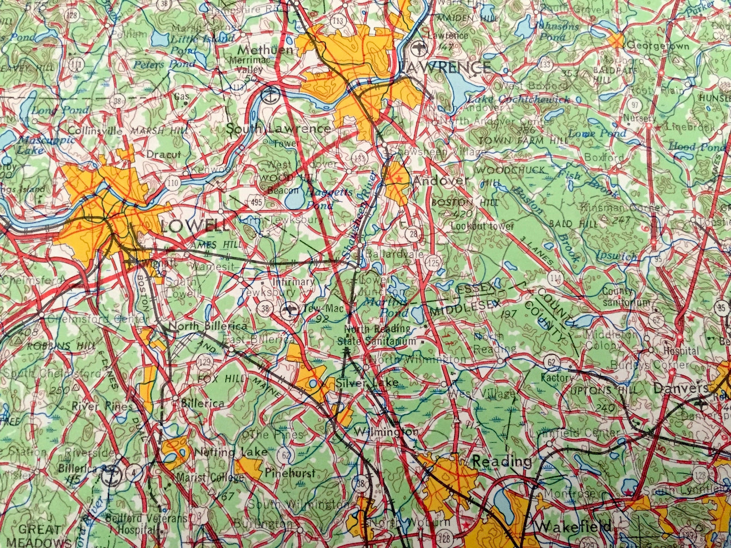
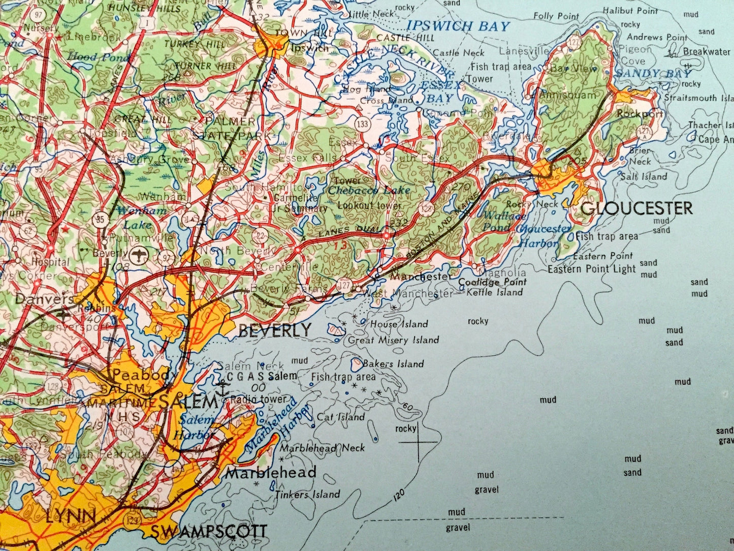
See what Massachusetts, New Hampshire, Connecticut, Rhode Island, and Maine looked like over 65 years ago. Lots of intricate details and geological contours. Map even has little squares for every house that existed at the time. The USGS cartographers were very thorough back then!
Perfect for the historian, map-lover, the curious or just as a conversation starter. Wonderful and rare. Vintage maps such as these make great gifts.
Edition of 1956, printed 1967
Dimensions: 32" width x 22" height
----
Features
Cities & Towns: MASSACHUSETTS - Boston, Medford, Arlington, Malden, Everett, Somerville, Waltham, Belmont, Chelsea, Melrose, Lynn, Peabody, Winchester, Lexington, Woburn, Stoneham, Reading, Gloucester, Rockport, Lowell, Lawrence, Haverhill, Amesbury, Newburyport, Danvers, Wakefield, Webster, Rockland, Milford, Oxford, Marlboro, Fitchburg, Gardner, Norwood, Clinton, Provincetown.
NEW HAMPSHIRE - Nashua, West Derry, Manchester, Milford, Wilton, Exeter.
CONNECTICUT - East Thompson, Wilsonville, Fabyan.
RHODE ISLAND - Woonsocket, Slatersville.
Points of Interest: MASSACHUSETTS - Atlantic Ocean, Massachusetts Bay, Quincy Bay, Boston Bay, Plum Island Sound, Palmer State Park, Parker River National Wildlife Refuge, Uptown State Forest, Douglas State Forest, Spencer State Forest Reservation, Leominster State Forest, Hopkinton State Park, Wachusett Reservoir, Merrimack River, Blue Hill Range and lots more hills, mountains, rivers, lakes, creeks, roads, highways and railroads.
NEW HAMPSHIRE - Atlantic Ocean, Merrimack River, Exeter River, Crotched Mountain, Annett State Reservation, Silver Lake State Park, Canobie Lake, Brand Rock Hill, Gumpas Pond and lots more hills, mountains, rivers, lakes, creeks, roads, highways and railroads.
CONNECTICUT - Windham County and lots more hills, mountains, rivers, lakes, creeks, roads, highways and railroads.
RHODE ISLAND - Providence County, Wallum Lake and lots more hills, mountains, rivers, lakes, creeks, roads, highways and railroads.
MAINE - Atlantic Ocean, Appledore Island, Smuttynose Island and lots more hills, mountains, rivers, lakes, creeks, roads, highways and railroads.
Condition: Good Vintage condition, commensurate with age. This map is in great shape for being over 55 years old. Has some edge-wear but this will all add to vintage character when framed.
----
We will happily adjust shipping price for multiple purchases. Maps are rolled up and shipped in sturdy mailing tubes, never folded.
Couldn't load pickup availability
Share