My Store
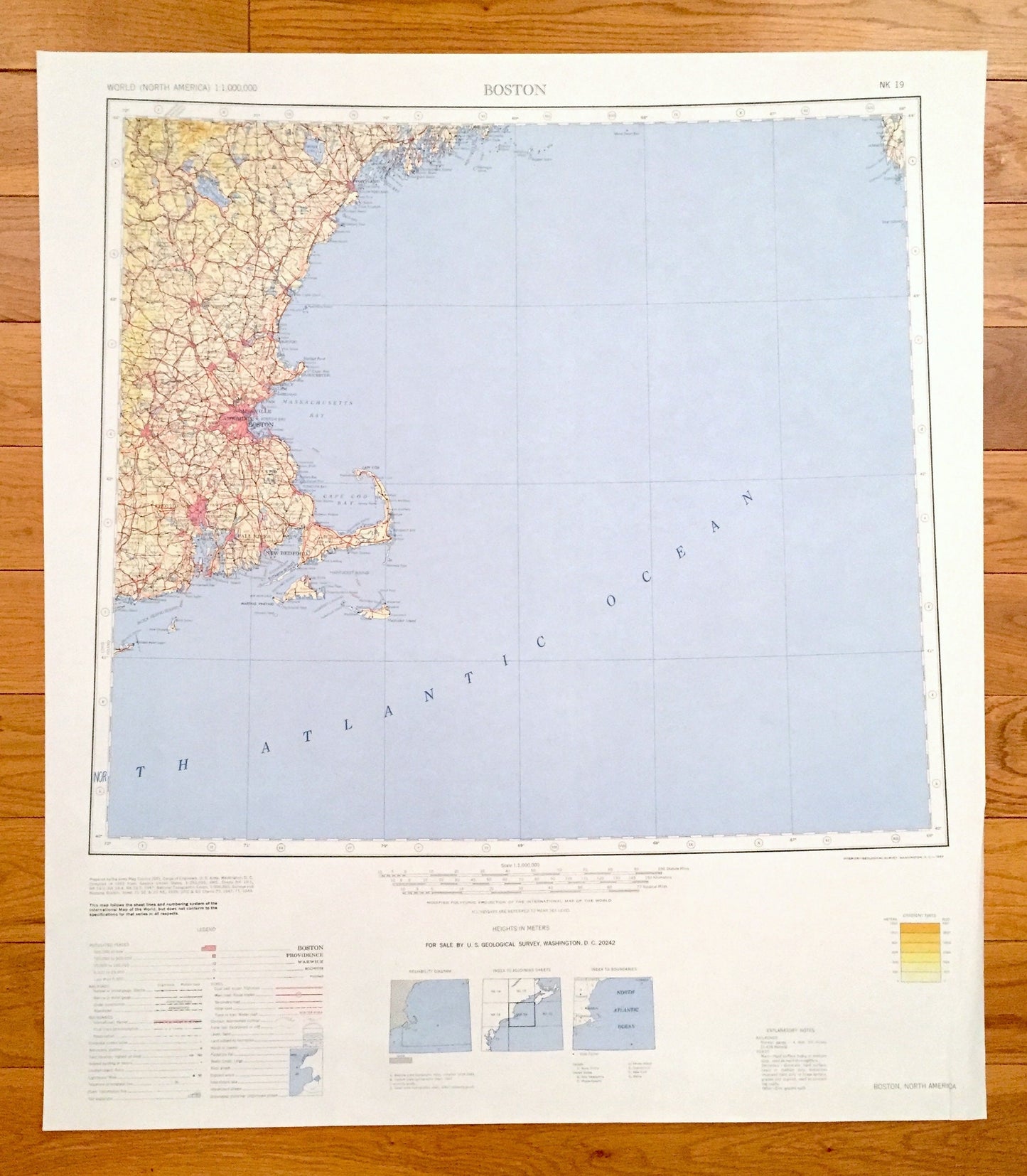
Antique Boston, Massachusetts 1969 US Geological Survey Topographic Map – Cambridge, Somerville, Worcester, Providence, Cape Cod Newport MA
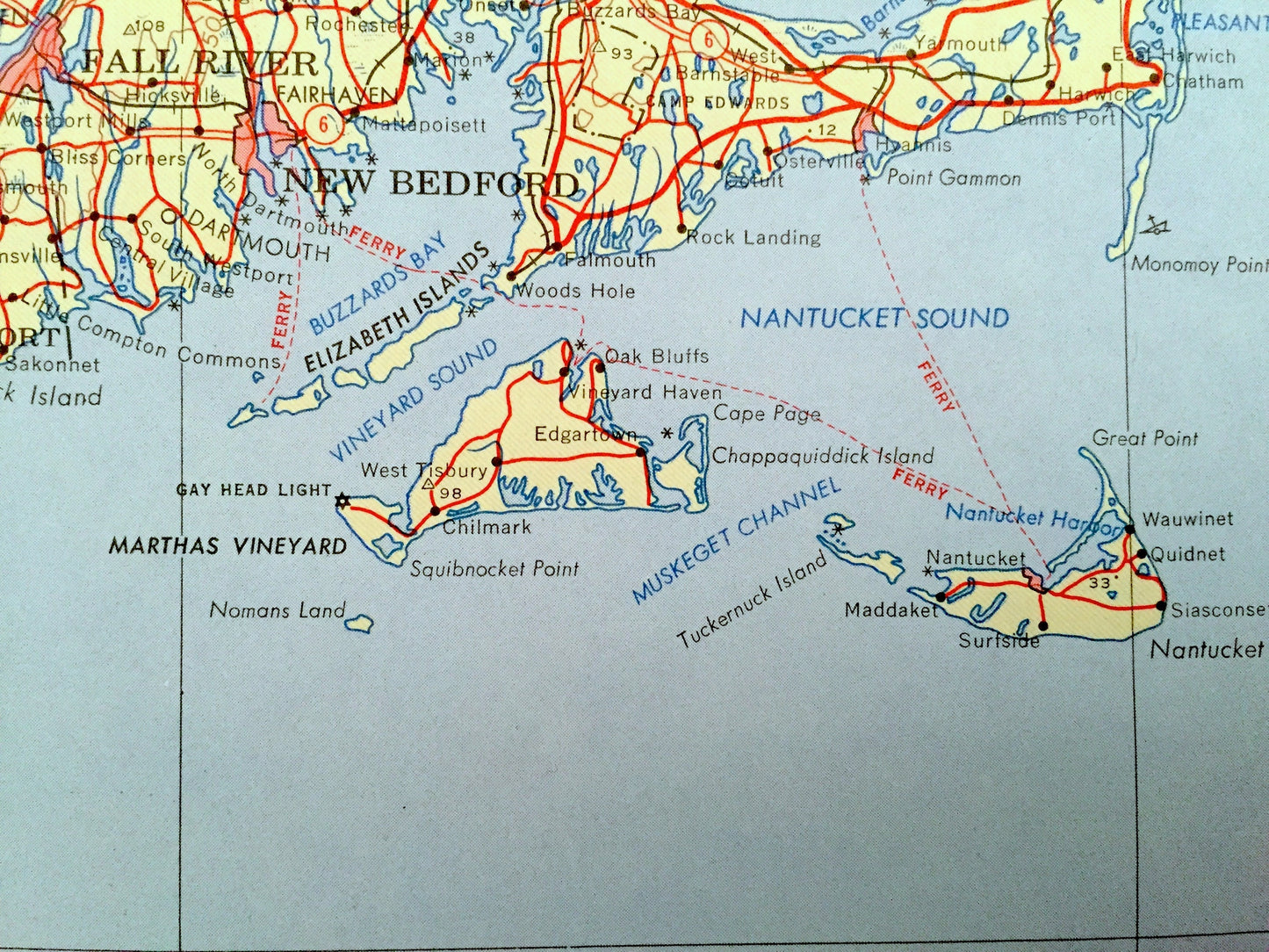
Antique Boston, Massachusetts 1969 US Geological Survey Topographic Map – Cambridge, Somerville, Worcester, Providence, Cape Cod Newport MA
Beautiful, antique map of Boston, Massachusetts and surrounding areas. This is a 1969 edition, 1969 print from the U.S. Geological Survey and NOT a computer reproduction.
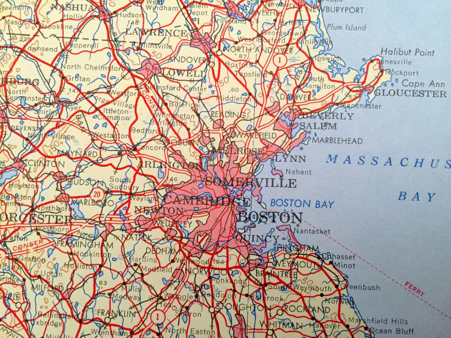
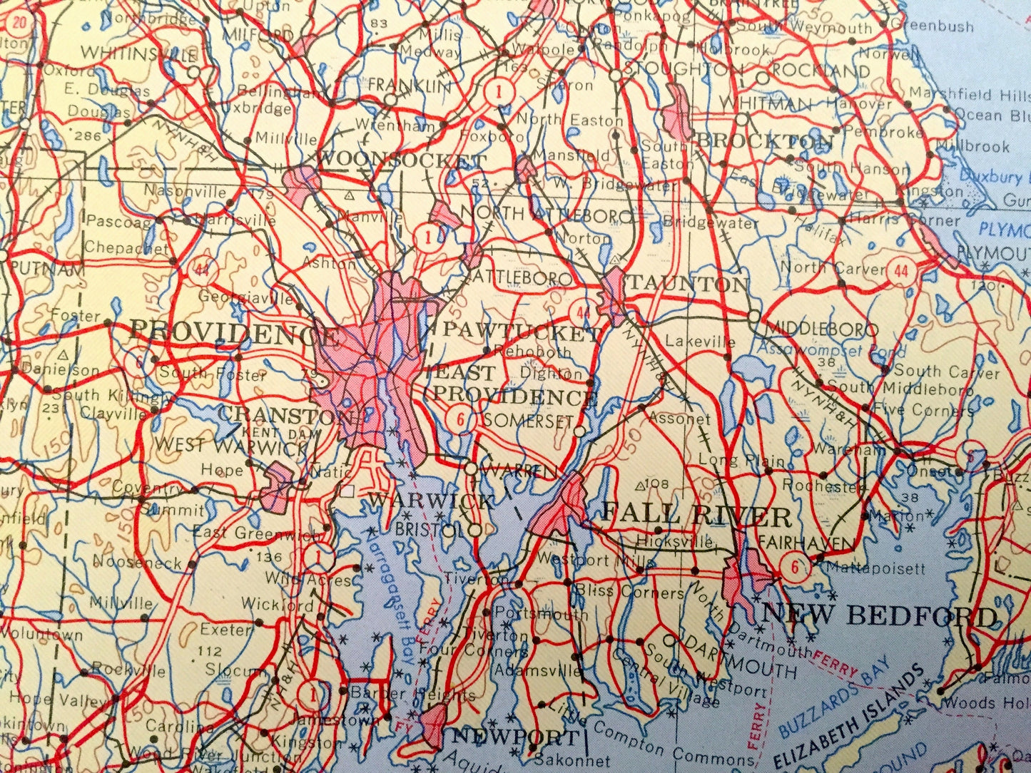
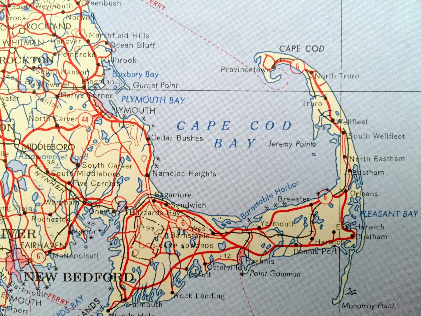
See what Massachusetts looked like over 50 years ago. Lots of intricate details and geological contours. Map even has little squares for every house that existed at the time. The USGS cartographers were very thorough back then!
Perfect for the historian, map-lover, the curious or just as a conversation starter. Wonderful and rare. Vintage maps such as these make great gifts.
Edition of 1969, printed 1969
Dimensions: 25" width x 26" height
----
Features
Cities & Towns: Boston, Newton, Brockton, Fall River, New Bedford, Cape Cod, Cranston, Fitchburg, Manchester, Portland, Concord, Newport, Woonsocket, Lowell, Cambridge, Somerville, Worcester, Providence, Pawtucket, Quincy.
Points of Interest: Atlantic Ocean, Massachusetts Bay, Cape Cod Bay, Marthas Vineyard, Nantucket Island, Nantucket Sound, Block Island Sound, Boston Bay, Sebago Lake, and lots more hills, mountains, lakes, rivers, creeks, roads, highways and railroads.
Condition: Good Vintage condition, commensurate with age. This map is in great shape for being over 50 years old. Has some edge-wear but this will all add to vintage character when framed.
----
We will happily adjust shipping price for multiple purchases. Maps are rolled up and shipped in sturdy mailing tubes, never folded.
Couldn't load pickup availability
Share