My Store
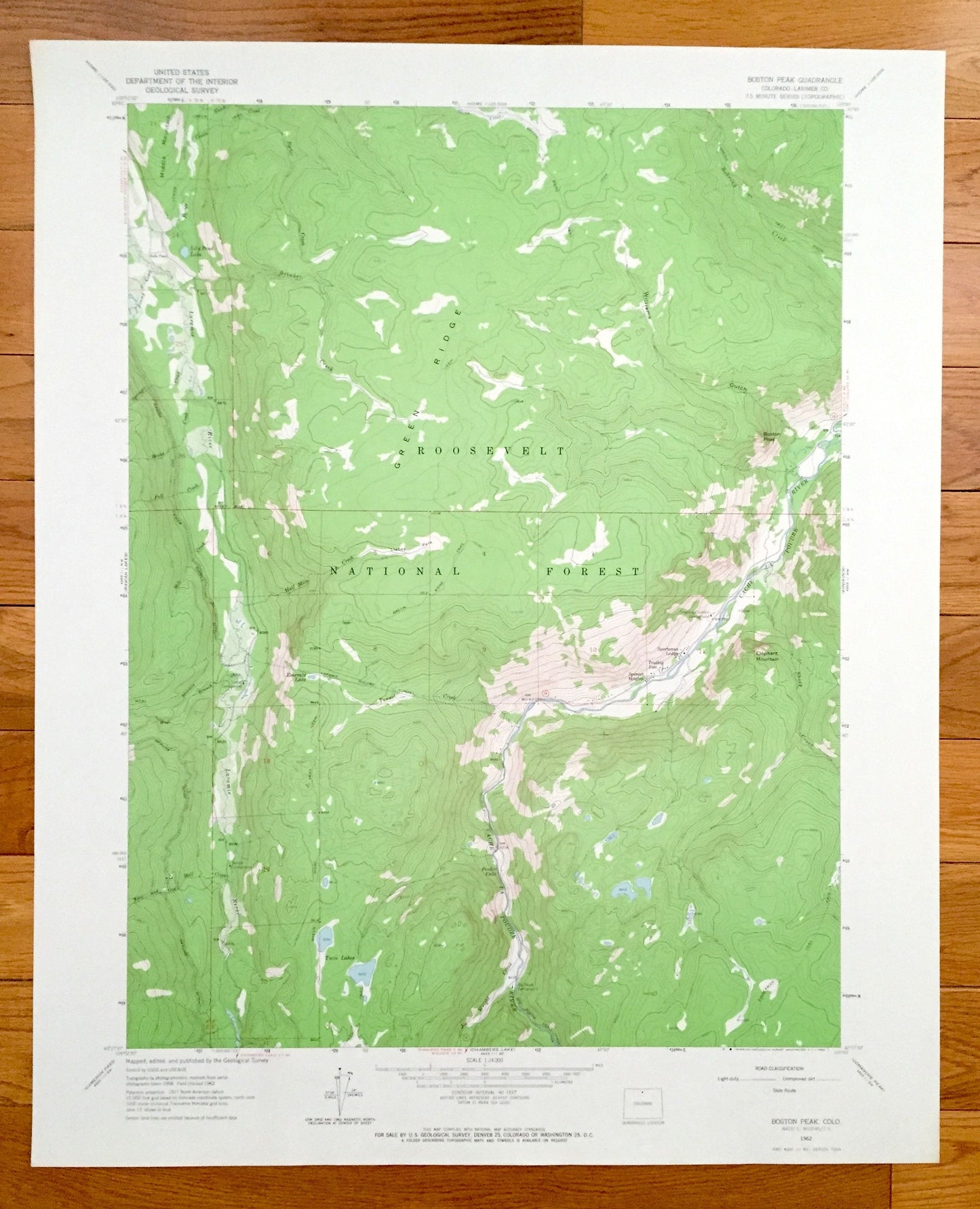
Antique Boston Peak, Colorado 1962 US Geological Survey Topographic Map – Larimer County, Roosevelt National Park, Green Ridge, Twin Lakes
Antique Boston Peak, Colorado 1962 US Geological Survey Topographic Map – Larimer County, Roosevelt National Park, Green Ridge, Twin Lakes
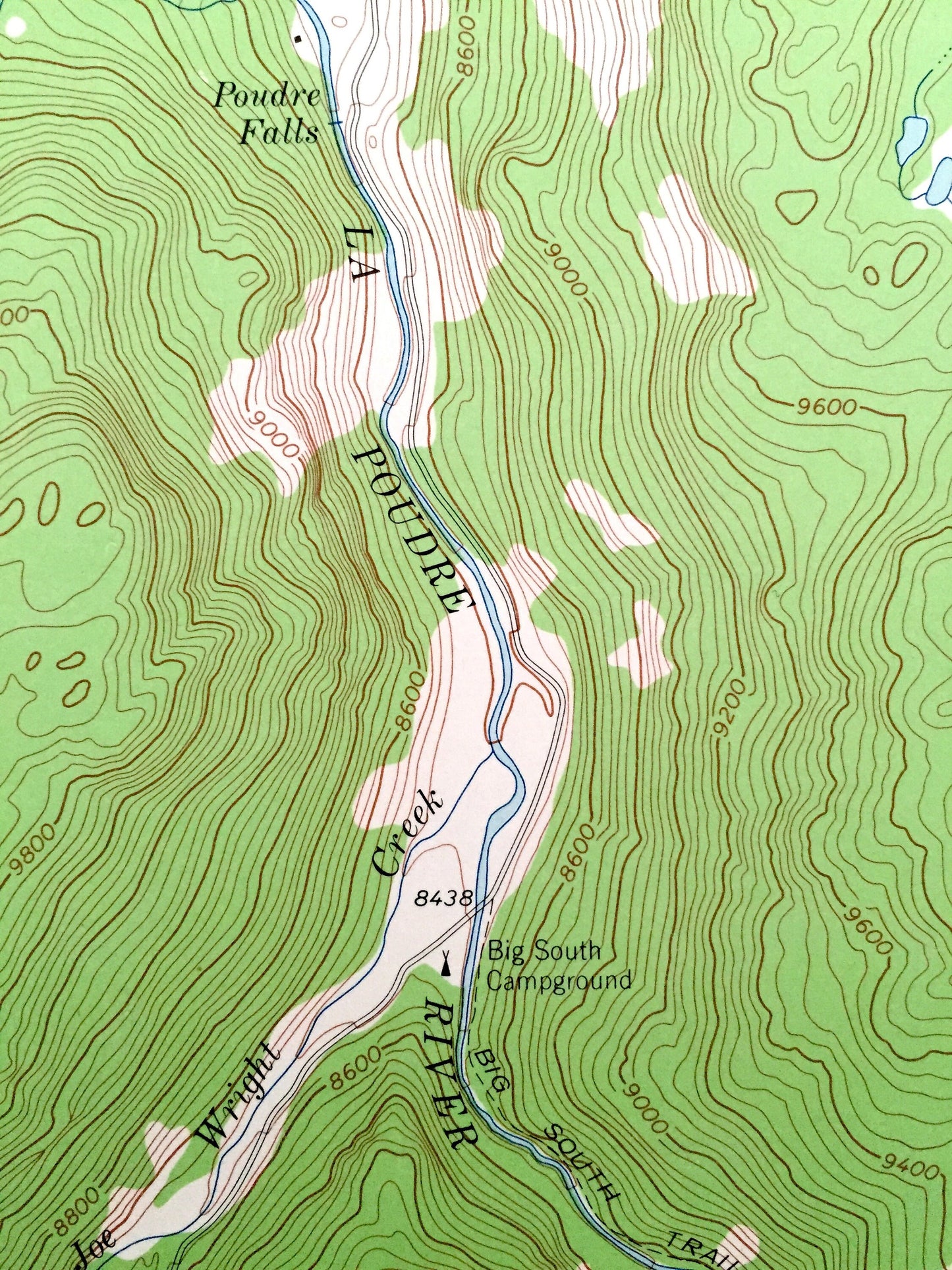
Beautiful, antique map of Boston Peak, Colorado, Roosevelt National Park and surrounding Larimer County area. This is an authentic 1962 print from the U.S. Geological Survey and NOT a computer reprint.
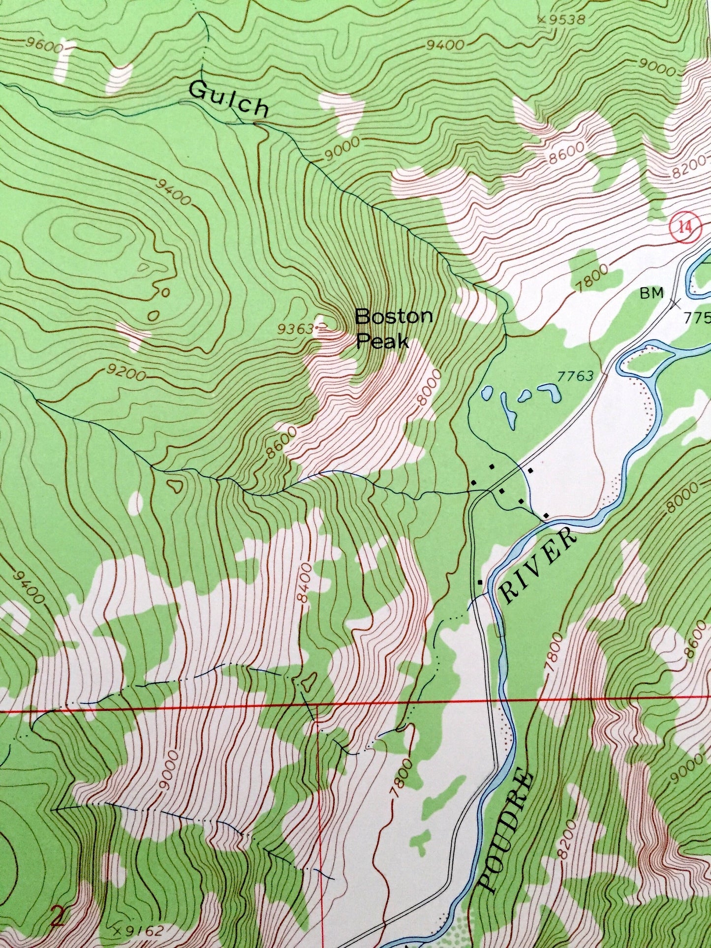
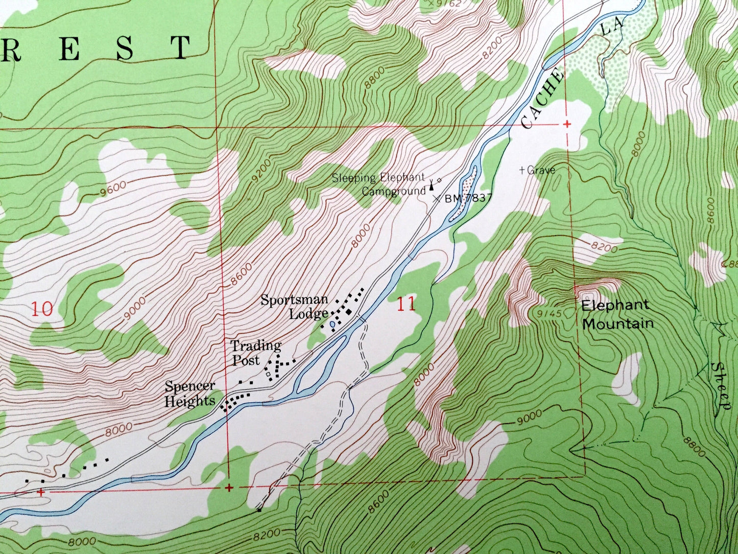
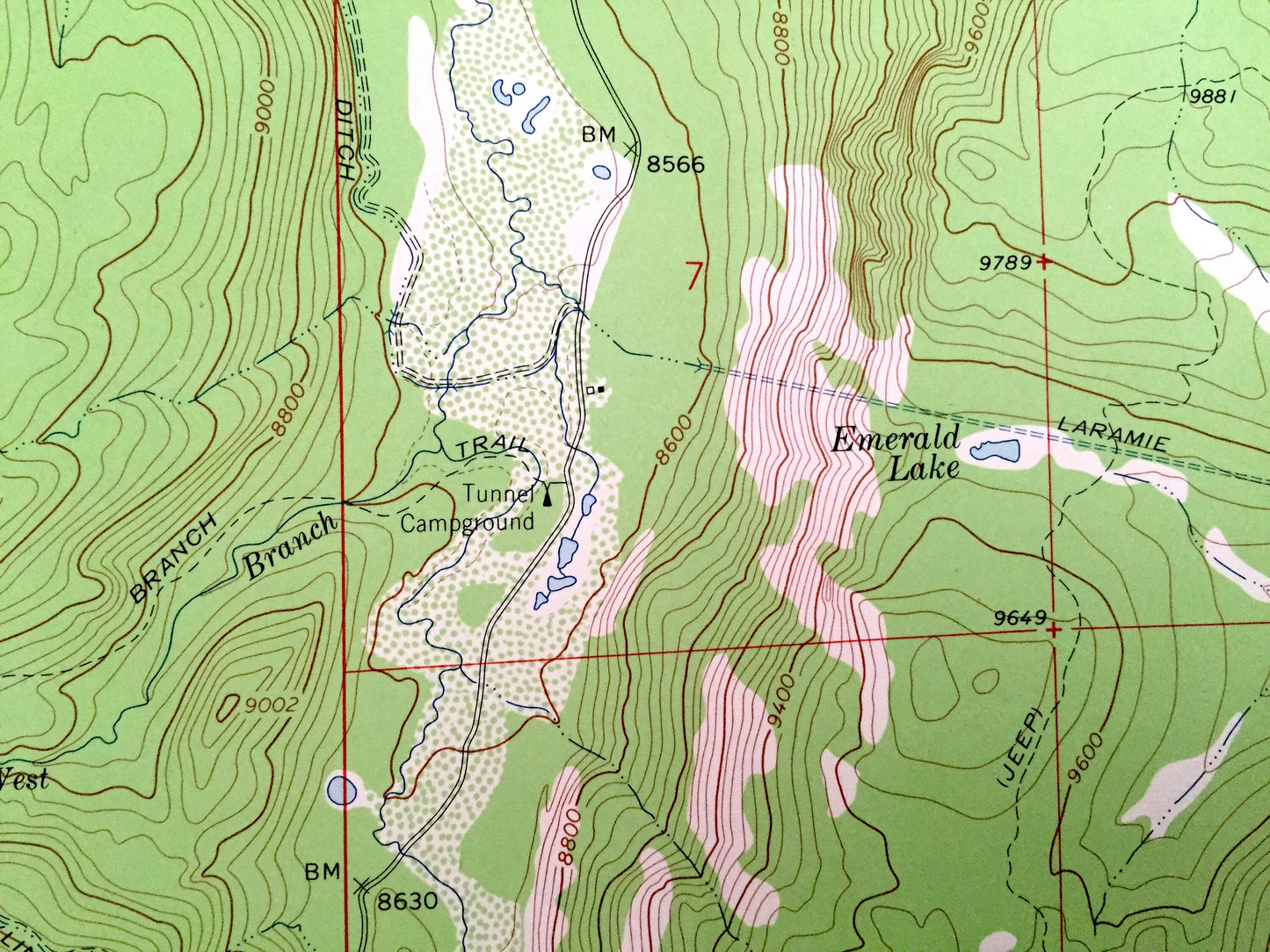
See what Colorado looked like more than 55 years ago. Lots of intricate details and geological contours. Map even has little squares for every house that existed. The USGS cartographers were very thorough back then!
Perfect for the historian, map-lover, the curious or just as a conversation starter. Wonderful and rare. Vintage maps such as these make great gifts.
Edition of 1962, printed 1962
Dimensions: 22" width x 27" height
----
Features
Points of Interest: Larimer County, Roosevelt National Forest, Twin Lakes, Green Ridge, Elephant Mountain, Cache Poudre River, Lily Pond Lake, Middle Mountain, Emerald Lake and many more smaller lakes, creeks, mountains, valleys, houses, schools, roads, churches and train tracks.
Condition: Very Good condition, commensurate with age. This map is in incredible shape for being almost 60 years old.
----
We will happily adjust shipping price for multiple purchases. Maps are rolled up and shipped in sturdy mailing tubes, never folded.
Couldn't load pickup availability
Share