My Store
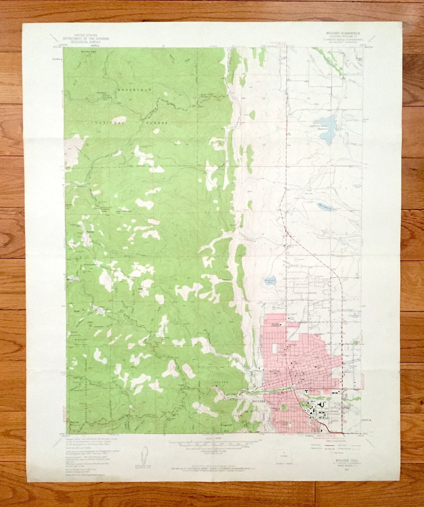
Antique Boulder, Colorado 1957 US Geological Survey Topographic Map – Roosevelt National Forest, University of, Boulder Mountain Park, CO
Antique Boulder, Colorado 1957 US Geological Survey Topographic Map – Roosevelt National Forest, University of, Boulder Mountain Park, CO
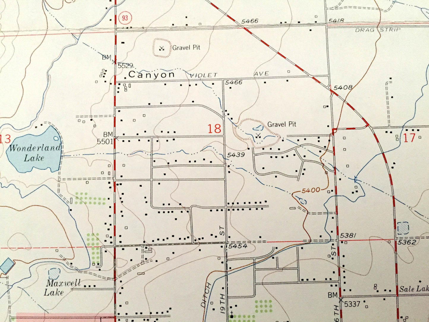
Beautiful, antique map of Boulder, Roosevelt National Park and surrounding Boulder County area. This is an authentic 1957 edition, 1959 print from the U.S. Geological Survey and not a computer reprint.
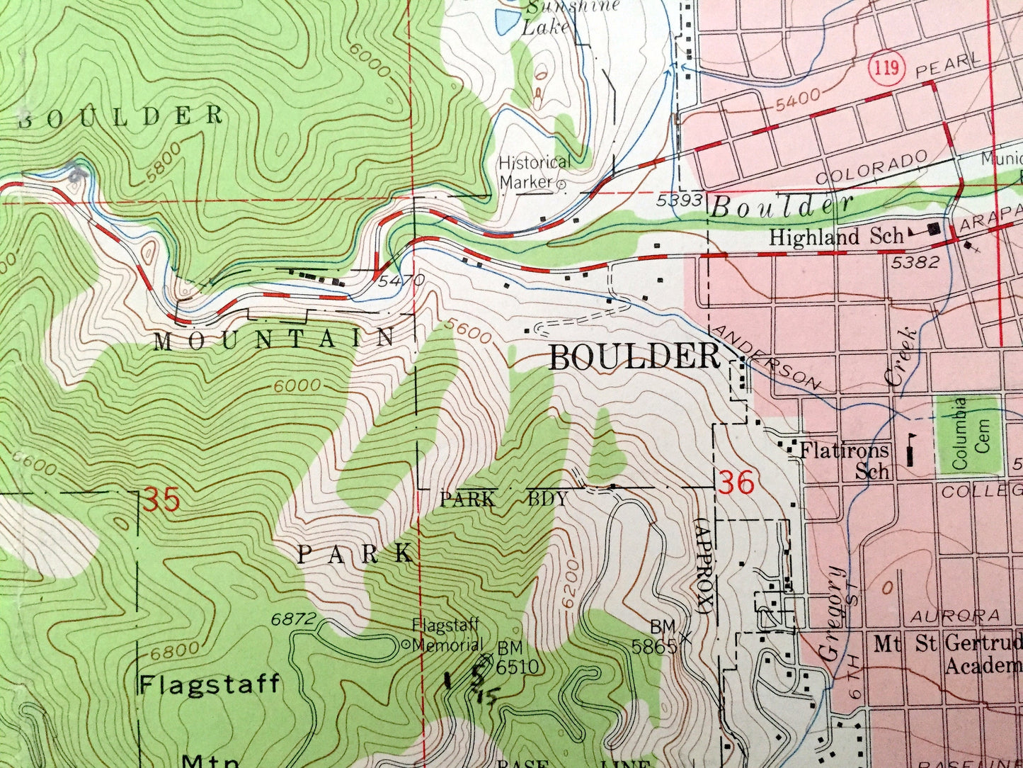
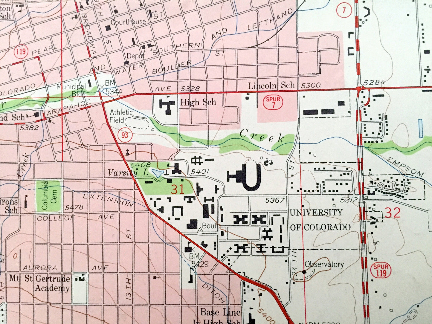
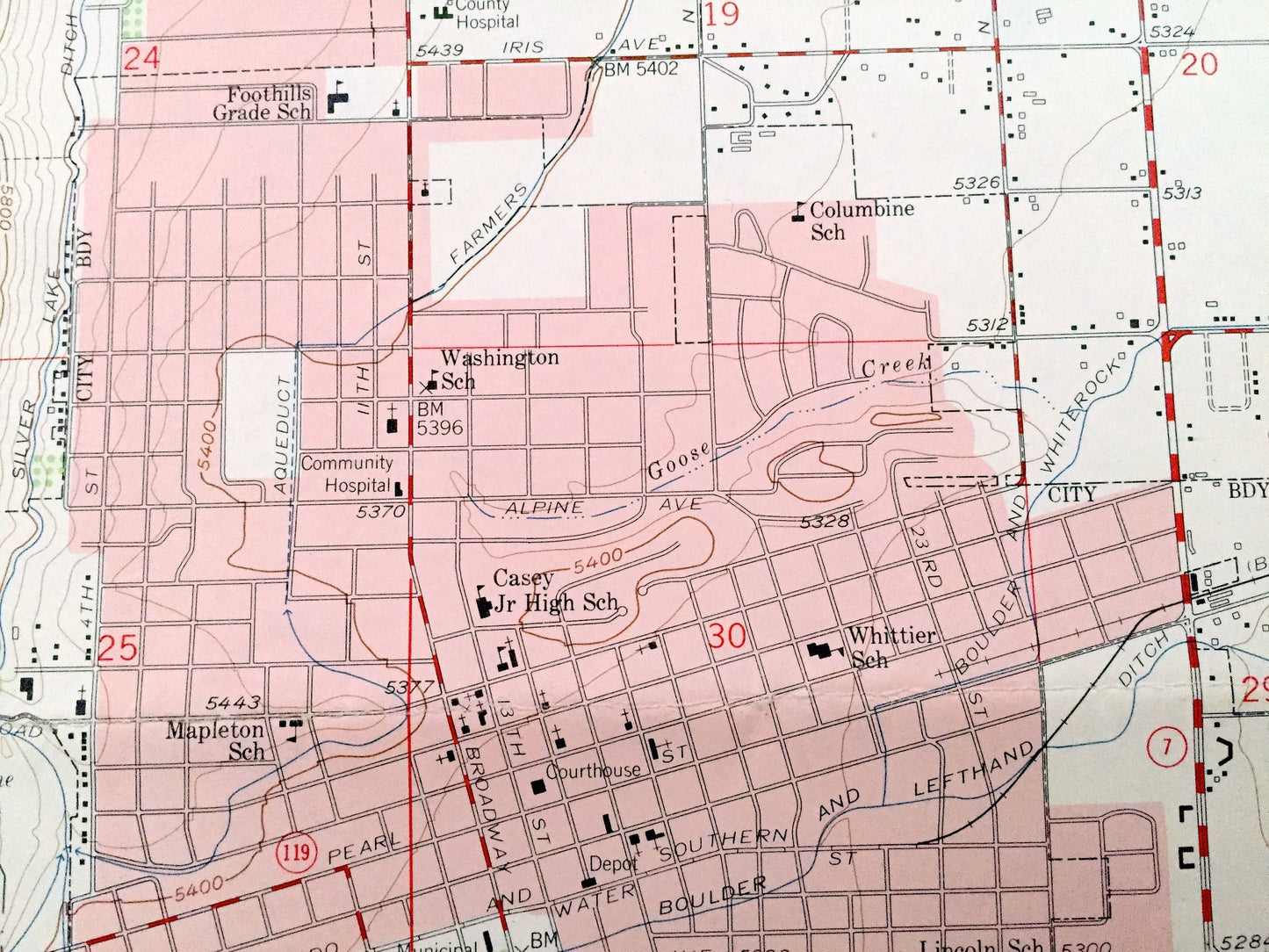
See what Boulder and the Rocky Mountains looked like more than 60 years ago. Lots of intricate details and geological contours. Map even has little squares for every house that existed. The USGS cartographers were very thorough back then!
Perfect for the historian, map-lover, the curious or just as a conversation starter. Wonderful and rare. Vintage maps such as these make great gifts.
Edition of 1957, printed 1959
Dimensions: 22" width x 27" height
----
Features
Cities & Towns: Boulder, Springdale, Sunshine, Crisman, Wheelman, Orodell.
Mountains: Boulder County, Roosevelt National Forest, Boulder Mountain Park, University of Colorado, Wonderland Lake, Arkansas Mountain, Lefthand Canyon, Fourmile Canyon, Twomile Canyon, and many more smaller lakes, streams, houses, schools, roads, churches and train tracks.
Condition: Good Vintage condition, commensurate with age. This map is in great shape for being more than 60 years old. Has light wear, toning and folds as-issued, but these will flatten easily and all will add to vintage character when framed.
----
We will happily adjust shipping price for multiple purchases. Maps are rolled up and shipped in sturdy mailing tubes, never folded.
Couldn't load pickup availability
Share