My Store
Antique Bowman, Maine & Pittsburg, New Hampshire 1931 US Geological Survey Topographic Map – Moose Bog, Coos, Oxford County, Parmachenee NH
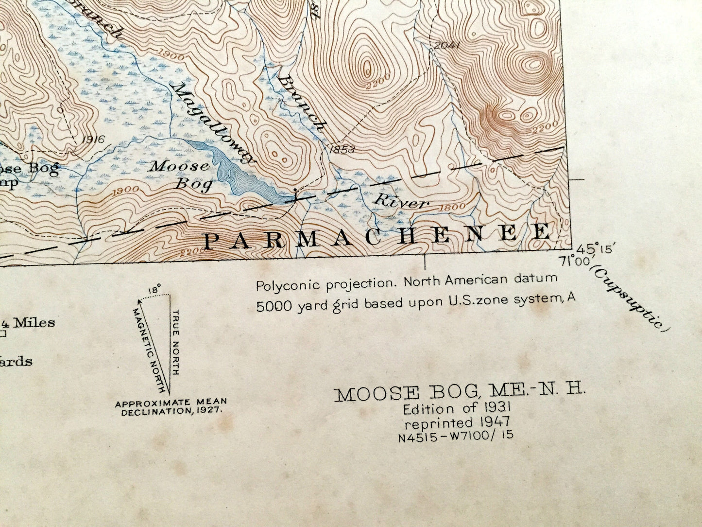
Antique Bowman, Maine & Pittsburg, New Hampshire 1931 US Geological Survey Topographic Map – Moose Bog, Coos, Oxford County, Parmachenee NH
Beautiful, antique map of Moose Bog, Maine and surrounding area of Coos County, New Hampshire and Oxford County, Maine on the Canadian border. This is an authentic 1931 edition, 1947 print from the U.S. Geological Survey and NOT a computer reproduction.
See what Pittsburg, Bowman and Parmachenee looked like over 80 years ago. Lots of intricate details and geological contours. Map even has little squares for every house that existed at the time. The USGS cartographers were very thorough back then! On the back is a description of topographic symbols and map guide.
Perfect for the historian, map-lover, the curious or just as a conversation starter. Wonderful and rare. Maps such as these make great gifts.
Edition of 1931, printed 1947
Dimensions: 17" width x 21" height
----
Features
Cities & Towns: Pittsburg, Bowman, Parmachenee.
Points of Interest: Coos County, Oxford County, United States-Canada Border, Moose Bog, Prospect Hill, Bowman Hill, Magalloway River, Parker Pond, Mountain Pond, Moose Bog Camp, Bowman Farm, Moose Brook and lots more hills, mountains, streams, ponds, marshes, camps, roads.
Condition: Fair or "Very Vintage" condition, commensurate with age. This map is in great shape for being almost 80 years old. Map has light edge-wear, spotting, and punch holes, which are easily concealed with placing a similar-colored paper behind the print, and all of which will read as vintage character when framed.
----
We will happily adjust shipping price for multiple purchases. Maps are rolled up and shipped in sturdy mailing tubes, never folded.
Couldn't load pickup availability
Share