My Store
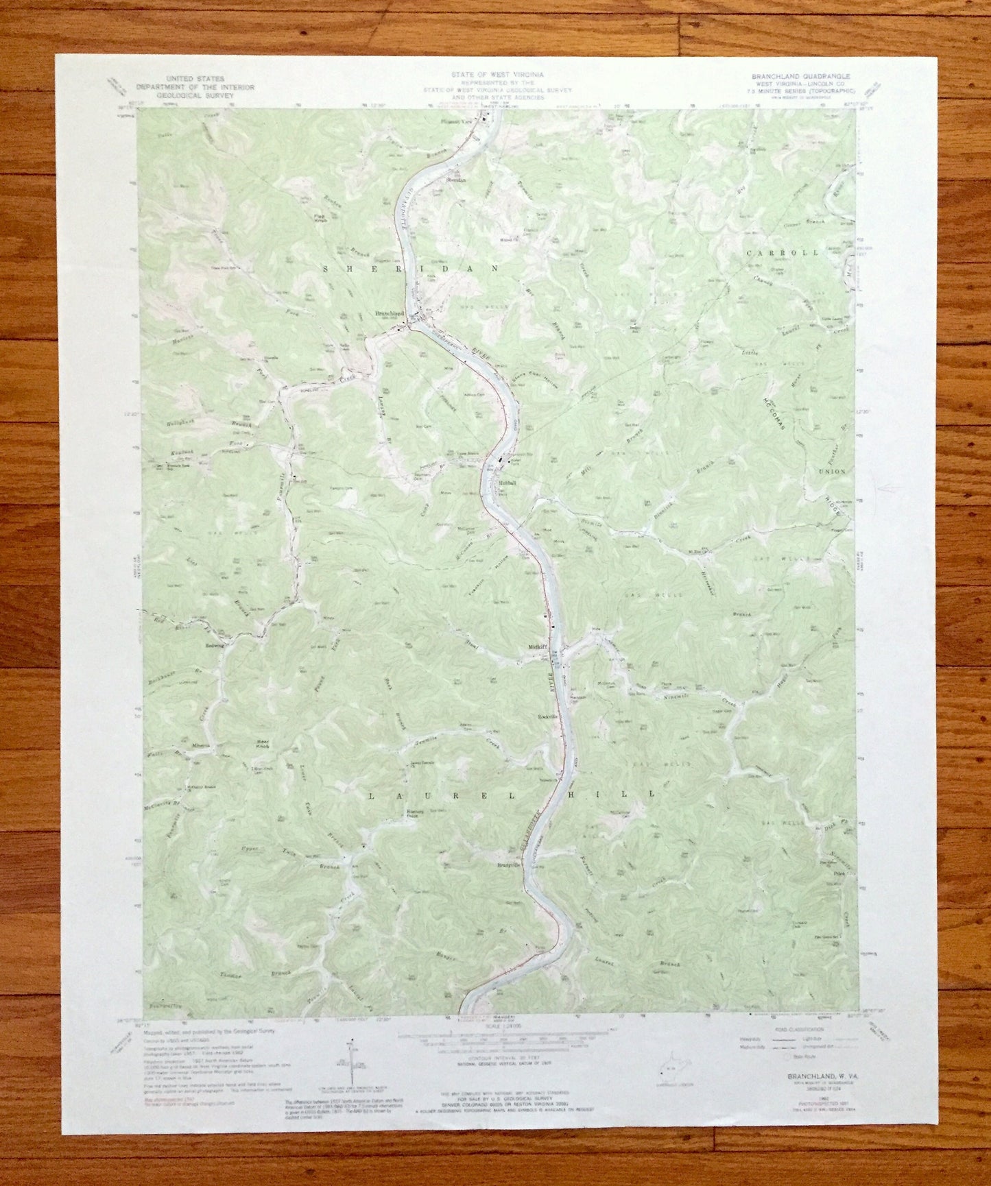
Antique Branchland, West Virginia 1962 US Geological Survey Topographic Map — Lincoln County, Sheridan, Carroll, Laurel Hill, Hubball, WV
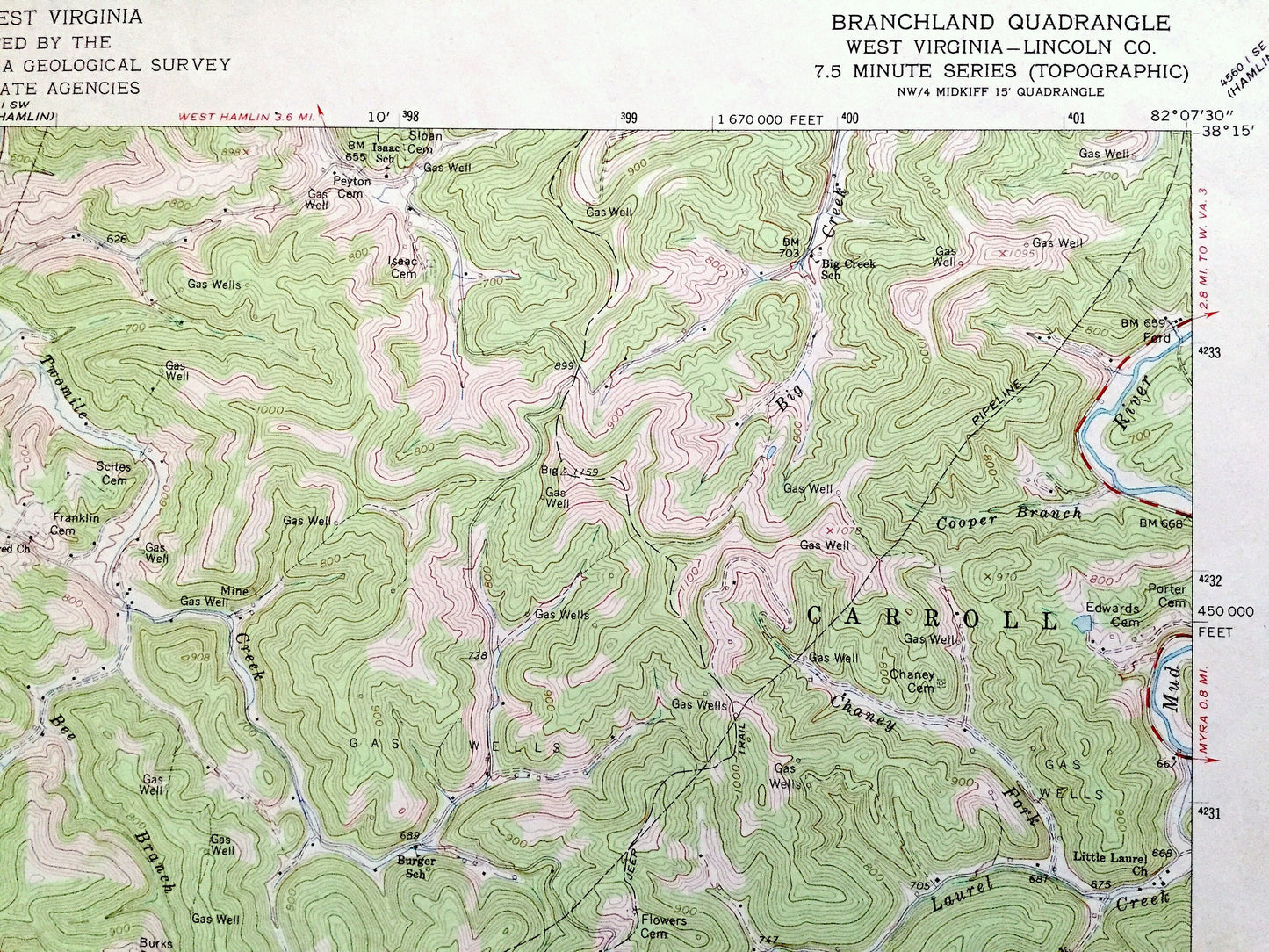
Antique Branchland, West Virginia 1962 US Geological Survey Topographic Map — Lincoln County, Sheridan, Carroll, Laurel Hill, Hubball, WV
Beautiful, antique map of Branchland, West Virginia and surrounding Lincoln County area. This is an authentic 1962 edition, 1991 print from the U.S. Geological Survey and NOT a computer reproduction.
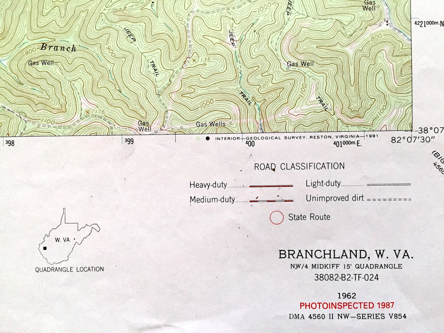
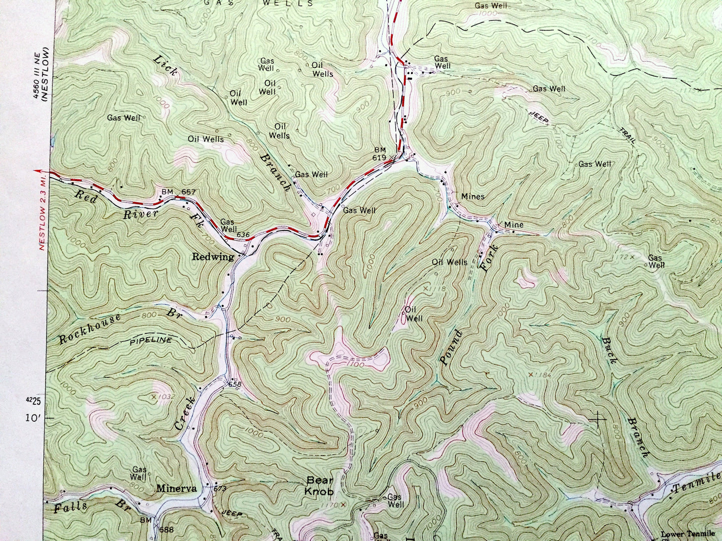
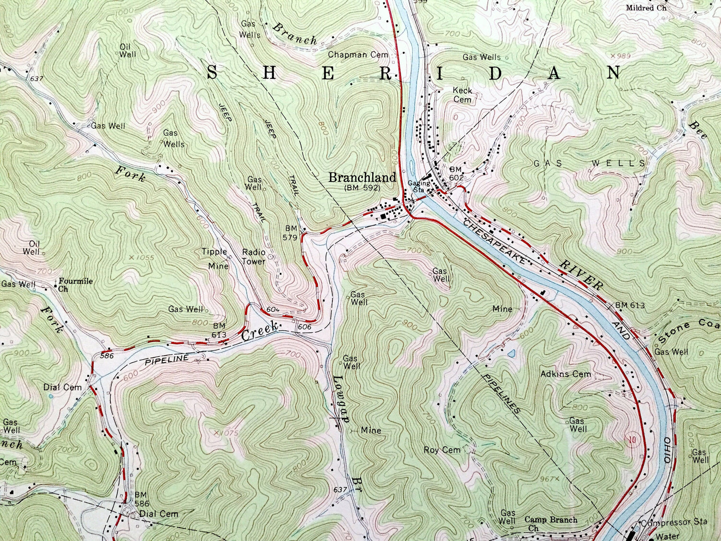
See what West Virginia looked like over 60 years ago. Lots of intricate details and geological contours. Map even has little squares for every house that existed at the time. The cartographers were very thorough back then!
Perfect for the historian, map-lover, the curious or just as a conversation starter. Wonderful and rare. Vintage maps such as these make great gifts.
Edition of 1962, printed 1991
Dimensions: 22" width x 27" height
----
Features
Cities & Towns: Sheridan, Carroll, Laurel Hill, Hubball, Pleasant View, Redwing, Minerva, Bradyville, Rockville, Midkiff, Price, Hunters Point, Union.
Points of Interest: Guyandotte River, Trace Fork, Harless Fork, Big Creek, Twomile Creek, Fourmile Creek, Sixmile Creek, Furnett Creek, Stout Creek, McComas Ridge, Red River, and many more hills, streams, ponds, houses, schools, railroads, churches and roads.
Condition: Very Good Vintage condition, commensurate with age. This map is in great condition for being over 30 years old. Has light edge-wear but will read as character when framed.
----
We will happily adjust shipping price for multiple purchases. Maps are rolled up and shipped in sturdy mailing tubes, never folded.
Couldn't load pickup availability
Share