My Store
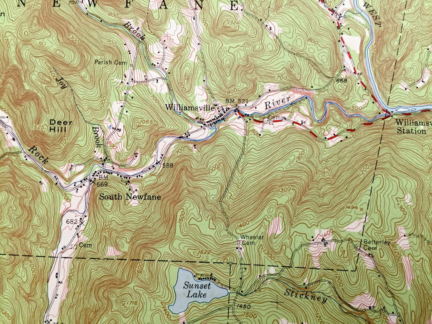
Antique Brattleboro, Vermont 1954 US Geological Survey Topograph Map – Dummerston, Vernon, Newfane, Guilford, Windham, New Hampshire, VT NH
Antique Brattleboro, Vermont 1954 US Geological Survey Topograph Map – Dummerston, Vernon, Newfane, Guilford, Windham, New Hampshire, VT NH
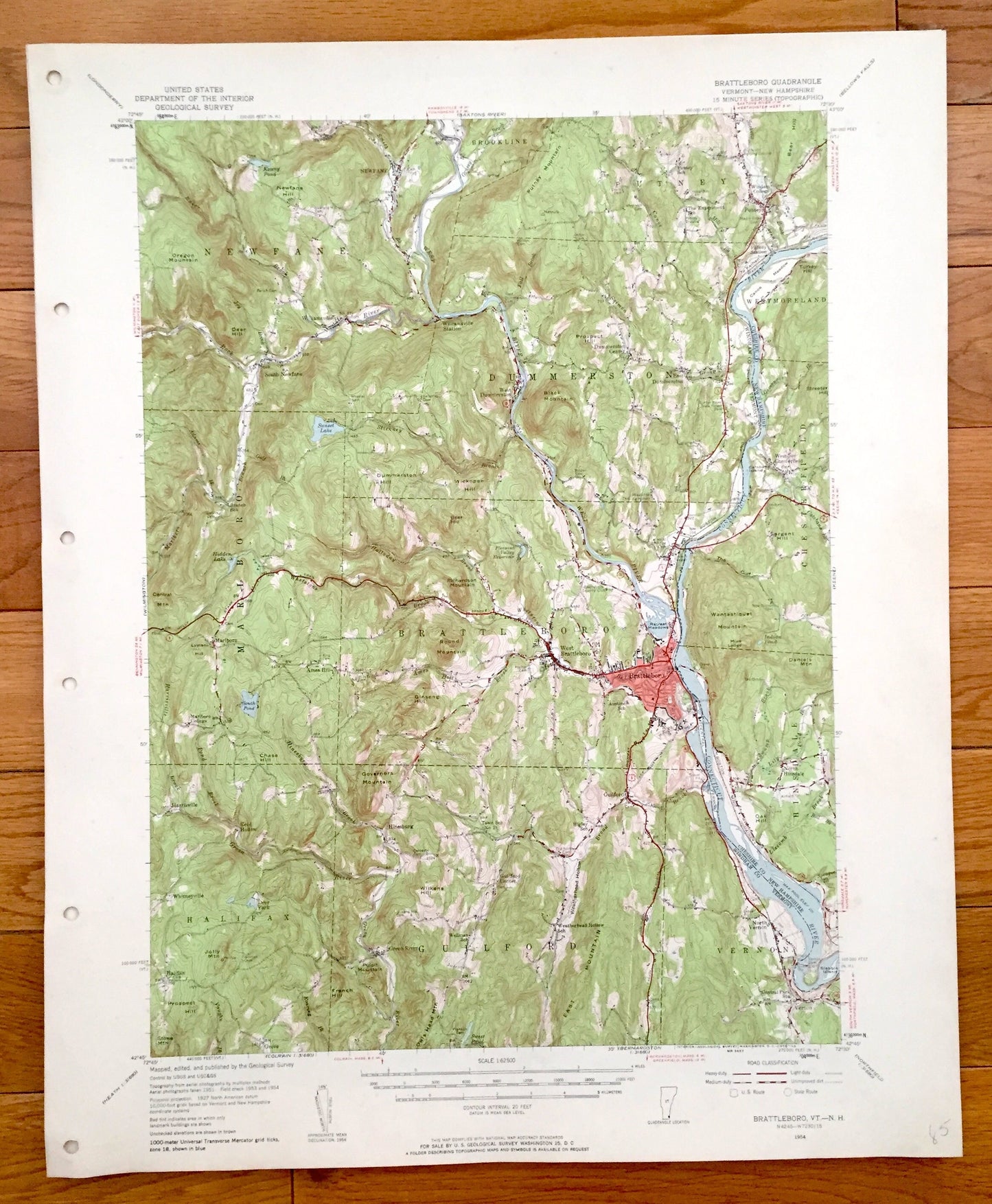
Beautiful, antique map of Brattleboro, Vermont and surrounding Windham County area on the Connecticut River, including the New Hampshire side. This is an authentic 1954 print from the U.S. Geological Survey and NOT a computer reproduction.
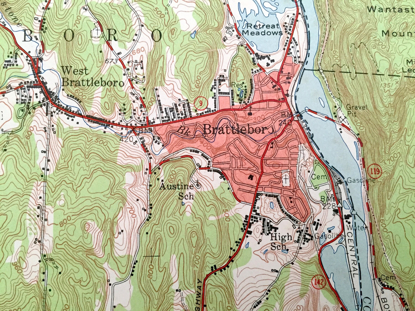
See what Vermont and New Hampshire looked like more than 60 years ago. Lots of intricate details and geological contours. Map even has little squares for every house that existed at the time. The USGS cartographers were very thorough back then!
Perfect for the historian, map-lover, the curious or just as a conversation starter. Wonderful and rare. Vintage maps such as this make great gifts.
Edition of 1954, printed 1954
Dimensions: 17" width x 21" height
----
Features
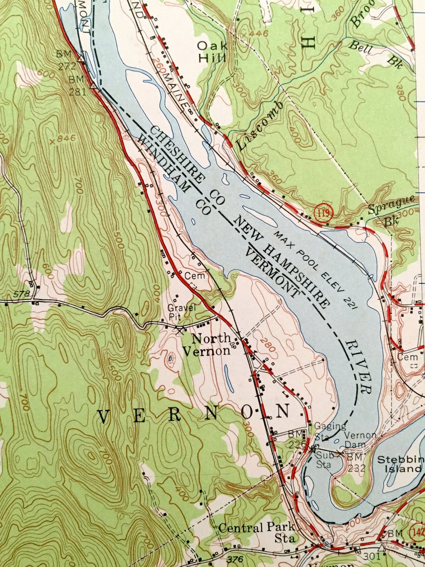
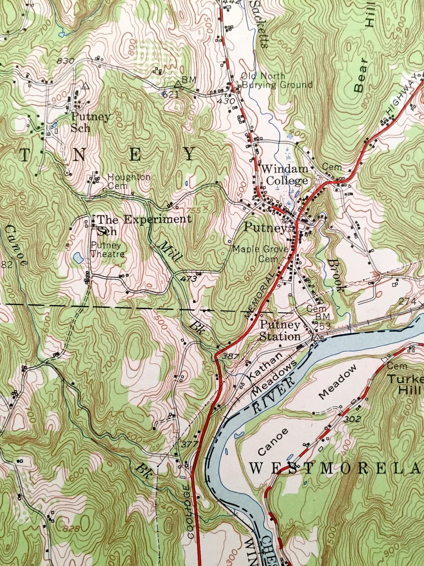
Cities & Towns: VERMONT: Newfane, Brooline, Putney, Dummerston, Marlboro, Brattleboro, Halifax, Guilford, Vernon, Williamsville, South Newfane, Ames Hill, Harrisville, Reid Hollow, Whitneyville, Hinesburg, Green River.
NEW HAMPSHIRE: Westmoreland, Chesterfield, Hinsdale.
Points of Interest: Cheshire County, Windham County, Connecticut River, West River, Green River, Kenny Pond, Sunset Lake, South Pond, Deer Park, Oregon Mountain, Putney Mountain, Bear Hill, Deer Hill, Prospect Hill, Black Mountain, Dummerston Hill, Wickopee Hill, Central Mountain, Round Mountain, Ginseng Hill, Governors Mountain, East Mountain, Wantastiquet Mountain, Daniels Mountain, Oak Hill, Retreat Meadows, Catsbane Island, Windham College, Canoe Meadow, Boston & Maine Railroad and many more small towns, houses, churches, roads, train tracks, hills and creeks.
Condition: Good Vintage condition, commensurate with age. This map is in incredible shape for being almost 70 years old. Has light edge-wear and pencil marking, but this will read as vintage character when framed. Map has punch holes but these are easily concealed with framing or placing a similar-colored paper behind the map, as can be seen in the photos.
----
We will happily adjust shipping price for multiple purchases. Maps are rolled up and shipped in sturdy mailing tubes, never folded.
Couldn't load pickup availability
Share