My Store
Antique Bridger-Teton National Forest, Wyoming 1973 US Geological Survey Topographic Map – Jackson Hole Snow King Mountain Yellowstone WY
Antique Bridger-Teton National Forest, Wyoming 1973 US Geological Survey Topographic Map – Jackson Hole Snow King Mountain Yellowstone WY
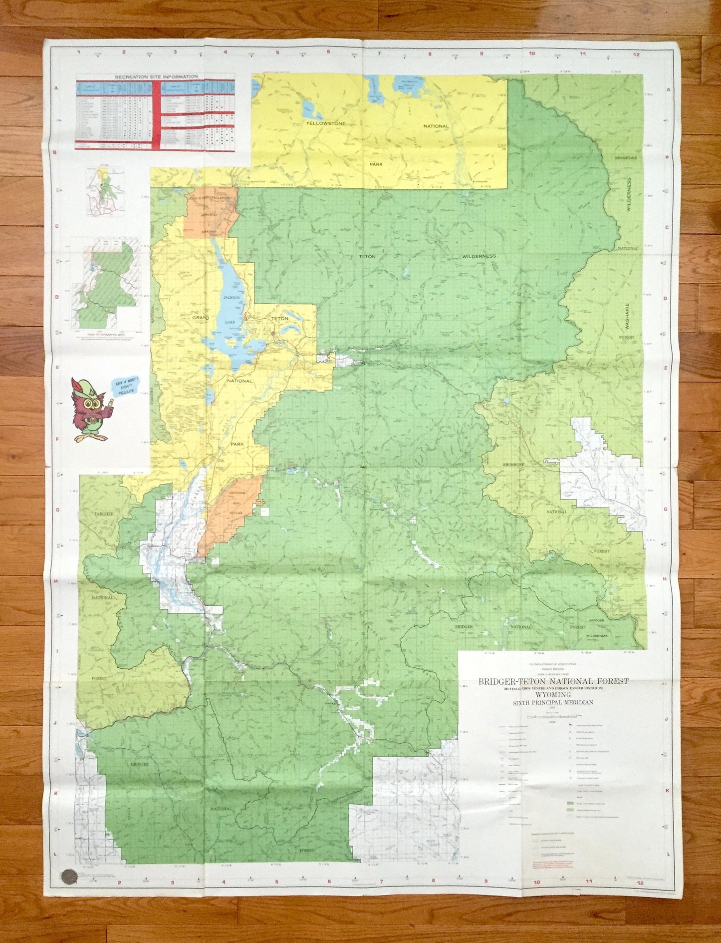
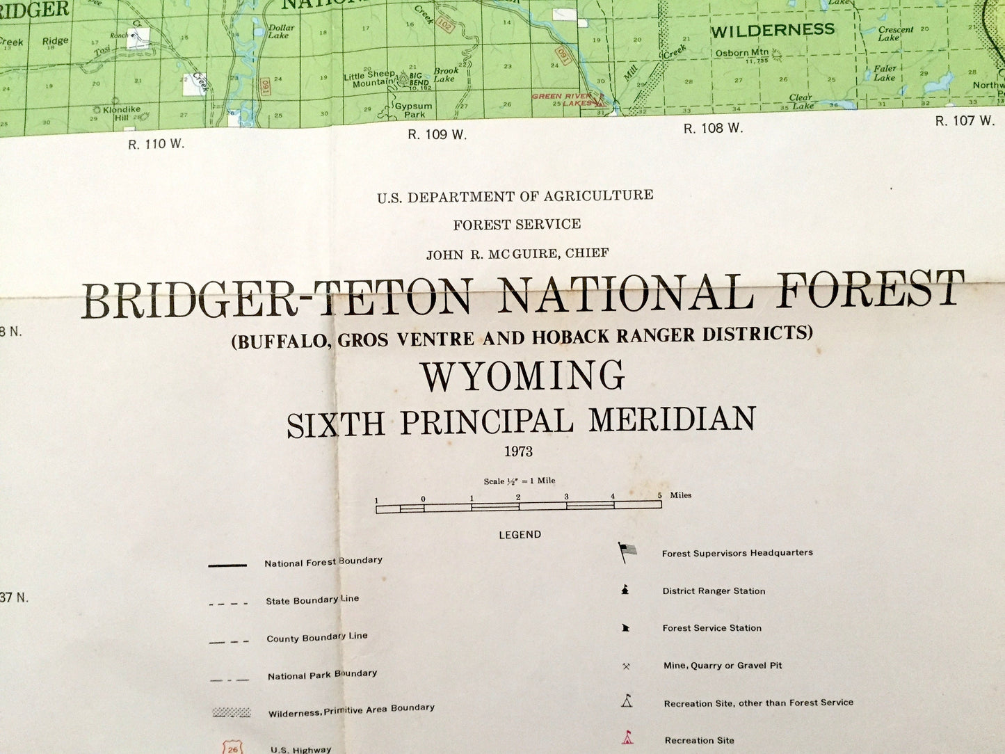
Beautiful, antique and very colorful map of Bridger-Teton National Forest, including Jackson Hole, Jackson Lake, the Grand Teton Range and Shoshone, Targhee & Yellowstone National Park. This is an authentic 1973 print from the U.S. Department of Agriculture and is NOT a computer reproduction.
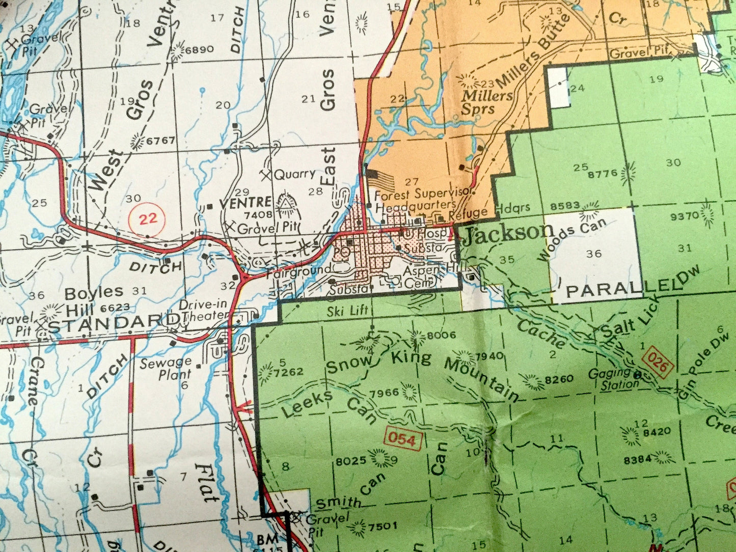
See what Bridger-Teton looked like over 45 years ago. Lots of intricate details like rivers and preaks. Map even has little squares for every house and building that existed at the time. The cartographers were very thorough back then!
This map is very large, about 3 feet by 4 1/2 feet, and the print is as detailed as the smaller USGS maps. The breadth of detail is incredible and would be the focal point of wherever it is hung. (See roll of coin in the bottom left corner of the map in first photo for scale.) Verso is blank.
Perfect for the historian, map-lover, the curious or just as a conversation starter. Wonderful and rare. Vintage maps such as these make great gifts.
Edition of 1973, printed 1973
Dimensions: 38 1/2" width x 52" height
----
Features
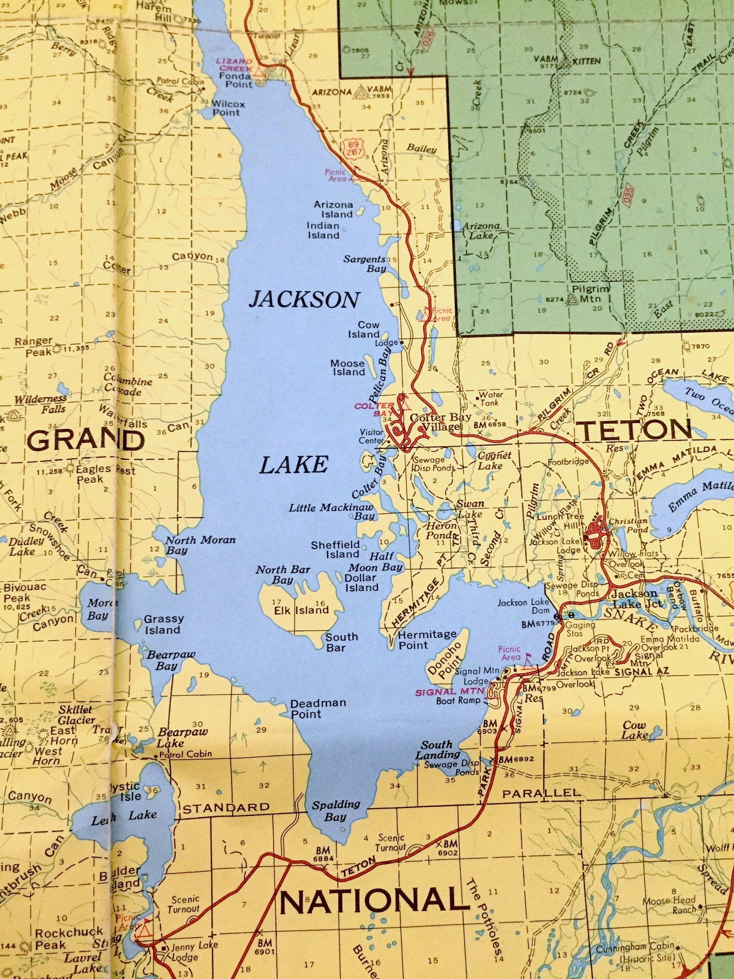
Cities & Towns: Jackson, Wilson, Teton Village, Gros Venture Junction, Kelly, Moose, Beaver Creek, Moran, Colter Bay Village, Jackson Lake Junction, many more.
Points of Interest: Grand Teton National Park, Teton National Forest, Yellowstone National Forest, Targhee National Forest, Bridger National Forest, National Elk Refuge, John D Rockefeller Memorial Parkway, Teton Wilderness, Teton Mountain Range, Teton County, Jackson Hole, Jackson Lake, Snake River, National Elk Refuge, Phelps Lake, Taggart Lake, Jenny Lake, Leigh Lake, Emma Matilda Lake, Two Ocean Lake, Lower Slide Lake, Snow King Mountain, Mt Moran, Mt St John, Storm Point, Eagle Rest Peak, Doane Peak, Pilgrim Mountain, Wildcat Peak, East Gros Venture Butte, Blacktail Butte and many more mountains, peaks, ranges, canyons, buttes, crests, rivers, creeks, lakes, ponds, springs, trails, campgrounds, caves, valleys, hills, towns, roads and train tracks.
Condition: Very Good Vintage condition, commensurate with age. This map is in great shape for being over 45 years old. Light edge-wear, toning, very small separations at fold corners, and fold as-issued, but these will flatten easily and all of which will add to vintage character when framed.
----
We will happily adjust shipping price for multiple purchases. Maps are shipped fully-insured, rolled up and shipped in sturdy mailing tubes, never folded.
Couldn't load pickup availability
Share