My Store
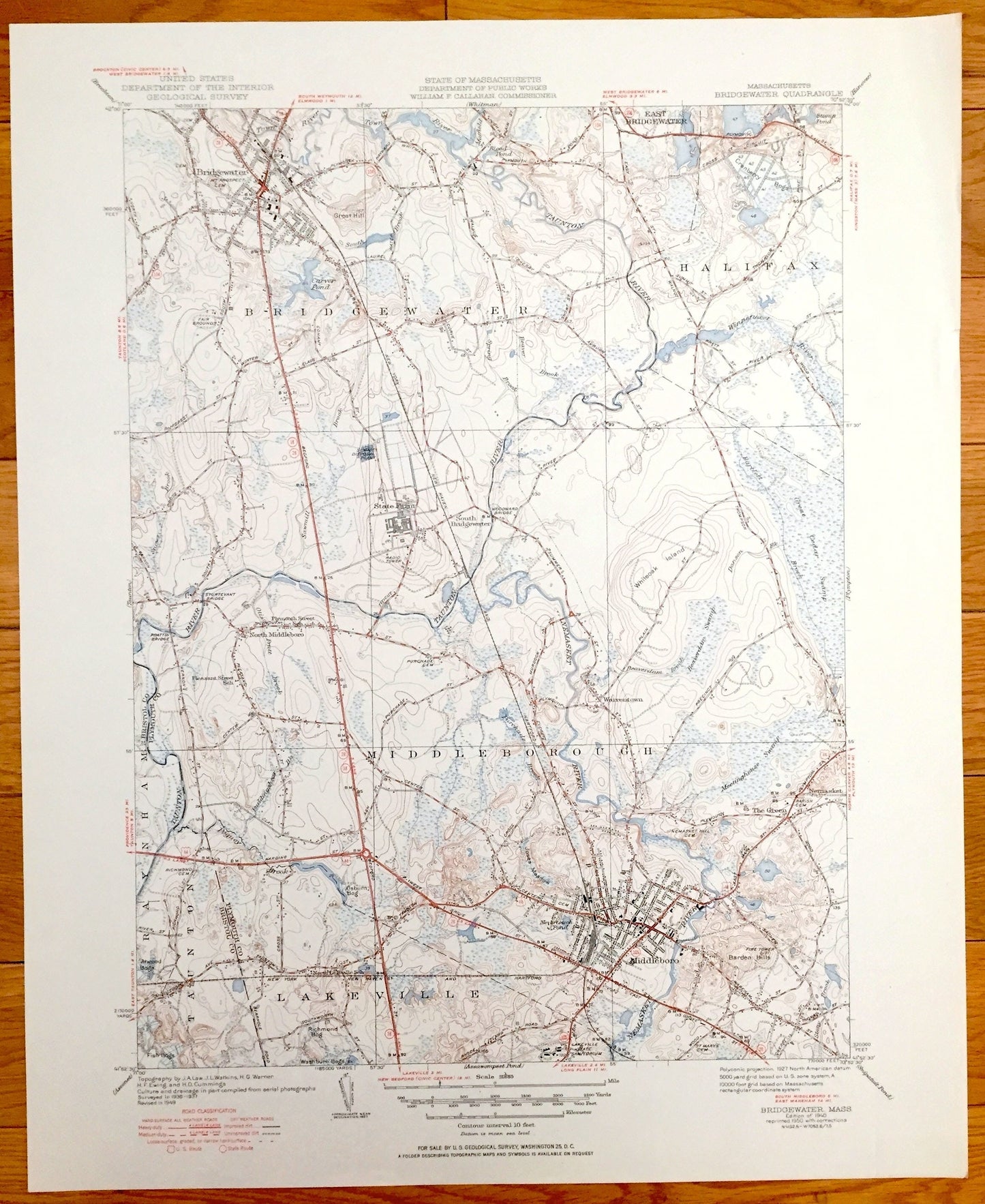
Antique Bridgewater, Massachusetts 1940 US Geological Survey Topographic Map – Middleboro, Halifax, Middleborough, Warrentown, Nemasket, MA
Antique Bridgewater, Massachusetts 1940 US Geological Survey Topographic Map – Middleboro, Halifax, Middleborough, Warrentown, Nemasket, MA
Beautiful, antique map of Bridgewater, Middleborough and Lakeville, Massachusetts. This is an authentic edition of 1950 print of 1940 survey data from the U.S. Geological Survey and NOT a computer reproduction.
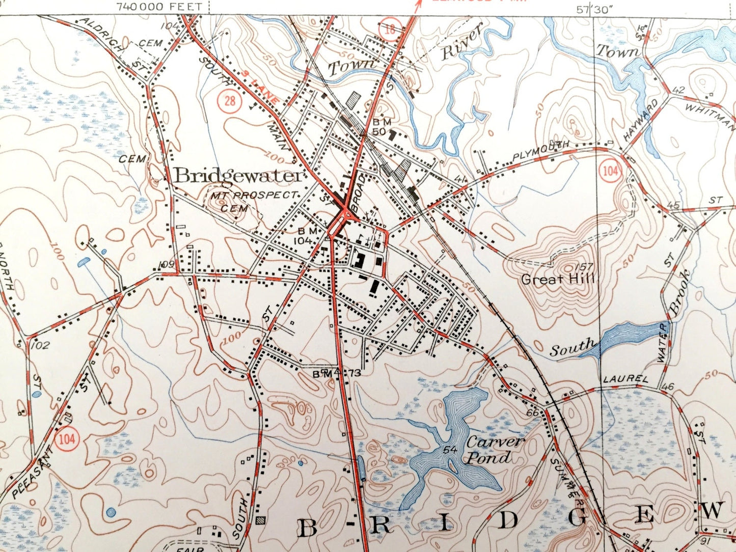
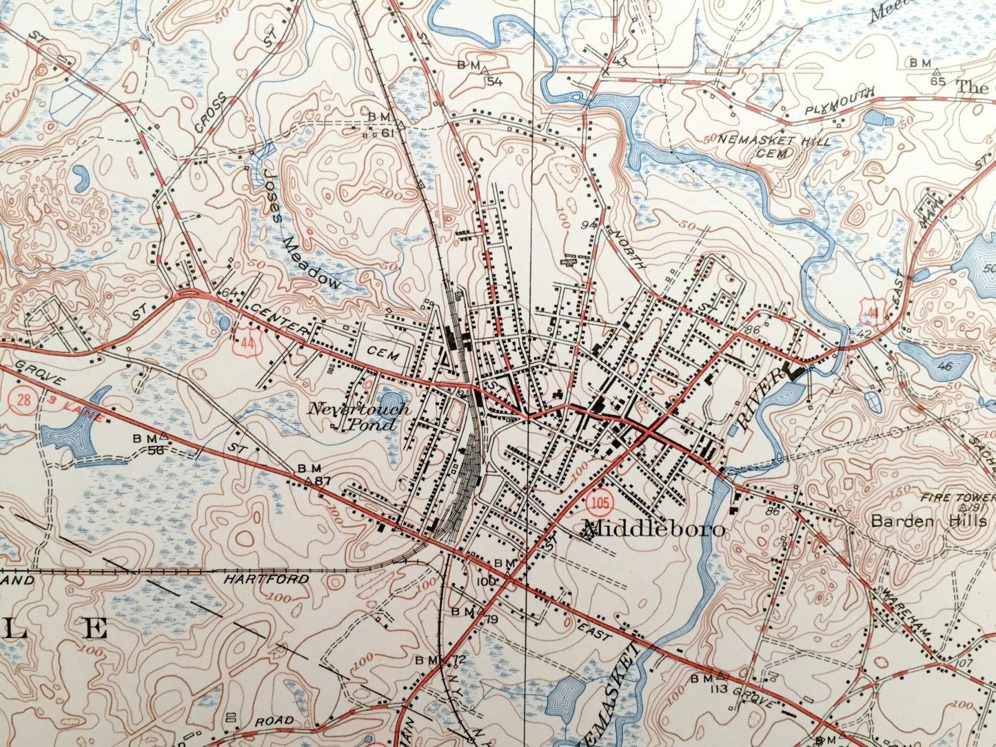
See what Bridgewater and surrounding Plymouth County area looked like over 80 years ago. Lots of intricate details and geological contours. Map even has little squares for every house that existed at the time. The USGS cartographers were very thorough back then! On the back is a description of topographic symbols and map guide.
Perfect for the historian, map-lover, the curious or just as a conversation starter. Wonderful and rare. Vintage maps such as these make great gifts.
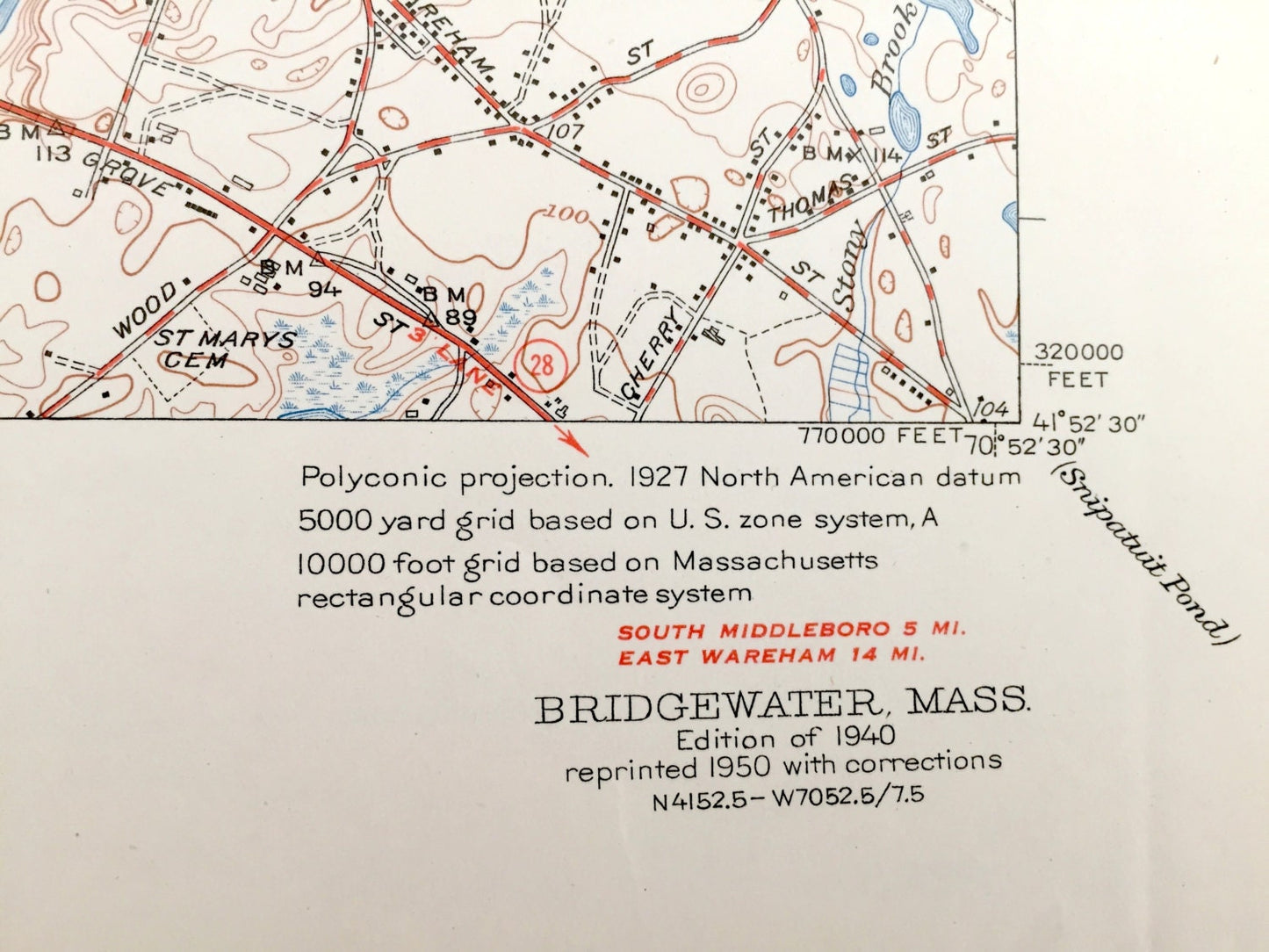
Edition of 1940, printed 1950
Dimensions: 16 1/2" width x 20" height
----
Features
Cities & Towns: Bridgewater, Halifax, Middleborough, East Bridgewater, South Bridgewater, North Middleborough, Warrentown, Nemasket, Lakeville.
Points of Interest: State Fair Grounds, Cranberry Bogs, Winnafaucet River, Taunton River, Great Cedar Swamp, New York New Haven and Hartford Railroad, Meetinghouse Swamp, Plymouth Street School, North Lakeville School, Pleasant Street School and more roads, houses, ponds, hills, streams, bogs and even a radio tower.
Condition: Very Good Vintage condition, commensurate with age. This map is in great shape for being over 70 years old.
----
We will happily adjust shipping price for multiple purchases. Maps are rolled up and shipped in sturdy mailing tubes, never folded.
Couldn't load pickup availability
Share