My Store
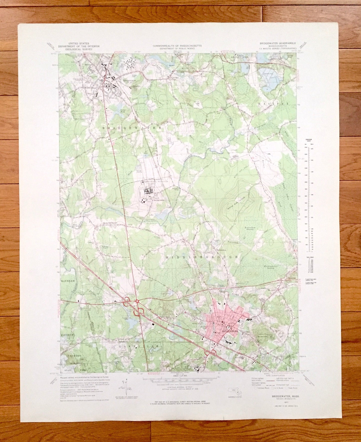
Antique Bridgewater, Massachusetts 1977 US Geological Survey Topographic Map – Plymouth, Bristol County, Halifax, Middleborough, Taunton, MA
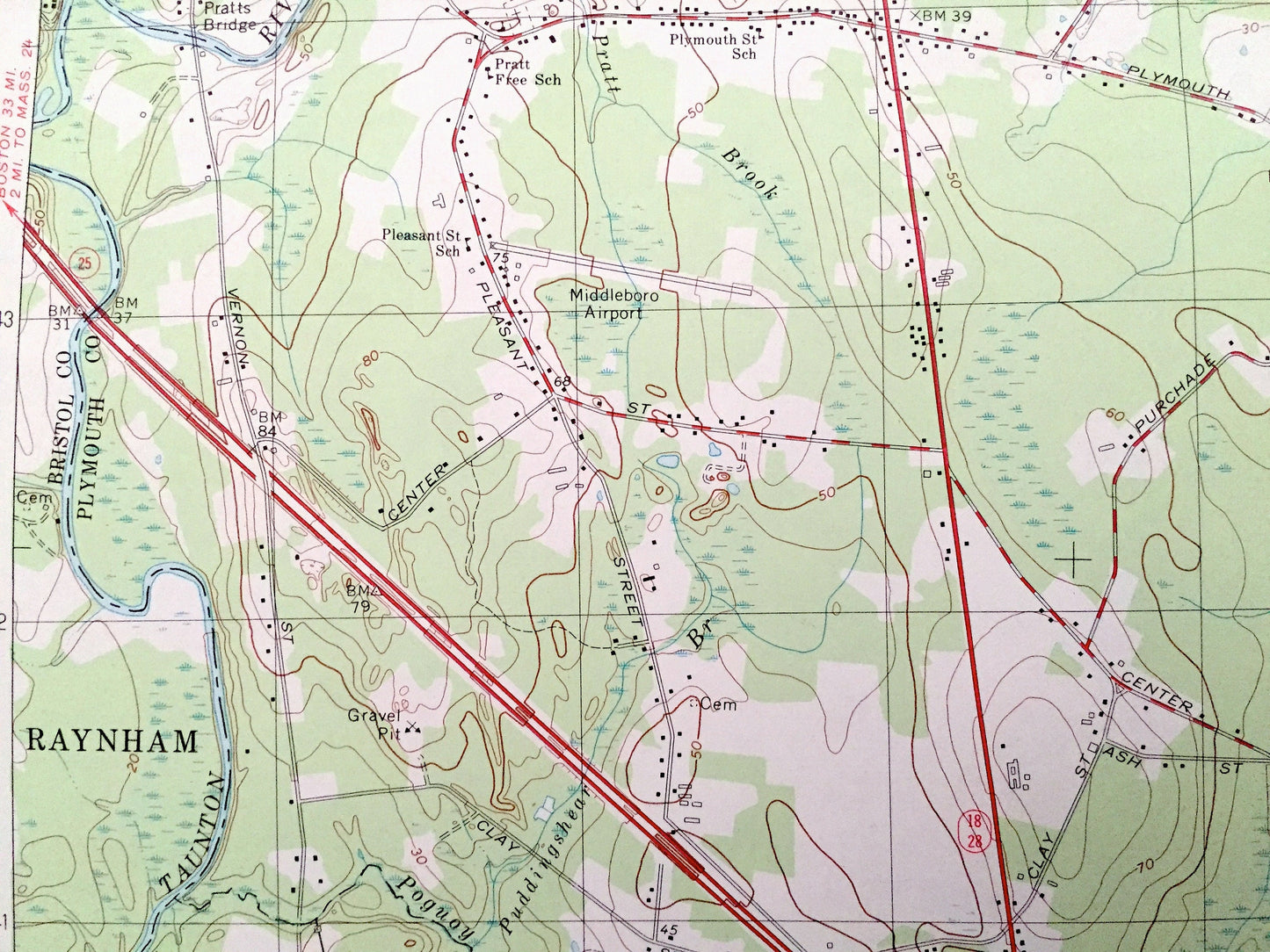
Antique Bridgewater, Massachusetts 1977 US Geological Survey Topographic Map – Plymouth, Bristol County, Halifax, Middleborough, Taunton, MA
Beautiful, antique map of Bridgewater, Massachusetts and surrounding Bristol & Plymouth County areas. This is an authentic 1977 edition, 1978 print from the U.S. Geological Survey and NOT a computer reproduction.
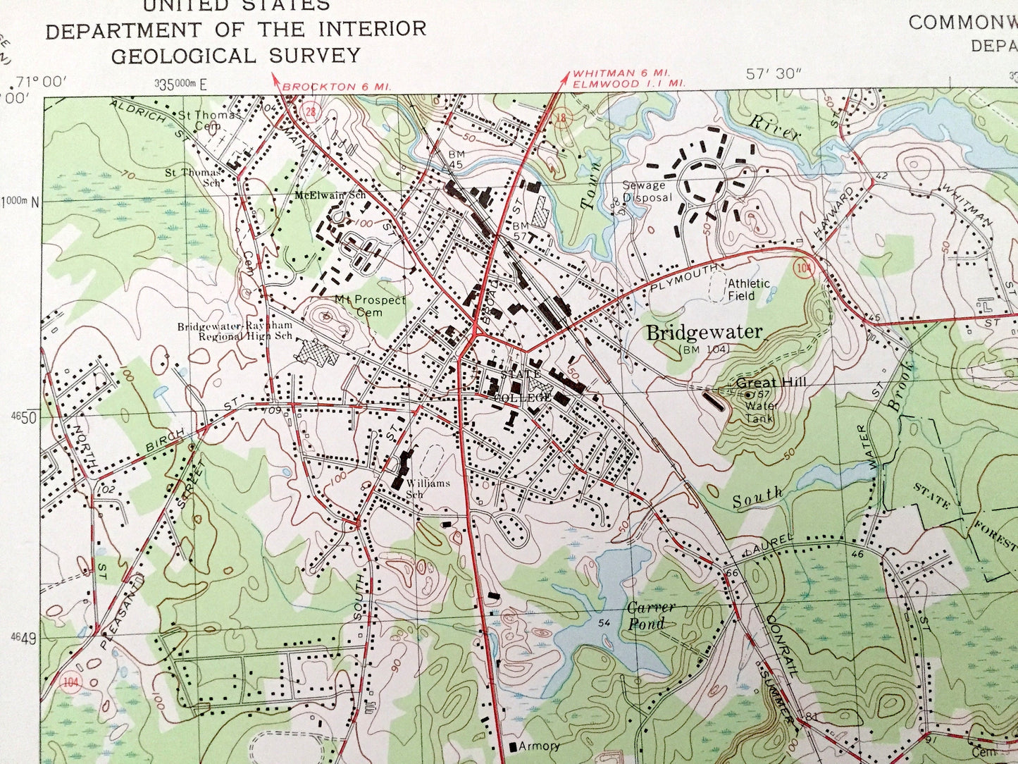
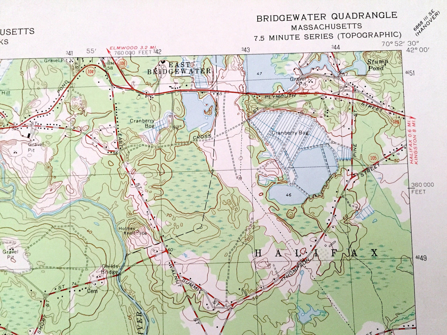
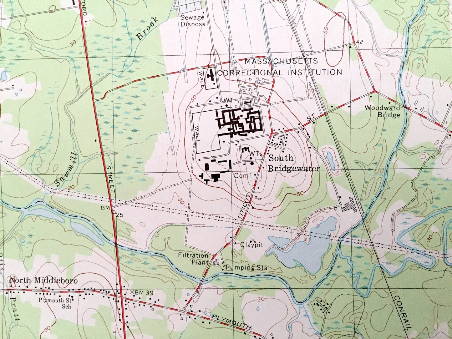
See what Massachusetts looked like over 40 years ago. Lots of intricate details and geological contours. Map even has little squares for every house that existed at the time. The USGS cartographers were very thorough back then!
Perfect for the historian, map-lover, the curious or just as a conversation starter. Wonderful and rare. Vintage maps such as these make great gifts.
Edition of 1977, printed 1978
Dimensions: 22" width x 27" height
----
Features
Cities & Towns: Raynham, Lakeville, Paper Mill Village, East Bridgewater, South Bridgewater, North Middleboro, Warrentown, Nemasket, The Green, Middleboro.
Points of Interest: Massasoit State Park, Massachusetts Correctional Institution, Woodward Bridge, Lakeville State Hospital, Middleboro Airport, Great Hill, White Oak Island, Great Cedar Swamp, Beaverdam Swamp, Meetinghouse Swamp, Town River, Carver Pond, Taunton River, Winnetuxet River, Nemasket River, Poguoy Brook, and many more hills, streams, ponds, houses, schools, railroads, churches and roads.
Condition: Very Good Vintage condition, commensurate with age. This map is in great shape for being over 40 years old. Has light edge-wear but will read as character when framed.
----
We will happily adjust shipping price for multiple purchases. Maps are rolled up and shipped in sturdy mailing tubes, never folded.
Couldn't load pickup availability
Share