My Store
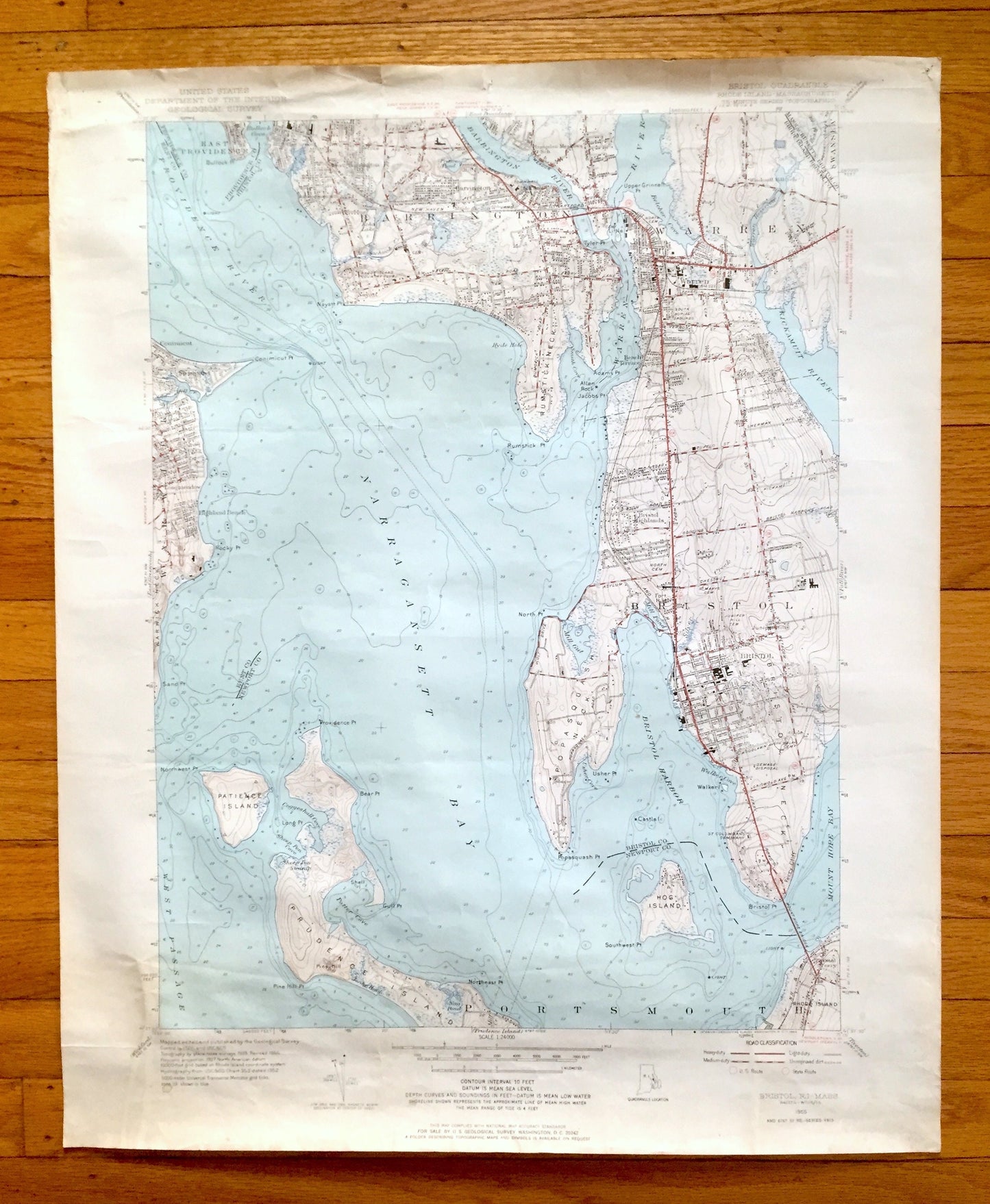
Antique Bristol, Rhode Island 1955 US Geological Survey Topographic Map – Newport County, Barrington, Warren, Nayatt, Shawomet Warwick RI MA
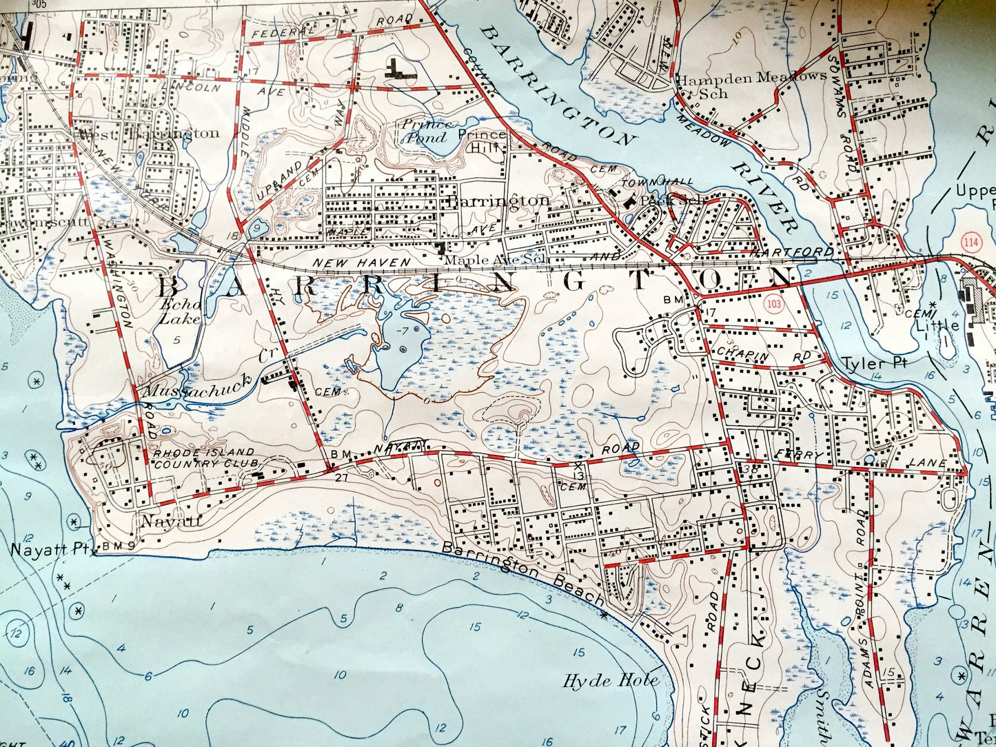
Antique Bristol, Rhode Island 1955 US Geological Survey Topographic Map – Newport County, Barrington, Warren, Nayatt, Shawomet Warwick RI MA
Beautiful, antique map of Bristol, Rhode Island and surrounding Massachusetts and Bristol, Newport, and Kent County area. This is an authentic 1955 edition, 1966 print from the U.S. Geological Survey and NOT a computer reproduction.
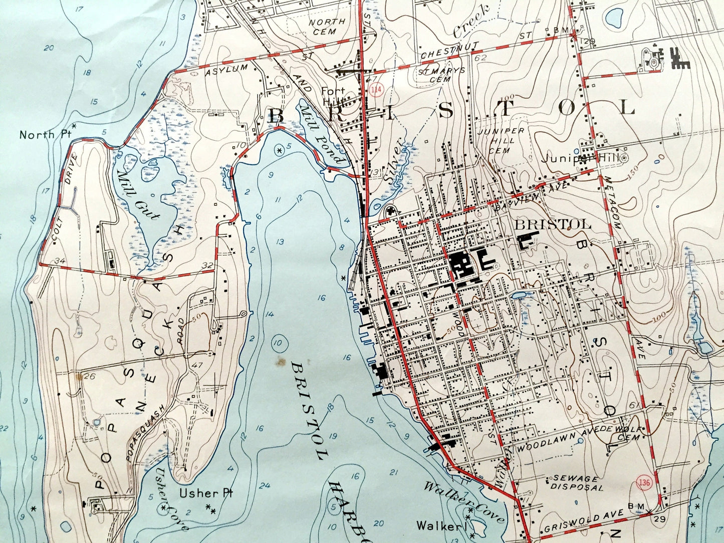
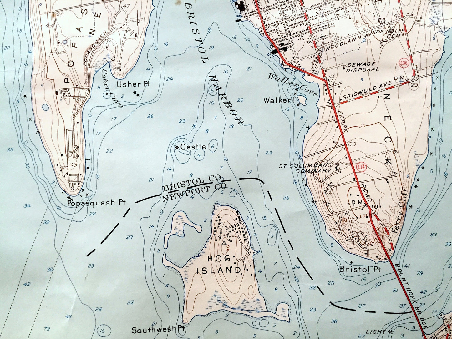
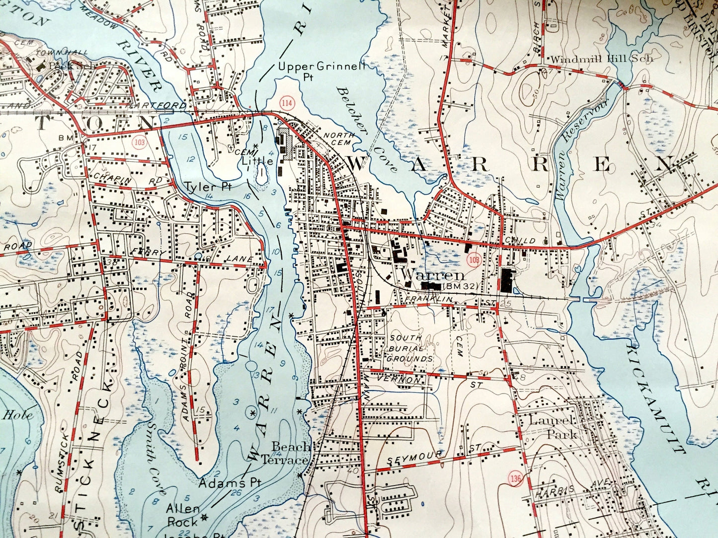
See what Rhode Island looked like over 65 years ago. Lots of intricate details and geological contours. Map even has little squares for every house that existed at the time. The USGS cartographers were very thorough back then!
Perfect for the historian, map-lover, the curious or just as a conversation starter. Wonderful and rare. Vintage maps such as these make great gifts.
Edition of 1955, printed 1966
Dimensions: 22" width x 27" height
----
Features
Cities & Towns: Bristol, Conimicut, Bristol Ferry, Shawomet, Warwick, Longmeadow, Highland Beach, East Providence, Barrington, Nayatt, Warren, Beach Terrace, Laurel Park, Bristol Highlands, Portsmouth.
Points of Interest: Narragansett Bay, Bristol Harbor, Hog Island, West Passage, Patience Island, Prudence Island, Providence River, Colt State Park, Brickyard Pond, Barrington River, Warren River, Popasquash Neck, Mill Gut, Warren Reservoir, Kickamuit River, New Meadow Neck, Ferry Hill, and many more hills, streams, ponds, houses, schools, churches and roads.
Condition: Good or "Very Vintage" condition, commensurate with age. This map is in great shape for being over 55 years old. Has some real wear, foxing and toning, but this will add to vintage character when framed.
----
We will happily adjust shipping price for multiple purchases. Maps are rolled up and shipped in sturdy mailing tubes, never folded.
Couldn't load pickup availability
Share