My Store
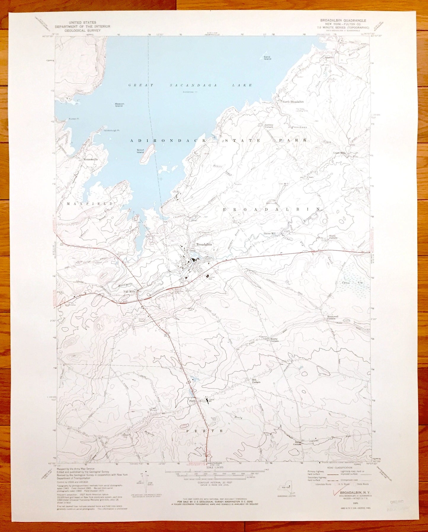
Antique Broadalbin, New York 1970 US Geological Survey Topographic Map – Mayfield, Vail Mills, Perth, Union Mills, Adirondack State Park
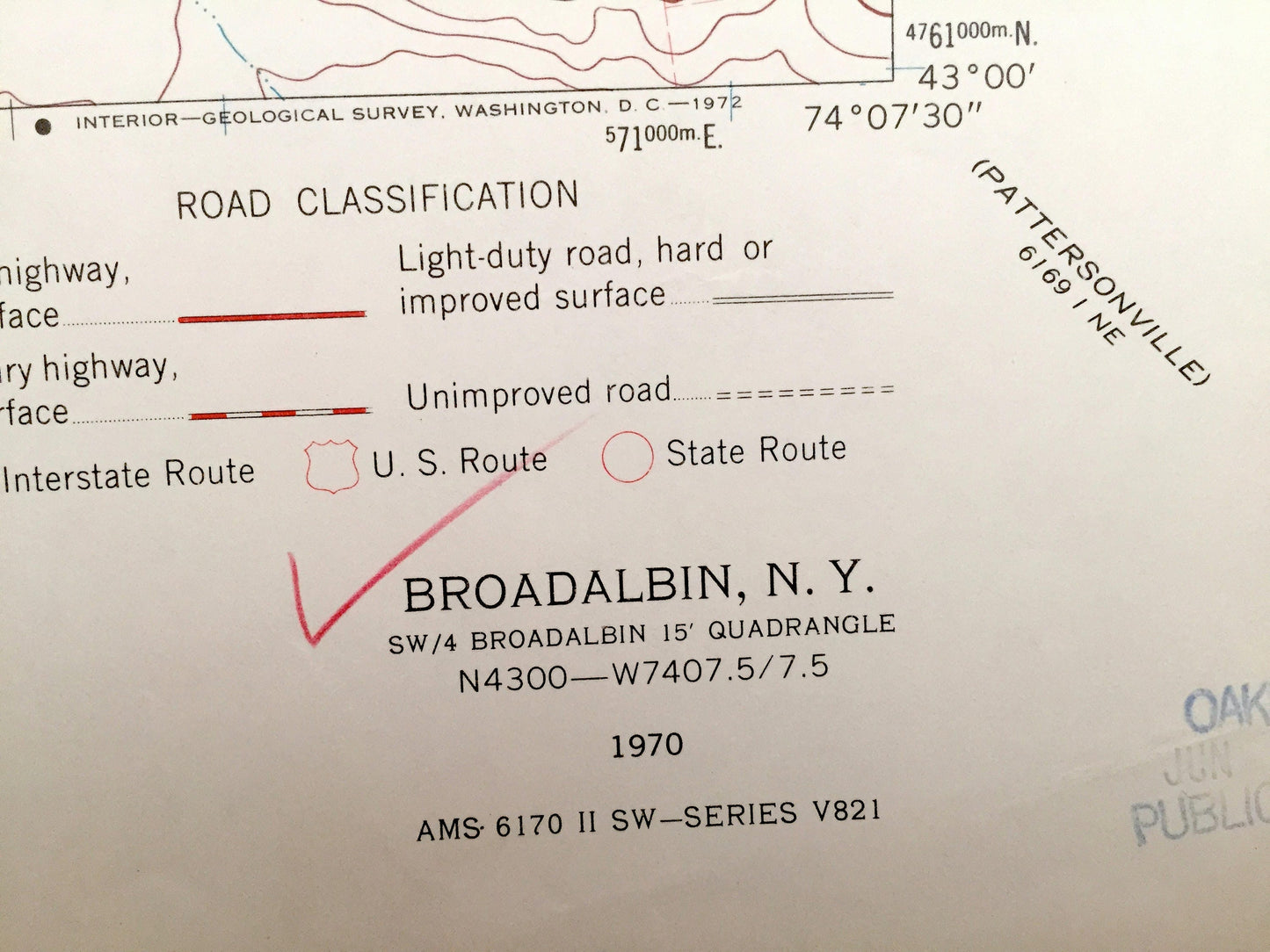
Antique Broadalbin, New York 1970 US Geological Survey Topographic Map – Mayfield, Vail Mills, Perth, Union Mills, Adirondack State Park
Beautiful, antique map of Broadalbin, Mayfield, Vail Mills, Perth, Union Mills, and Benedict, New York. This is an authentic 1970 print from the U.S. Geological Survey and NOT a computer reproduction.
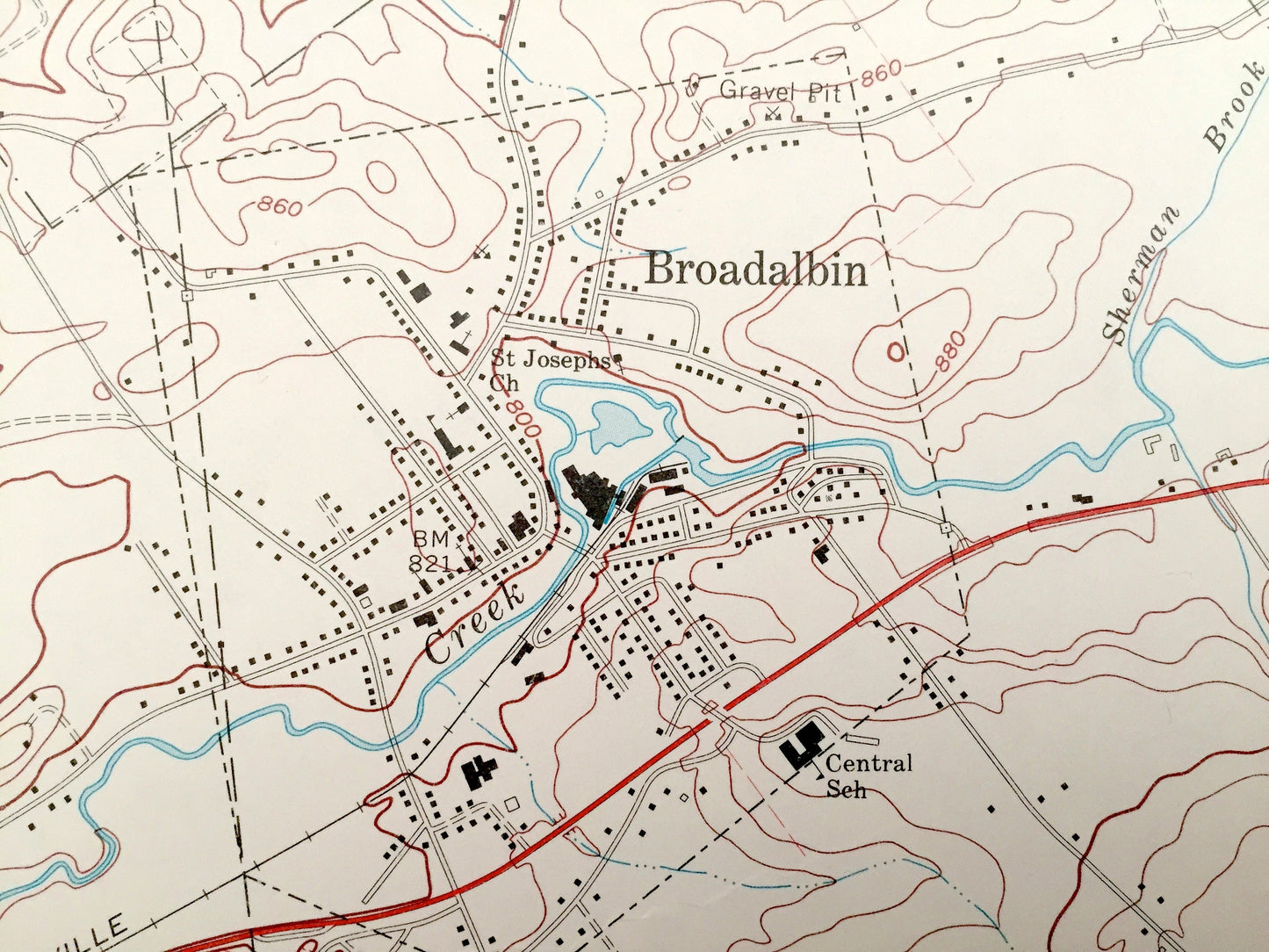
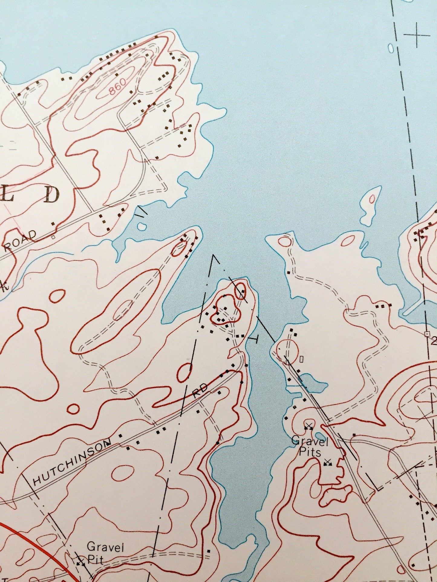
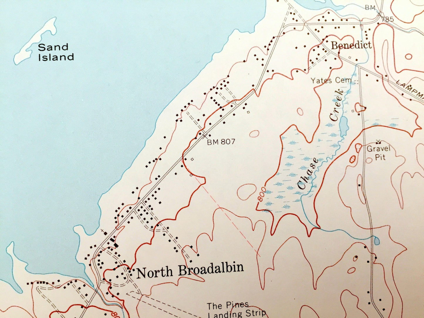
See what Fulton County and Adirondack State Park of New York, looked like almost 50 years ago. Lots of intricate details and geological contours. Map even has little squares for every house that existed at the time. The USGS cartographers were very thorough back then!
Perfect for the historian, map-lover, the curious or just as a conversation starter. Wonderful and rare. Vintage maps such as this make great gifts.
Edition of 1970, printed 1970
Dimensions: 22" width x 27" height
----
Features
Cities & Towns: Munsonville, Broadalbin, Benedict, North Broadalbin, Steele Corners, Honeywell Corners, Beatty Corners, Hill Corners, Stars Corners, Mayfield, Vail Mills, Perth, Union Mills, Sand Island, Beacon Island, Scout Island.
Points of Interest: Adirondack State Park, Great Sacandaga Lake, Perth Central School, Kennyetto Creek, The Pines Landing Strip, Kunkel Point, Vandenburgh Point, and many more roads, streams, houses, and rivers.
Condition: Very Good condition, commensurate with age. This map is in incredible shape for being almost 30 years old.
----
We will happily adjust shipping price for multiple purchases. Maps are rolled up and shipped in sturdy mailing tubes, never folded.
Couldn't load pickup availability
Share