My Store
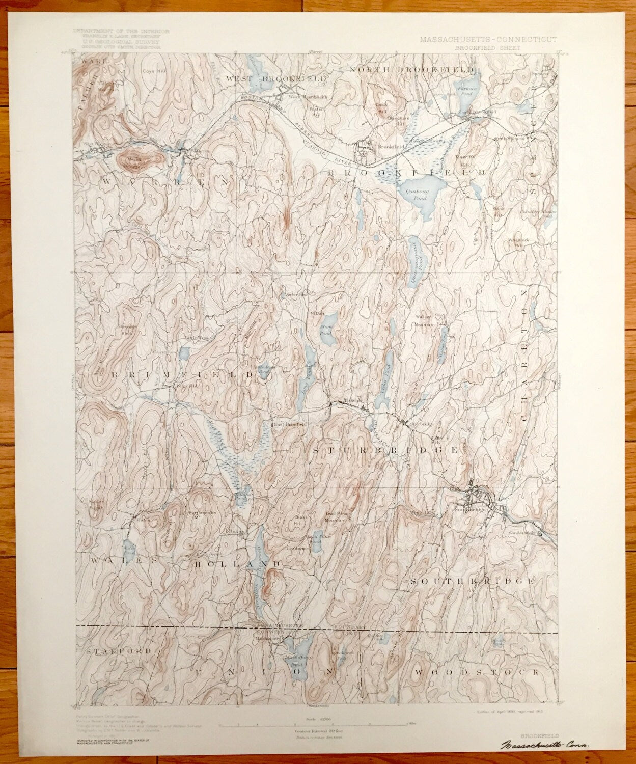
Antique Brookfield, Massachusetts 1893 US Geological Survey Topographic Map – Sturbridge, Ware, Palmer, Brinfield, Southbridge, Union, MA CT
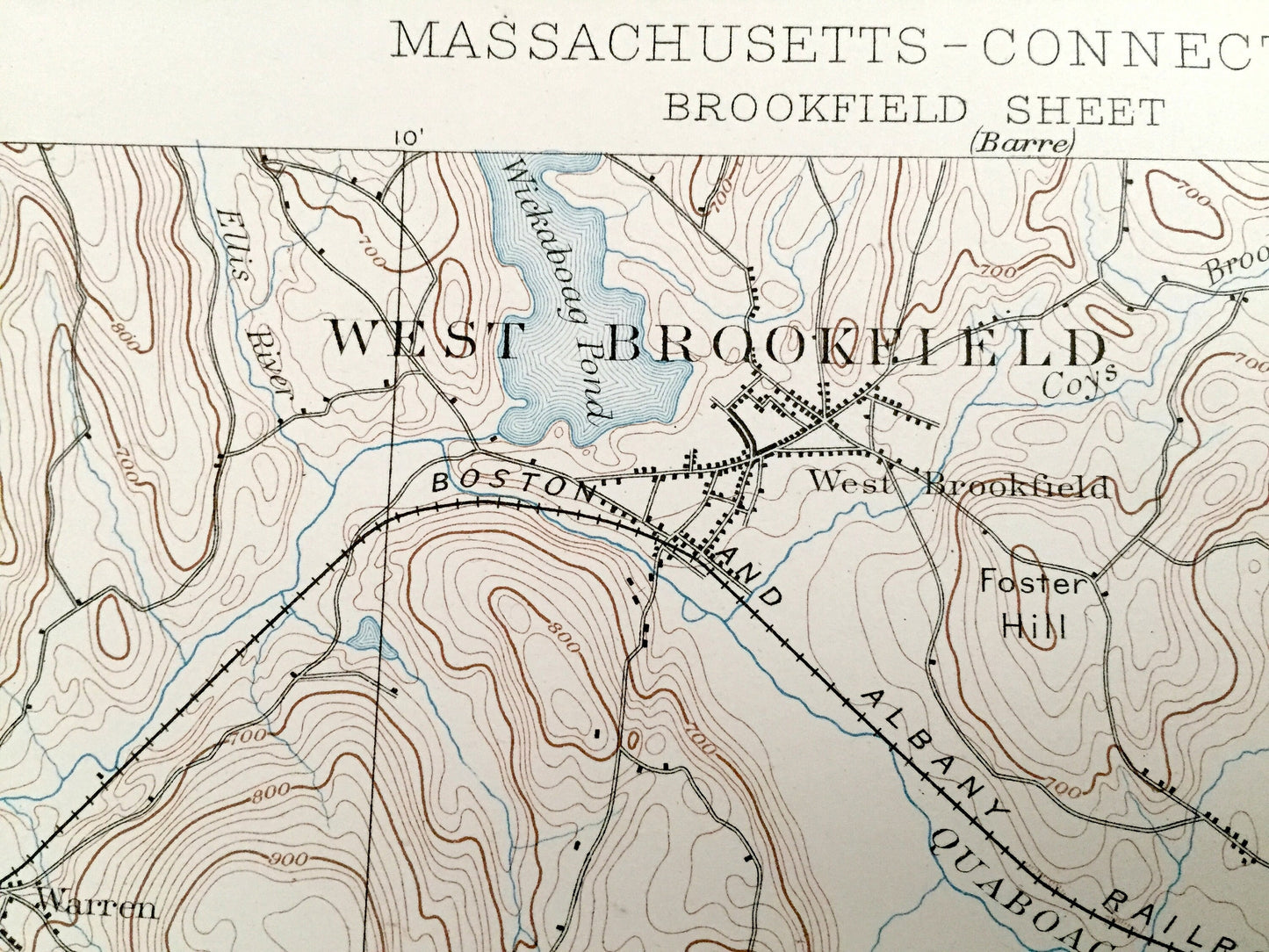
Antique Brookfield, Massachusetts 1893 US Geological Survey Topographic Map – Sturbridge, Ware, Palmer, Brinfield, Southbridge, Union, MA CT
Beautiful, antique map of Brookfield, Massachusetts and surrounding Worcester County, MA and Tolland County, CT area. This is an authentic 1893 edition, 1916 print from the U.S. Geological Survey and NOT a computer reproduction.
See what Massachusetts and Connecticut looked like over 125 years ago. Lots of intricate details and geological contours. Map even has little squares for every house that existed at the time. The USGS cartographers were very thorough back then! On the back is a description of topographic symbols and map guide.
Perfect for the historian, map-lover, the curious or just as a conversation starter. Wonderful and rare. Vintage maps such as these make great gifts.
Edition of 1893, printed 1916
Dimensions: 16 1/2" width x 20" height
----
Features
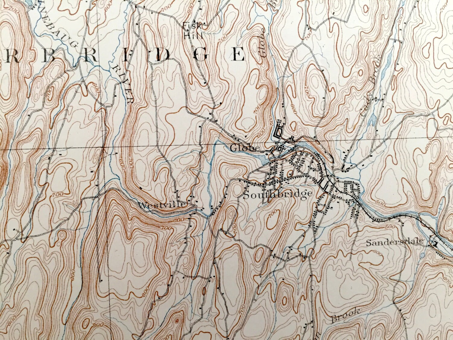
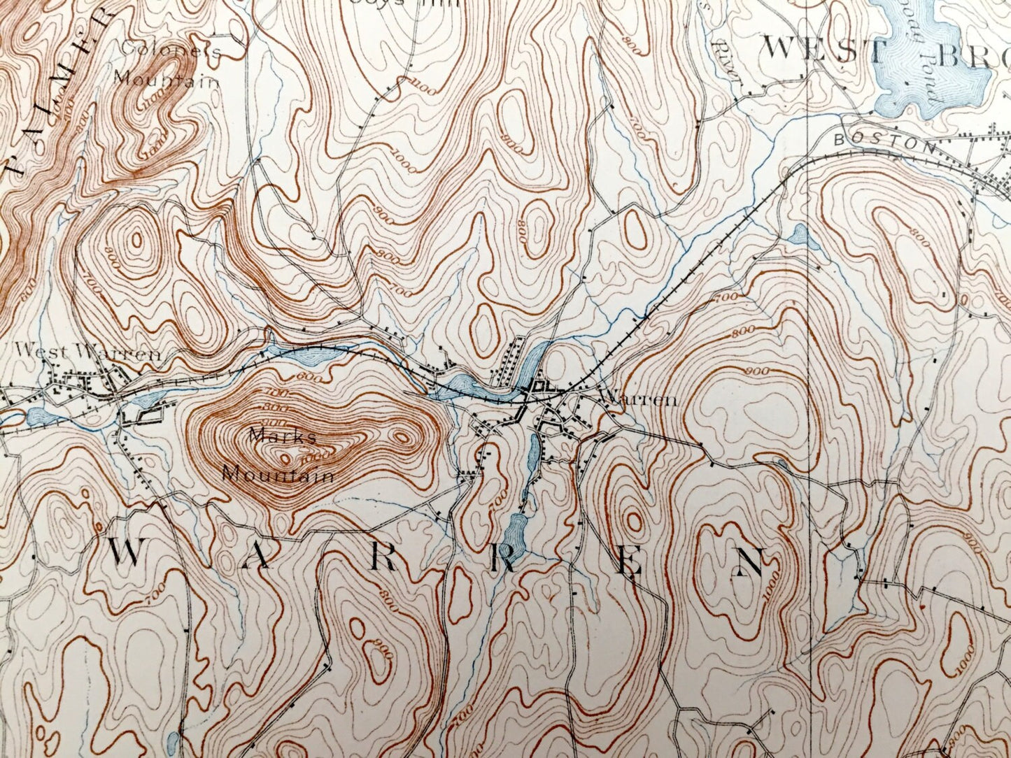
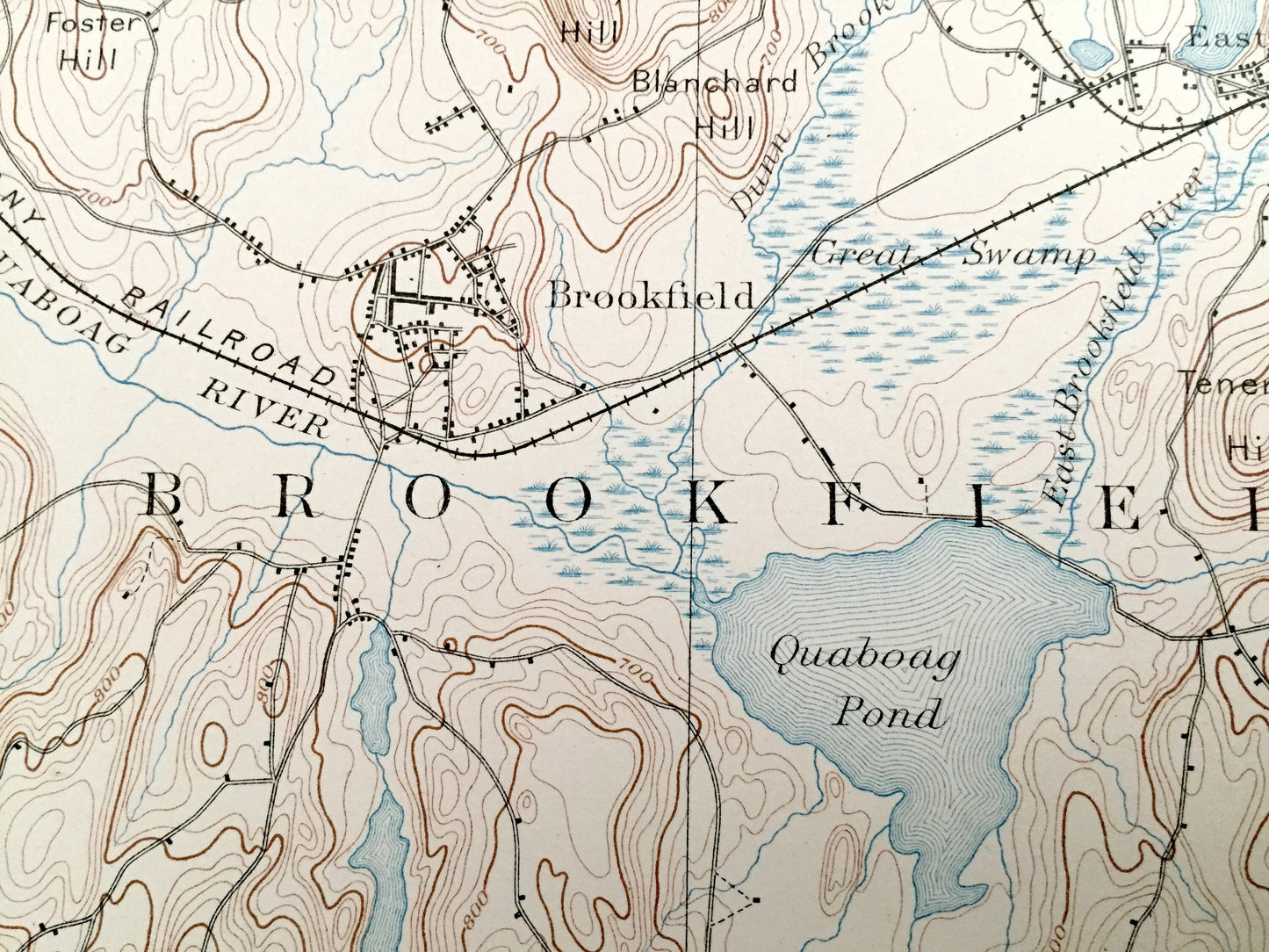
Cities & Towns: MASSACHUSETTS: Brookfield, West Brookfield, North Brookfield, East Brookfield, Ware, Palmer, Brinfield, Spencer, Charlton, Sturbridge, Wales, Holland, South Bridge, South Spencer, Little Rest, Westville, West Warren, Leadmine, Globe.
CONNECTICUT: Stafford, Union, Woodstock, Mashapaug, East Brimfield, Fiskdale
Points of Interest: Quaboag Pond, Furnace Pond, Wickaboag Pond, Boston and Albany Railroad, Quacumquasit Pond, Mt. Dan, Walker Mountain, Rattlesnake Mountain and more roads, houses, ponds, hills, streams and mountains.
Condition: Good Vintage condition, commensurate with age. This map is in great shape for being over 100 years old. Has light wear, toning, foxing and writing in margin, but this will all add to vintage character when framed.
----
We will happily adjust shipping price for multiple purchases. Maps are rolled up and shipped in sturdy mailing tubes, never folded.
Couldn't load pickup availability
Share