My Store
Antique Brooklyn Borough, New York 1941 Historical Atlas Map – Williamsburg, Greenpoint, Park Slope, Red Hook, Bushwick, Kings County NY NYC
Antique Brooklyn Borough, New York 1941 Historical Atlas Map – Williamsburg, Greenpoint, Park Slope, Red Hook, Bushwick, Kings County NY NYC
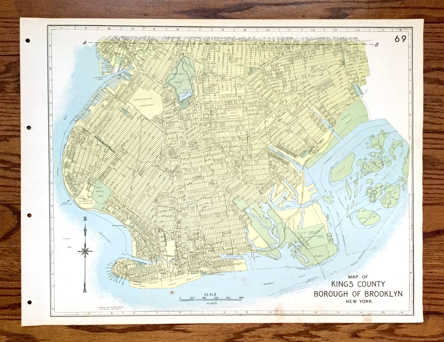
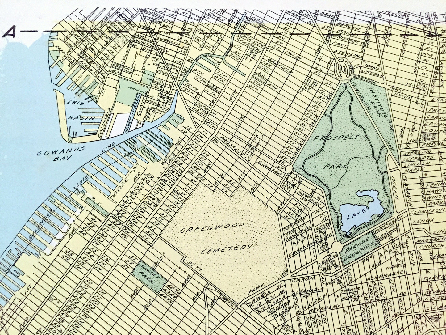
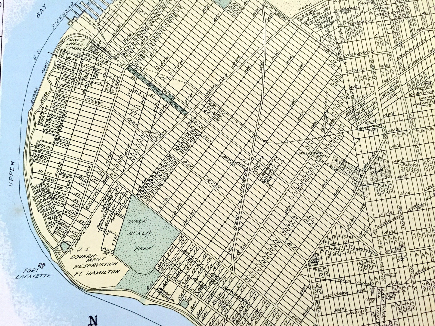
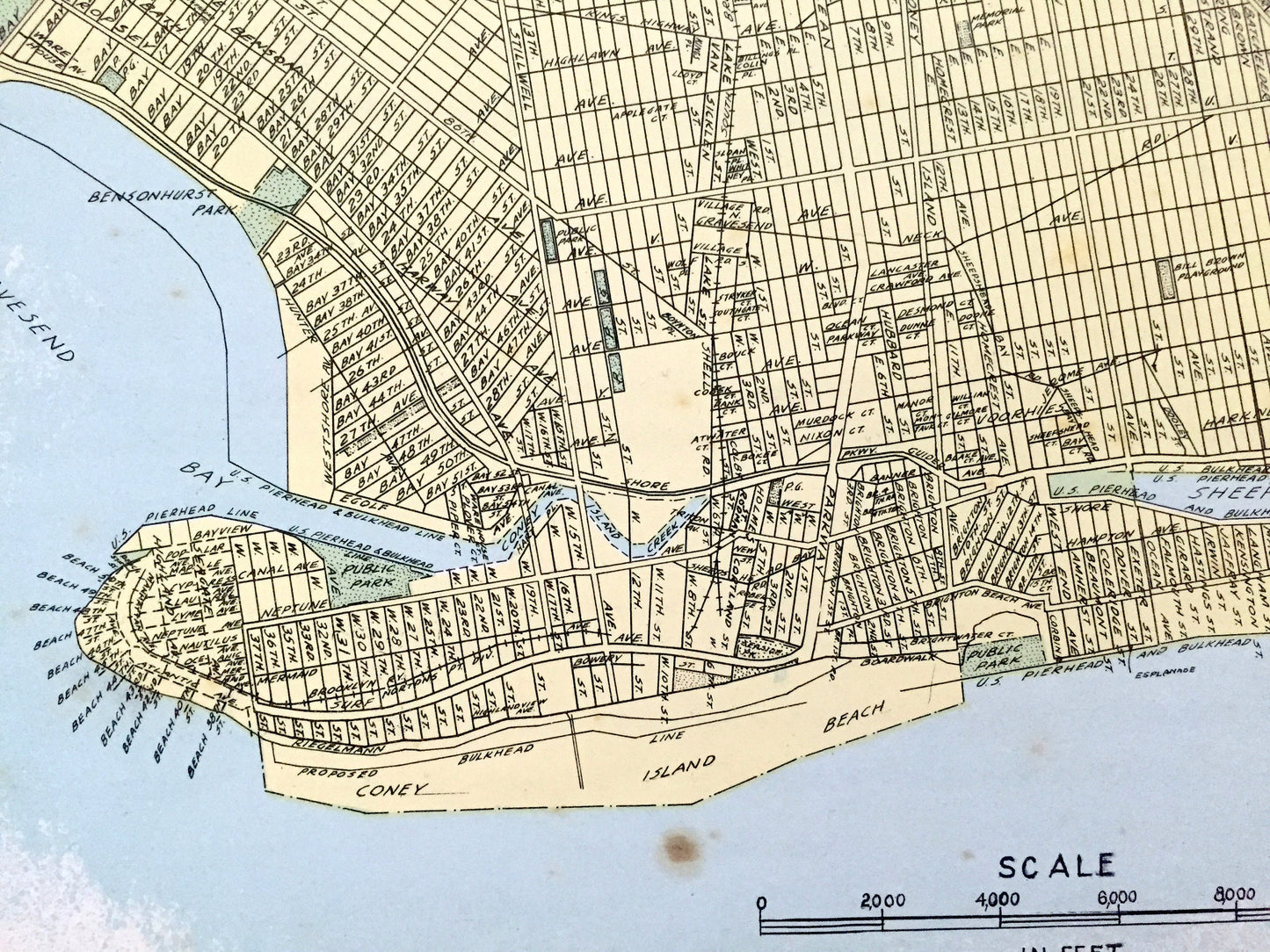
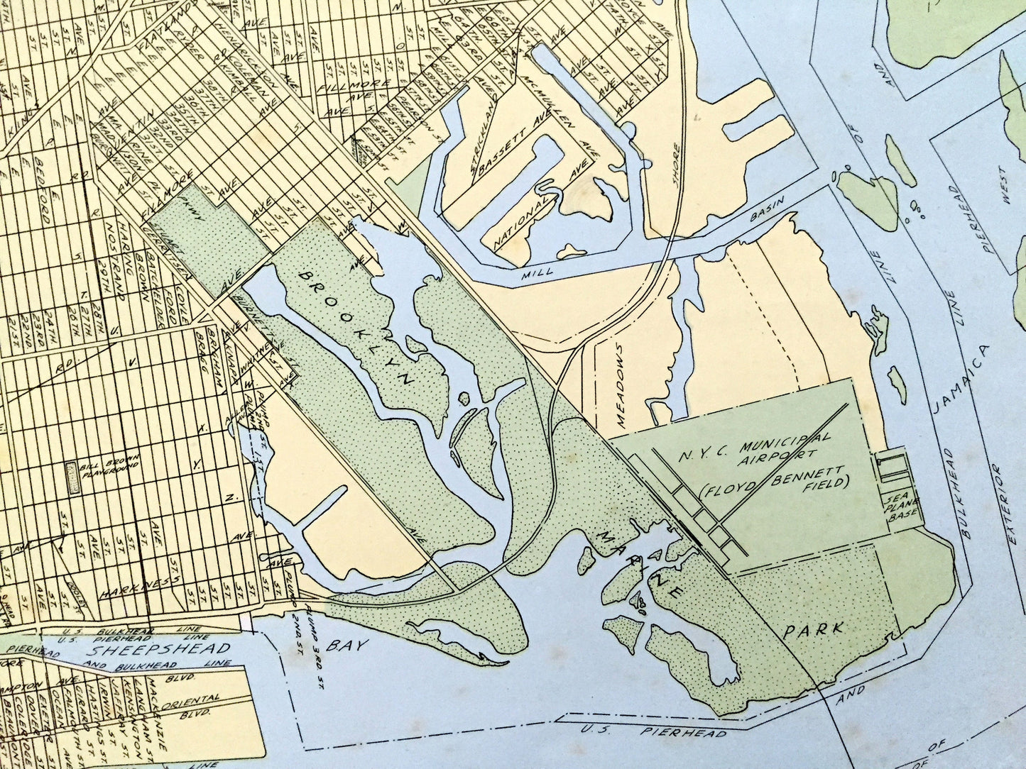
Beautiful, antique double-sided street map of Brooklyn, New York. This is an authentic map taken from the rare "Historical Atlas of New York State" by William P. Munger, published by Frank E. Richards Co. in 1941, and is NOT a computer reproduction.
See what Brooklyn looked like more than 80 years ago. Lots of details and contours, major streets and parks, as well as geographical points of interest. It is a large, colorful print and will be a showpiece wherever it is presented. Reverse side is the north part of the borough as well as a street index.
Perfect for the historian, map-lover, the curious or just as a conversation starter. Wonderful and rare. Vintage maps such as these make great gifts.
Edition of 1941, printed 1941
Dimensions: 22" width x 16 1/2" height
----
Condition: Good Vintage condition, commensurate with age. This map is in great shape for being over 80 years old. Has light wear, foxing, toning, and holes in margin where the print was removed from atlas, but this will all add to vintage character when framed.
(Images of atlas cover and frontispiece for information only and not included.)
----
We will happily adjust shipping price for multiple purchases. Maps are rolled up and shipped in sturdy mailing tubes, never folded.
Couldn't load pickup availability
Share