My Store
Antique Brooklyn & Queens, New York City 1901 US Geological Survey Topographic Map – Manhattan, Far Rockaway, Williamsburg, Prospect Park NY
Antique Brooklyn & Queens, New York City 1901 US Geological Survey Topographic Map – Manhattan, Far Rockaway, Williamsburg, Prospect Park NY
Beautiful, antique map of Brooklyn and Queens, when parts of it were still undeveloped. See how the world has changed. This is an authentic 1901 print from a U.S. Geological Survey folio and NOT a computer reproduction.
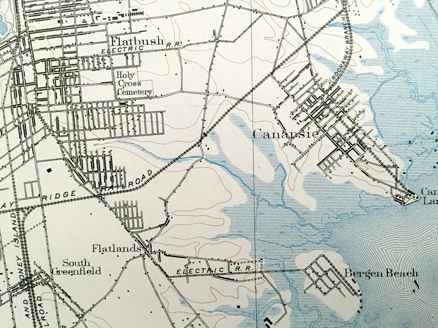
See what Manhattan, Brooklyn & Queens looked like 120 years ago. Lots of intricate details and geological contours. Map even has little squares for every house that existed at the time. The USGS cartographers were very thorough back then! This is one of the rare maps with the map legend on the front.
Perfect for the historian, map-lover, the curious or just as a conversation starter. Very rare. Vintage maps such as these make great gifts.
Edition of 1901, printed 1901
Dimensions: 18 1/2" width x 21 1/2" height
----
Features
Cities, Neighborhoods & Towns: Manhattan, Brooklyn, Queens, Hunters Point, Greenpoint, Williamsburg, Bushwick, Woodside, Elmhurst, Newtown, Winfield Junction, Maspeth, Columbusville, Linden Hill, East Williamsburg, Fresh Pond, Corona, Ridgewood, Forest Park, Richmond Hill, Maple Grove, Jamaica, Woodhull Park, Hollis, Aqueduct, Jamaica South, Springfield, Flatbush, Park Slope, West Brooklyn, Parkville, Mapleton, New Utrecht, Unionville, Gravesend Beach, Brighton Bech, Manhattan Beach, Sheepshead Bay, Sough Greenfield, Flatlands, Blythebourne, Canarsie, Canarsie Landing, Bergen Beach, Remsen Landing, Threemile Mill, Idlewild, Barren Island, Seaside, Oceanus, Arverne, Far Rockaway
Points of Interest: New York City, Nassau County, East River, Rockaway Inlet, Jamaica Bay, Newtown Creek, Prospect Park, Coney Island Creek, Flushing Creek, Grassy Bay, Beach Channel, The Raunt, Big Egg Marsh, Pumpkinpatch Channel, Head of Bay, Jo Co's Marsh, Little Bay, Big Channel, Wallabout Bay, Greenwood Cemetery, Long Island Railroad, New York & Far Rockaway Beach Railroad, and lots more hills, creeks, points, bays, marshes, islands, beaches, neighborhoods, schools, churches, roads and railroads.
Condition: Very Good Vintage condition, commensurate with age. This map is in great shape for being over 115 years old. Has light edge-wear and staple holes along the left margin, but these are easily-hidden with framing and all will add to vintage character when framed.
----
We will happily adjust shipping price for multiple purchases. Maps are rolled up and shipped in sturdy mailing tubes, never folded.
Couldn't load pickup availability
Share