My Store
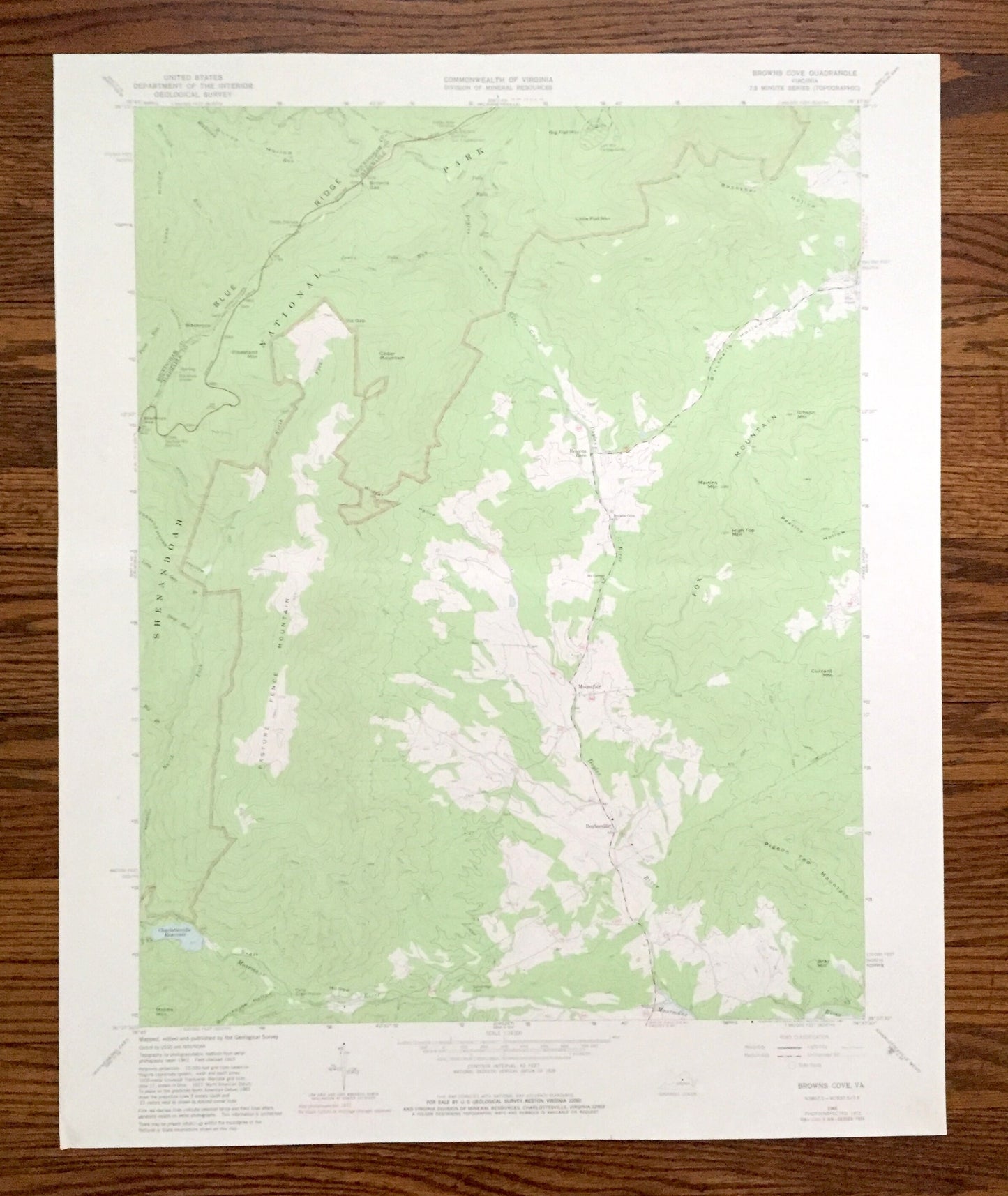
Antique Browns Cove, Virginia 1965 US Geological Survey Topographic Map – Albermarle County Shenandoah National Park Blue Ridge Mountains VA
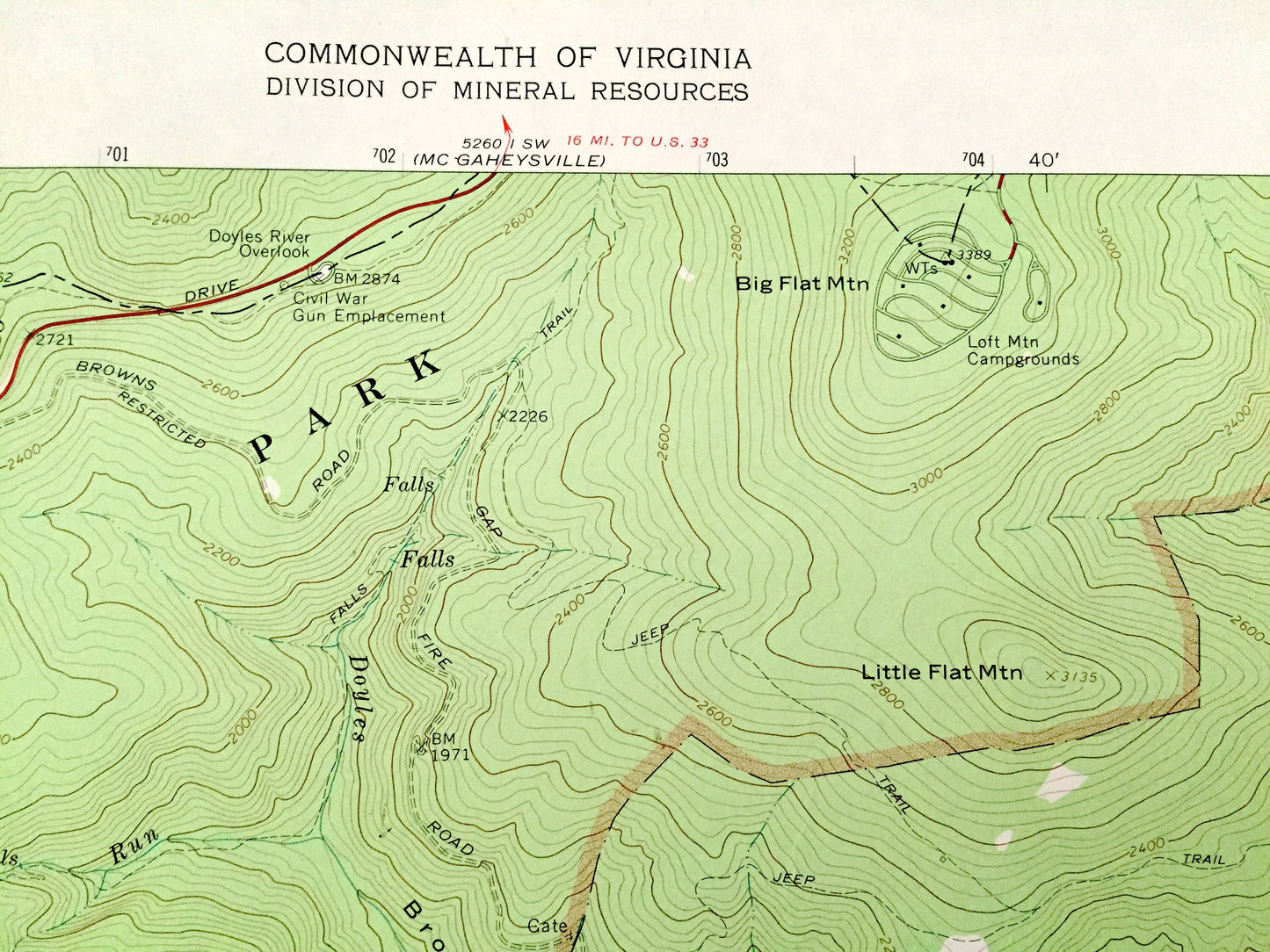
Antique Browns Cove, Virginia 1965 US Geological Survey Topographic Map – Albermarle County Shenandoah National Park Blue Ridge Mountains VA
Beautiful, antique map of Browns Cove, Virginia and surrounding Albermarle & Rockingham County area, including Shenandoah National Park and Blue Ridge Mountains. This is an authentic 1965 edition, 1981 print from the U.S. Geological Survey and NOT a computer reproduction.
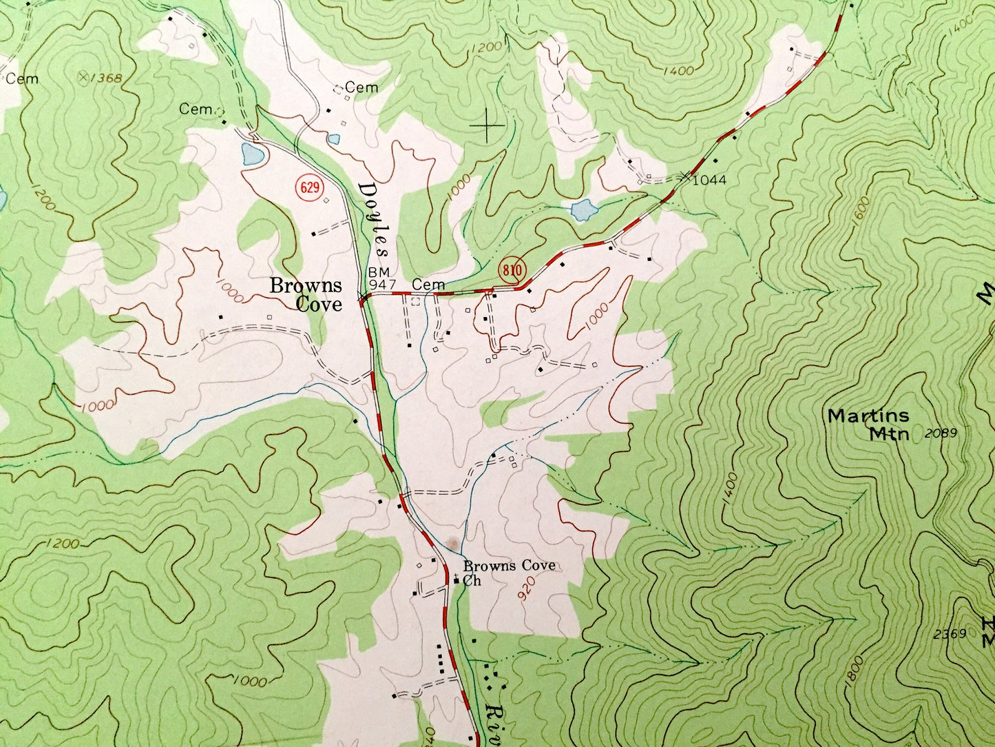
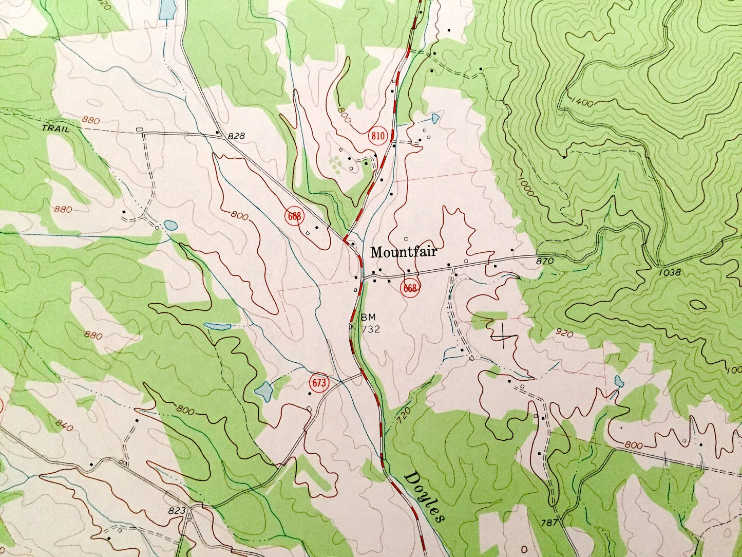
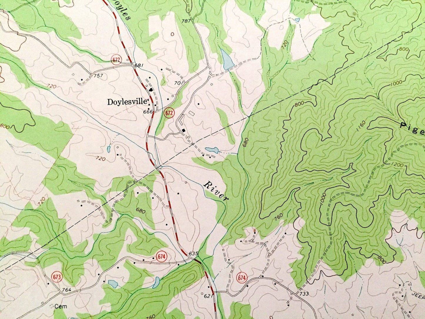
See what Virginia looked like over 55 years ago. Lots of intricate details and geological contours. Map even has little squares for every house that existed at the time. The USGS cartographers were very thorough back then!
Perfect for the historian, map-lover, the curious or just as a conversation starter. Wonderful and rare. Vintage maps such as these make great gifts.
Edition of 1965, printed 1981
Dimensions: 22" width x 27" height
----
Features
Cities & Towns: Browns Cove, Mountfair, Doylesville.
Points of Interest: Albermarle County, Rockingham County, Shenandoah National Park, Blue Ridge Mountains, Fox Mountain, Appalachian Trail, Big Flat Mountain, Loft Mountain Campgrounds, Cedar Mountain, Tobacco House Hollow, Pasture Fence Mountain, Charlottesville Reservoir (Sugar Hollow Dam and Reservoir), Moormans River, Headquarters, Innisfree Village, Doyles River Overlook, Pigeon Tap Mountain and many more hills, streams, ponds, houses, schools, churches and roads.
Condition: Good Vintage condition, commensurate with age. This map is in great shape for being over 40 years old. Has light wear but this will add to vintage character when framed.
----
We will happily adjust shipping price for multiple purchases. Maps are rolled up and shipped in sturdy mailing tubes, never folded.
Couldn't load pickup availability
Share