My Store
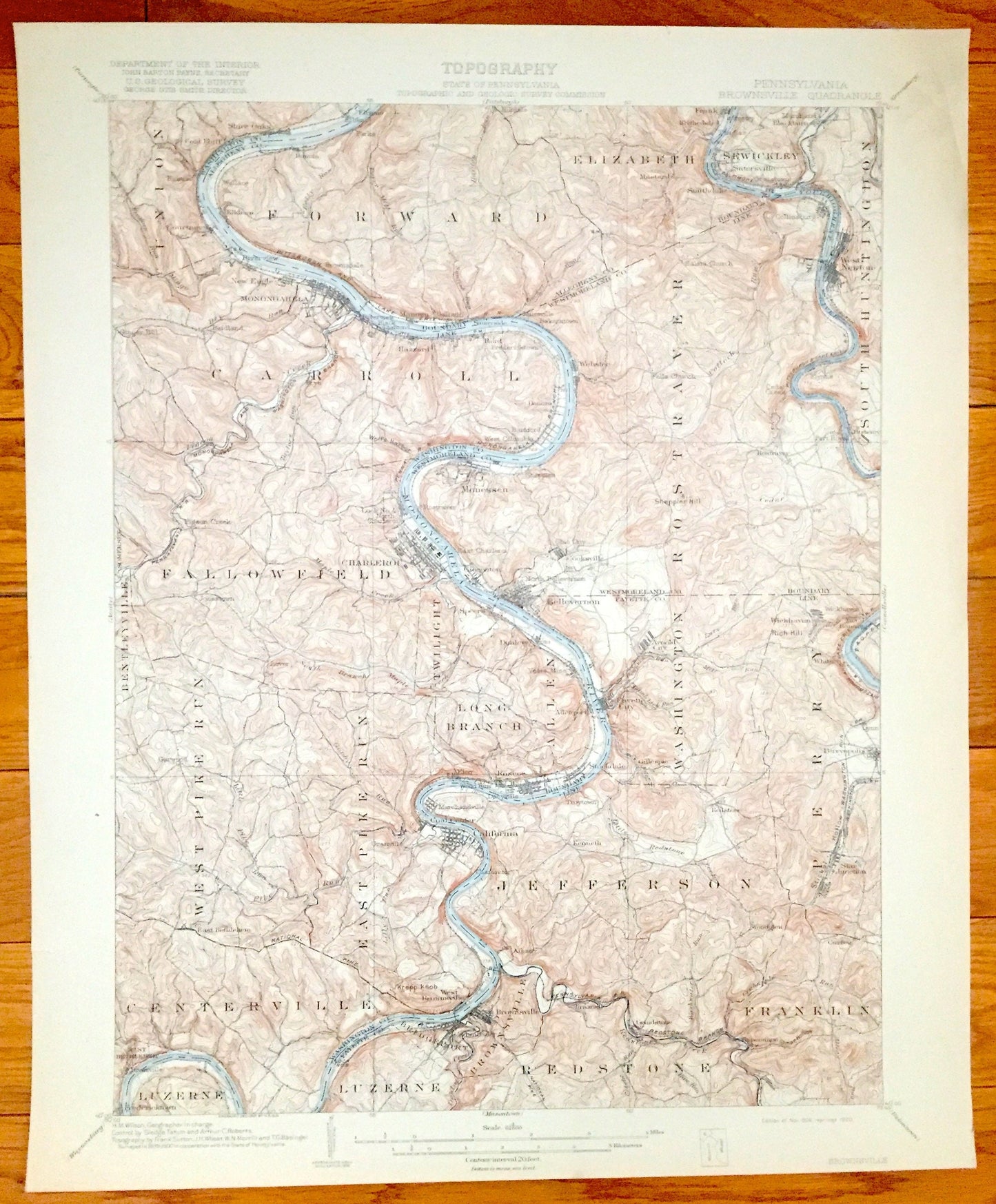
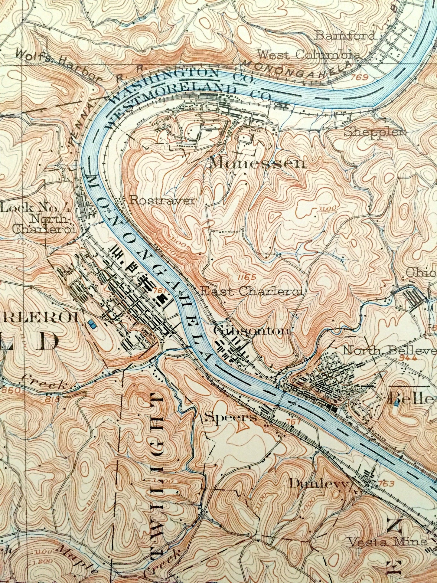
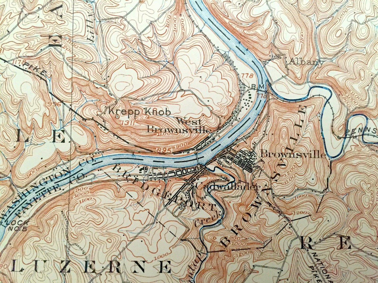
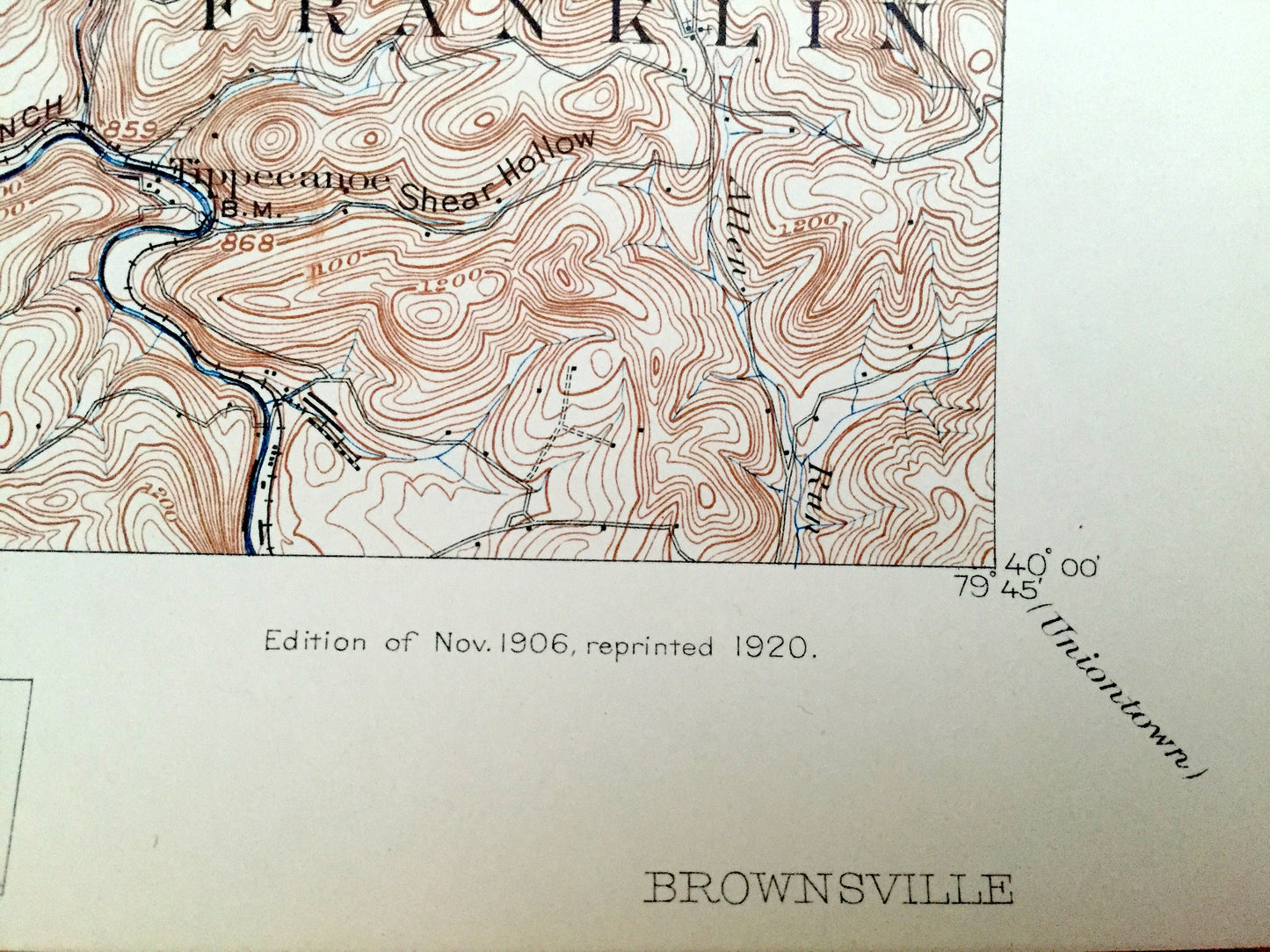
Antique Brownsville, Pennsylvania 1906 US Geological Survey Map – California, Charleroi, Monongahela, West Newton, Webster, Coal Center, PA
Antique Brownsville, Pennsylvania 1906 US Geological Survey Map – California, Charleroi, Monongahela, West Newton, Webster, Coal Center, PA
Beautiful, antique map of Brownsville, Pennsylvania and surrounding Washington, Allegheny, Westmoreland & Fayette County area. This is an authentic 1906 edition, 1920 print from the U.S. Geological Survey and NOT a computer reproduction.
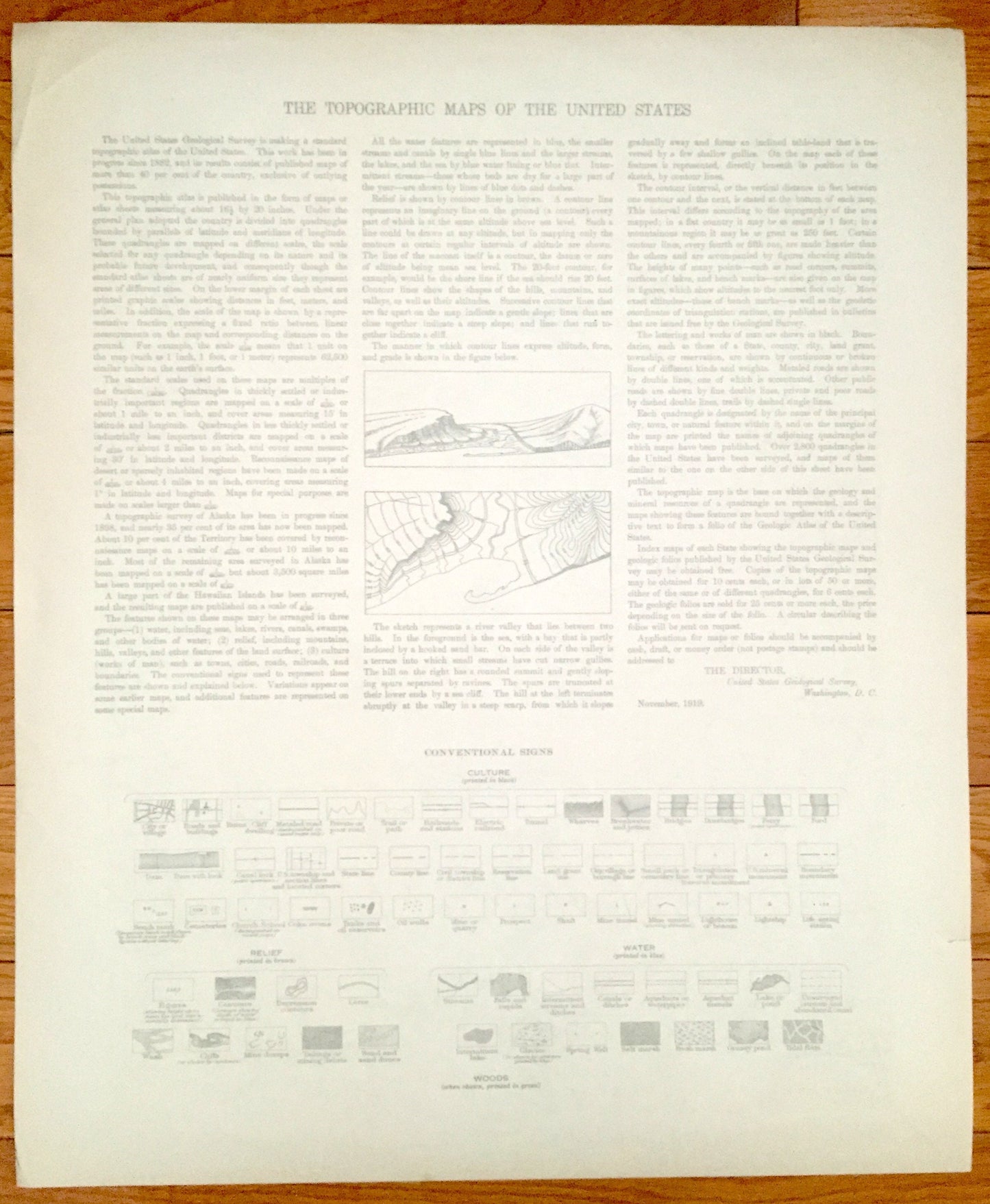
See what Pennsylvania looked like more than 115 years ago. Lots of intricate details and geological contours. Map even has little squares for every house that existed at the time. The USGS cartographers were very thorough back then! On the back is a description of topographic symbols and map guide.
Perfect for the historian, map-lover, the curious or just as a conversation starter. Wonderful and rare. Maps such as these make great gifts.
Edition of 1906, printed 1920
Dimensions: 16 1/2" width x 20" height
----
Features
Cities & Towns: Union, Forward, Elizabeth, Sewickley, South Huntington, Carroll, Rostraver, Bentleyville, Somerset, Fallowfield, West Pike Run, East Pike Run, Long Branch, Twilight, Allen, Washington, Perry, Centerville, Luzerne, Brownsville, Redstone, Franklin, Shire Oaks, Elrama, Elben, Parke, Huston, Wallace, Bunola, Courtney, Ginger Hill, New Eagle, Baidland, Monongahela, Riverview, Black Diamond, Hazzard, Hilldale, Gallatin, Sunnyside, Baird, Fredericktown, Milesville, Bakerstown, Webster, Donora, Bamford, West Columbia, Frank, Blythedeale, Industry, Douglas, Marchland, Blackburn, Sutersville, Smithdale, Mustard, Collinsburg, West Newton, Cedar Creek, Flynns, Fitzhenry, Port Royal, Pigeon Creek, Jonestown, Garwood, North Charleroi, Monessen, Sheppler, Ohio City, East Charleroi, Gibsonton, Charleroi, Cooksville, North Belle Vernon, Belle Vernon, Speers, Dunlevy, Vesta Mine, Allenport, Fayette City, Rostraver, Wickhaven, Banning, Whitse, Arnold City, Perryopolis, Gillespie, Stockdale, East Bethlehem, Riverville, Fredericktown, Marchandville, Elco, Roscoe, Wood Run, Lucyville, Troytown, California, Kenneth, Chamouni, Albany, West Brownsville, Bridgeport, Cadwallader, Braznell, Star Junction, Woodglen, Curfew, Grindstone, Tippecanoe.
Points of Interest: Westmoreland County, Washington County, Allegheny County, Monongahela River, Youghiogheny River, Pigeon Creek, Pennsylvania Railroad, Little Redstone Creek, National Pike and lots more hills, mountains, creeks, towns, schools, churches, roads and railroads.
Condition: Good Vintage condition, commensurate with age. This map is in great shape for being over 100 years old. Light wear and toning, but this will add to vintage character when framed.
----
We will happily adjust shipping price for multiple purchases. Maps are rolled up and shipped in sturdy mailing tubes, never folded.
Couldn't load pickup availability
Share