My Store
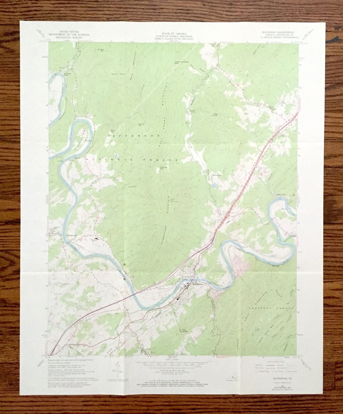
Antique Buchanan, Virginia 1961 US Geological Survey Topographic Map – Botetourt County, Jefferson National Forest, Springwood, Greyledge VA
Antique Buchanan, Virginia 1961 US Geological Survey Topographic Map – Botetourt County, Jefferson National Forest, Springwood, Greyledge VA
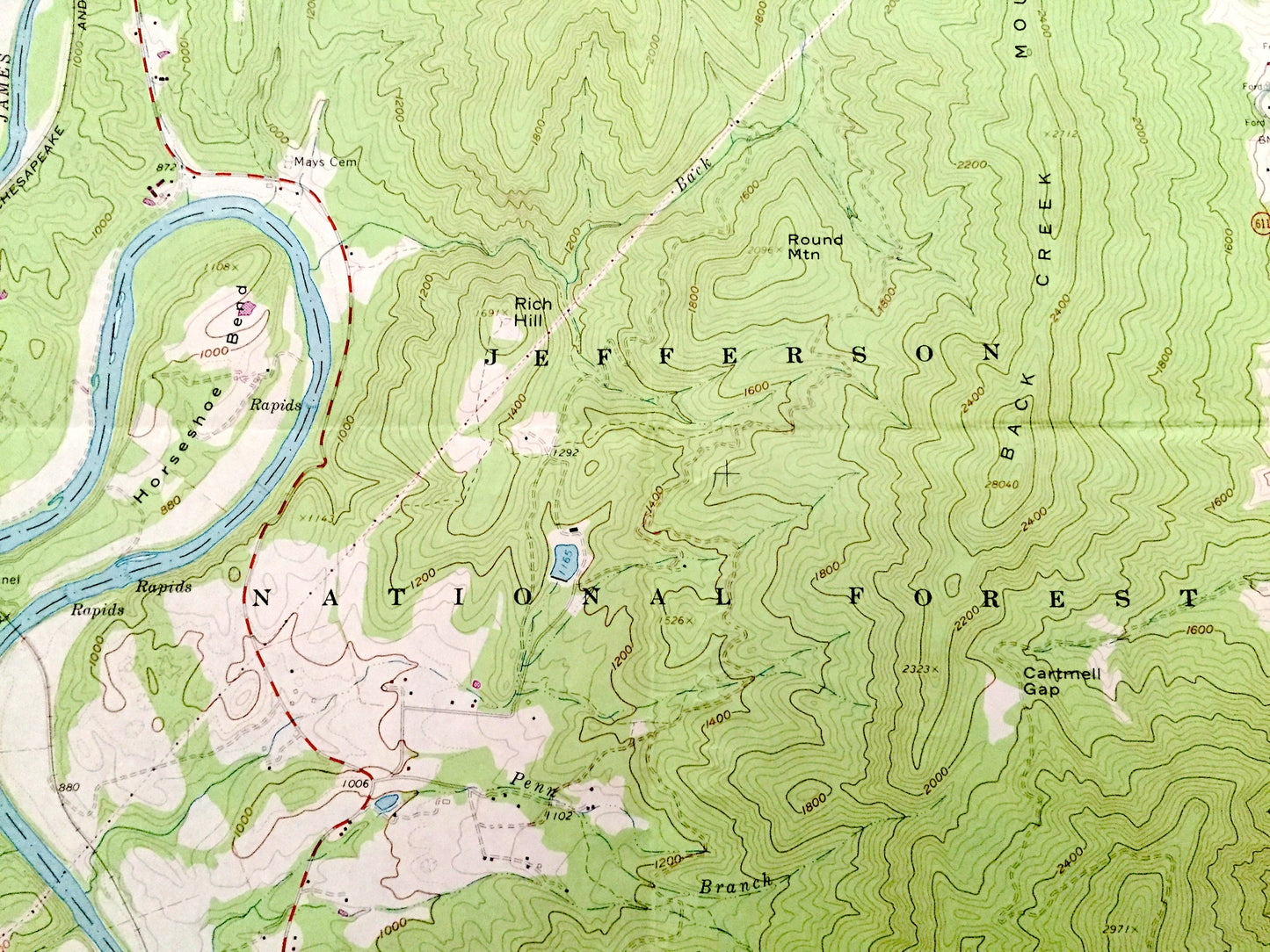
Beautiful, antique map of Buchanan, Virginia and surrounding Botetourt County area. This is an authentic 1961 edition, 1973 print from the U.S. Geological Survey and NOT a computer reproduction.
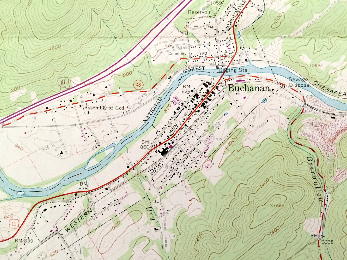
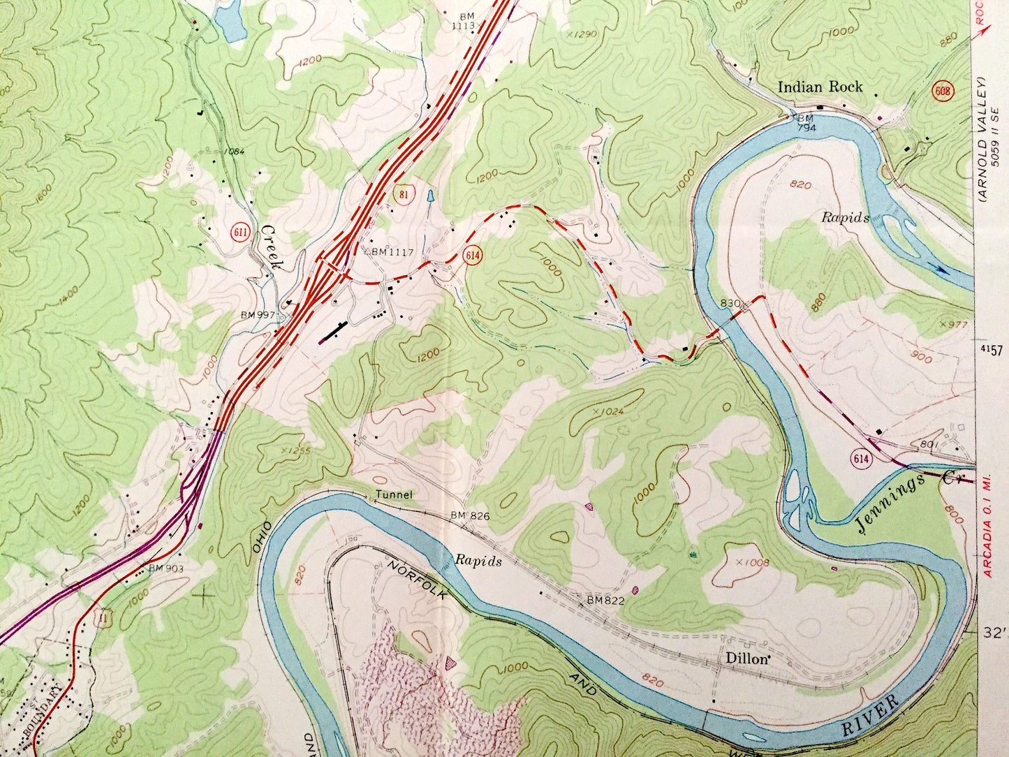
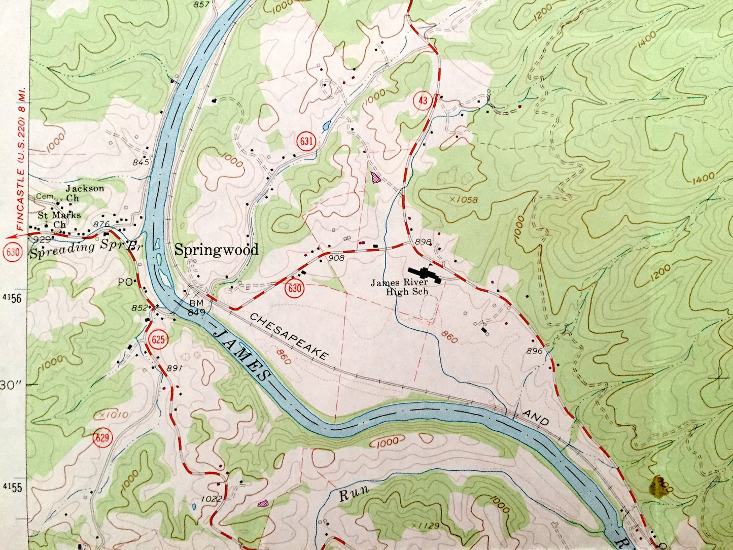
See what Virginia looked like over 60 years ago. Lots of intricate details and geological contours. Map even has little squares for every house that existed at the time. The USGS cartographers were very thorough back then!
Perfect for the historian, map-lover, the curious or just as a conversation starter. Wonderful and rare. Vintage maps such as these make great gifts.
Edition of 1961, printed 1973
Dimensions: 22" width x 27" height
----
Features
Cities & Towns: Buchanan, Saltpetre Cave, Springwood, Indian Rock, Greyledge, Dillon.
Points of Interest: Botetourt County, Jefferson National Forest, James River, Bearwallow Creek, Back Creek Mountain, Purgatory Mountain, Green Spur, Mays Mountain, Cherry Orchard Gap, Hickory Hollow, Horseshoe Bend, The Gorge, Cove Mountain, Renick Run< The Knob, Purgatory Creek, Karnes Spring , and many more creeks, hills, houses and roads.
Condition: Good Vintage condition, commensurate with age. This map is in great shape for being almost 50 years old. Has light wear and folds as-issued, but these will flatten easily and all will read as vintage character when framed.
----
We will happily adjust shipping price for multiple purchases. Maps are rolled up and shipped in sturdy mailing tubes, never folded.
Couldn't load pickup availability
Share