My Store
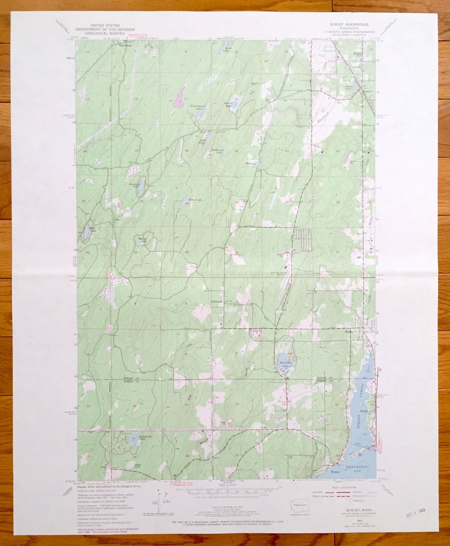
Antique Burley, Washington 1953 US Geological Survey Topographic Map – Kitsap Co, Pierce Co, Bethel, Wauna, Purdy, Horseshoe Lake
Antique Burley, Washington 1953 US Geological Survey Topographic Map – Kitsap Co, Pierce Co, Bethel, Wauna, Purdy, Horseshoe Lake
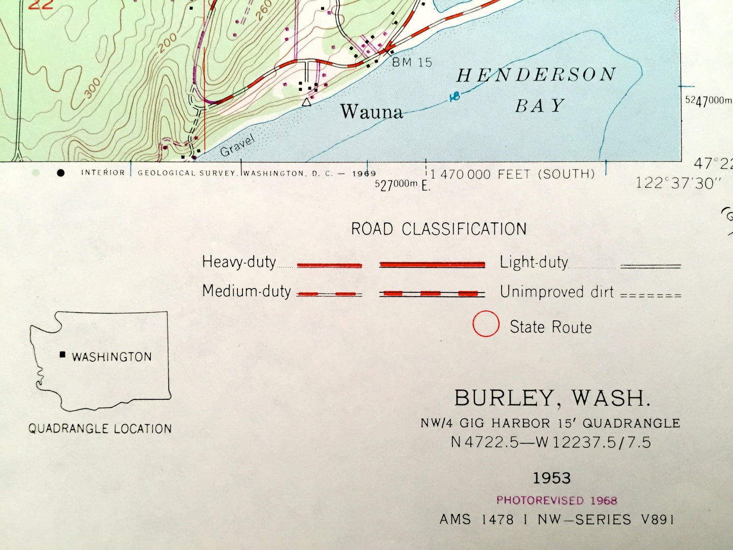
Beautiful, antique map of Burley, Washington and surrounding Kitsap County and Pierce County areas. This is an authentic 1953 edition, 1968 print from the U.S. Geological Survey and NOT a computer reproduction.
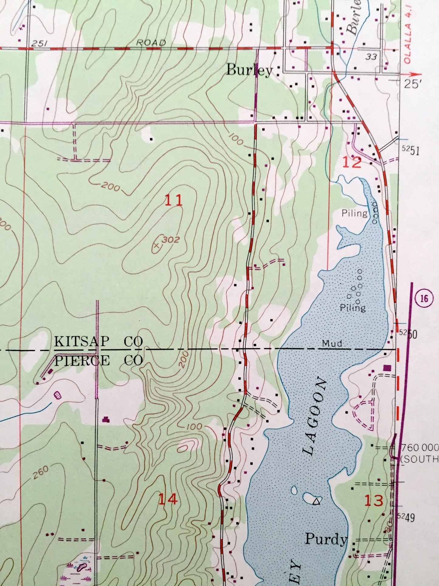
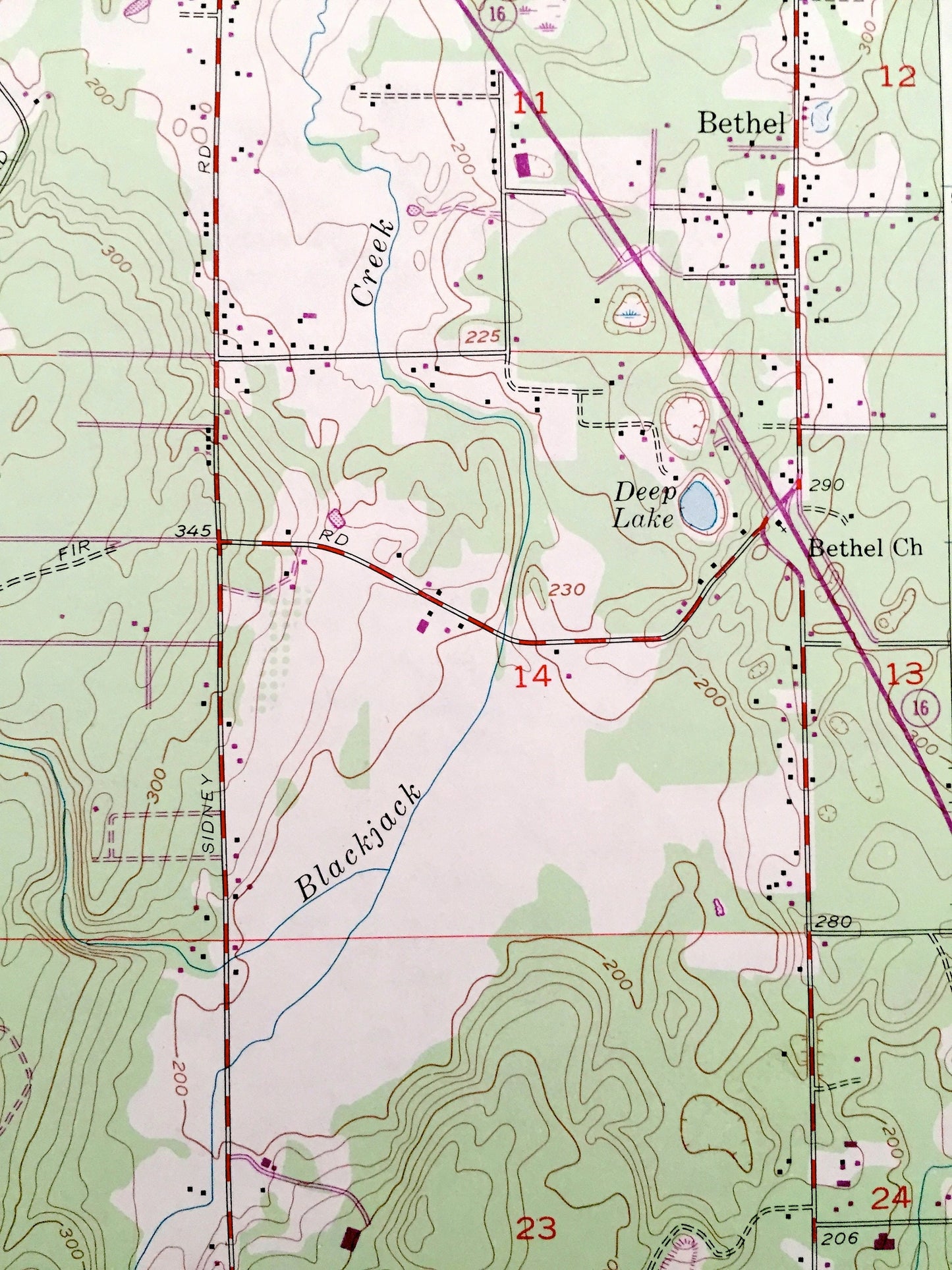
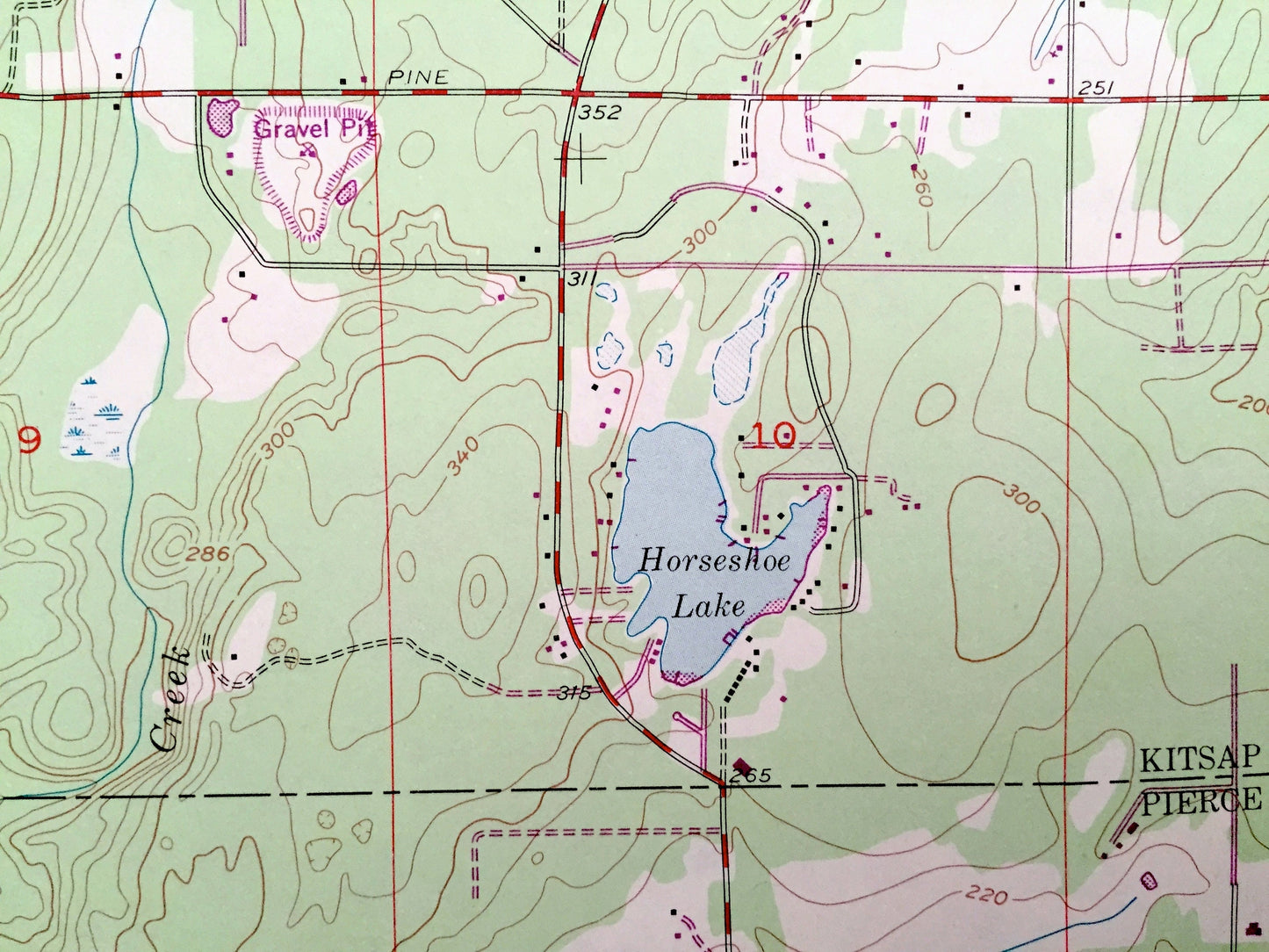
See what Washington State looked like 65 years ago. Lots of intricate details and geological contours. Map even has little squares for every house that existed at the time. The USGS cartographers were very thorough back then!
Perfect for the historian, map-lover, the curious or just as a conversation starter. Wonderful and rare. Vintage maps such as these make great gifts.
Edition of 1953, printed 1968
Dimensions: 22" width x 27" height
----
Features
Cities & Towns: Burley, Wauna, Purdy, Glenwood, Sunnyslope, Bethel, Wildwood.
Points of Interest: Kitsap County, Pierce County, Doyle Pond, Stansberry Lake, Helena Lake, Bear Lake, Fairview Lake, Wicks Lake, Matthews Lake, Lake Flora, Square Lake, Nels Johnson Lakes, North Lake, Horseshoe Lake, Henderson Bay, Burley Lagoon, Blackjack Creek, Square Creek, Deep Lake, Minter Creek, and lots more hills, rivers, creeks, ponds, towns, schools, roads and train tracks.
Condition: Very Good condition, commensurate with age. This map is in incredible shape for being 50 years old. Has light edge-wear and one fold as issued, all of which will read as vintage character when framed.
----
We will happily adjust shipping price for multiple purchases. Maps are rolled up and shipped in sturdy mailing tubes, never folded.
Couldn't load pickup availability
Share