My Store
Antique Burnet, Texas 1911 US Geological Survey Topographic Map – San Saba, Llano, Williamson, Travis County, Marble Falls, Kingsland, TX
Antique Burnet, Texas 1911 US Geological Survey Topographic Map – San Saba, Llano, Williamson, Travis County, Marble Falls, Kingsland, TX
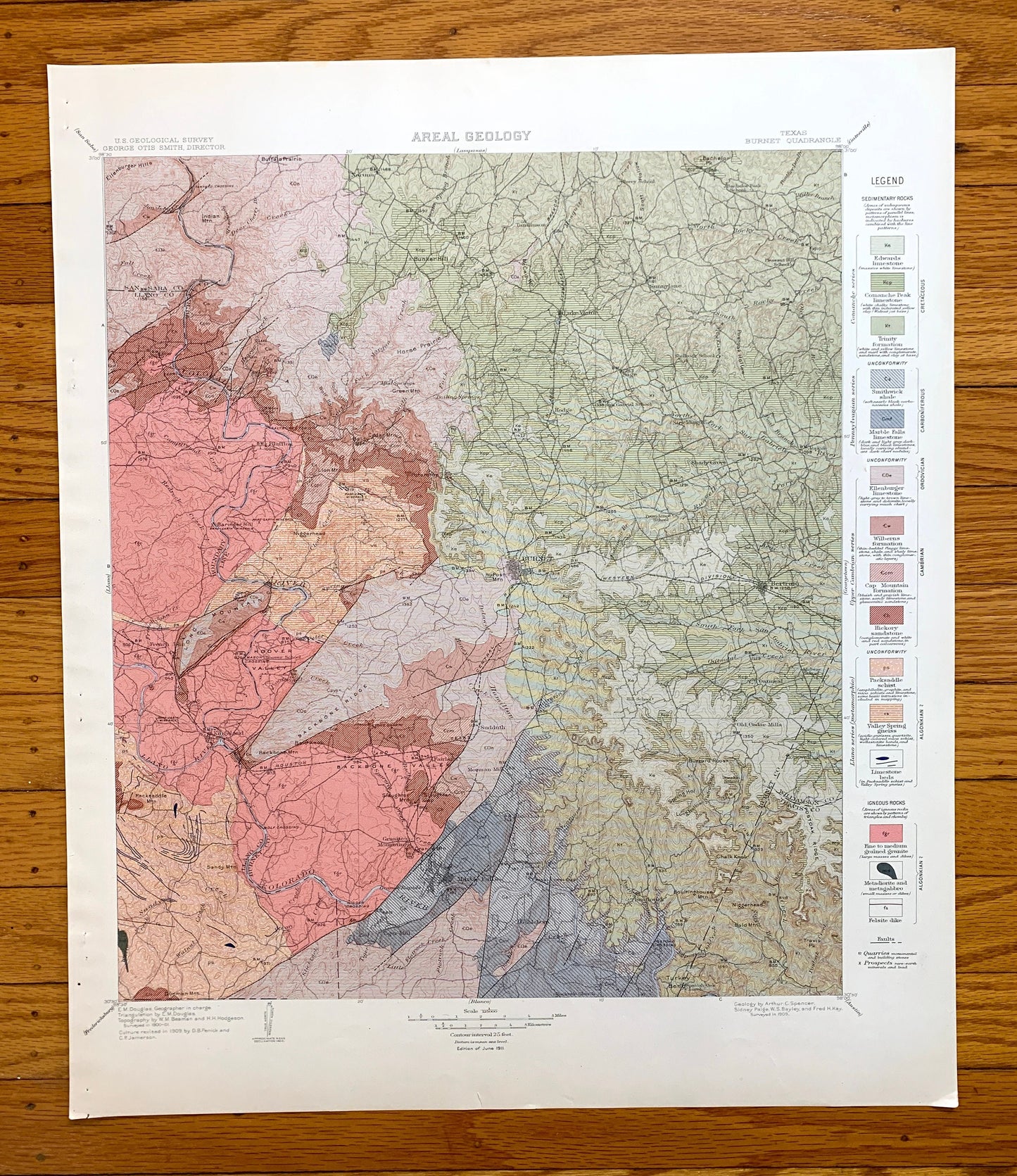
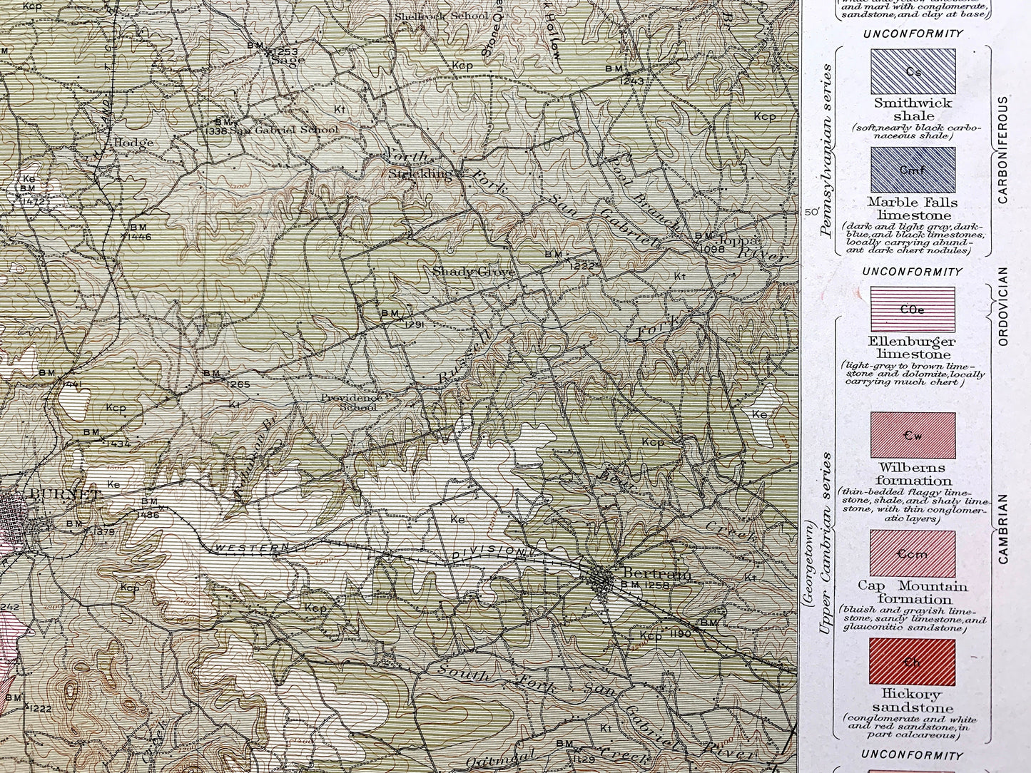
Beautiful, antique map of Burnet, Texas and surrounding Burnet County area. This is an authentic 1911 edition, 1911 print from the U.S. Geological Survey and NOT a computer reproduction. It is from a Geologic Atlas folio.
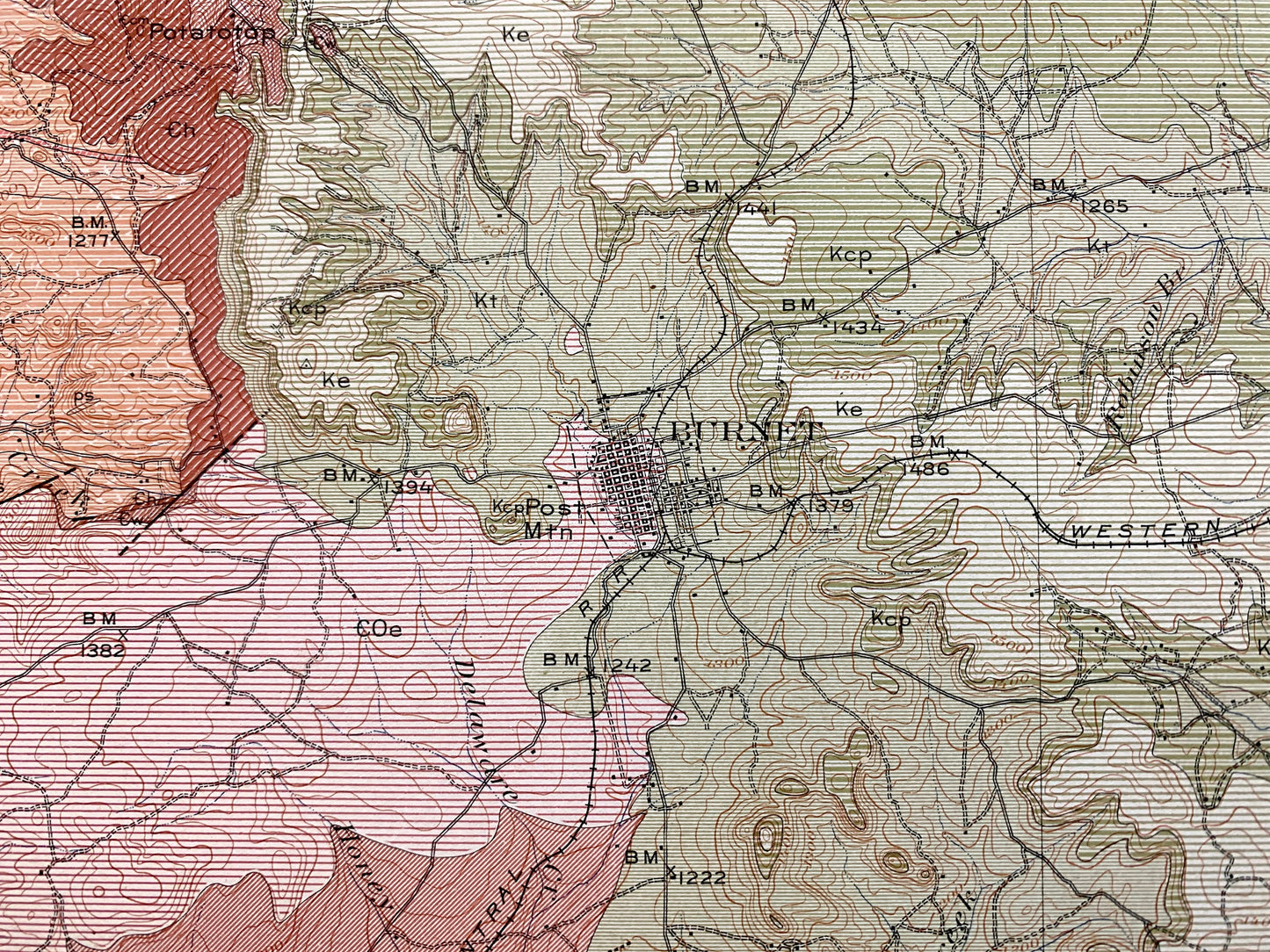
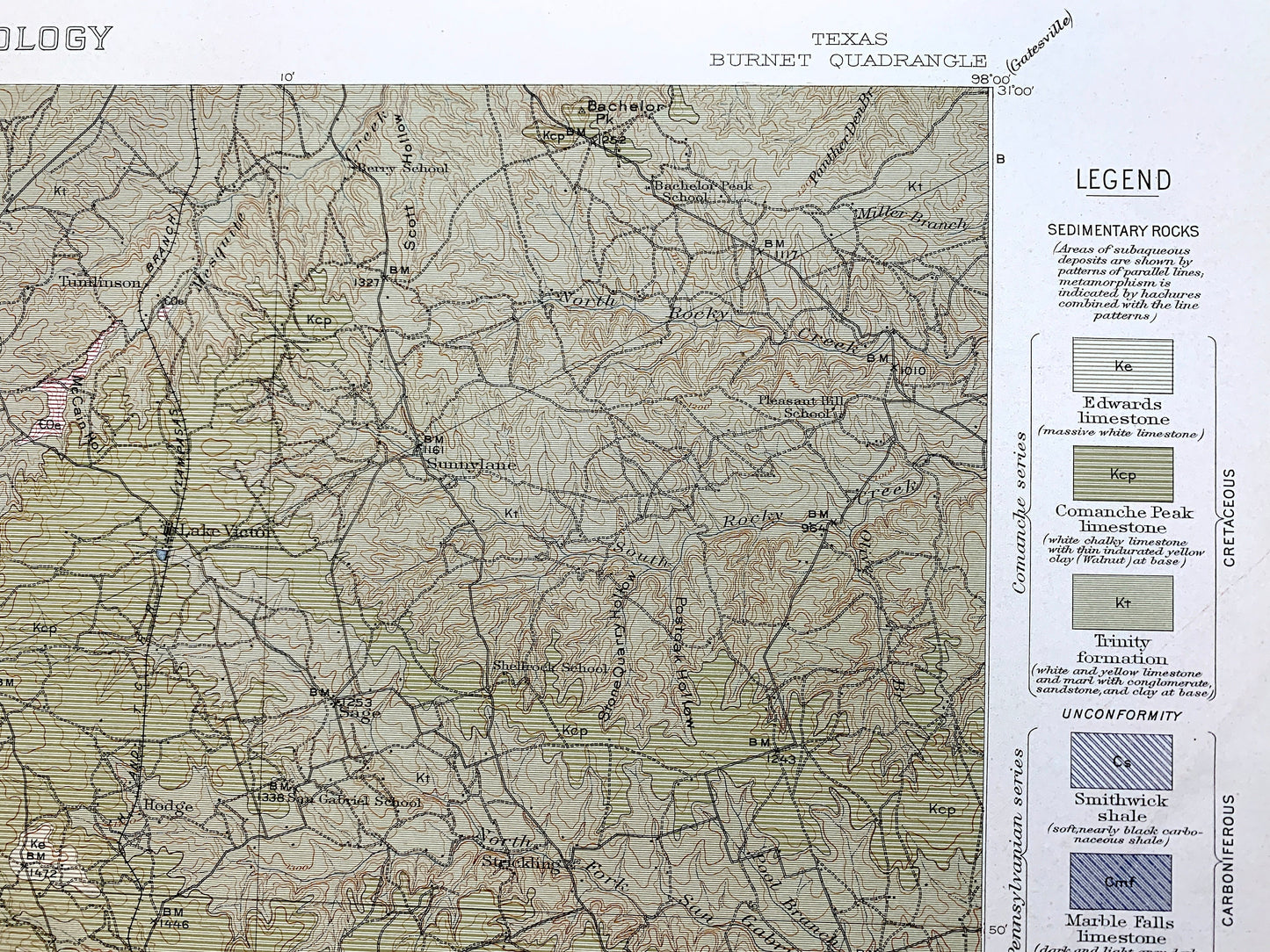
See what Texas looked like over 110 years ago. Lots of intricate details and geological contours. Map even has little squares for every house that existed at the time. The USGS cartographers were very thorough back then! This is one of the rare maps where the topographic symbols and map guide are on the front.
Perfect for the historian, map-lover, the curious or just as a conversation starter. Wonderful and rare. Vintage maps such as these make great gifts.
Edition of 1911, printed 1911
Dimensions: 18 1/2" width x 22" height
----
Features
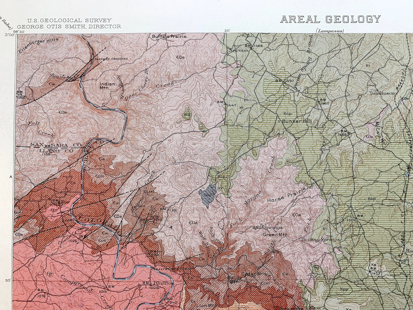
Cities & Towns: Burnet, Marble Falls, Kingsland, Hopewell, Smithwick, Bertram, Oatmeal, Joppa, Strickland, Sunnylane, Lake Victor, Naruna, Bluffton, Tumlinson, Hodge, Sage, Fairland, Mormon Mill, Tiger Mill.
Points of Interest: Burnet County, San Saba County, Llano County, Williamson County, Travis County, Colorado River, Llano River, Texas Central Railroad, Backbone Ridge, Backbone Alley, Long Mountain, and lots more hills, creeks, towns, schools, churches, roads and train tracks.
Condition: Very Good Vintage condition, commensurate with age. This map is in great shape for being over 100 years old. Has light edge-wear and staple holes in the margin, but this will add to vintage character when framed.
----
We will happily adjust shipping price for multiple purchases. Maps are rolled up and shipped in sturdy mailing tubes, never folded.
Couldn't load pickup availability
Share