My Store
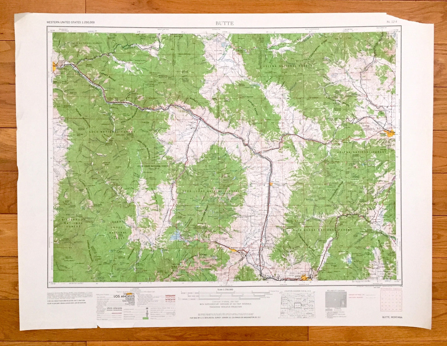
Antique Butte, Montana 1962 US Geological Survey Topographic Map – Helena, Deer Lodge, Anaconda, Boulder, Missoula, Continental Divide, MT
Antique Butte, Montana 1962 US Geological Survey Topographic Map – Helena, Deer Lodge, Anaconda, Boulder, Missoula, Continental Divide, MT
Beautiful, antique map of Butte, Montana and surrounding area. This is an authentic 1962 edition, 1962 print from the U.S. Geological Survey and NOT a computer reproduction.
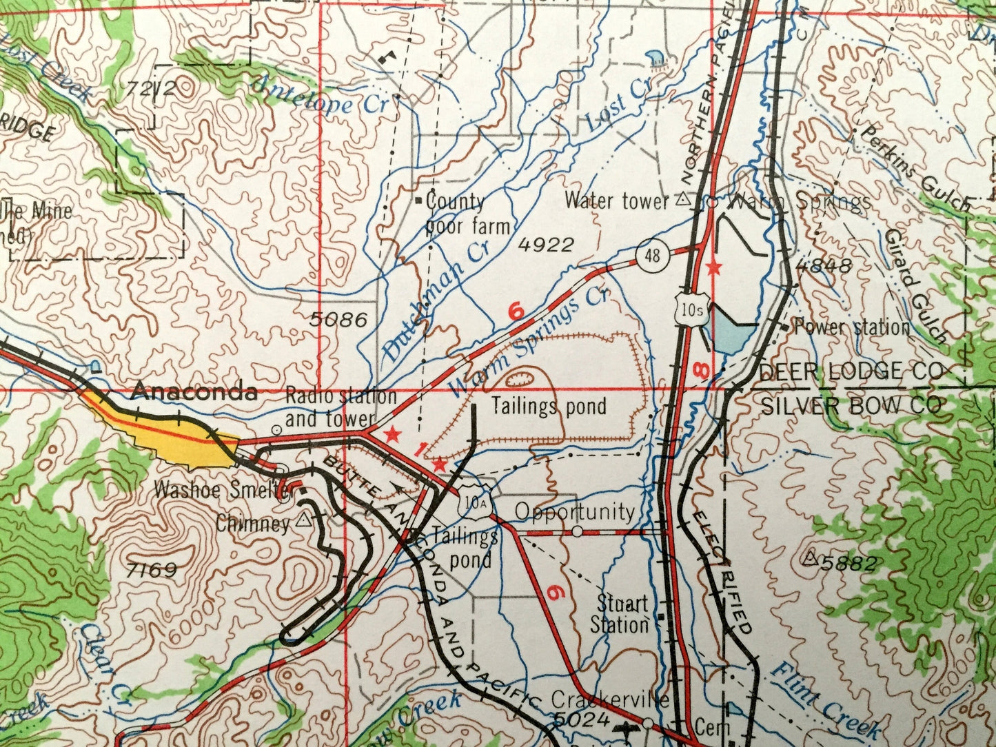
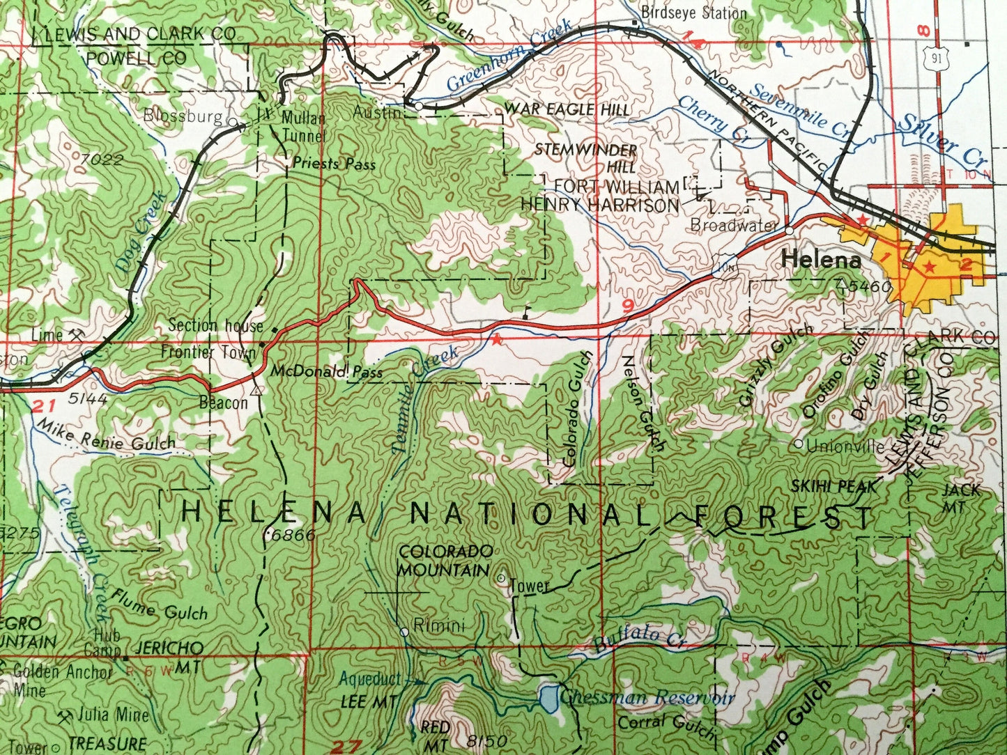
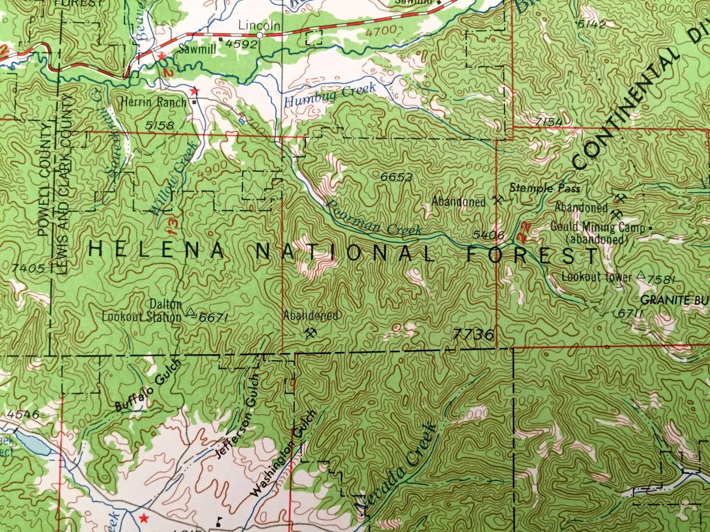
See what Montana looked like over 60 years ago. Lots of intricate details and geological contours. Map is incredibly large and in the grand 1:250,000 scale. The USGS cartographers were very thorough back then!
Perfect for the historian, map-lover, the curious or just as a conversation starter. Wonderful and rare. Vintage maps such as these make great gifts.
Edition of 1962, printed 1962
Dimensions: 32" width x 22 1/2" height
----
Features
Cities & Towns: Butte, Helena, Deer Lodge, Anaconda, Boulder, Missoula.
Points of Interest: Helena National Forest, Deerlodge National Forest, Lolo National Forest, Bitterroot National Forest, Deerlodge National Forest, Continental Divide, Garnet Range, Flint Creek Range, Anaconda Range, Sapphire Mountains, John Long Mountains, Bull Mountain, Blackfoot River, Clark Fork, Boulder River, Georgetown Lake and lots more hills, mountains, lakes, creeks, highways, railroads.
Condition: Good Vintage condition, commensurate with age. This map is in great shape for being over 60 years old. Has some edge-wear, all of which will read as vintage character when framed.
----
We will happily adjust shipping price for multiple purchases. Maps are rolled up and shipped in sturdy mailing tubes, never folded.
Couldn't load pickup availability
Share