My Store
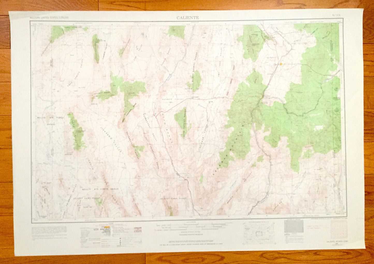
Antique Caliente, Nevada 1954 US Geological Survey Topographic Map – Pioche, Panaca, Carp, Crystal Springs, Alamo, Hiko Delamar Mountains NV
Antique Caliente, Nevada 1954 US Geological Survey Topographic Map – Pioche, Panaca, Carp, Crystal Springs, Alamo, Hiko Delamar Mountains NV
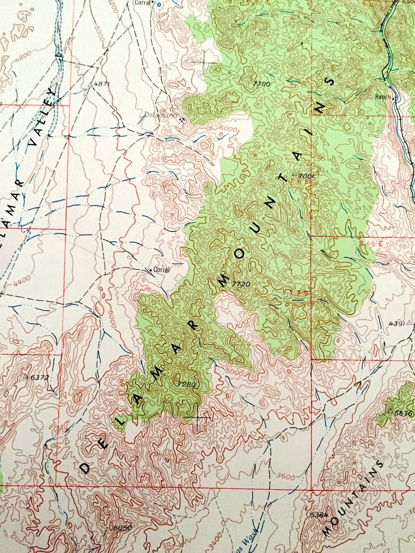
Beautiful, antique map of Caliente, Nevada and surrounding Utah areas. This is a 1954 edition, 1968 print from the U.S. Geological Survey and NOT a computer reproduction.
See what Nevada and Utah looked like over 65 years ago. Lots of intricate details and geological contours. Map even has little squares for every house that existed at the time. The USGS cartographers were very thorough back then!
Perfect for the historian, map-lover, the curious or just as a conversation starter. Wonderful and rare. Vintage maps such as these make great gifts.
Edition of 1954, printed 1968
Dimensions: 32" width x 22" height
----
Features
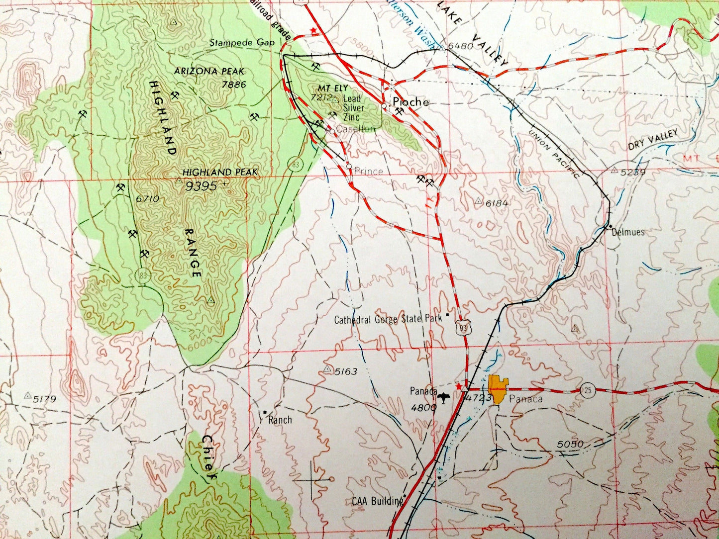
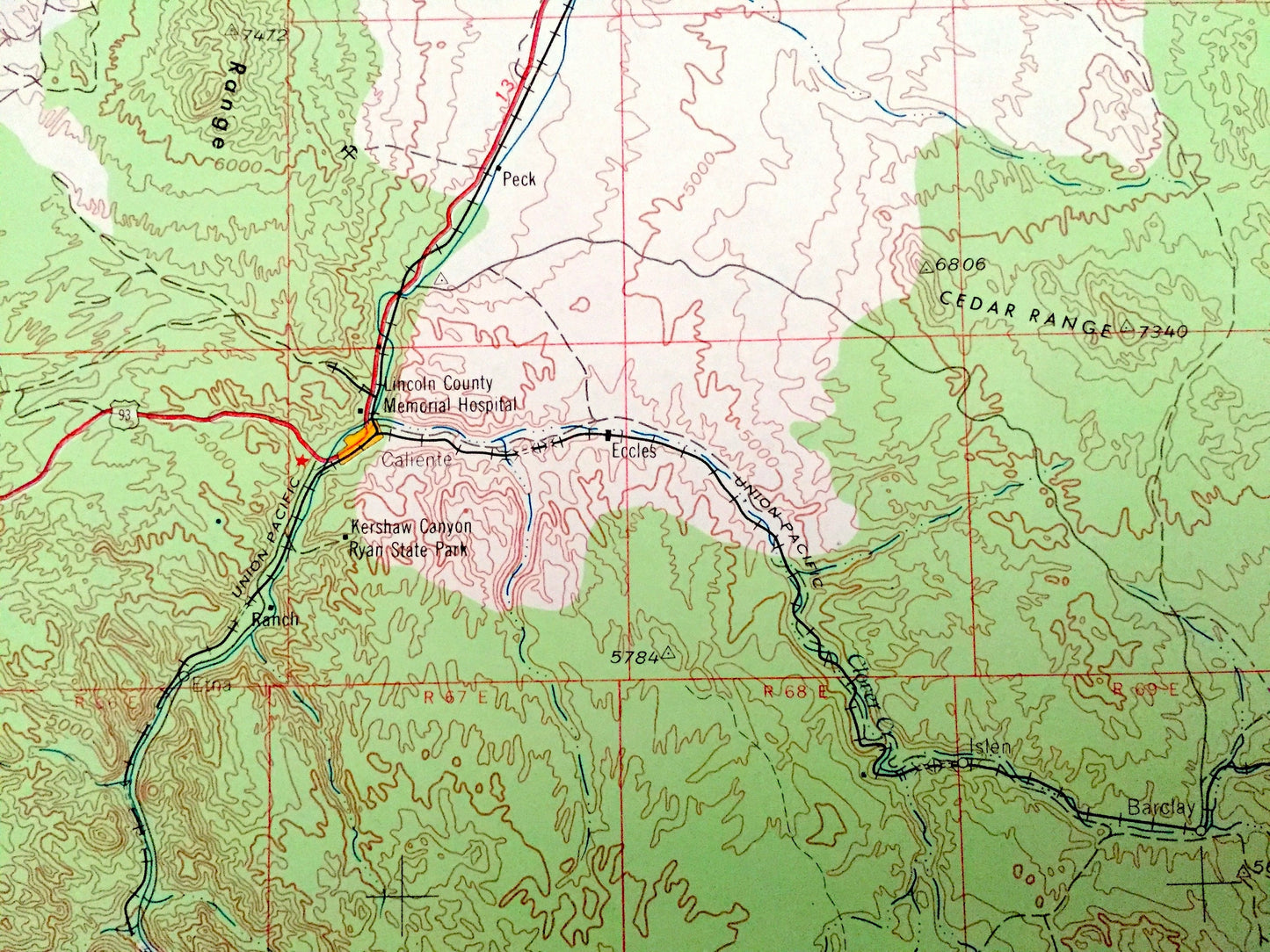
Cities & Towns: NEVADA - Caliente, Galt, Pioche, Panaca, Carp, Crystal Springs, Alamo, Hiko.
UTAH - Uvada.
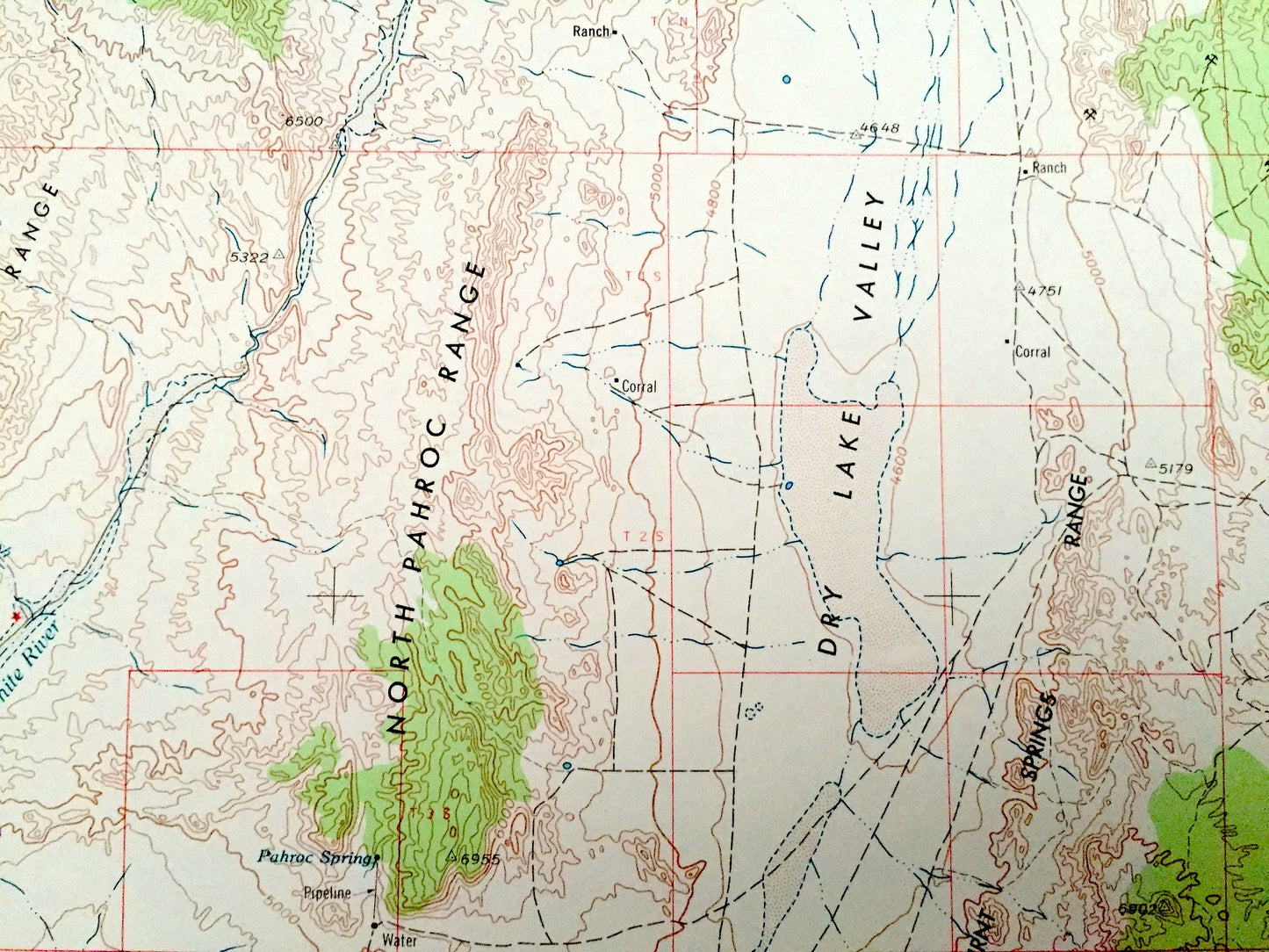
Points of Interest: NEVADA - Delamar Mountains, Meadow Valley Mountains, Mormon Mountains, North Pahroc Range, South Pahroc Range, Pahranagat Range, Sand Spring Valley, Garden Valley, Tikaboo Valley, Nellis Air Force Range, Meadow Valley Wash, Maynard Lake, White River, and lots more hills, mountains, lakes, rivers, creeks, roads, highways and railroads.
UTAH - Washington County, Iron County, Dixie National Forest, Beaver Dam Wash and lots more hills, mountains, rivers, lakes, creeks, roads, highways and railroads.
Condition: Good Vintage condition, commensurate with age. This map is in great shape for being over 50 years old. Has some edge-wear but this will all add to vintage character when framed.
----
We will happily adjust shipping price for multiple purchases. Maps are rolled up and shipped in sturdy mailing tubes, never folded.
Couldn't load pickup availability
Share