My Store
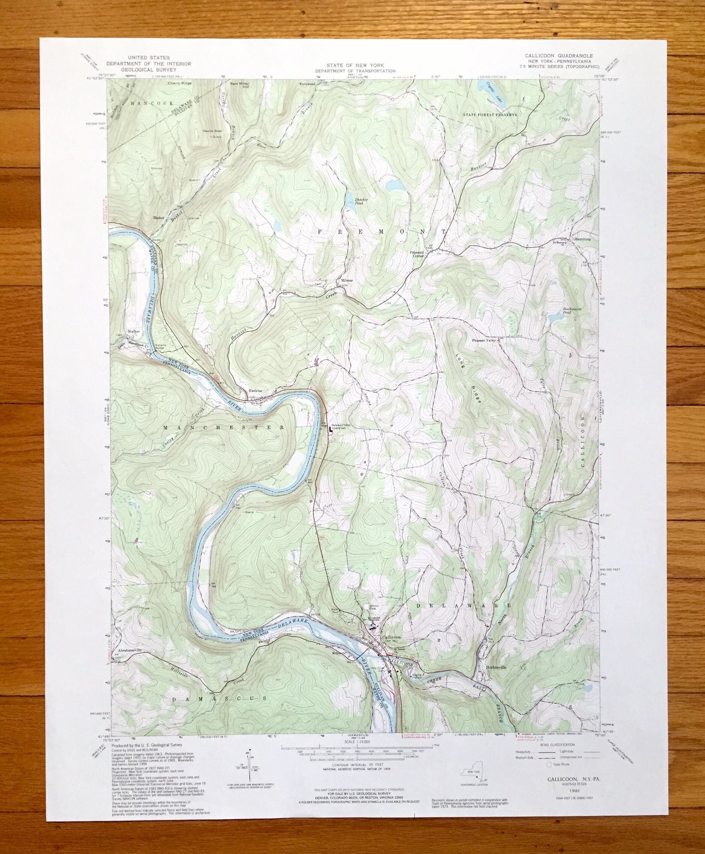
Antique Callicoon, New York 1992 US Geological Survey Topographic Map – Delaware, Sullivan County, Fremont, NY, Wayne County, Manchester, PA
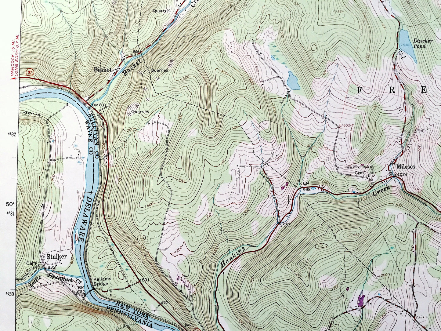
Antique Callicoon, New York 1992 US Geological Survey Topographic Map – Delaware, Sullivan County, Fremont, NY, Wayne County, Manchester, PA
Beautiful, antique map of Callicoon, New York and surrounding Sullivan County and Delaware County areas, including Pennsylvania’s Wayne County. This is an authentic 1992 edition, 1994 print from the U.S. Geological Survey and NOT a computer reproduction.
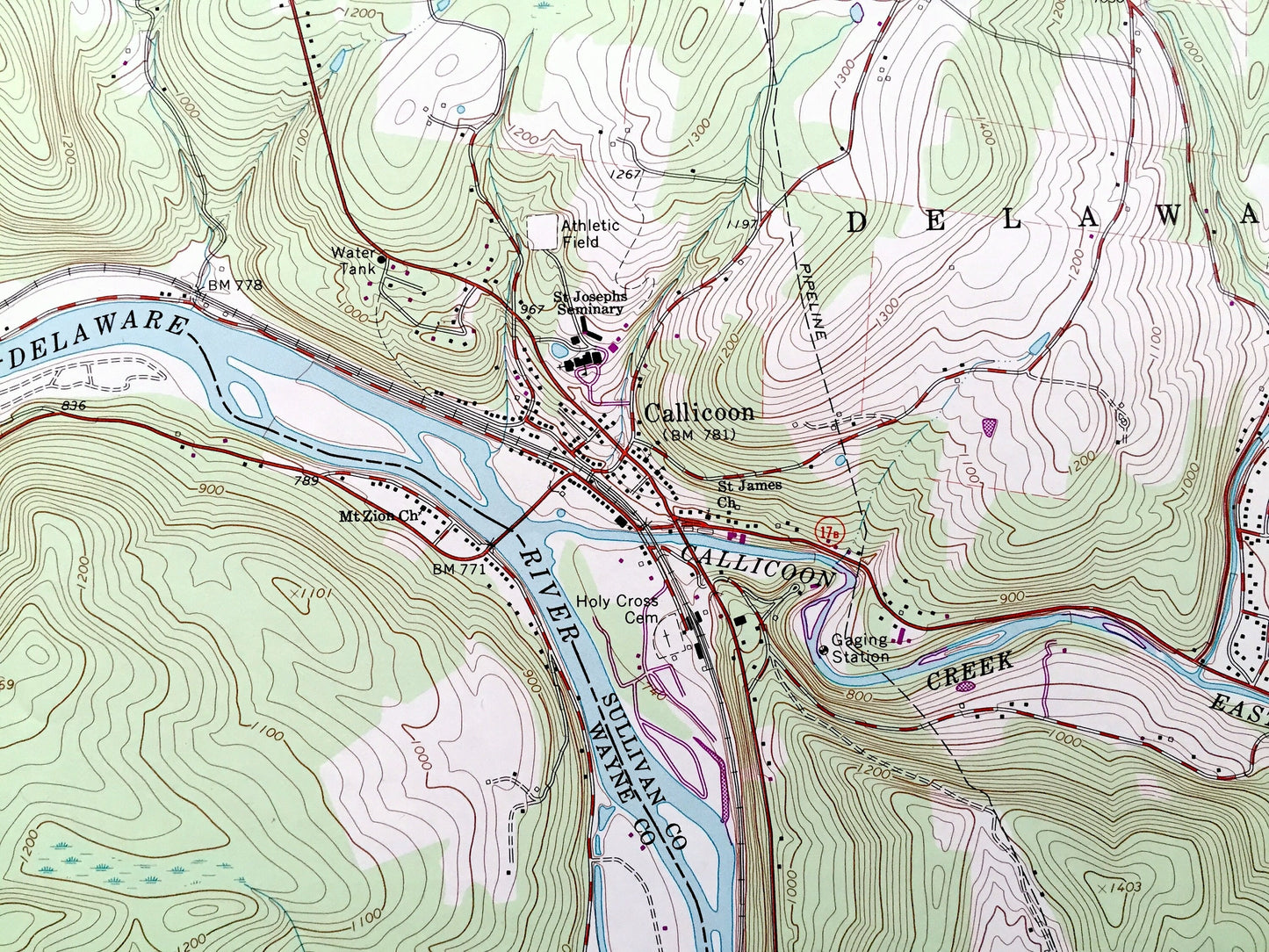
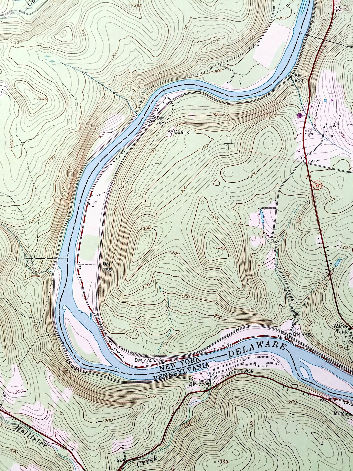
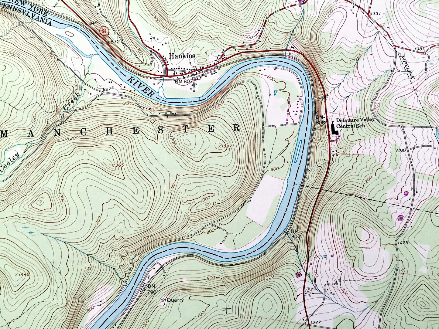
See what New York and Pennsylvania looked like over 30 years ago. Lots of intricate details and geological contours. Map even has little squares for every house that existed. The USGS cartographers were very thorough back then!
Perfect for the historian, map-lover, the curious or just as a conversation starter. Wonderful and rare. Vintage maps such as these make great gifts.
Edition of 1992, printed 1994
Dimensions: 22" width x 27" height
----
Features
Cities & Towns:
NEW YORK: Fremont, Hancock, Delaware, Fernwood, Basket, Fremont Center, Mileses, Obernburg, Pleasant Valley, Hankins, Hortonville.
PENNSYLVANIA: Manchester, Damascus, Stalker, Abrahamsville.
Points of Interest: State Forest Preserve, Cherry Ridge, Sam Miller Hill, Long Ridge, Basket Creek, East Branch, Hankins Creek, North Branch, Cooley Creek, Hollisterville Creek, Calkins Creek, and many more hills, streams, ponds, houses, schools, railroads, churches and roads.
Condition: Very Good Vintage condition, commensurate with age. This map is in great shape for being over 25 years old. Has a small stain in the bottom right margin but will add to character when framed.
----
We will happily adjust shipping price for multiple purchases. Maps are rolled up and shipped in sturdy mailing tubes, never folded.
Couldn't load pickup availability
Share