My Store
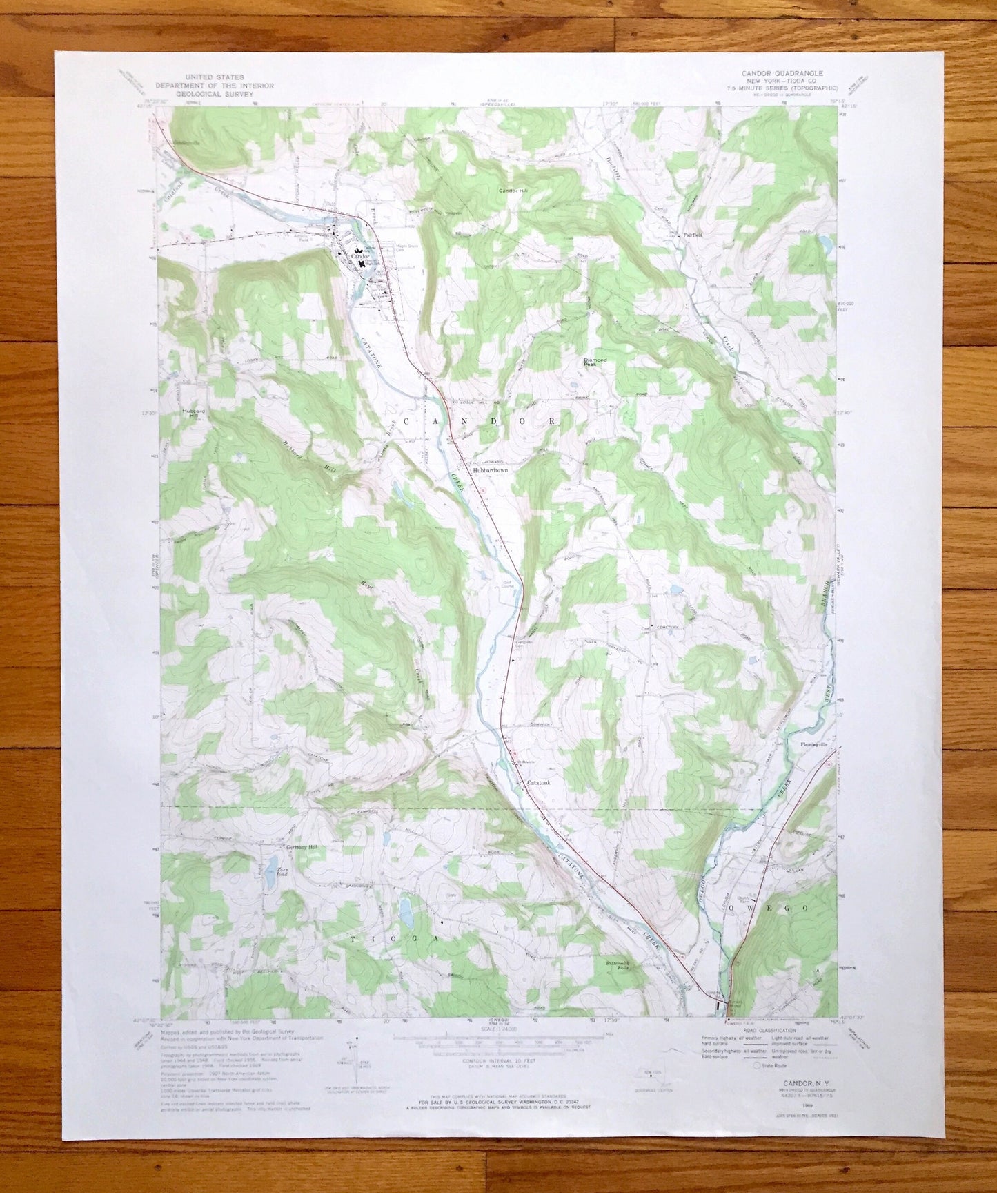
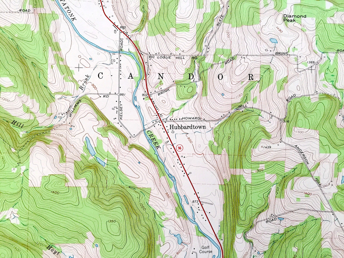
Antique Candor, New York 1969 US Geological Survey Topographic Map — Tioga County, Owego, Gridleyville, Fairfield, Hubbardtown, Catatonk, NY
Antique Candor, New York 1969 US Geological Survey Topographic Map — Tioga County, Owego, Gridleyville, Fairfield, Hubbardtown, Catatonk, NY
Beautiful, antique map of Candor, New York and surrounding Tioga County area. This is an authentic 1969 edition, 1971 print from the U.S. Geological Survey and NOT a computer reprint.
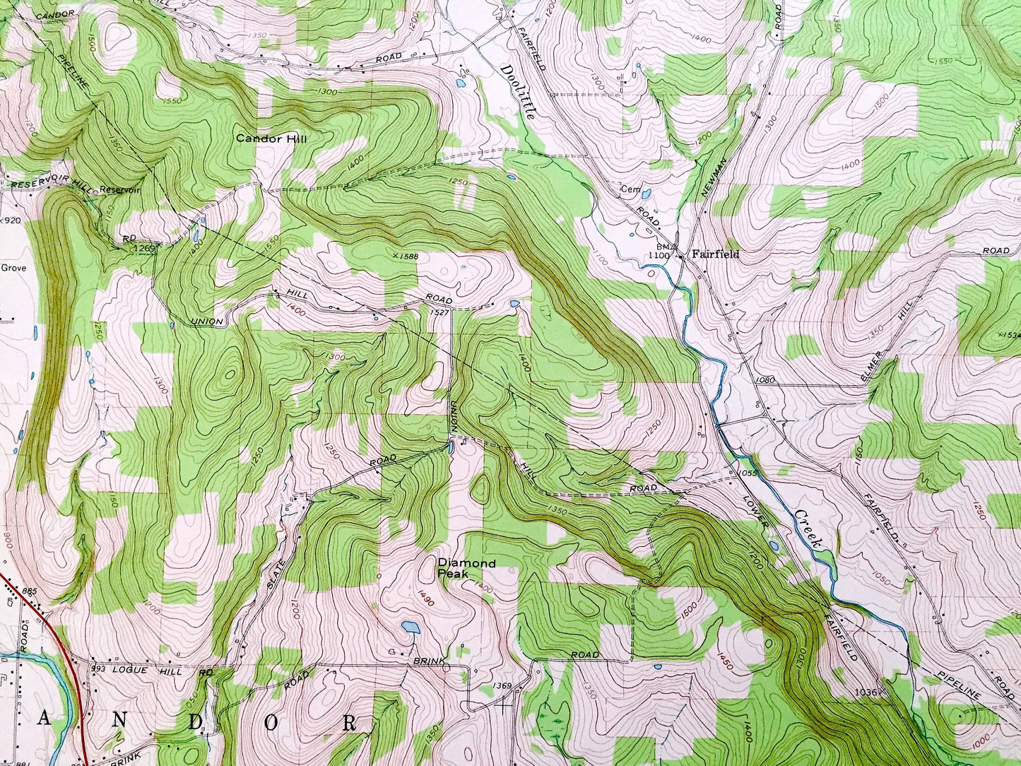
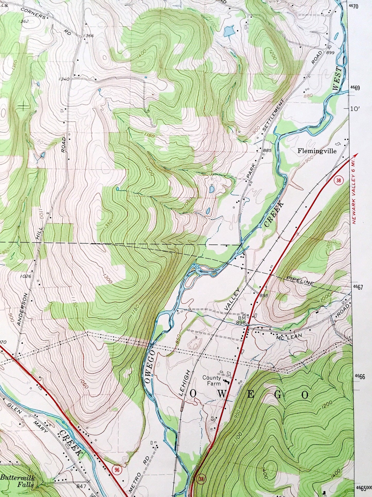
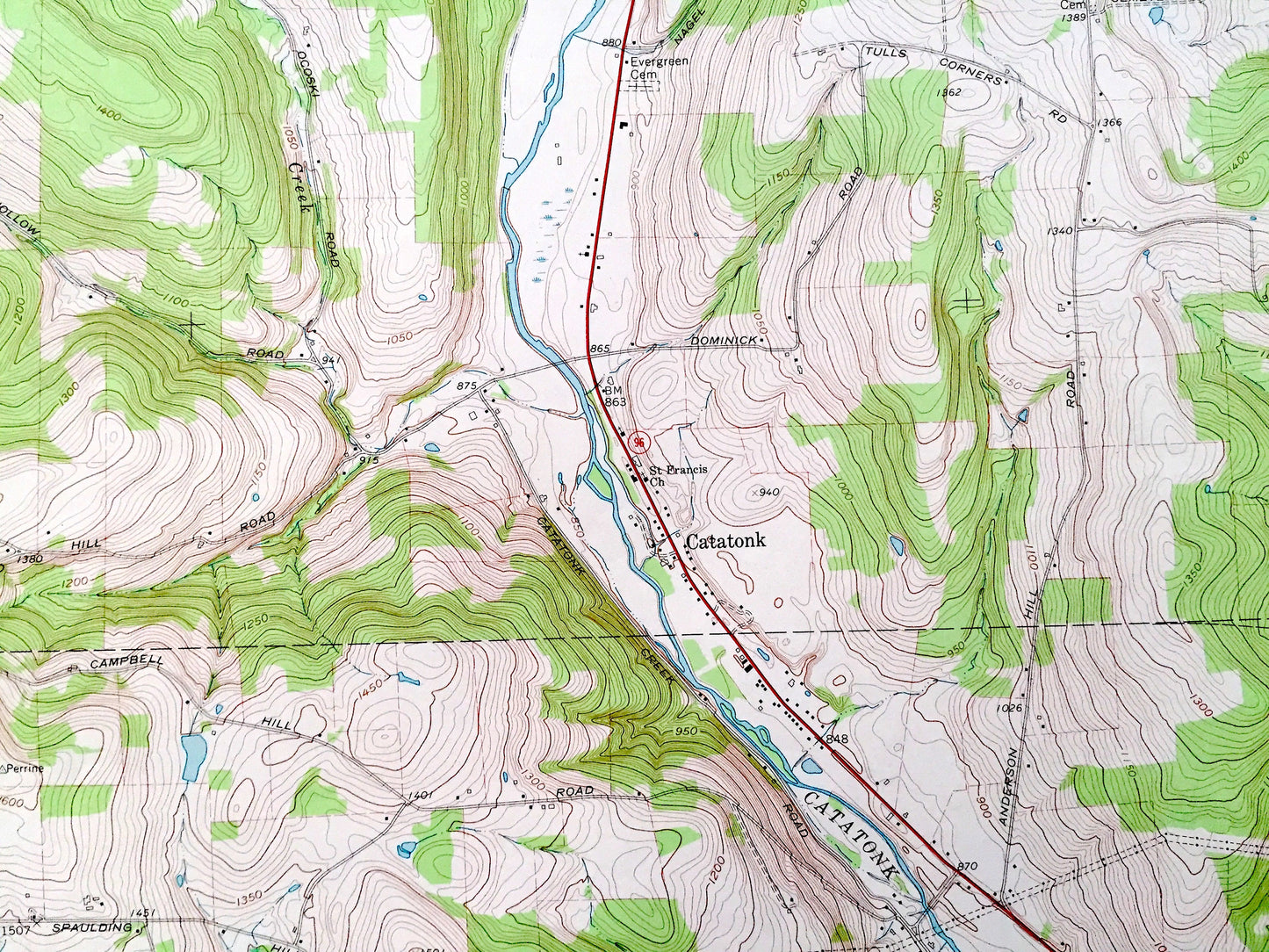
See what New York looked like over 50 years ago. Lots of intricate details and geological contours. Map even has little squares for every house that existed. The USGS cartographers were very thorough back then!
Perfect for the historian, map-lover, the curious or just as a conversation starter. Wonderful and rare. Vintage maps such as these make great gifts.
Edition of 1969, printed 1971
Dimensions: 22" width x 27" height
----
Features
Cities & Towns: Tioga, Owego, Gridleyville, Fairfield, Hubbardtown, Catatonk, Flemingville, Germany Hill.
Points of Interest: Candor Hill, Diamond Peak, Hubbard Hill, Buttermilk Falls, Catatonk Creek, Doolittle Creek, Owego Creek, Hubbard Hill Brook, Willseyville Creek, Zorn Pond, West Branch, and many more hills, streams, ponds, houses, schools, railroads, churches and roads.
Condition: Very Good Vintage condition, commensurate with age. This map is in great shape for being over 50 years old. Has subtle edge-wear but will read as character when framed.
----
We will happily adjust shipping price for multiple purchases. Maps are rolled up and shipped in sturdy mailing tubes, never folded.
Couldn't load pickup availability
Share