My Store
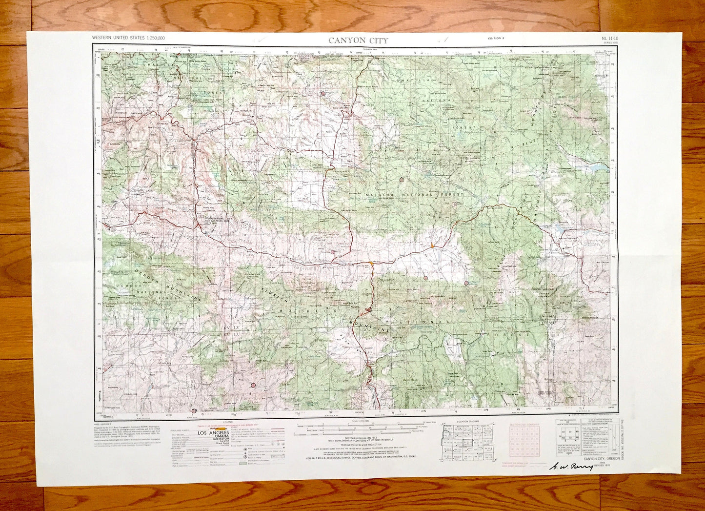
Antique Canyon City, Oregon 1955 US Geological Survey Topographic Map – John Day, Hamilton, Hereford Malheur National Forest Grant County OR
Antique Canyon City, Oregon 1955 US Geological Survey Topographic Map – John Day, Hamilton, Hereford Malheur National Forest Grant County OR
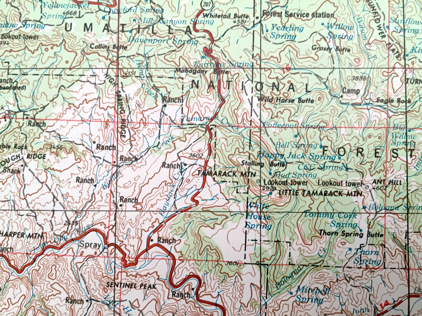
Beautiful, antique map of Canyon City, Oregon and surrounding area. This is an authentic 1955 edition, 1972 print from the U.S. Geological Survey and NOT a computer reproduction.
See what Oregon looked like over 65 years ago. Lots of intricate details and geological contours. Map is incredibly large and in the grand 1:250,000 scale. The USGS cartographers were very thorough back then!
Perfect for the historian, map-lover, the curious or just as a conversation starter. Wonderful and rare. Vintage maps such as these make great gifts.
Edition of 1955, printed 1972
Dimensions: 32" width x 22" height
----
Features
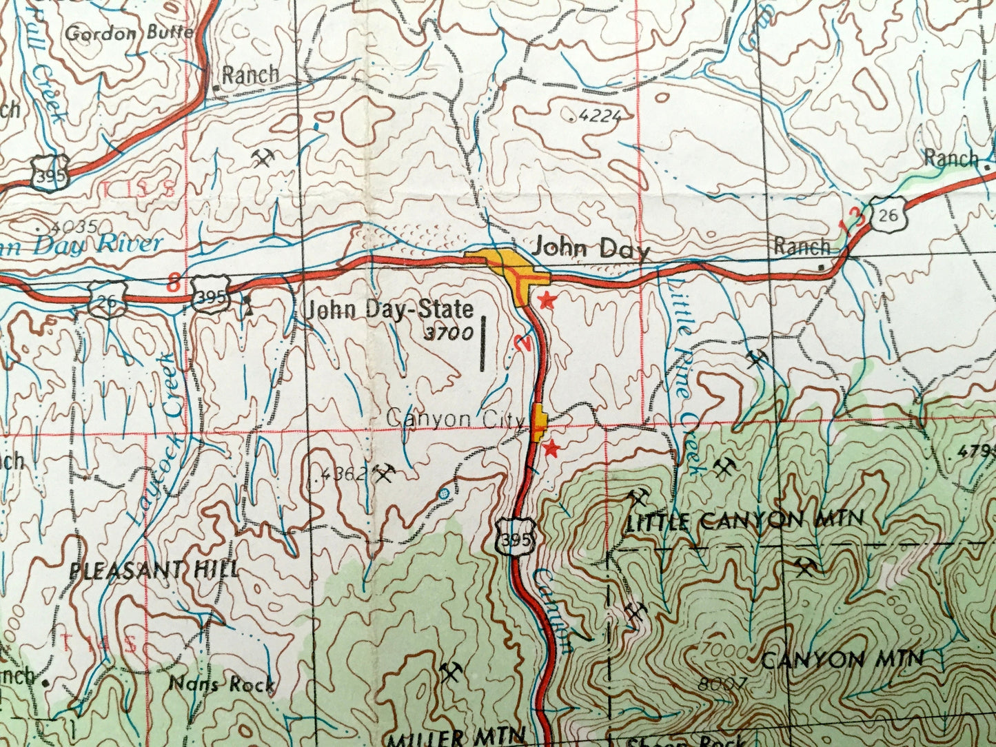
Cities & Towns: Canyon City, Long Creek, Beech Creek, John Day, Hamilton, Hereford.
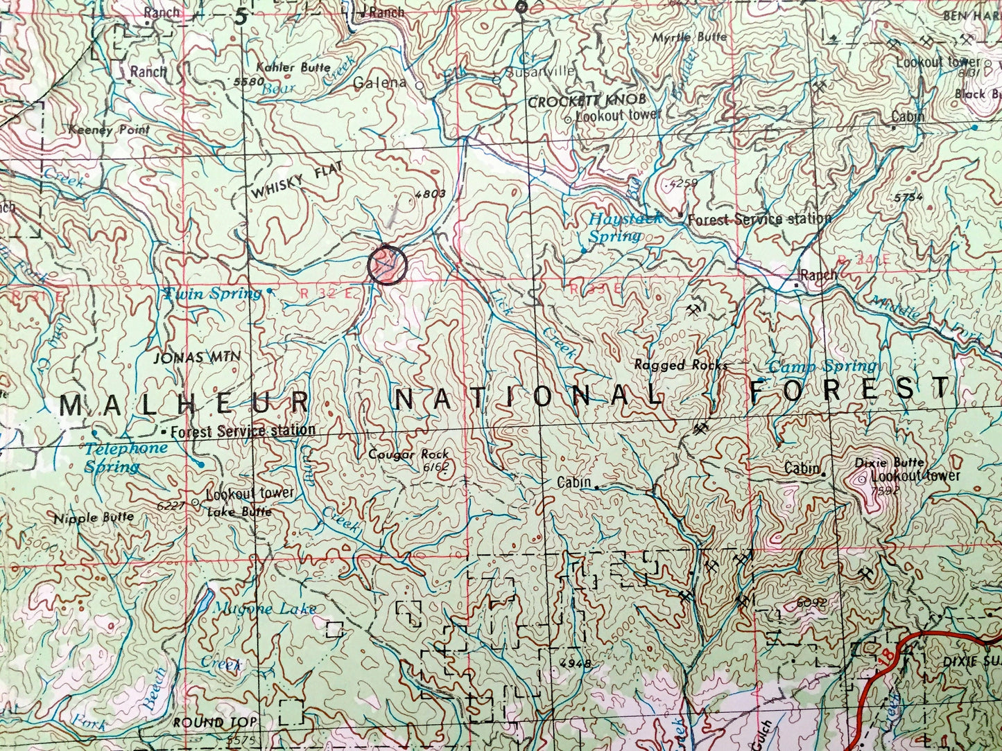
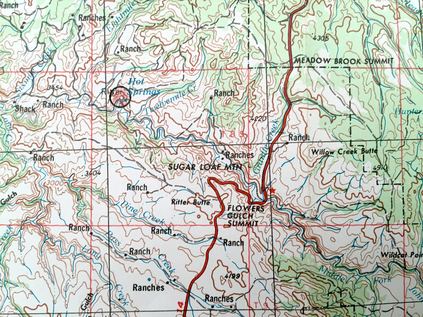
Points of Interest: Malheur National Forest, Ochoco National Forest, Umatilla National Forest, Blue Mountain Experimental Forest, Whitman National Forest, John Day Fossil Beds State Park, John Day River, Dutchman Flat, Johnny Creek and lots more hills, mountains, rivers, lakes, creeks, roads, highways and railroads.
Condition: Very Good condition, commensurate with age. This map is in great shape for being over 45 years old. Has some light edge-wear, pen in margin and folds as-issued, but these will flatten easily and all of which will read as vintage character when framed.
----
We will happily adjust shipping price for multiple purchases. Maps are rolled up and shipped in sturdy mailing tubes, never folded.
Couldn't load pickup availability
Share